Fluvial Deposits Floodplain
Deposits Aeolian Deposits Palaeosol
Deposits
Logs and Palaeocurrent Data
![]()
Below are the descriptions of the 6 main facies that have been recognized at this location within the Otter Sandstone Formation. These can be related to the logs taken along the outcrop at various points as you move from west to east.
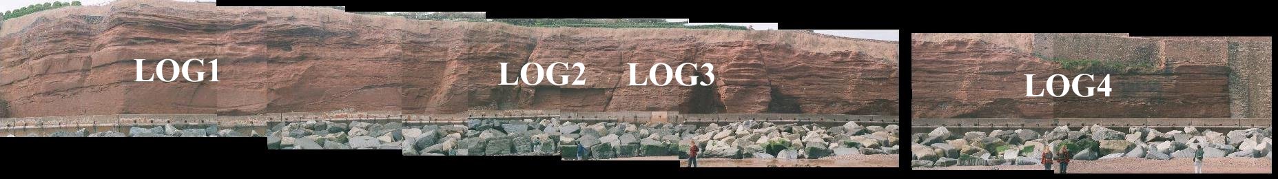
The 4 logs are shown on the panoramic view below and further
down as clickable image maps that give a close-up of the location of the log
and a link to the logs themselves.
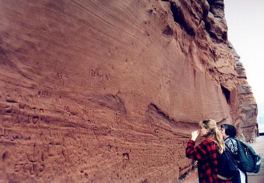
Extent of the Otter Sandstone Formation at outcrop, Sidmouth,
Devon. GR: SY 115869
(Photo from Jonathan
Redfern, 1999)
The red coloration of the Sherwood Sandstone Group is related
to sediment deposited under oxidizing conditions, which is assisted by arid
conditions.
The Otter Sandstone Formation is composed largely of
medium- to fine-grained reddish brown, commonly cross-bedded sandstones.
These sandstones occur in cycles with occasional conglomerate bases, which
fine upwards. Both drill cuttings and geophysical logs show that the base
of the succession is cleaner and coarser (Holloway,
1989).
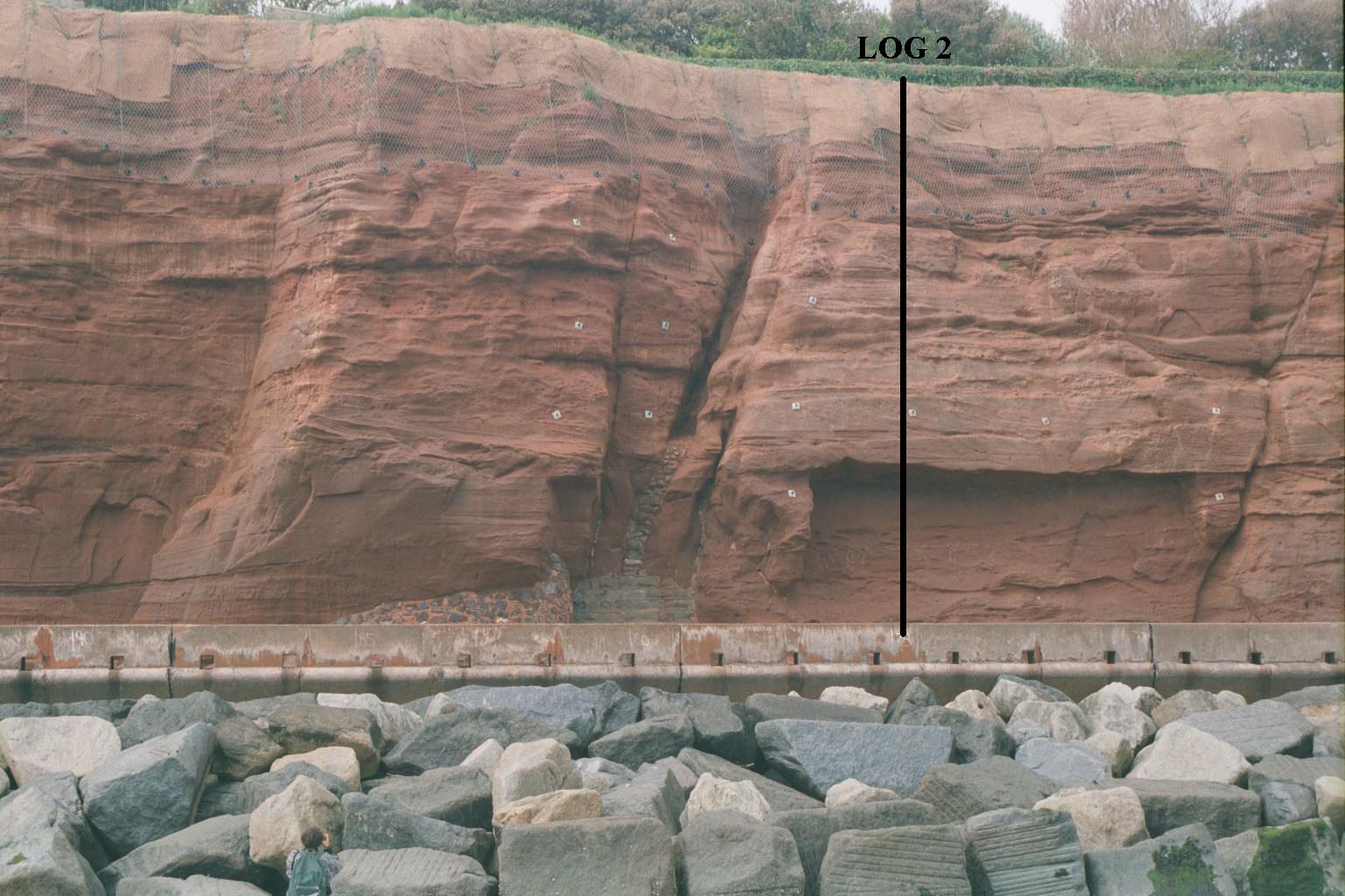
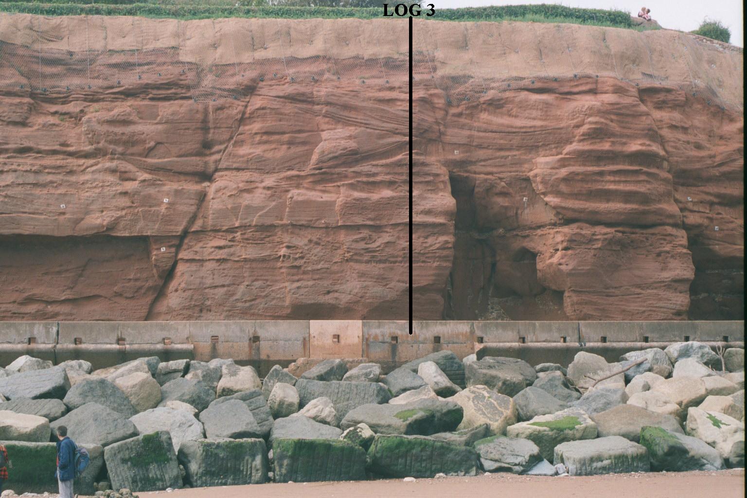
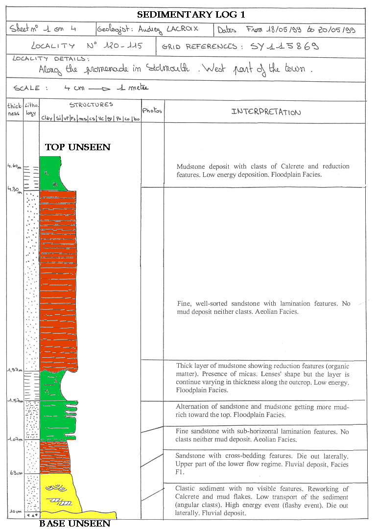
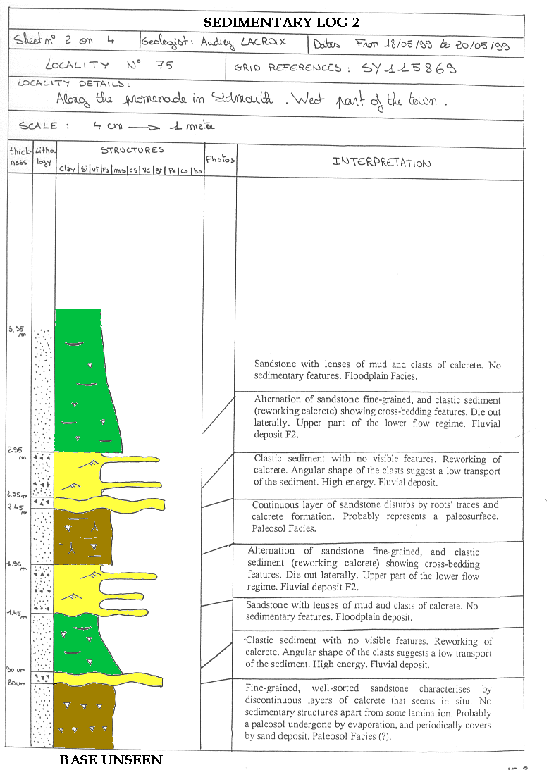
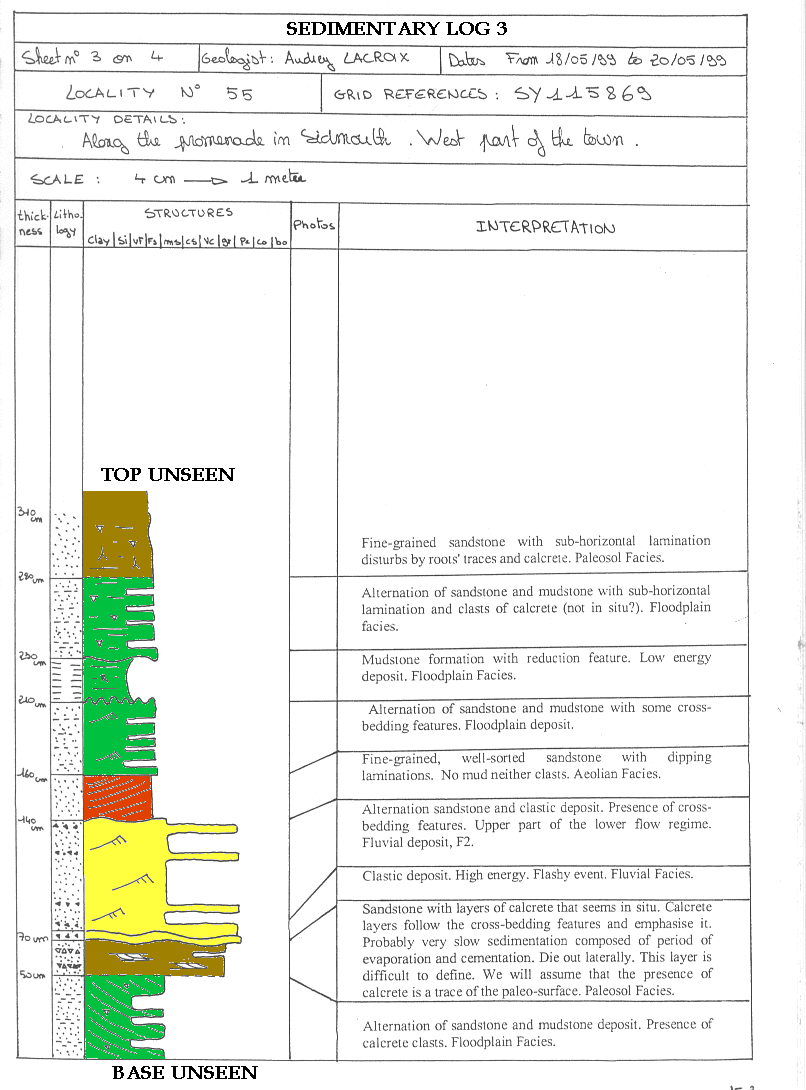
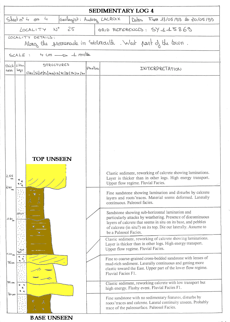
4 logs were taken along the outcrop to show the laterally changing facies.
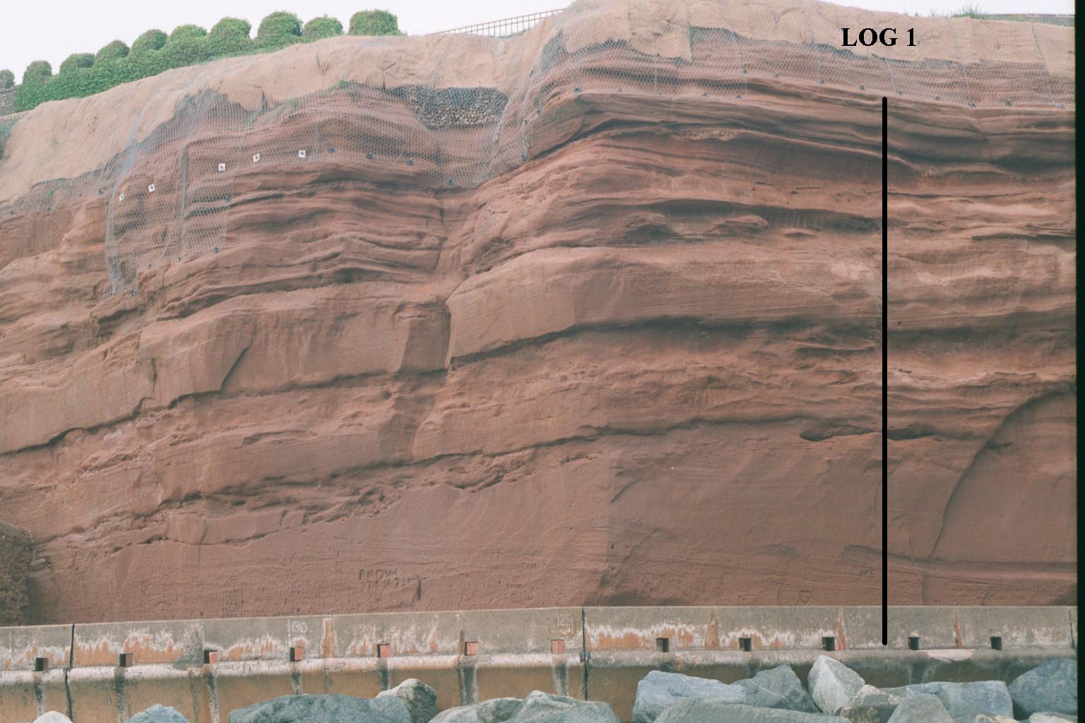
LOG 1 |
LOG 2 |
LOG 3 |
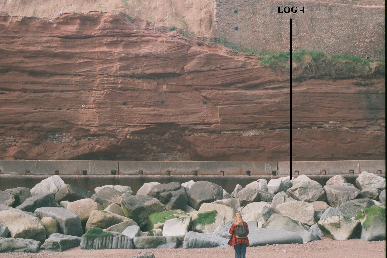
LOG 4 |
(Photo from Jonathan Redfern, 1999)
Six main facies were recognised in the report. (Lacroix, 1999)
![]() Fluvial
- F1 and F2
Fluvial
- F1 and F2
![]() Floodplain
- Fl 1 and Fl2
Floodplain
- Fl 1 and Fl2
F1 can be seen in log 1
and 4.
These are channel fill deposits with very coarse to fine
grain size. The coarser grained basal layers contain rip-up clasts of calcrete
and mudrock.
The low maturity of the sediment suggests short transport,
but these clasts are probably reworked deposits from the bank of the channel
indicative of high flow regimes.
The unit is characterised by beds between 50 cm - 2m
thick, consisting of well sorted very fine to fine grain sized sandstones.
These are interbedded with some discontinuous mud rich sandstone layers.
Sedimentary structures include planar tabular and trough
cross bedding showing a N/S current direction.
| F2 can be seen in log 2
and 3.
The unit is characterised by 40 - 60cm thick beds of fine-grained sandstone interbedded with conglomerate deposits. The conglomerates are composed of reworked calcrete clasts and mudstone and sandstone intraclasts suggesting a high level of flow. The intraclasts are course grain sized and poorly sorted. Cross bedding is defined within the unit by weathering of carbonate rich layers. This unit dies out laterally. |
Cross bedding defined by carbonate rich layers.
|
The Fl 1 floodplain facies is made up of 1 - 1.5m thick
beds, which consist of thinly interbedded very fine to fine grained poorly
sorted sandstones and mudrocks, containing mudclasts and shallow fibrous
branching root traces.
The unit is present in Logs 1,
2
and 3. Log 2 shows calcrete
clasts and conjectural cross bedding.
Fl 2 consists of 1 - 50cm thick mudstone beds and is present
laterally all along the outcrop. The unit exhibits structures that are red with
green cracks and could be root marks or desiccation cracks. The green coloration
is a result of reduction of the iron in the sediment after decomposition of
organic matter. Reduction within the desiccation cracks is possible due to fluid
circulation within the area.
| This unit is visible in Log 1.
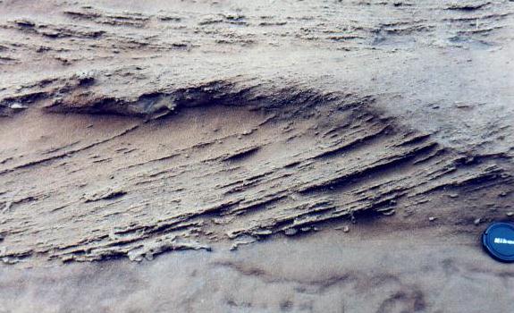
The aeolian deposits are 2 to 5m thick and are very fine-grained, and very well sorted. Fine parallel and sub-horizontal laminations show wind direction perpendicular to the outcrop, North to south or vice versa. The shape of the dunes is unknown due to the section being perpendicular to the current direction. The beds are laterally discontinuous and contain in-situ calcite deposits. |
Horizontal lamination within the aeolian unit.
|
| These consist of 30 - 60cm thick beds of very fine to
fine sandstone with visible vertical sinuous accumulations of carbonates
and horizontal calcrete horizons. Carbonate cementation is cylindrical
and perpendicular to bedding.
The top layer of the unit is an erosional surface whilst the base is gradational. The vertical structures have a root like shape; these contain a dense tubular micrite coating, which passes gradually into a less well cemented zone, which is a feature of rhizocretions. The presence of small tubules radiating from the central cavity closely resembles rootlets arranged around the central taproot. These are not burrows as they exhibit no features related to burrows and there is no evidence of faecal pellets (Purvis, 1991). |
Root traces connected to a palaeosurface appear as green
|
 |
 |
 |
 |
 |
|
|
|
|
|
|
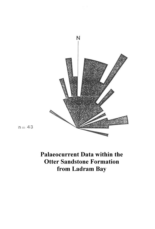 |
| Palaeocurrent Data |
![]()
 |
Page constructed by M. Wheeler
Copyright © 2000 Mark J Wheeler