It is important that you access this field trip on a laptop or desktop PC. Click on any image to enlarge it. Explore the area in Google Maps and Streetview
We are going to study the excellent cliff (Craig y Fulfran) and foreshore sections at the north end of the promenade. These are classic outcrops, important in the history of modern sedimentology. There's a lot to see and do at this location, and we usually spend about three hours here. We'll start by taking a general look at the section, then zooming in on some features of interest. Finally, we will measure a log through several metres of the section. We'll use these data to draw a graphic log, which we'll then try to interpret.
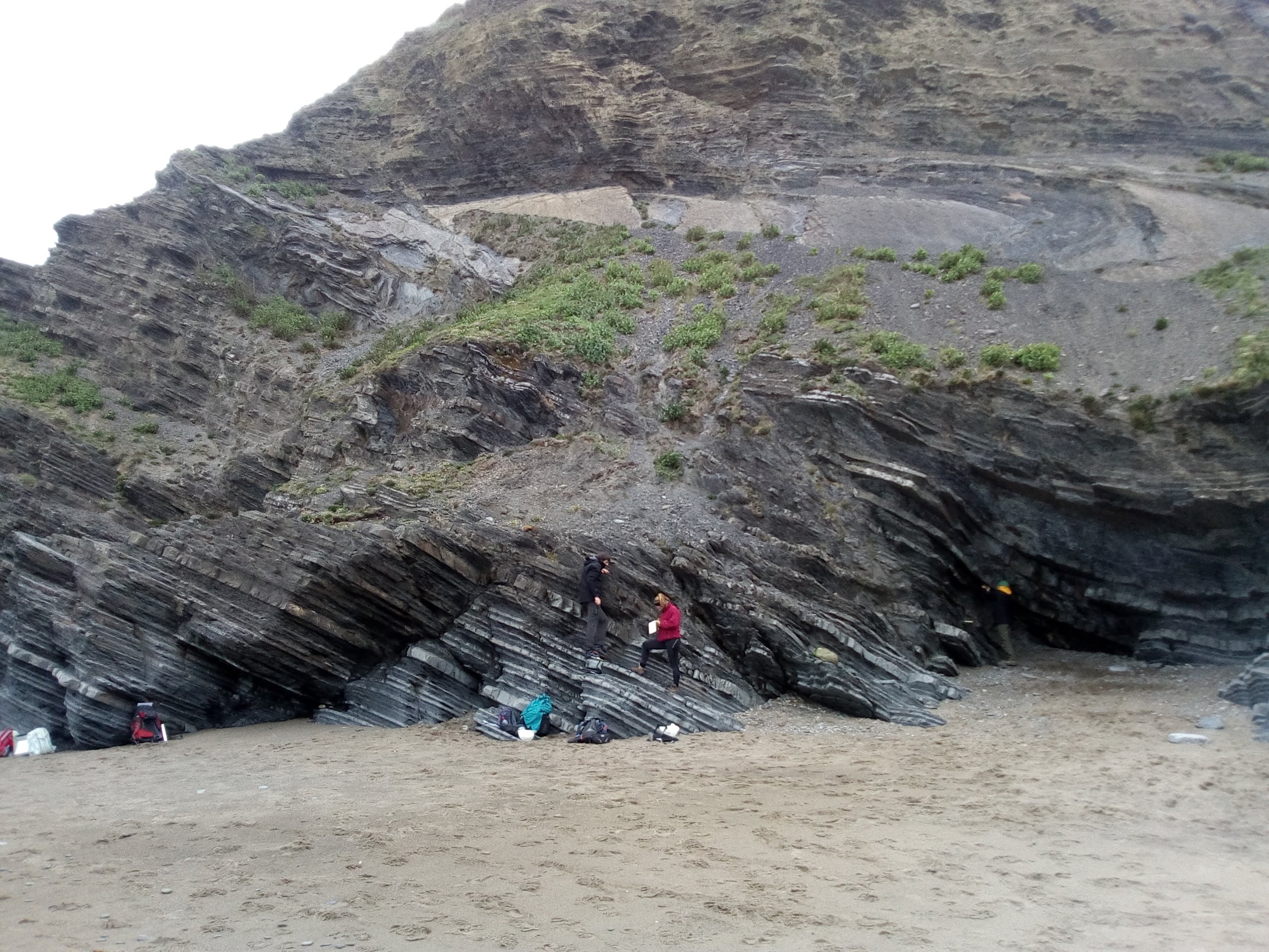 A1. General view of the cliff section. Note the large, sideways-facing fold higher in the cliff. |
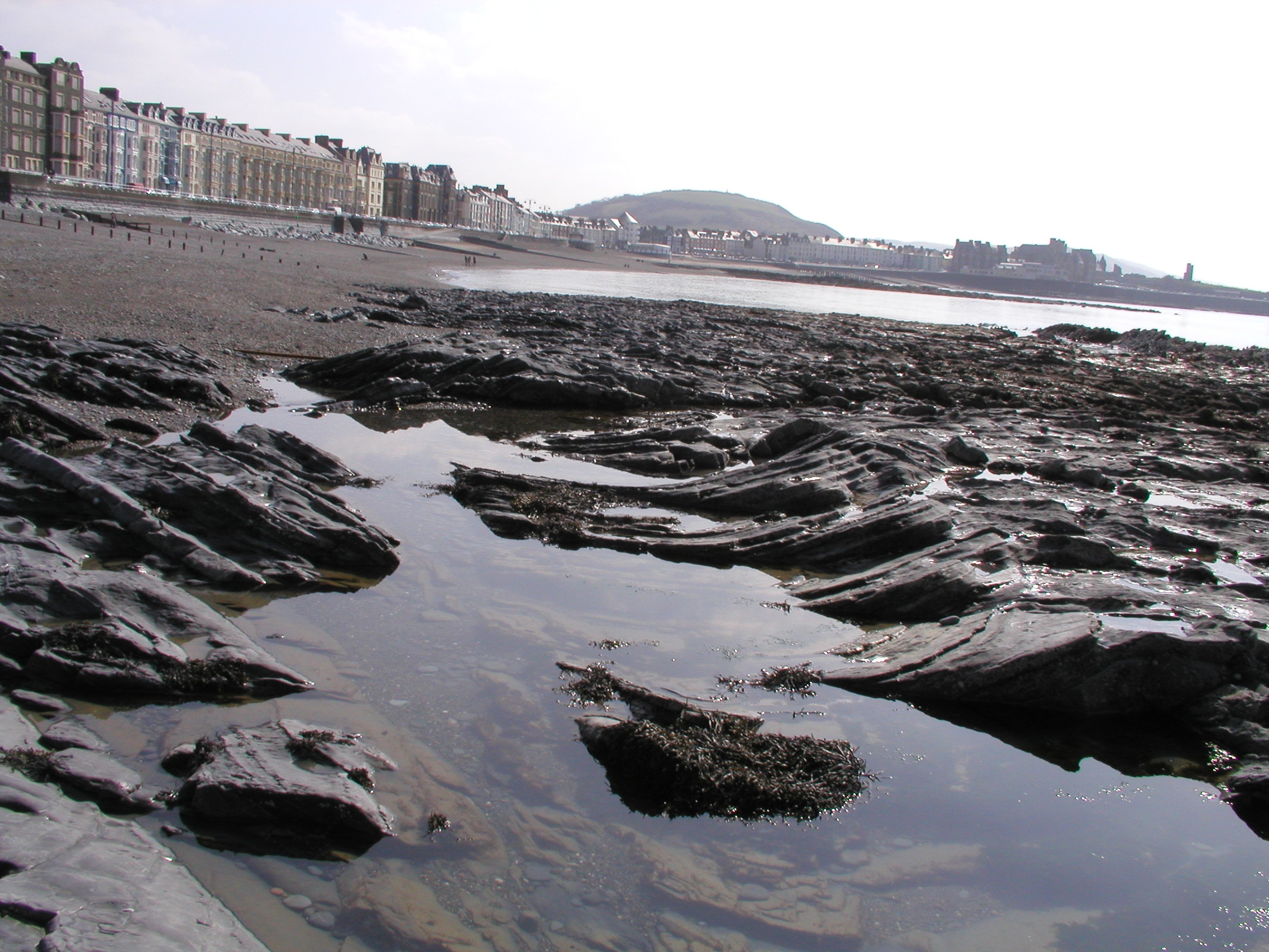 A2. Gentle synform in foreshore outcrops. Fold axes trend SW-NE, and defomation occurred during late stages of the Caledonian orogeny. |
|
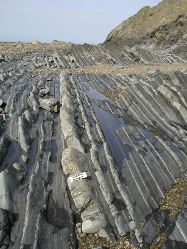
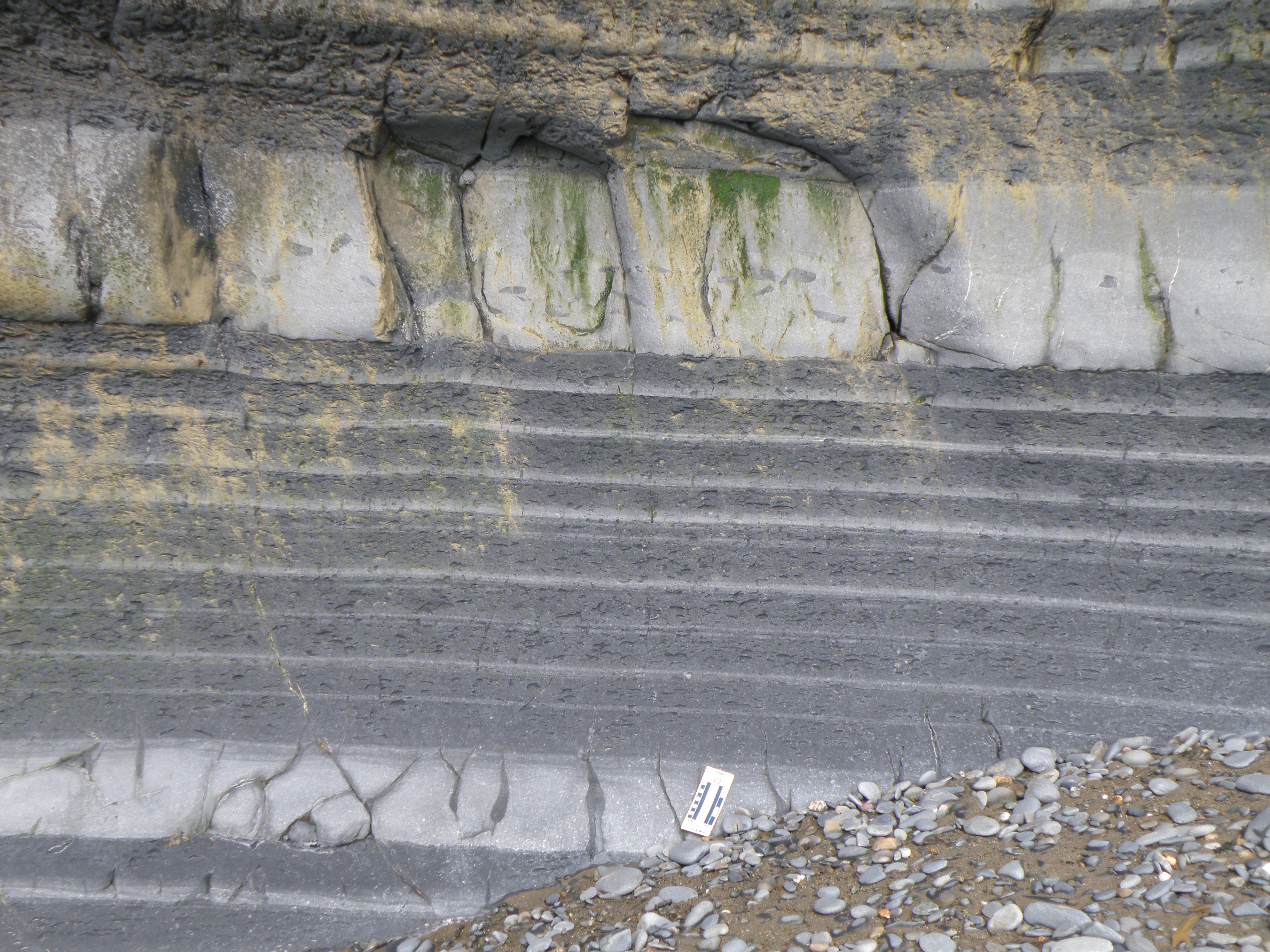
Describe the general appearance of the outcrop, including its height and lateral continuity of beds.. How many lithologies do you think there are are, and how can you distinguish them? (photos B2 and B3 may help). |
|
|
The aim of this exercise is to synthesize information of a variety of different types - for example lithology, thickness and geometry of sedimentary units, sedimentary structures and palaeocurrents, fossils and trace fossils (or absence thereof), lateral and vertical changes etc. From these observations, you should be able to attempt interpretations of the the processes and environments involved in the formation of the section. This integrated approach, using all available sources of information, is very important in sedimentology. You have seen a similar section in a practical earlier this semester.
Identifying and interpreting sedimentary structures is an important part of this exercise. If you need to brush up on these, the best sources are the appropriate chapters in the set books.
Handout: refer to the handout for today, which contains essential diagrams and information. Don't forget to use the information in the Field Guide too. Both are available in Course Resources.
Tasks: See today's handout.
![]()
Field evidence - zooming in
Study the outcrop photographs below. Describe and interpret them. Pay particular attention to field relationships - contacts between units, how units change as you trace them laterally, etc. Answer the questions and tasks attached to individual photos in your virtual notebook.
|
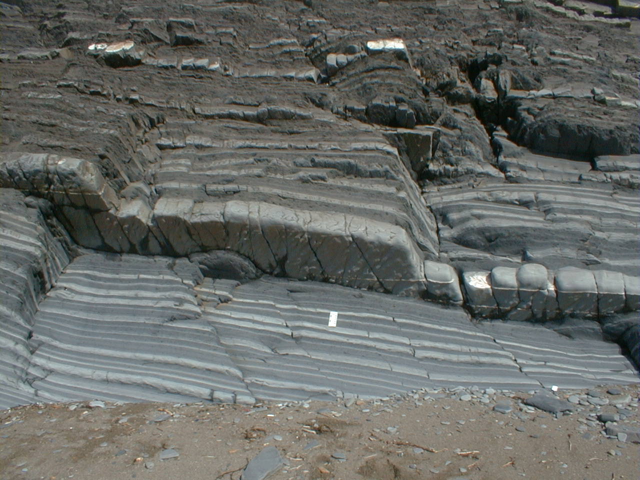
Describe the outcrop. What do the mudstone intervals represent? Remember
that mud compacts much more than sand during burial, so the original sequence
would have had a much greater thickness of mud. What does each sandstone
bed represent? |
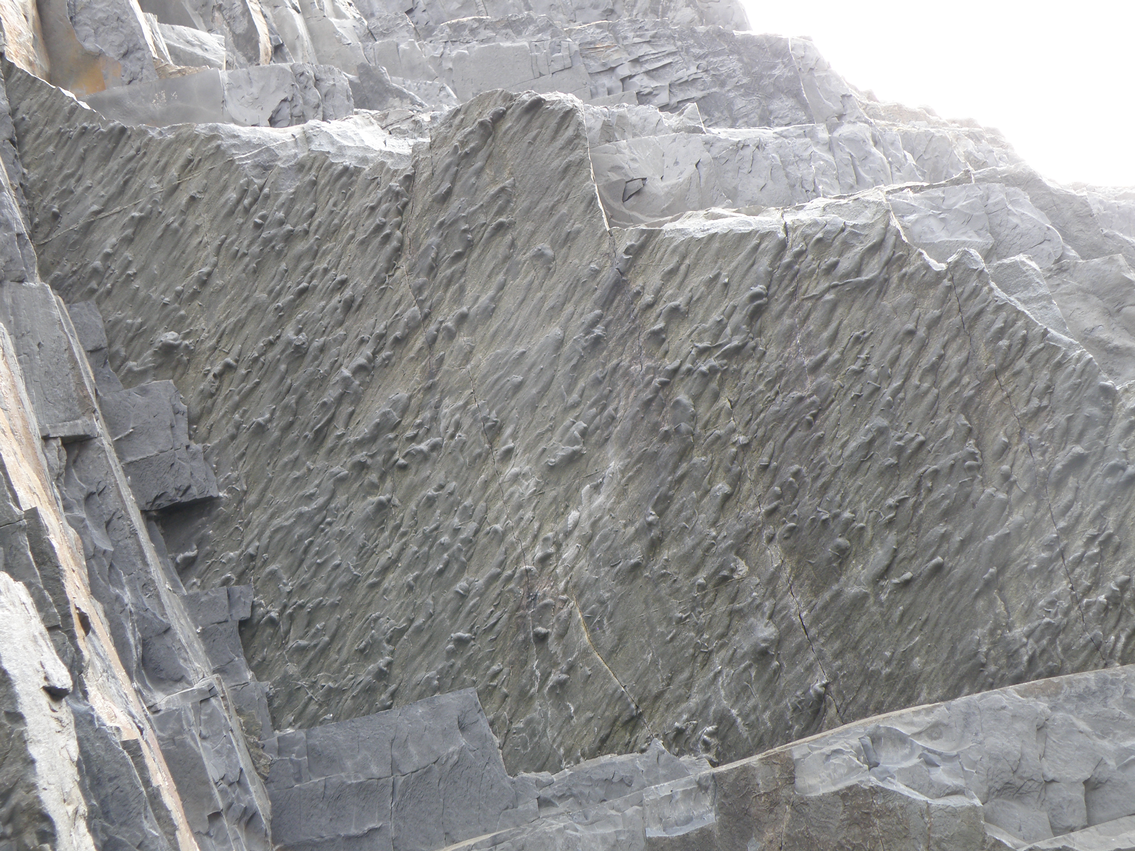
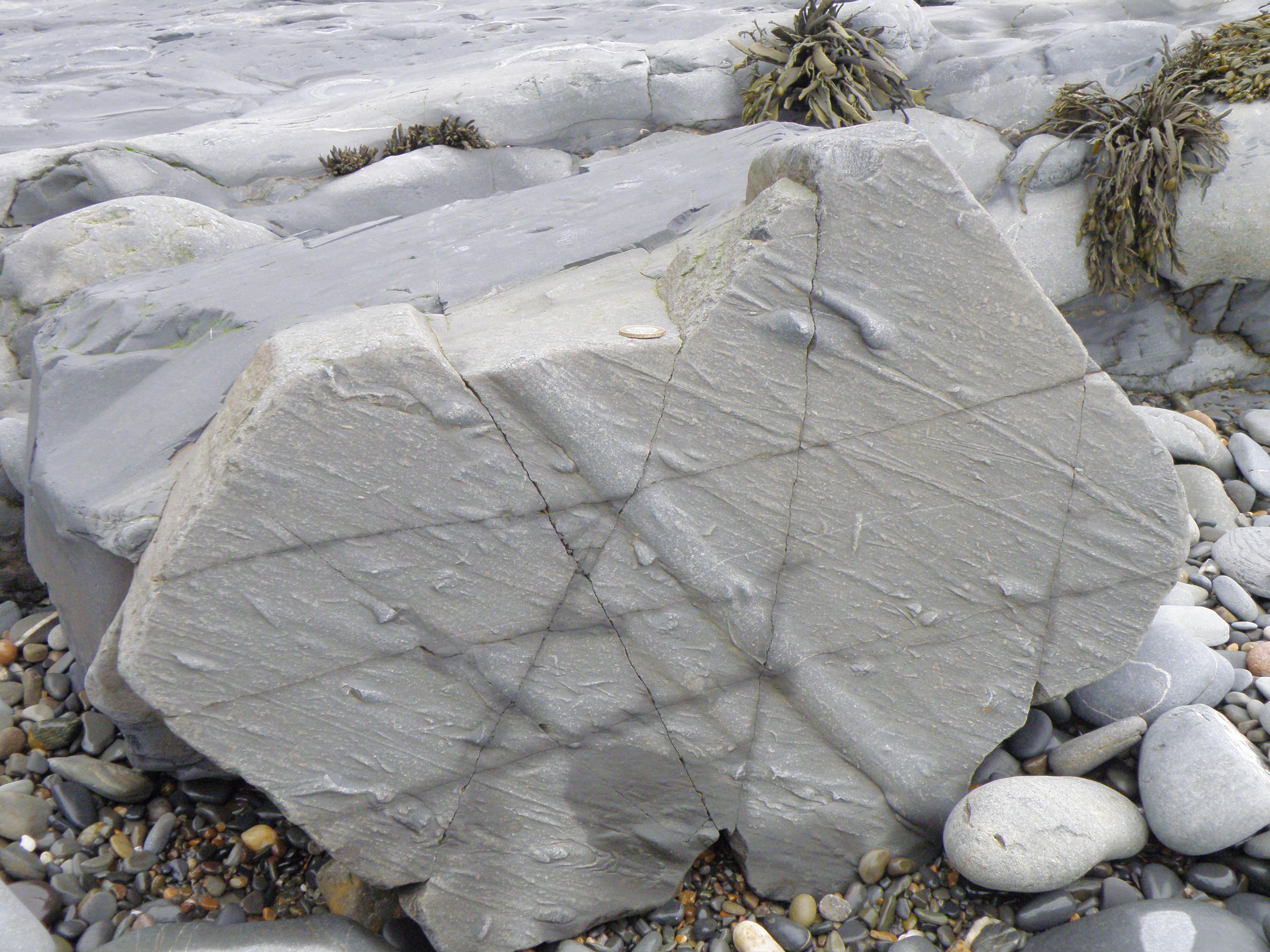
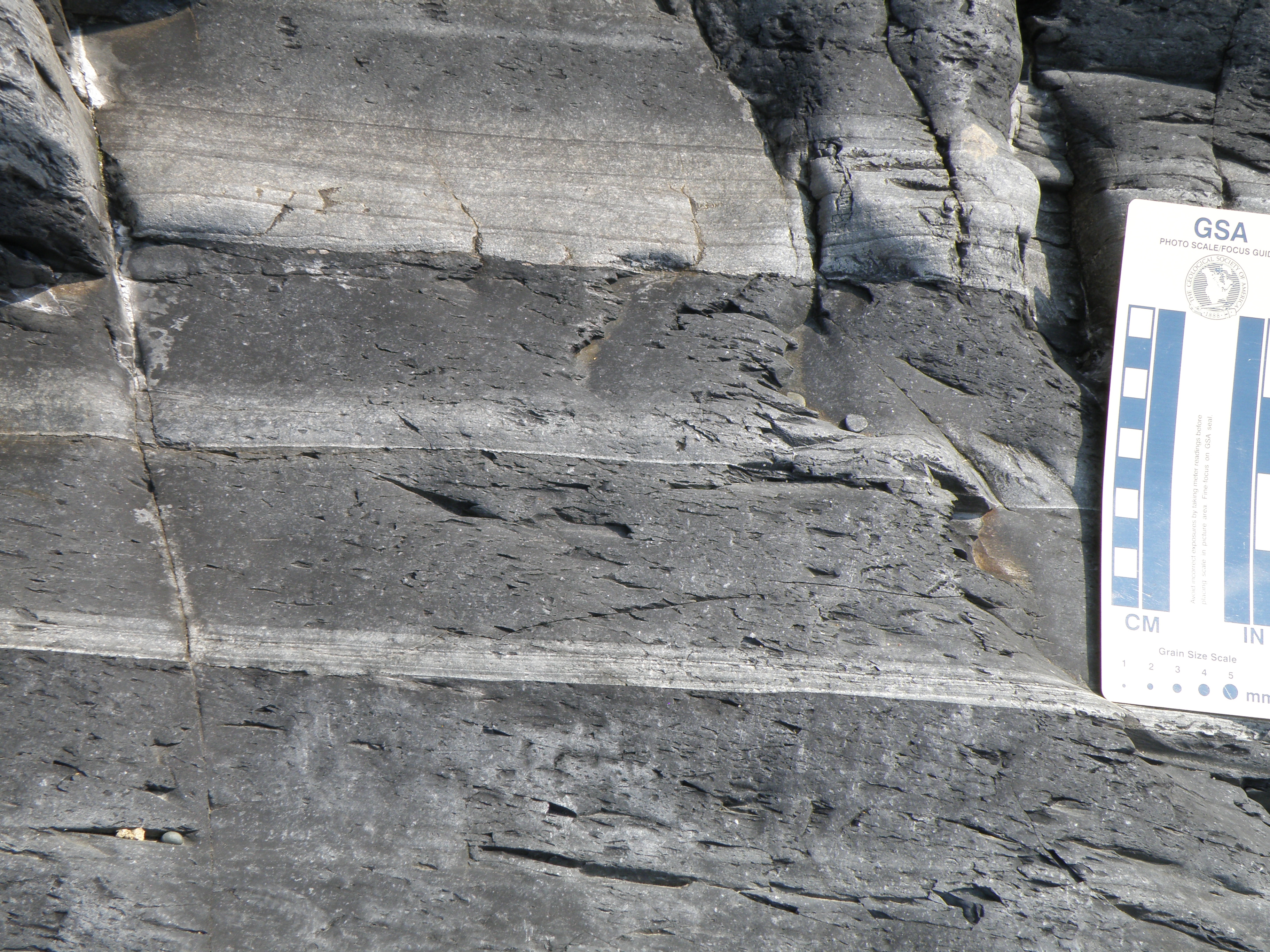
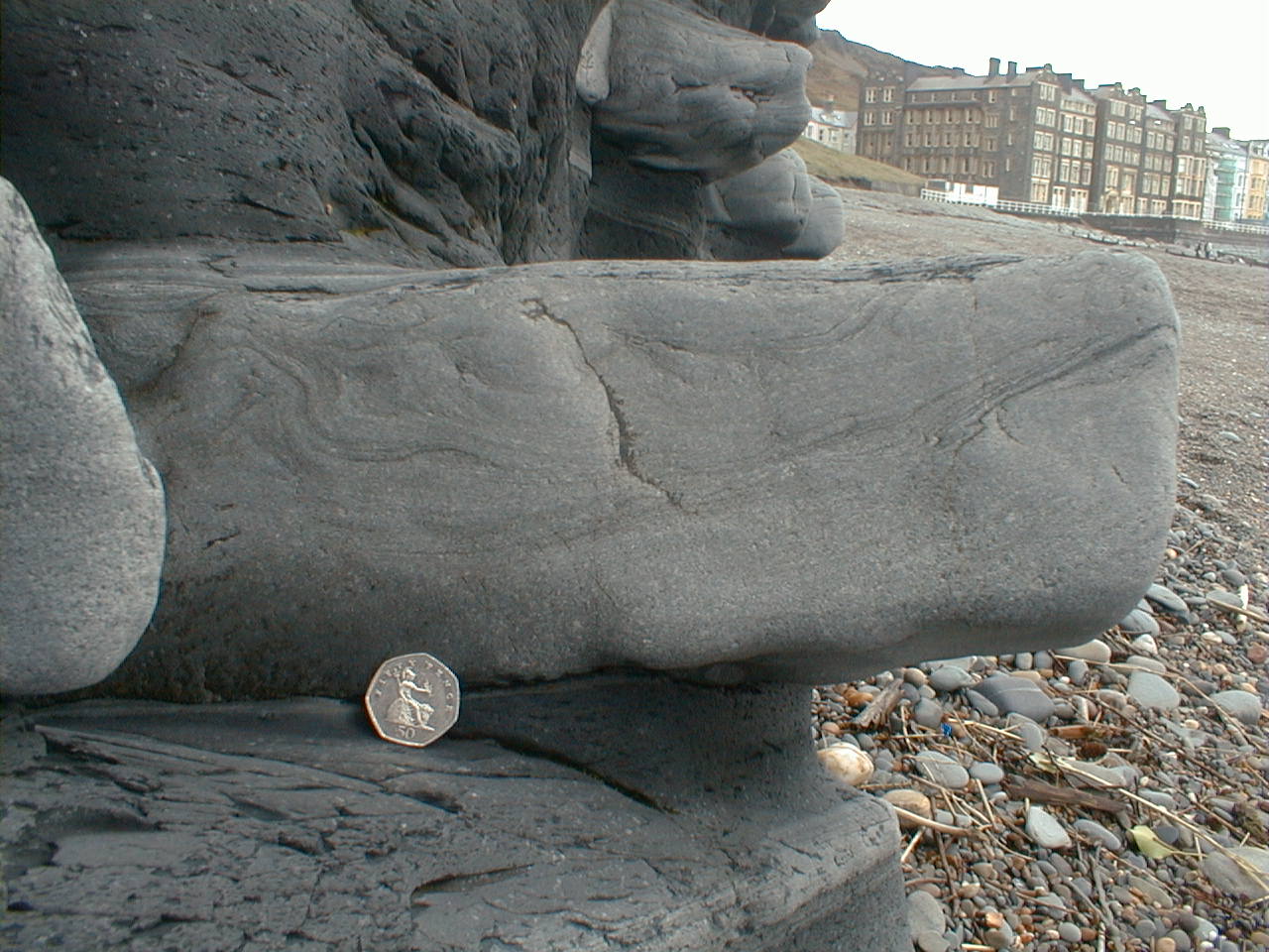
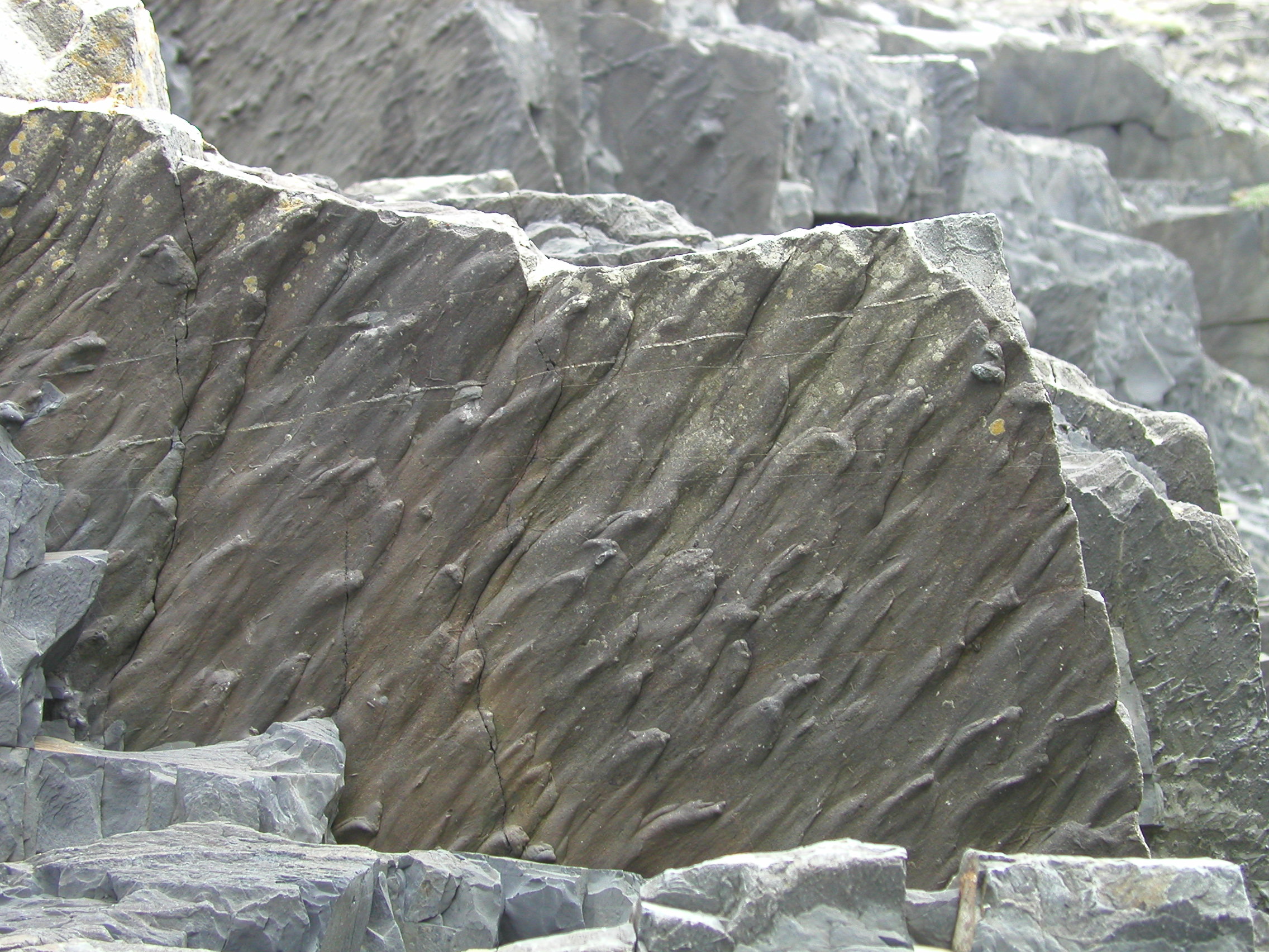
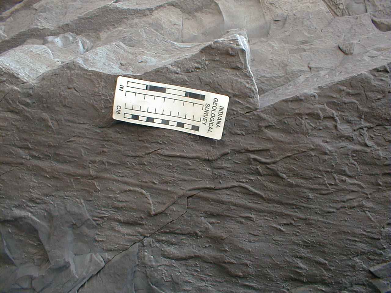
What are these structures? What do they tell us about sediment transport? |
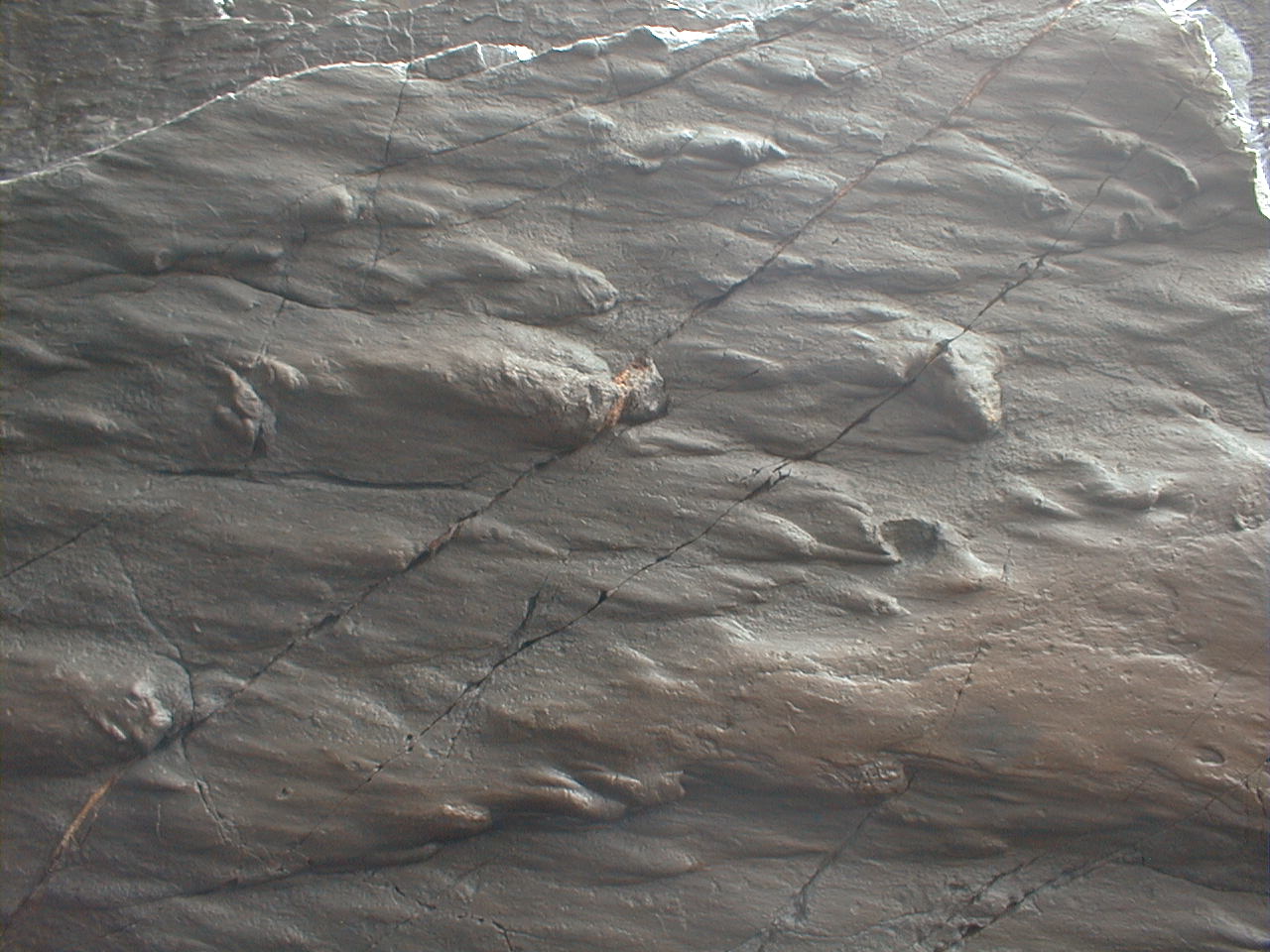 E. Close-up of similar structures on the base of a sandstone bed. |
|
|
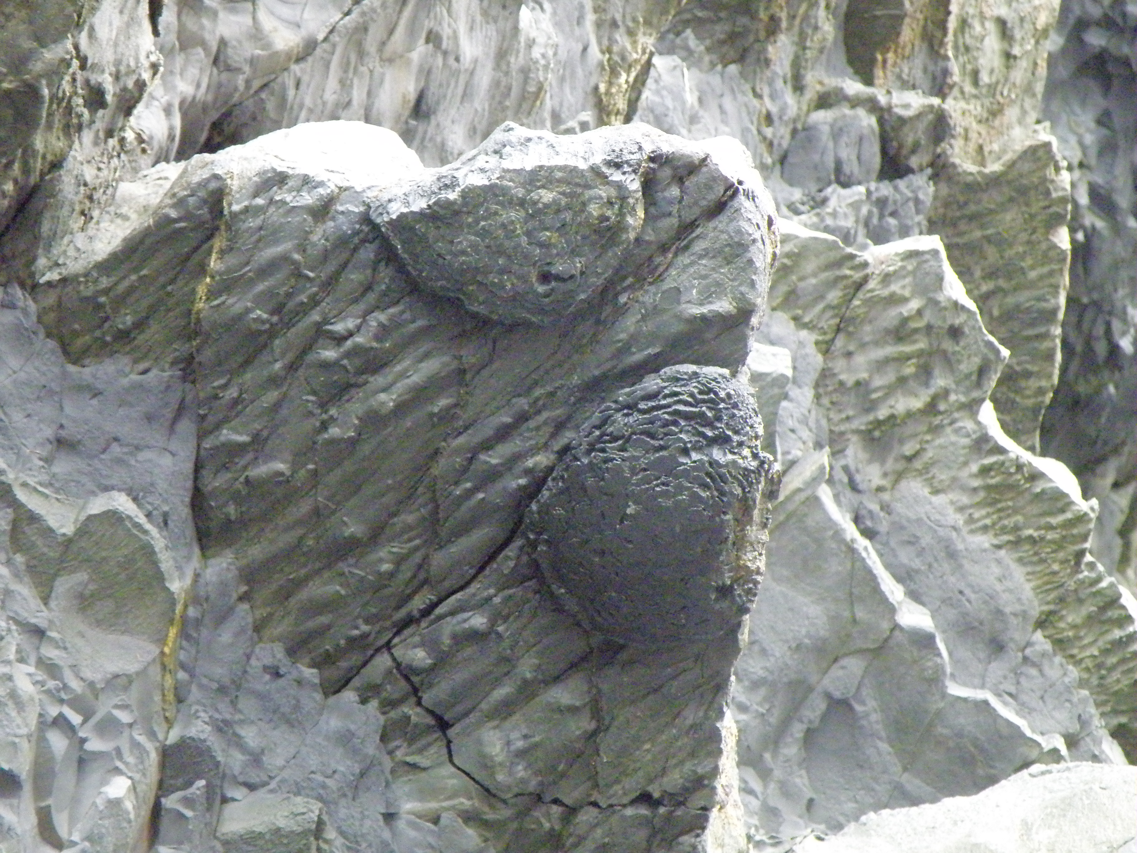
What are they, and how and when may they have formed? Think about the chemical conditions at the sites of deposition and diagenesis. |
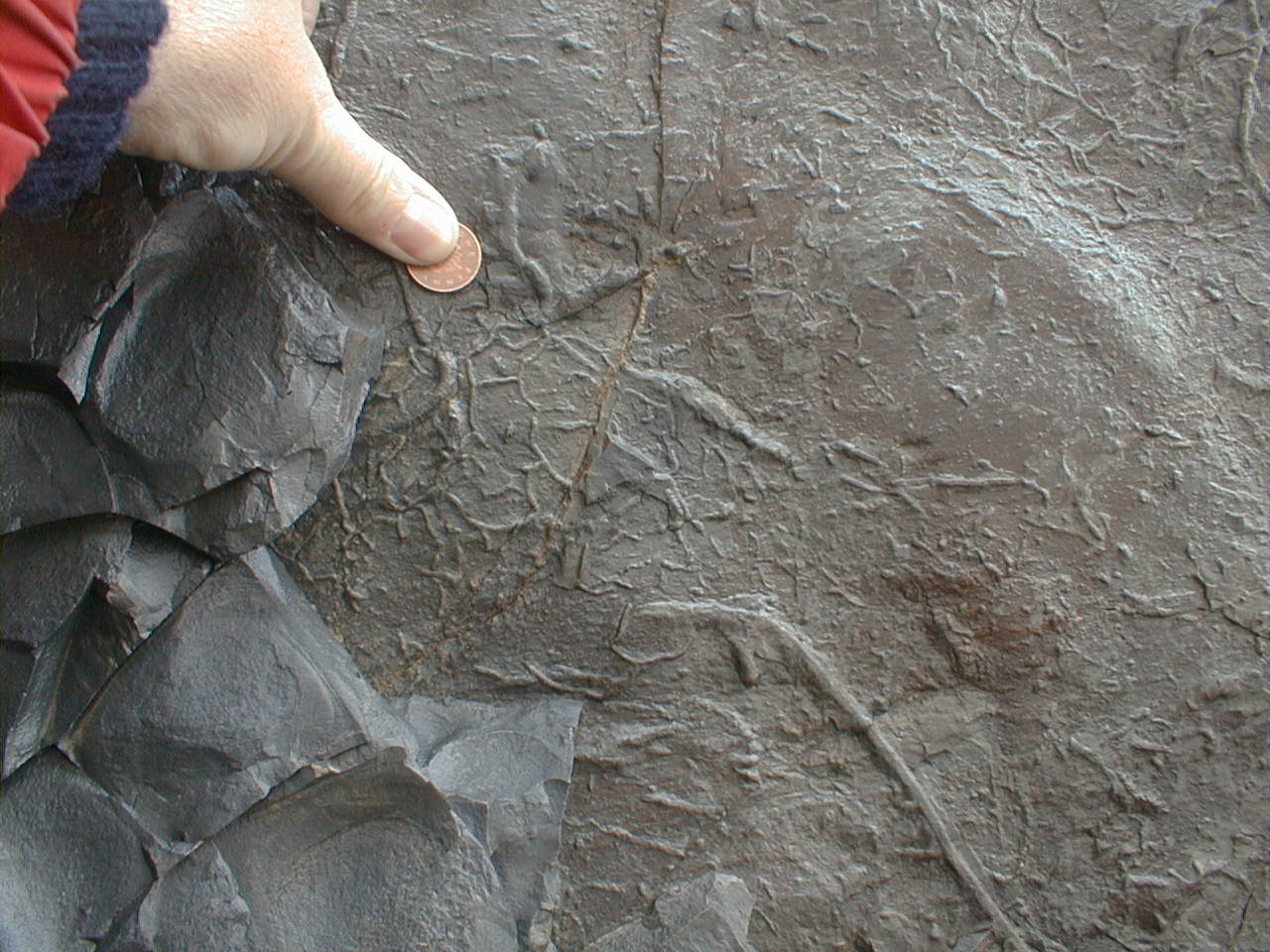
Look at photos which show sections through the beds, such as C, L and M. Can you see evidence of vertical or oblique burrowing? What is the degree of bioturbation? Explain your observations. |
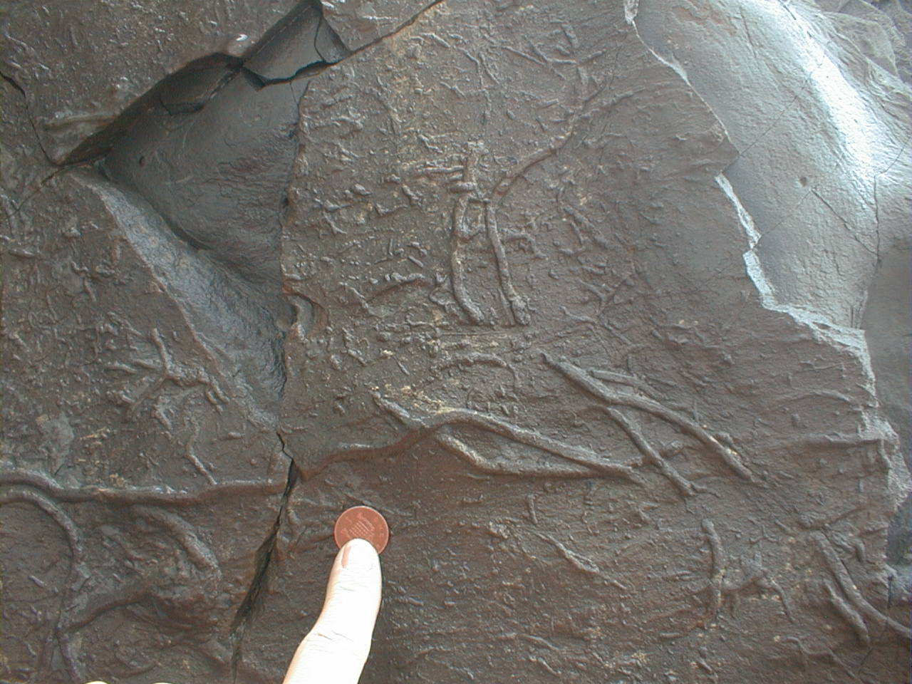
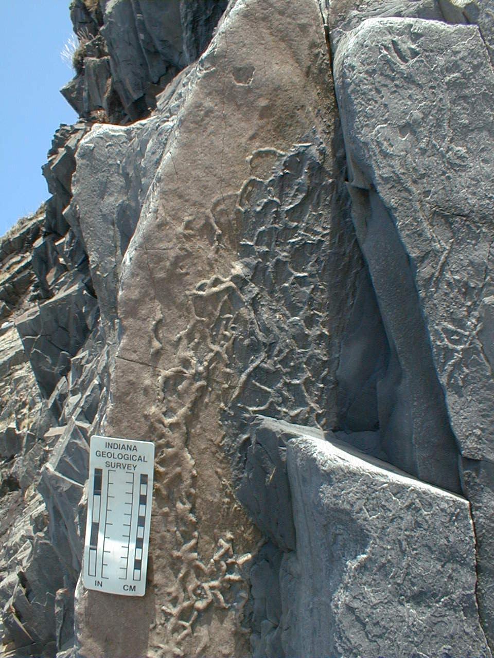
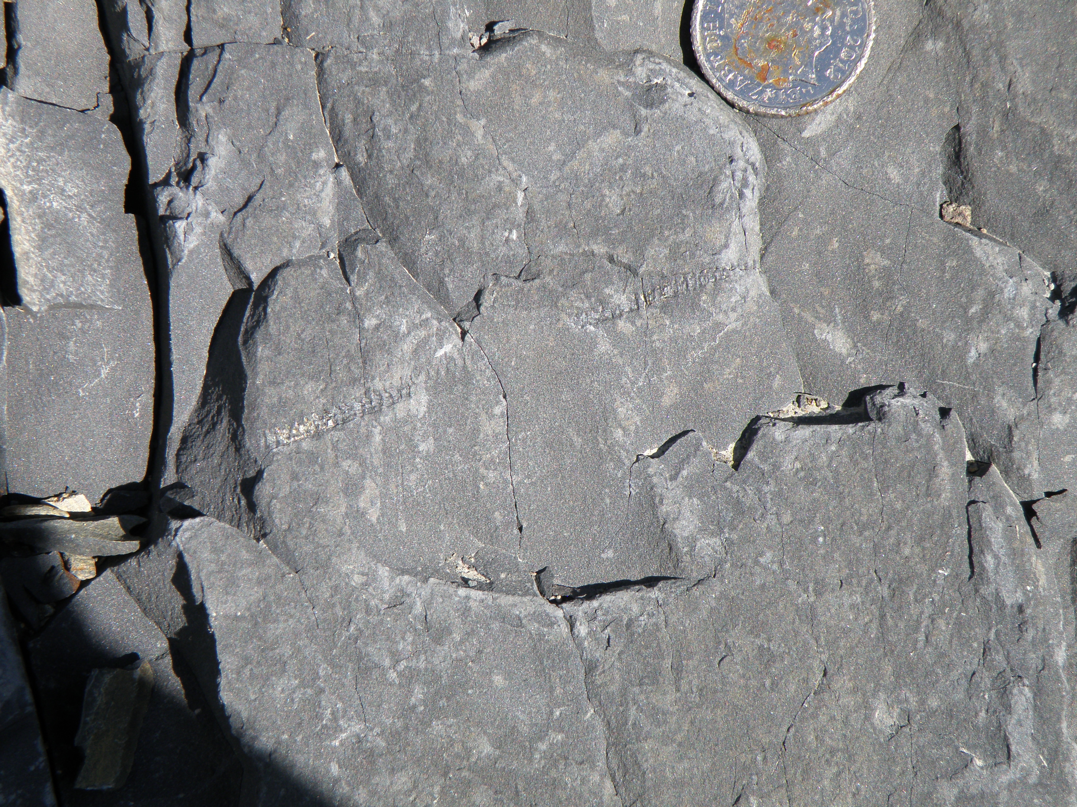
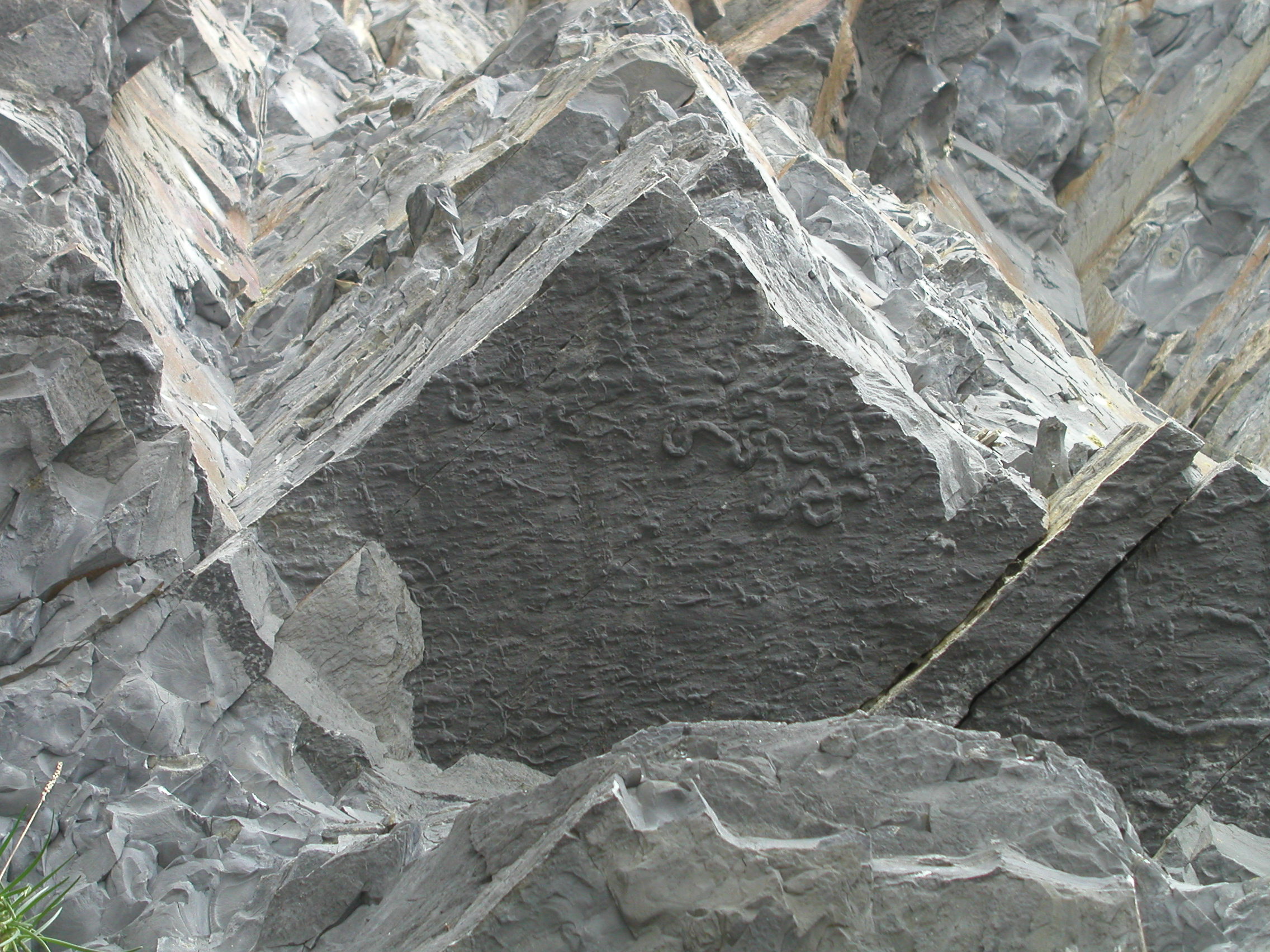
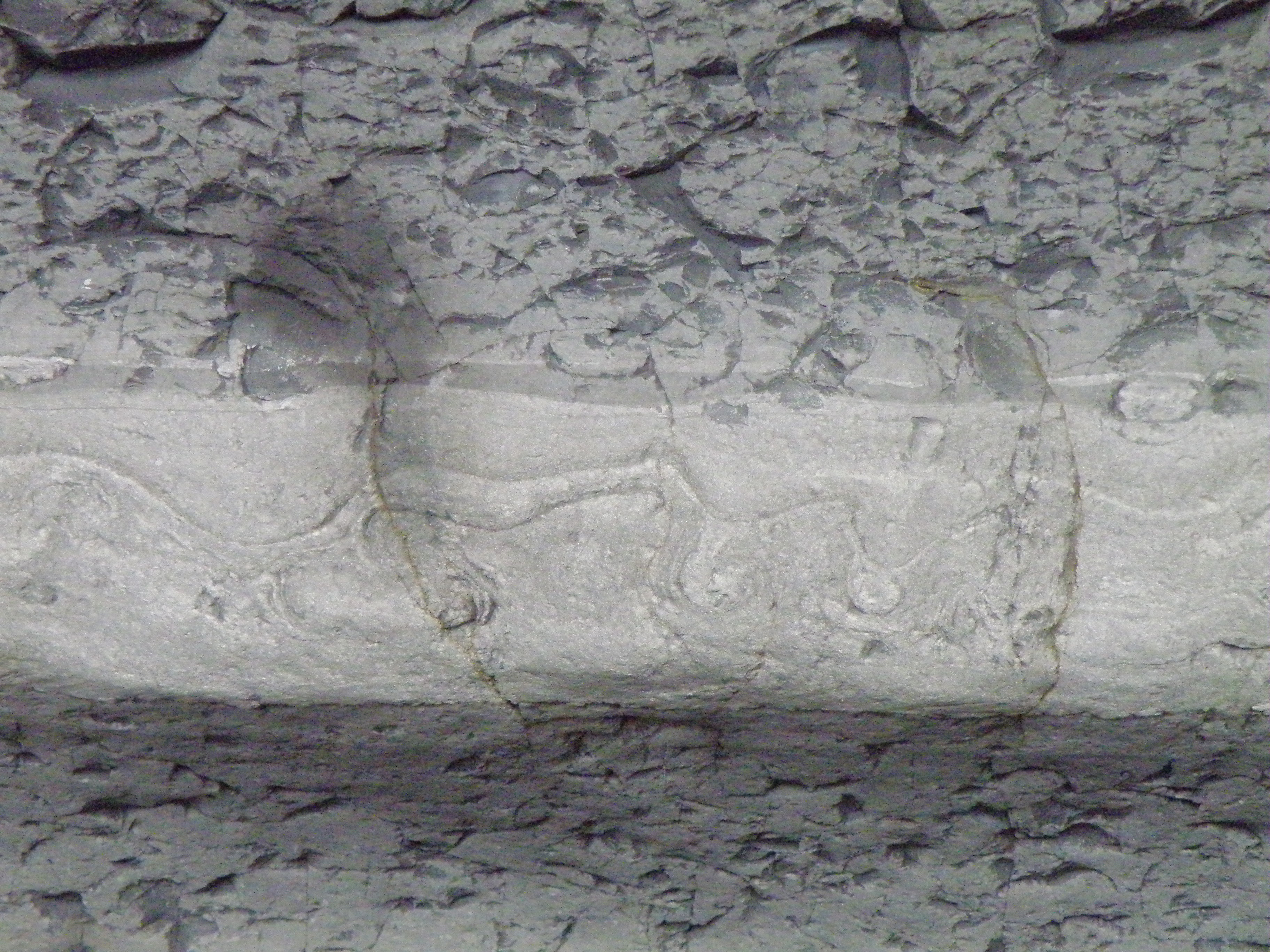
Investigate this trace fossil. What does it represent, in terms of animal behaviour, and what can it tell us about the sedimentary environment? |
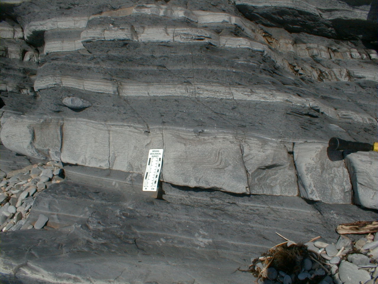
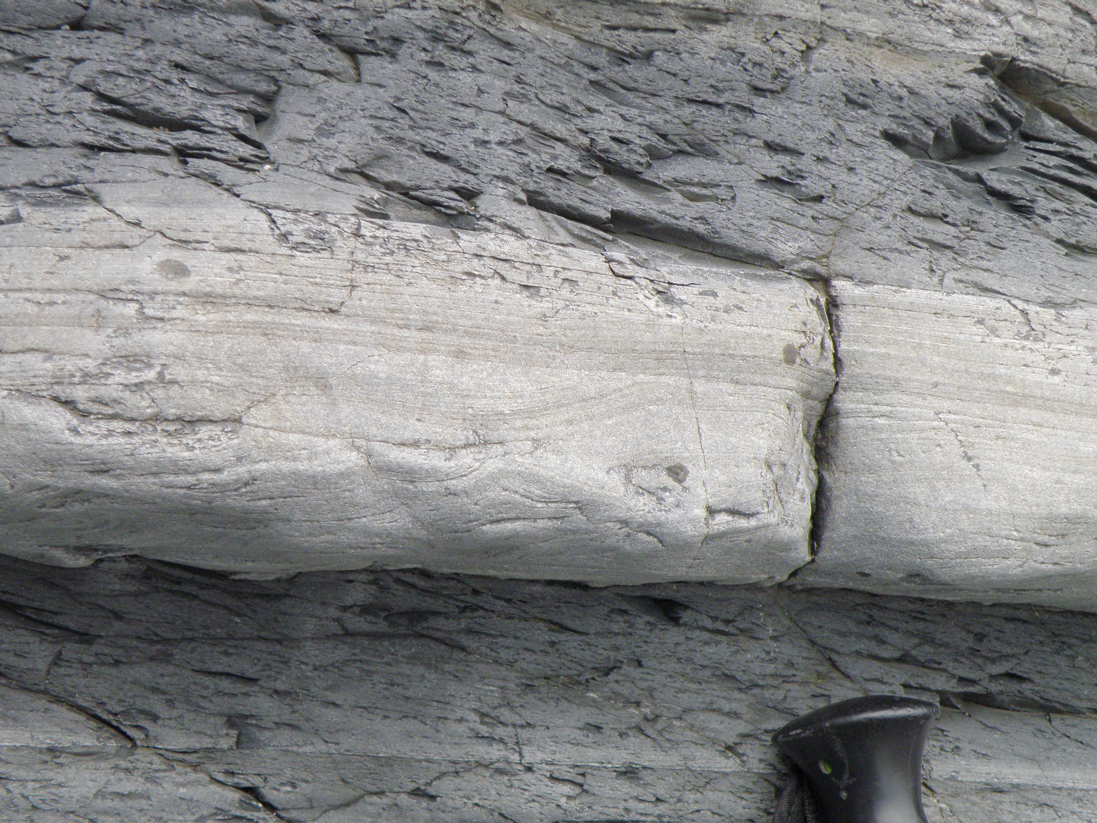
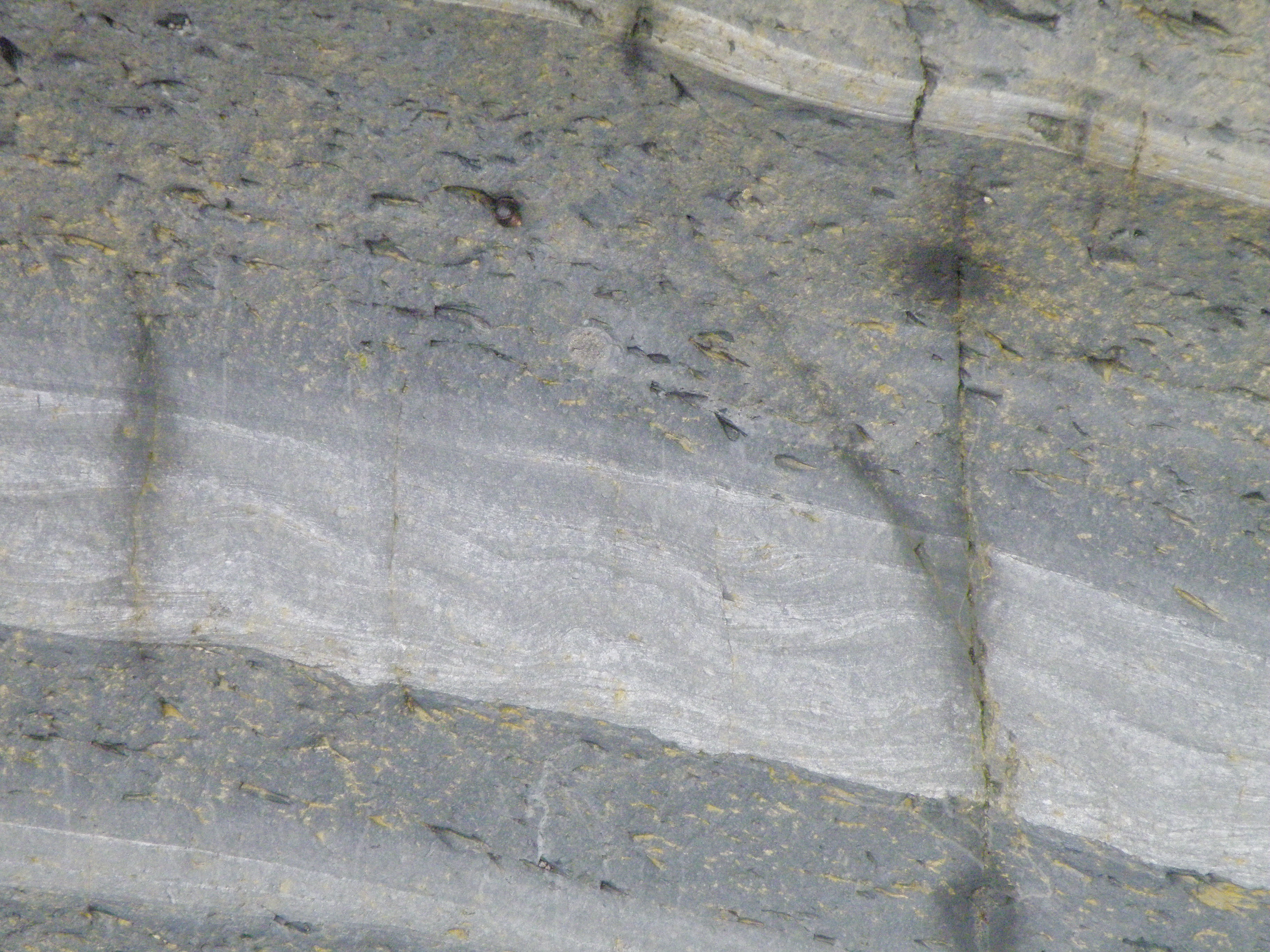
Study the outcrop in detail. How can you explain the varying thickness of the sandstone beds? What gives the mudstones their dark colour? |
|
What is the fossil? How did these organisms live? What does it tell us about the sedimentary environment? |
Study the outcrop in detail. What sedimentary structures are present within the sandstone beds? Interpret these in terms of flow conditions. |
|
|
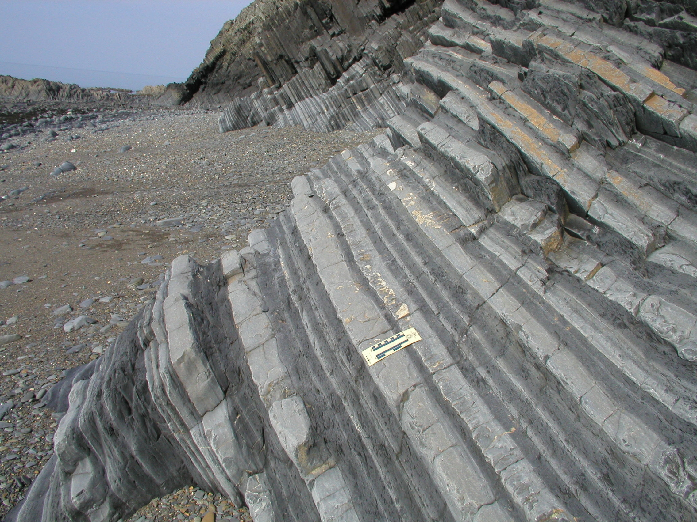
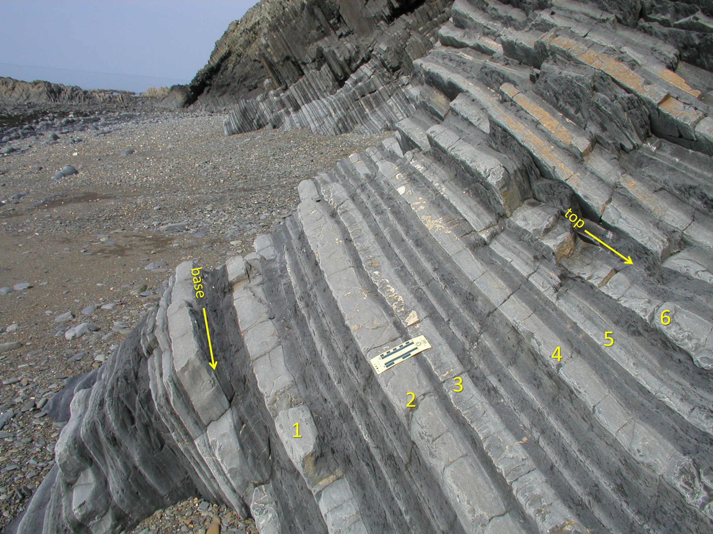
The logged section
Before you start logging, look carefully at the foreground and background in the photo below left. Can you match up beds, or groups of beds? What can you conclude from this?
|
Which way does the section young? Record your evidence - the close-up images below may help. Now it's time to start logging - follow the instructions in today's handout, and the logging instructions in the reference section of the Field Guide. |
The base of the section is taken at the top of a sandstone; the top of the section is within a mudstone interval. Measure thicknesses (Tip: use a ruler on the full-size image on the screen), and convert them to true thicknesses using the scale - the lefthand side of the scale is 10cm, with 1cm divisions.
|
By following beds along strike, we can see additional features. When logging, it's often not possible nor desirable to stick to a single straight line section through the outcrop. In dipping strata, instead of climbing the cliff, follow the beds by eye until they come down to beach level!
Make sure to look upwards for features of interest on the bases of sandstone beds.
|
|
|
|
 F. Close-up of thin sandstone within the mudstones between 3 and 4. |
 G. Looking up at the base of sandstone 6. |
 H. Looking up at the base of sandstone 6. |
 I. Close-up of sandstone 6. |
. |
Additional information: the sandstone beds are all rather similar: all are poorly to moderately sorted, and thin sections show that they are lithic wackes to lithic arenites. Beds 1, 3, 4 and 6 grade from fine sand at the base to siltstone at the top. Bed 2 grades from medium sand up into siltstone. Bed 5 grades from very fine sand up into siltstone.
The mudstones are dark grey in colour, sometimes show fine lamination, and are often cleaved. Grain size ranges from silt to clay. Cleavage is steeper than bedding.
Drawing and interpreting the log
You should now have acquired a substantial amount of information for the sedimentary sequence shown on your log. This includes lithology, sedimentary structures, fossils and field relationships. Your task now is to draw up the log and interpret it. See today's handout for details of what is required.
See Aberystwyth from a different perspective. Take a ride on the cliff railway, or fly a drone along the coast.
The large building at the north end of the promenade, a former hotel, is now a hall of residence for Aberystwyth University students. Streetview even allows you to see inside the building! The building was damaged during the powerful winter storms of 2013-14.
![]()
Make sure you've completed all the work for this locality. Now we can get back on the virtual coach and head off to our next stop at Borth
![]()
This page is maintained by Roger Suthren. Last updated 21 May, 2021 6:25 PM . All images © Roger Suthren unless otherwise stated. Images may be re-used for non-commercial purposes.