It is important that you access this field trip on a laptop or desktop PC. Click on any image to enlarge it.
This is a short stop, and our last look at the Lower Silurian on this trip. Explore the area in Google Maps and Streetview.
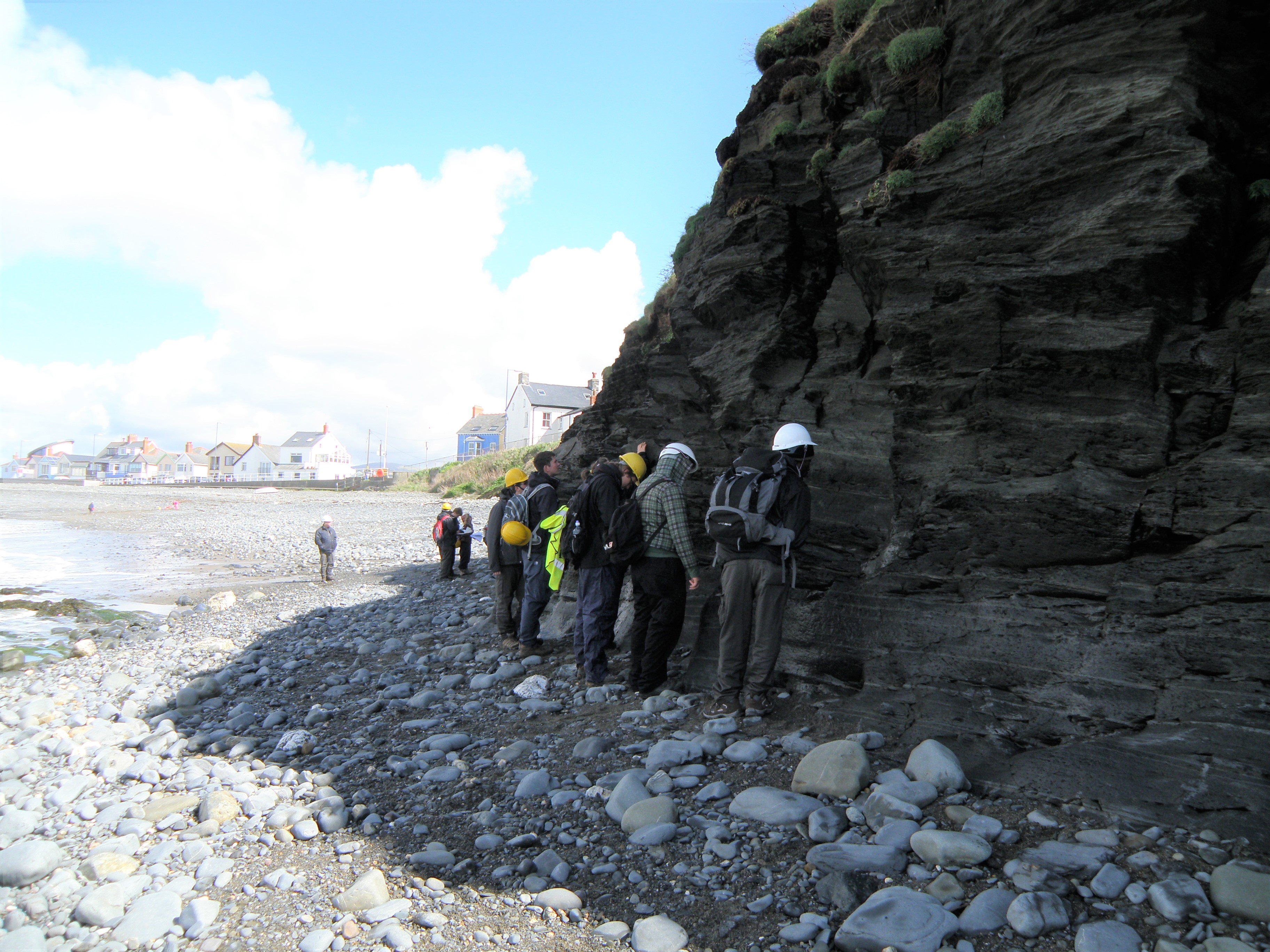
It's just a short walk from the village to the low cliffs at the south end of the beach. This is a beautiful, long pebbly beach. On a clear day you may see the mountains of Snowdonia to the north across Cardigan Bay.
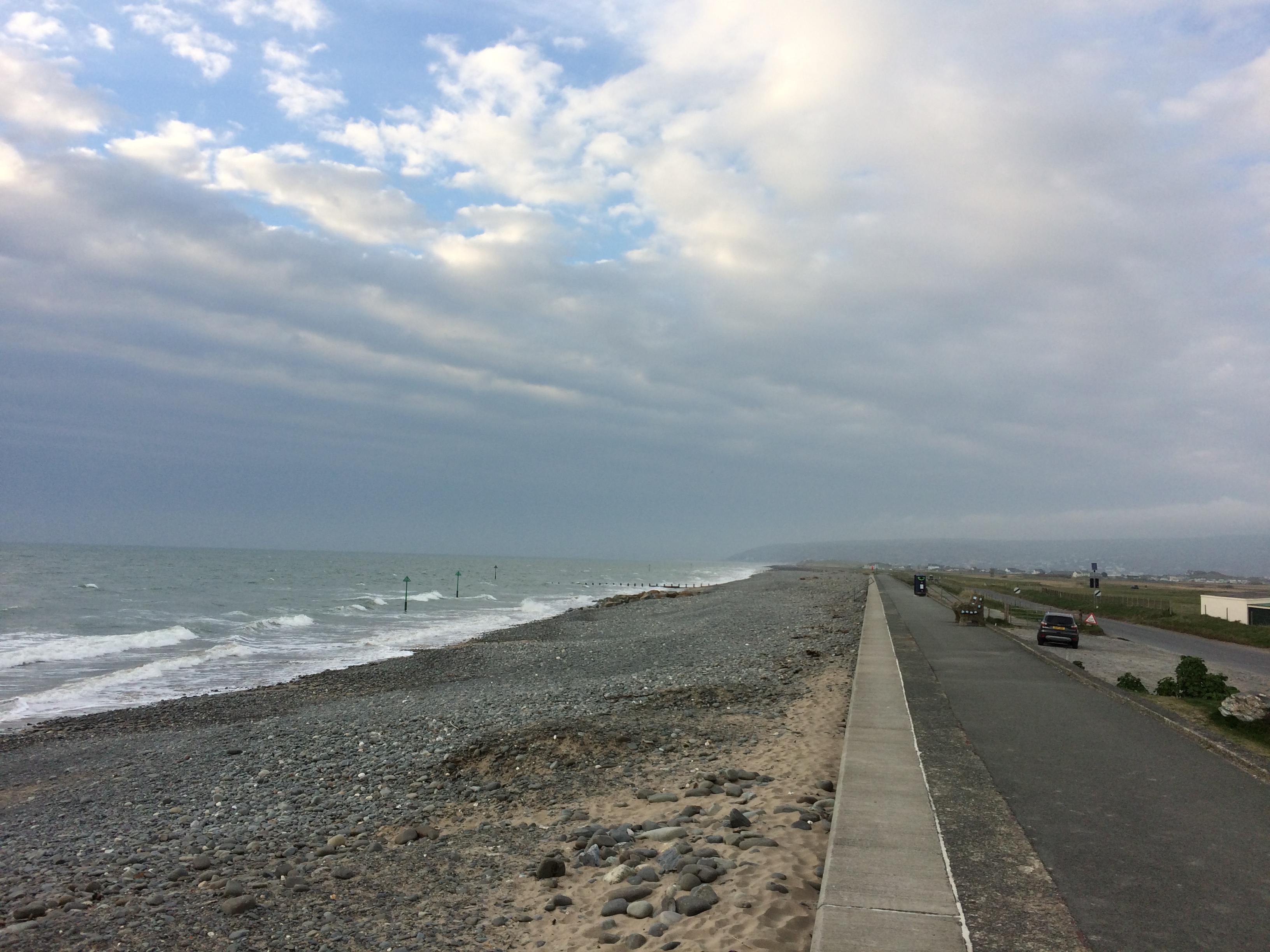 A. View north along the beach at Borth. The beach is exposed to westerly weather systems, so is popular with surfers, and prone to damage from winter storms. |
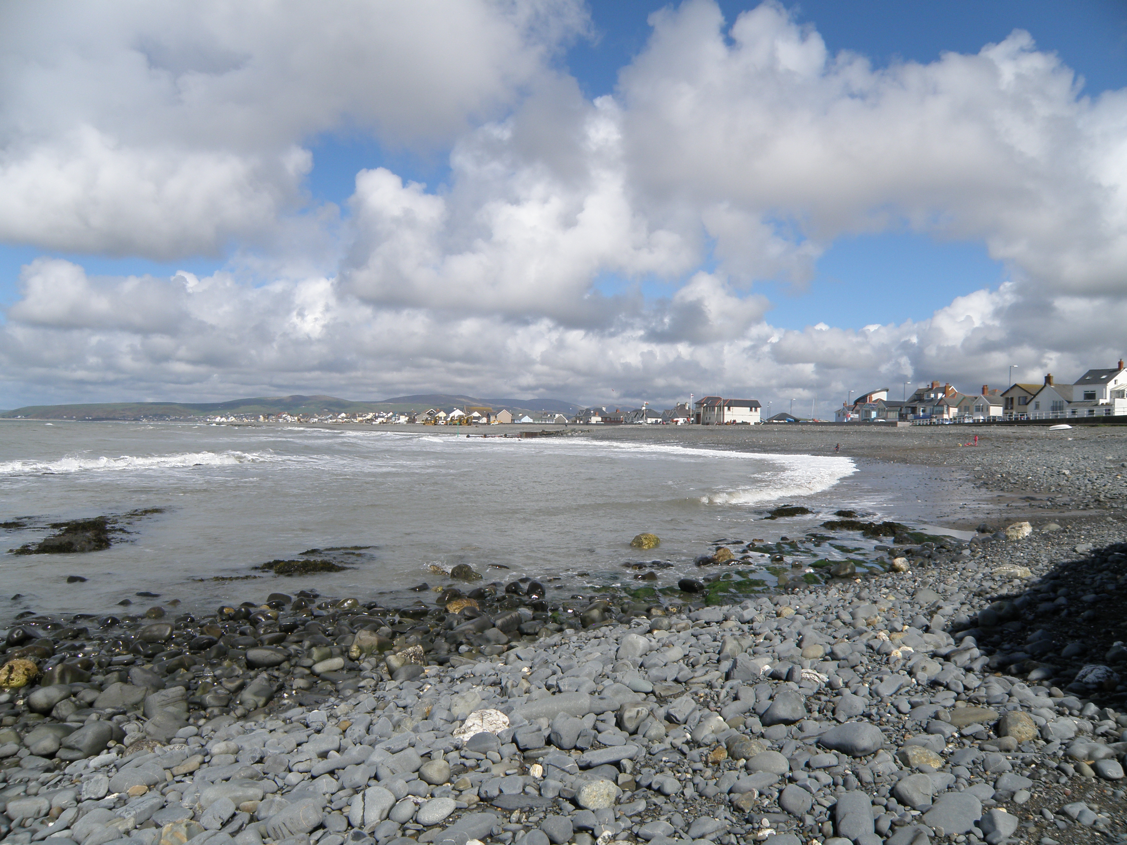 B. View north from the outcrops to the village of Borth. |
The rocks exposed here belong to the Borth Mudstone Formation (BMF), of Upper Llandovery (Lower Silurian) age. Near Borth, the Formation lies immediately beneath the Aberystwyth Grits Group (AGG). Elsewhere in the region, the BMF is the lateral equivalent of parts of the AGG - both units are diachronous.
Study the outcrops, make observations
in your virtual field notebook, and interpret the processes, conditions and
environments of this section.
Handout: refer to the handout for today, which contains essential diagrams and information. Don't forget to use the information in the Field Guide too. Both are available in Course Resources.
Tasks: See today's handout. Now that we have seen four localities of similar age, we should be able to draw broader conclusions about the palaeogeography and sedimentary systems in Llandovery (early Silurian) times.
Field evidence
Outcrop photographs. Describe them, and use them as evidence on which to base your interpretations. Pay particular attention to field relationships - contacts between units, how units change as you trace them laterally, etc.
|
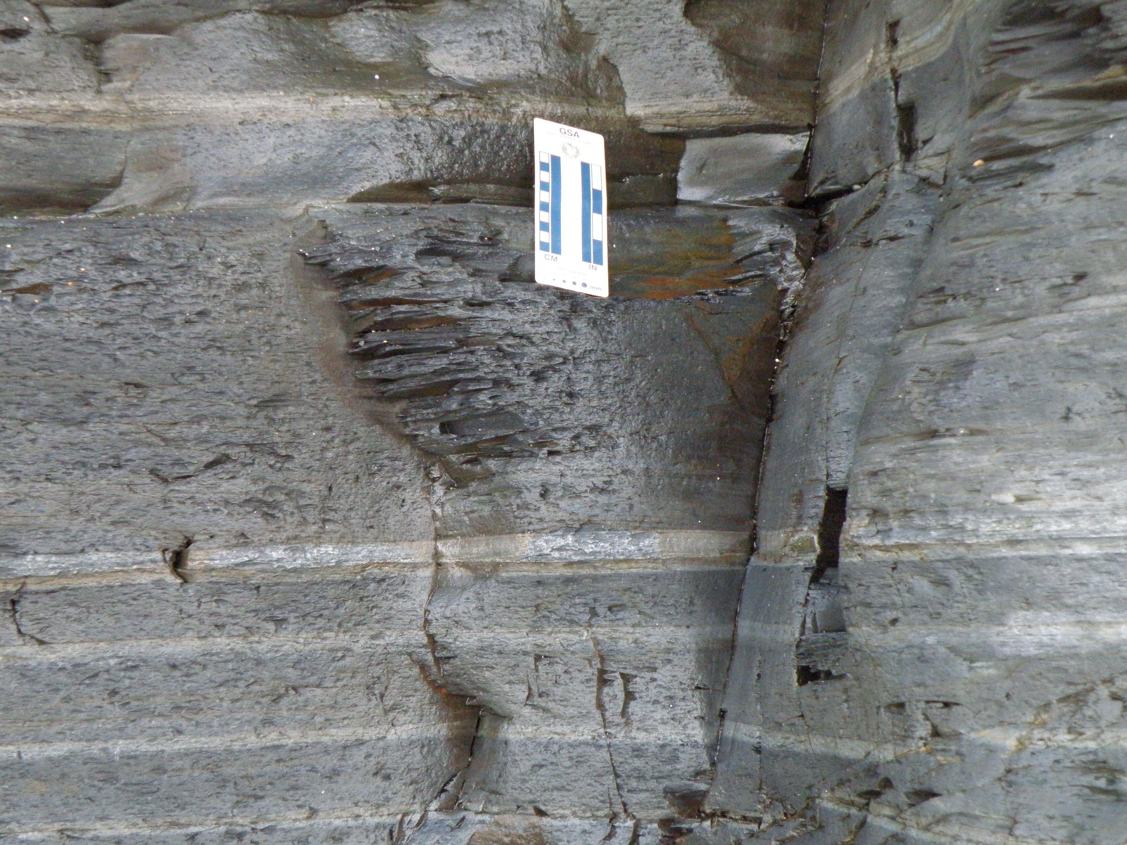
How many lithologies can you see. What is the predominant lithology? |
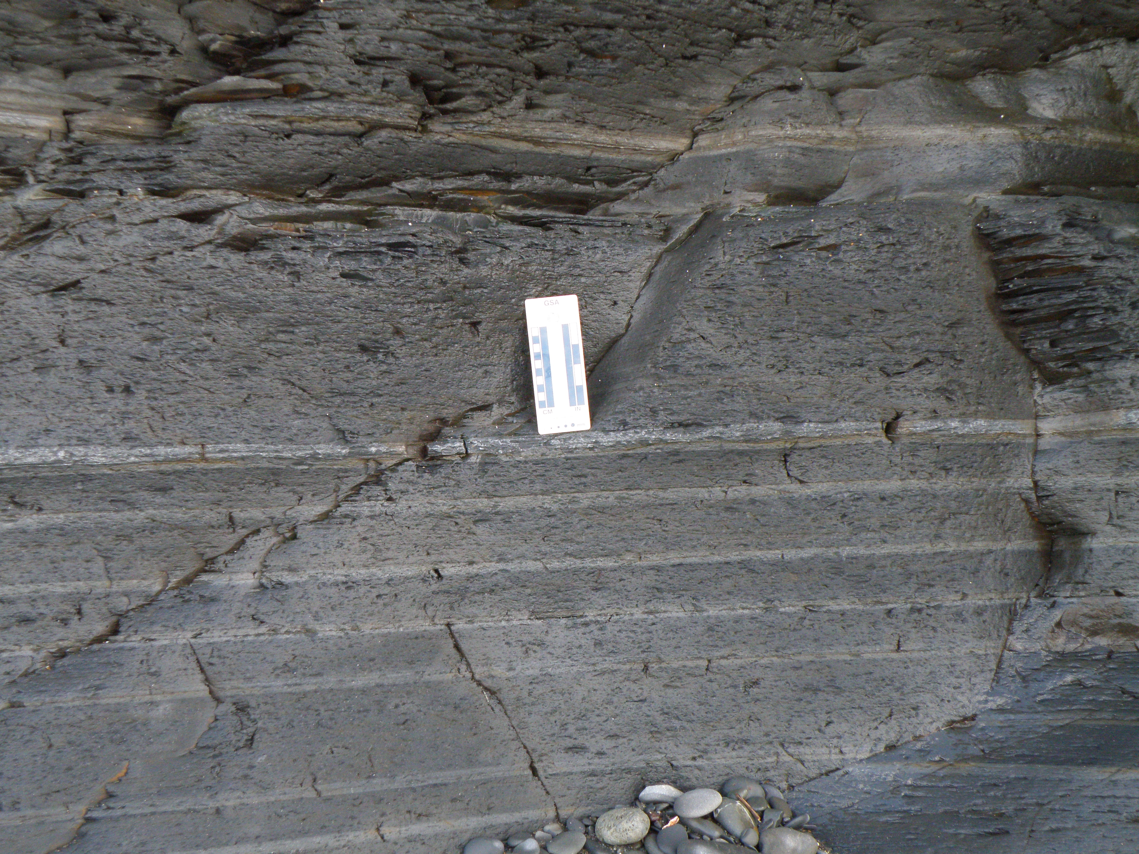
Comment on lateral continuity. Are any sedimentary structures present? Carry out a net:gross calculation on this photo. Now you have values from 3 locations to compare. |
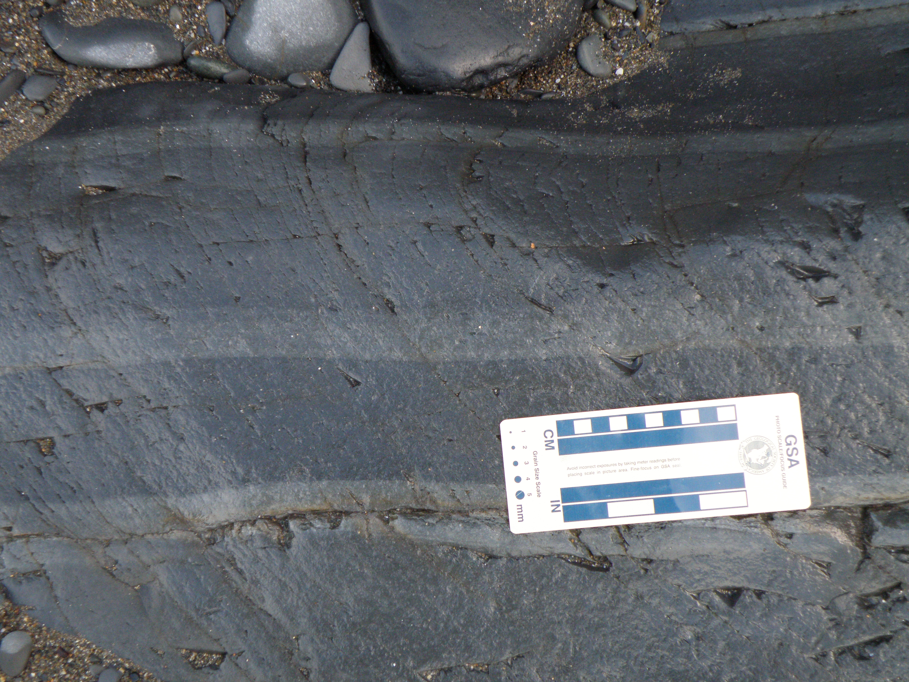
 E. Close-up of the top of the section seen in D. |
Look carefully at bed contacts and sedimentary structures, and describe them. Having seen all the evidence, what were the main processes and conditions during deposition of these sediments? |
![]()
Make sure you've completed all the work for this locality. That's the first day completed - we've seen a lot of geology. You've probably got questions about today's outcrops, so join us at the virtual picnic on the beach in Blackboard Collaborate at 5pm today (only available if you're a University of Derby student doing this field trip in real time on Monday 27 April, 2020!).
![]()
This page is maintained by Roger Suthren. Last updated 29 April, 2020 1:28 PM . All images © Roger Suthren unless otherwise stated. Images may be re-used for non-commercial purposes.