It is important that you access this field trip on a laptop or desktop PC. Click on any image to enlarge it.
This is the first of three localities where Lower Silurian (Upper Llandovery) rocks are exposed in coastal cliff sections. Explore the section in Google Maps
 |
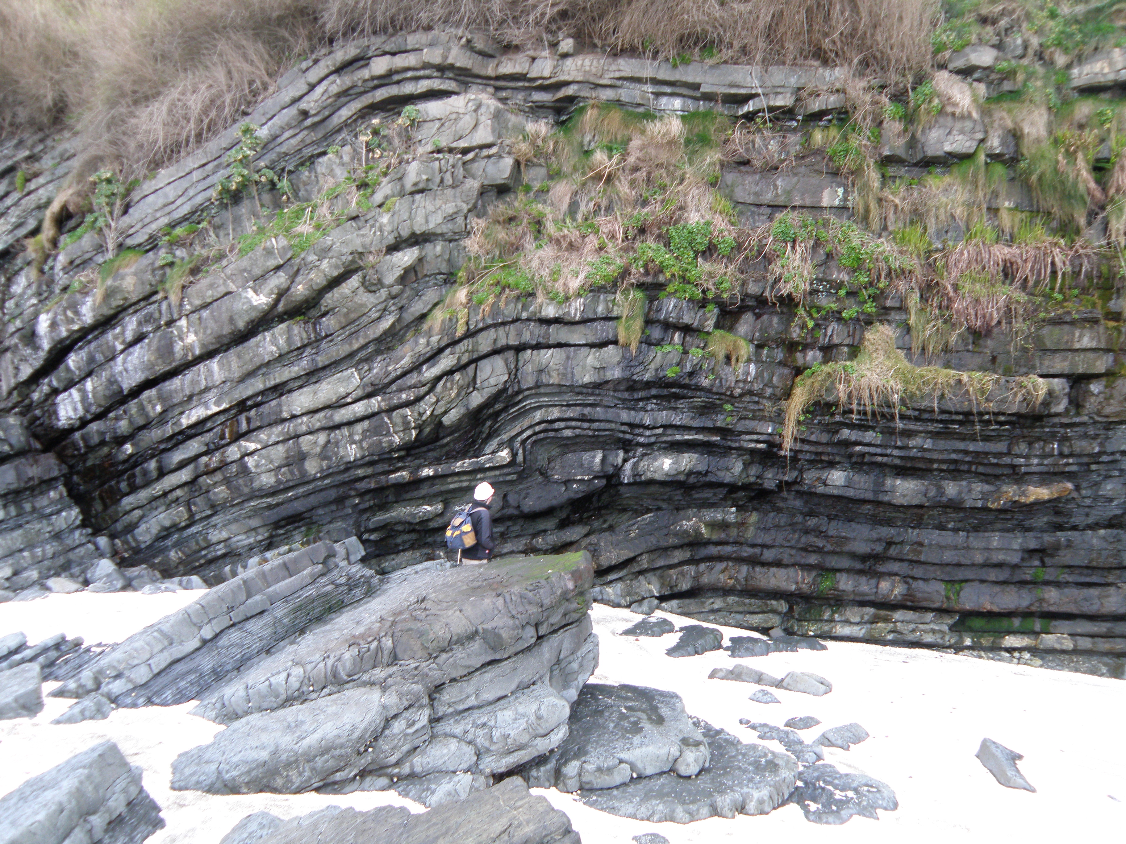 |
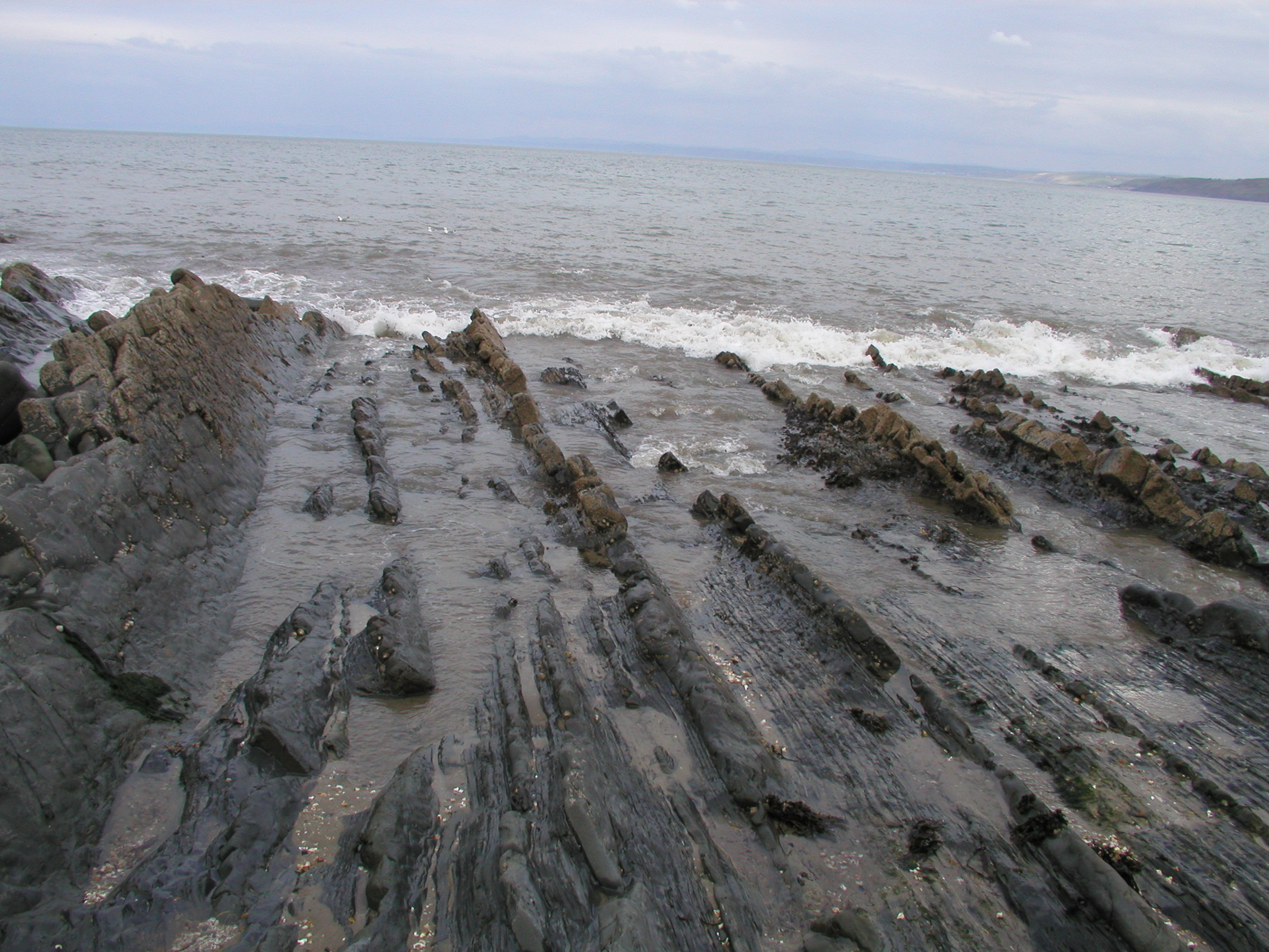
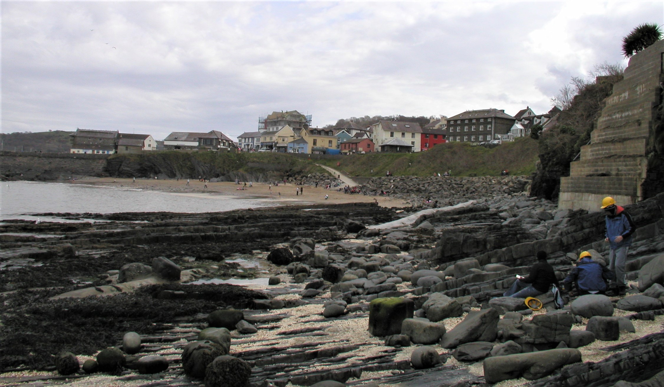
| A. General view of the section at New Quay. The beds are dipping roughly south, away from the camera. |
B. View of the cliff section, showing minor folds and faults. Sandstones stand out; mudstones weather in. Comment on lateral continuity of the beds. |
The Aberystwyth Grits Group is well
exposed on the foreshore and in the low cliffs.
The aim of this exercise is to synthesize information of a variety of different types - for example lithology, thickness and geometry (including lateral continuity) of sedimentary units, sedimentary structures, lateral and vertical changes etc. From these observations, you should be able to attempt interpretations of the processes and environments involved in the formation of the section. This integrated approach, using all available sources of information, is very important in sedimentology
Describing, identifying and interpreting sedimentary structures is an important part of this exercise. If you need to brush up on these, the best sources are the appropriate chapters in the set books - see day 1 in Course Resources.
Handout: refer to the handout for today, which contains essential diagrams, information and the exercises to be completed at each location. Don't forget to use the information in the Field Guide too. Both are available in Course Resources.
Tasks: see the handout for Day 1 locations.
![]()
Field evidence
Study the outcrop photographs below. Describe them, and use them as evidence on which to base your interpretations. Pay particular attention to field relationships - contacts between units, how units change as you trace them laterally, etc. Answer the questions and tasks attached to individual photos in your virtual notebook.
|
|
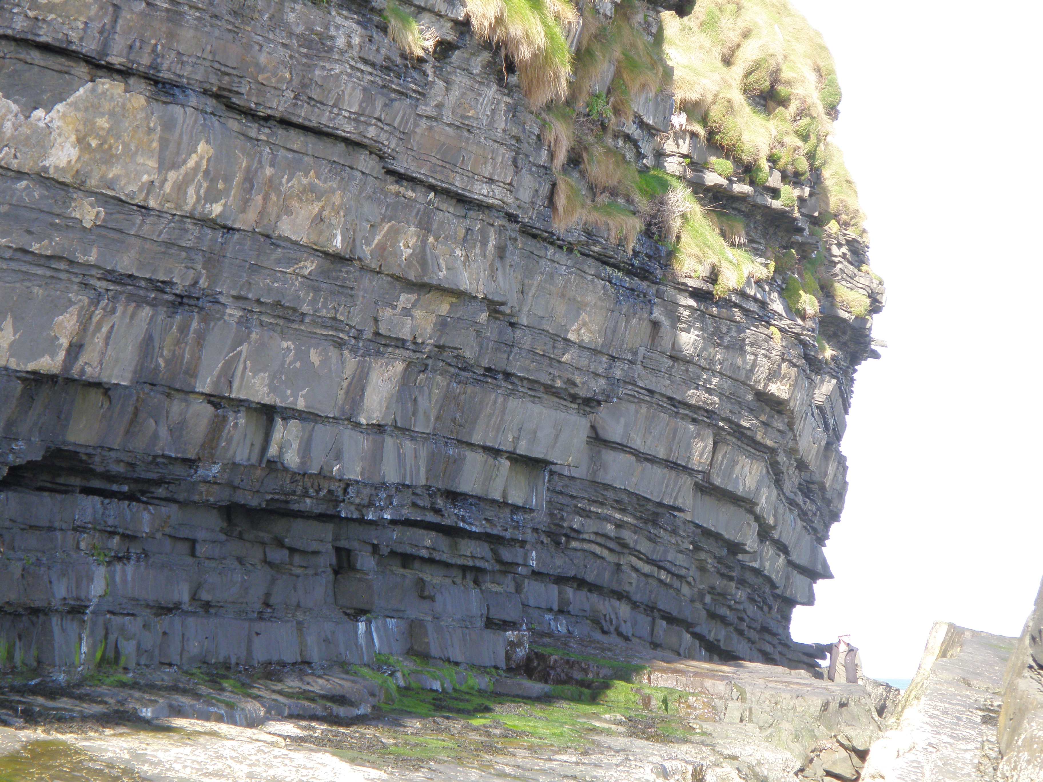
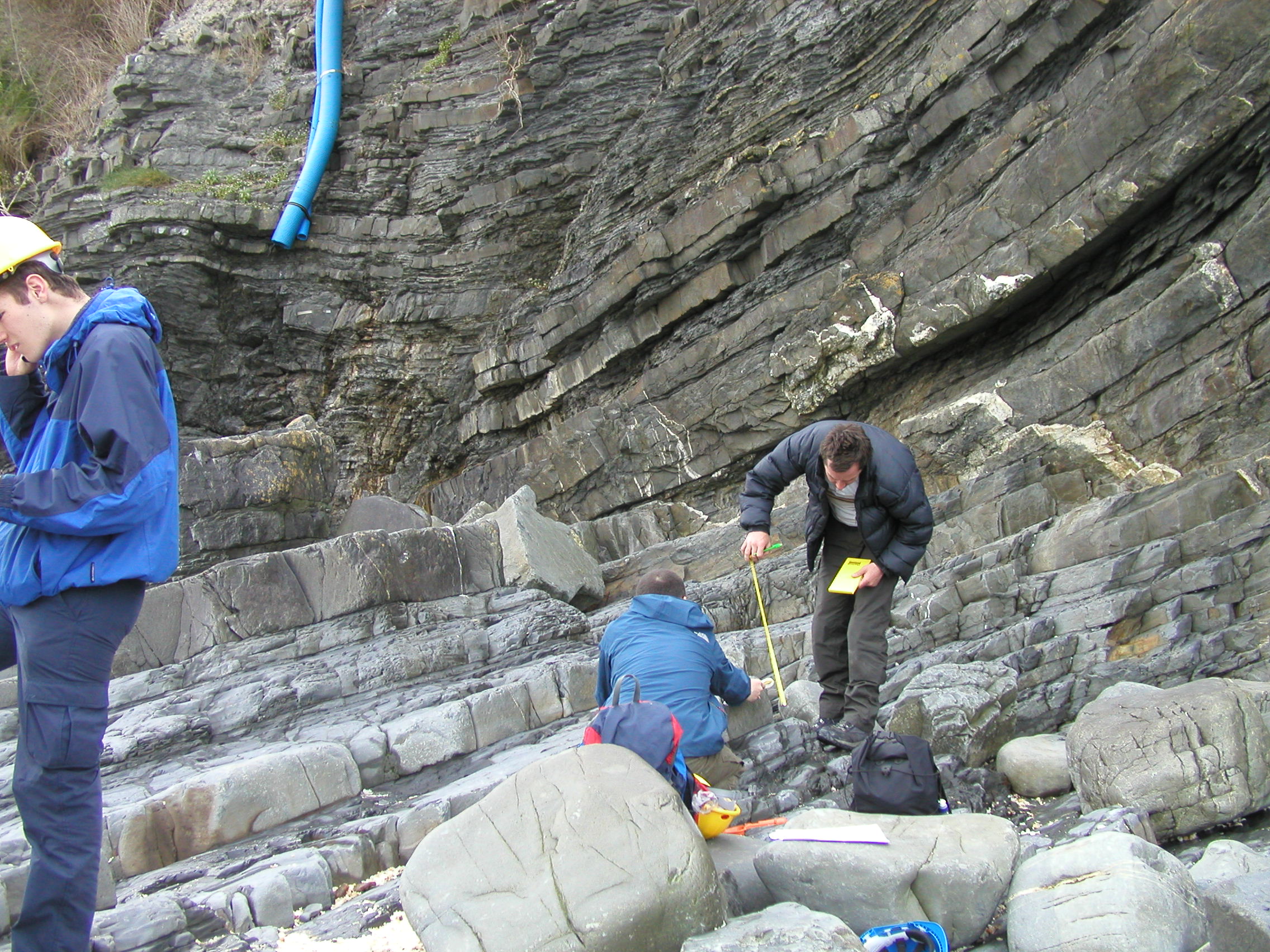 D. Logging the section |
Use this section for your net:gross measurements (Tip: use a ruler on the full-size image on the screen). Do you notice any systematic changes in sandstone bed thickness up the section? What might this mean? |
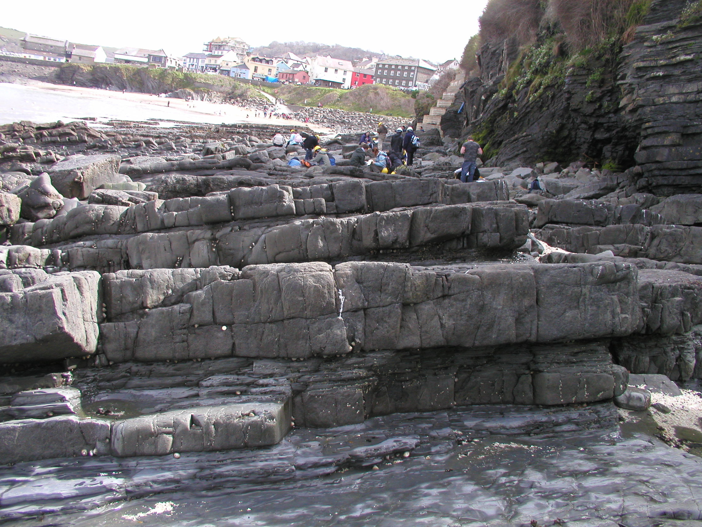
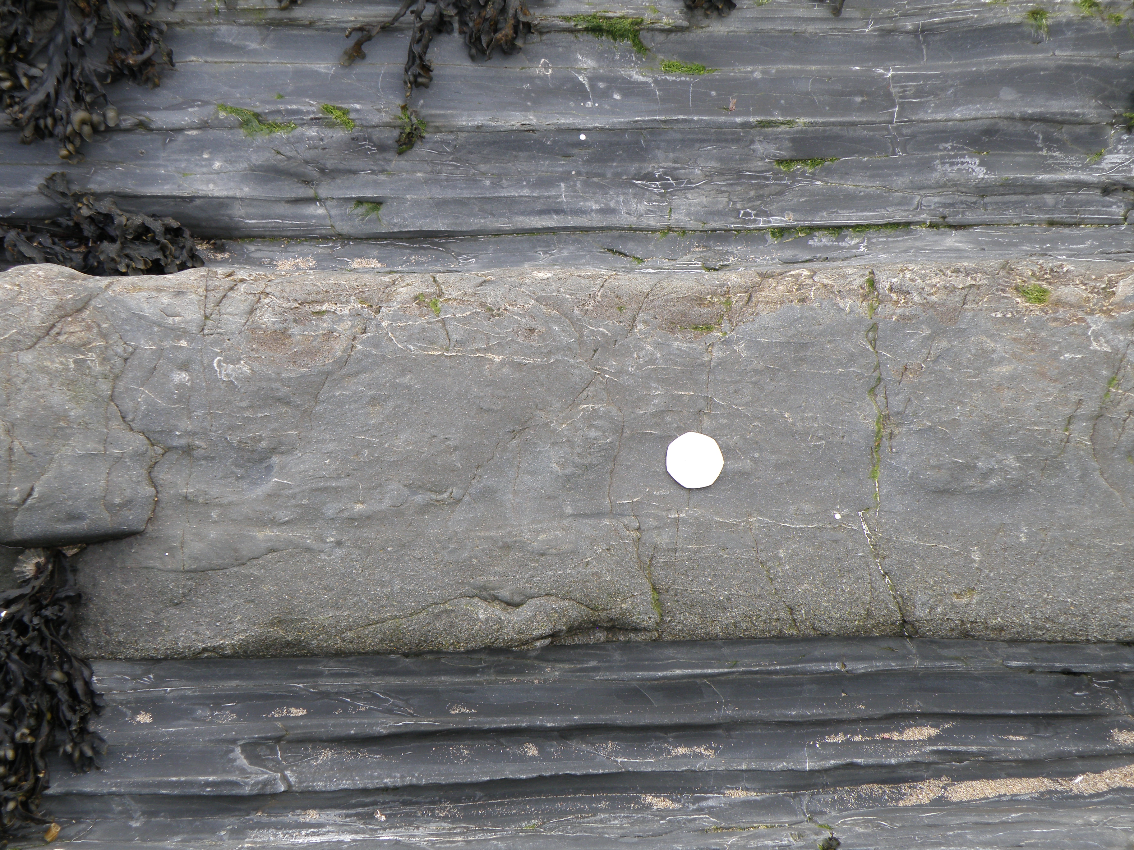
Describe the basal contacts and thicknesses of the sandstone beds. |
|
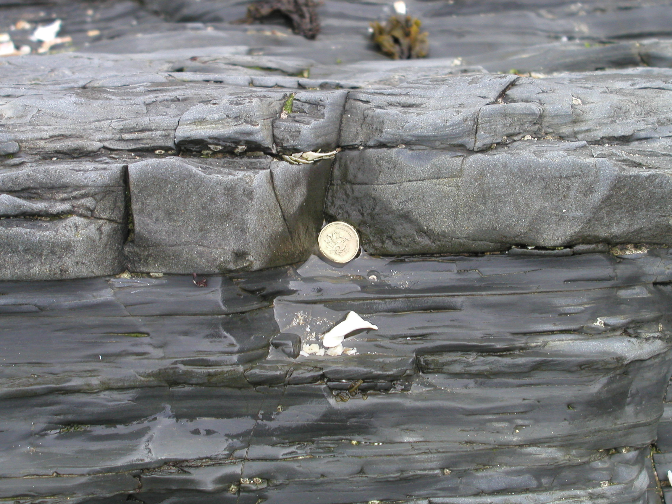
Describe the base of the sandstone, and make notes on any upward changes
in grain size and sedimentary structures within the bed. |
Note any grain size changes and sedimentary structures within the bed. |
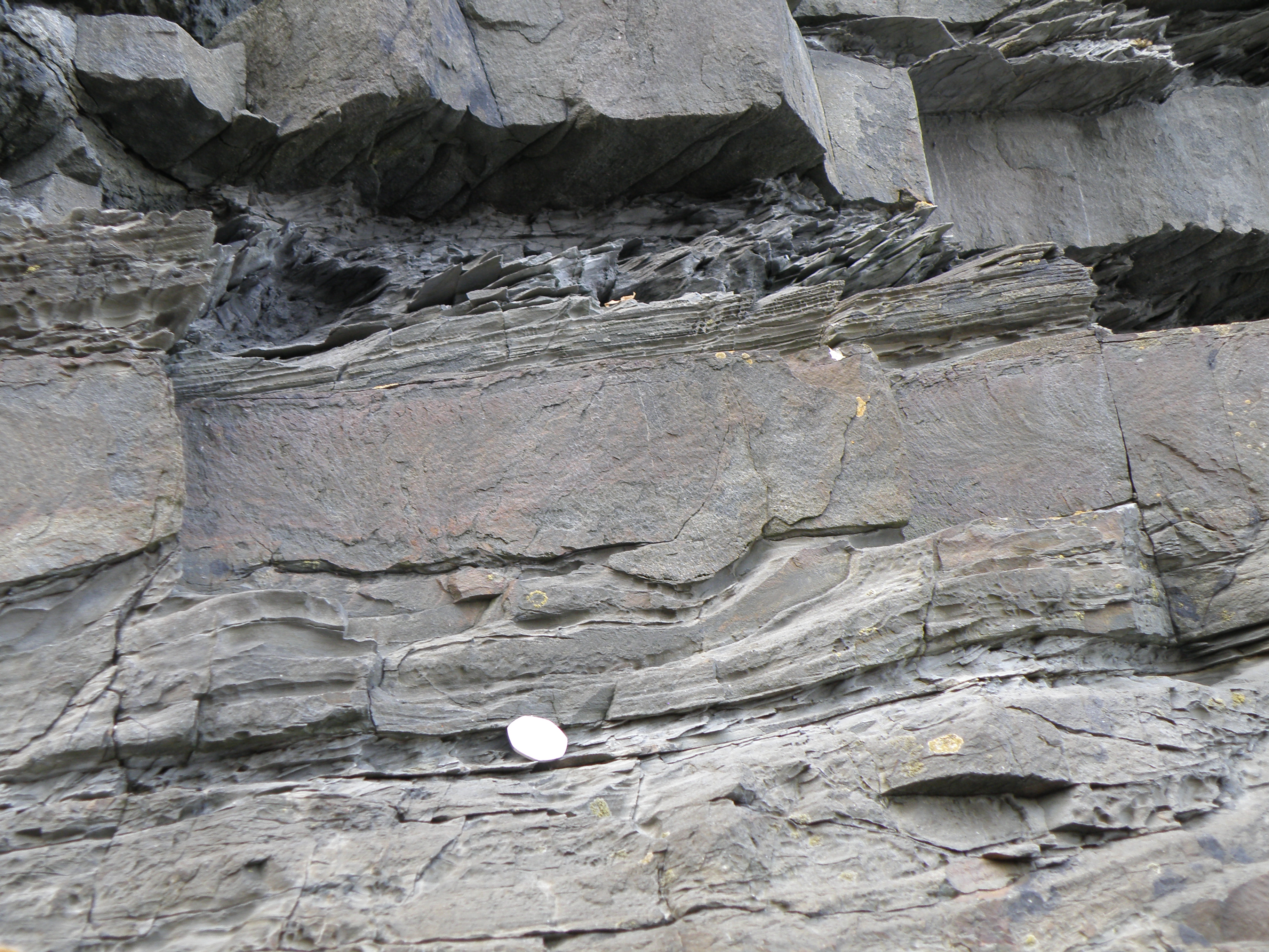
Look carefully at the bases of sandstone beds in this photo. What sedimentary structures can you see, and what do they tell us about processes and conditions of deposition? |
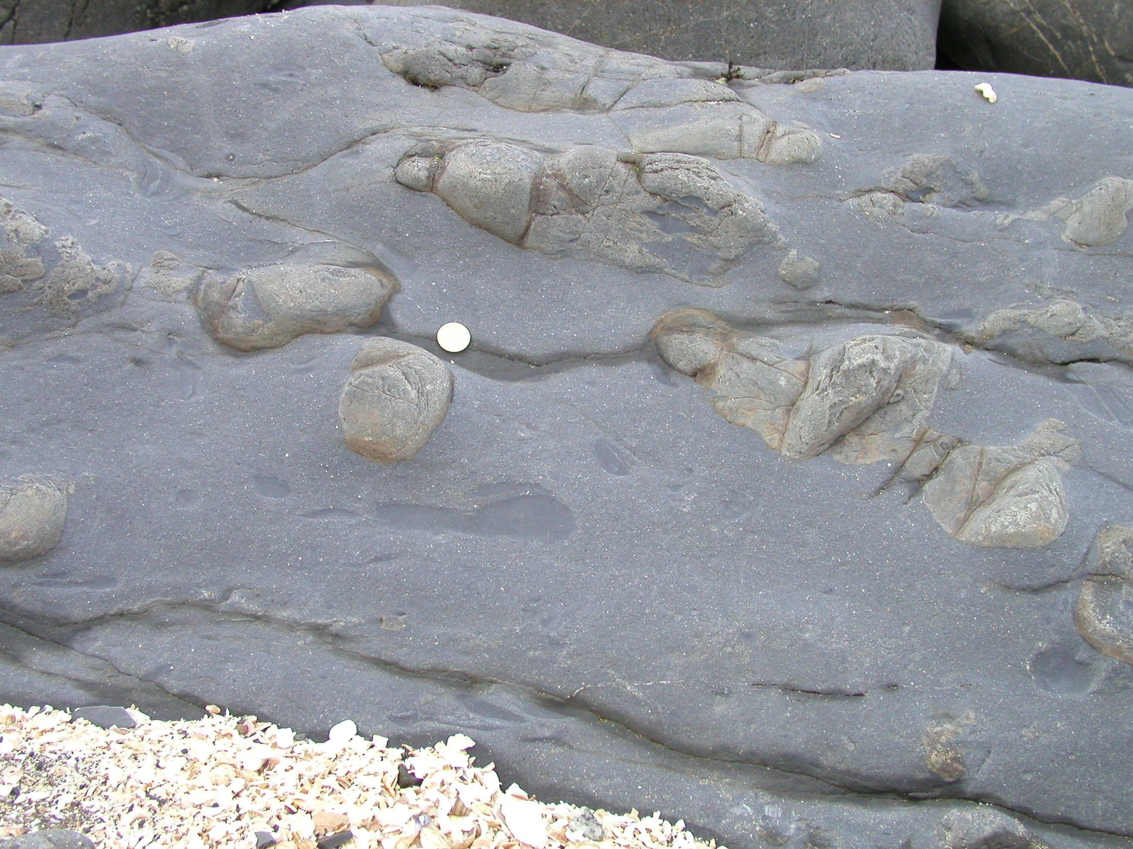
Describe the objects, particularly their shapes and internal structures,
and comment on how they may have formed. Briefly
list the sequence of events represented here, |
Interpreting the field evidence
Refer back to today's handout to make sure you have completed all the tasks. You should now have acquired a variety of different types of data on the New Quay section. This includes lithology, sedimentary structures and field relationships. Your task now is to interpret the data.
Write a brief interpretation of the processes and conditions which operated as this sequence was deposited. Include in your interpretation information such as environmental energy, flow regimes, salinity, oxygen levels, depth etc. There must be evidence to support all of your interpretations.
![]()
Grab an ice cream or a coffee in one of the shops at the top of the ramp. Explore
Dylan Thomas, Wales's most famous 20th century poet, spent a lot of time writing and drinking in New Quay. His fictional town of Llareggub (try spelling that backwards!) is at least partly based on New Quay and its people, and is the location for his wonderful, funny play for radio Under Milk Wood - the best version is the one narrated by Richard Burton in 1954 - Part 1 - Part 2. It was made into a film in 1972, currently available on YouTube, also narrated by Richard Burton.
Selected poems by Dylan Thomas. Do not go gentle into that good night, read by the poet.
Make sure you've completed all the work for this locality. Now we can get back on the virtual coach and head off to our next stop at Aberystwyth
![]()
This page is maintained by Roger Suthren. Last updated 22 April, 2021 11:58 AM . All images © Roger Suthren unless otherwise stated. Images may be re-used for non-commercial purposes.