It is important that you access this field trip on a laptop or desktop PC.
Click on any image to enlarge it - you will need to zoom in to see sufficient detail.
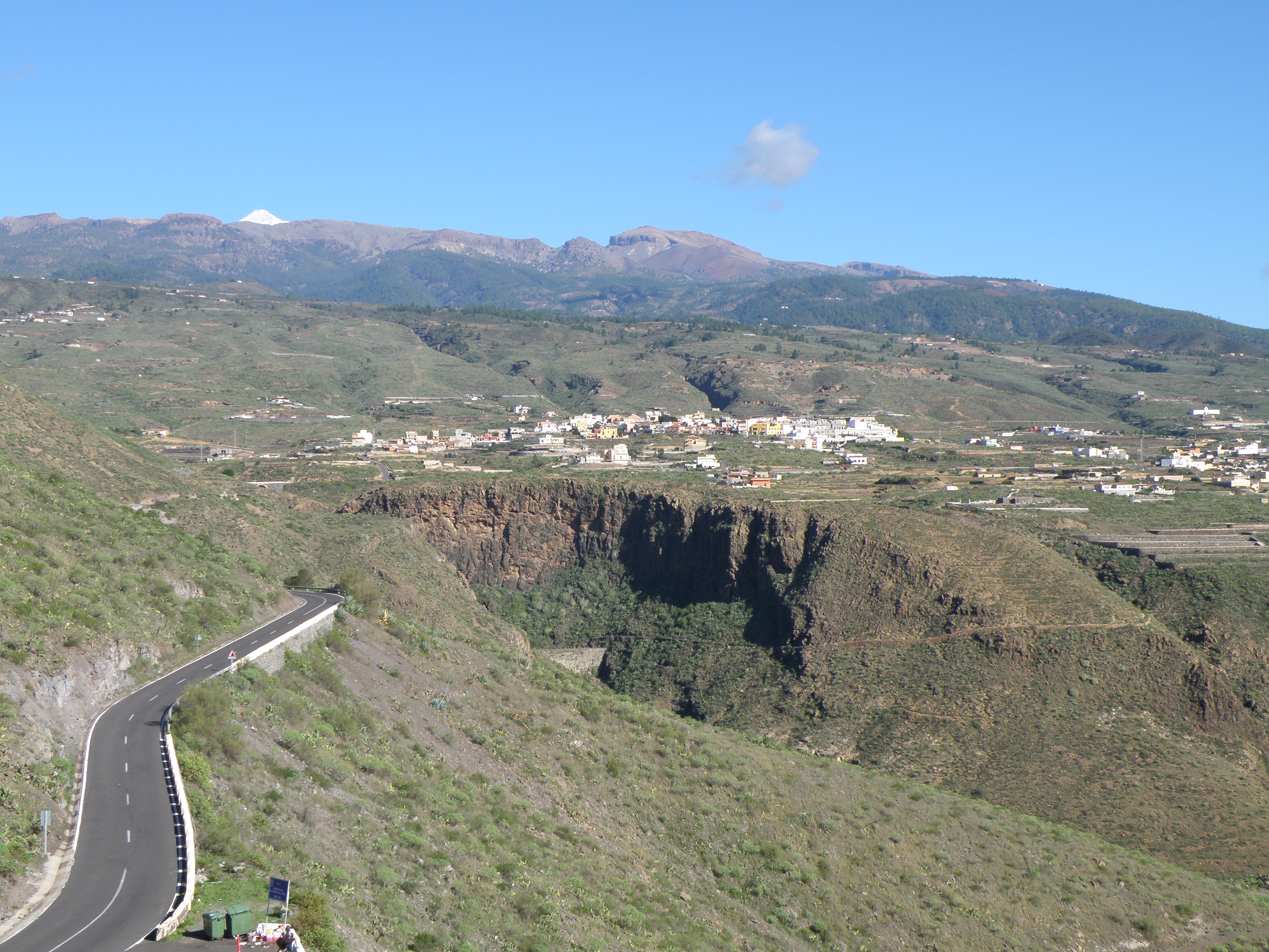
Where are we? Mirador is the Spanish word for viewpoint. This one is located about 1.5 km SE of the town of Valle de San Lorenzo, just off road number TF-28, between km markers 86 and 85. These markers at 1 km intervals are a very convenient way of locating yourself in Spain. We will walk up the steps to the viewpoint terrace. Another good viewpoint would be the restaurant below us, with its panoramic windows. It's on my list for future trips!
This is a really good place to start the field trip, because we can get an overview of all the main phases in the volcanic evolution of the island of Tenerife from here. Take a good look around the area in Google Maps and Streetview. Several 360° panoramas are available: view 1 ; view 2; view 3.
There's a lot to see from this location, and we usually spend around 1.5 hours here. Using Google Maps and Streetview as a virtual drone, we can fly closer to some locations to see more detail.
 |
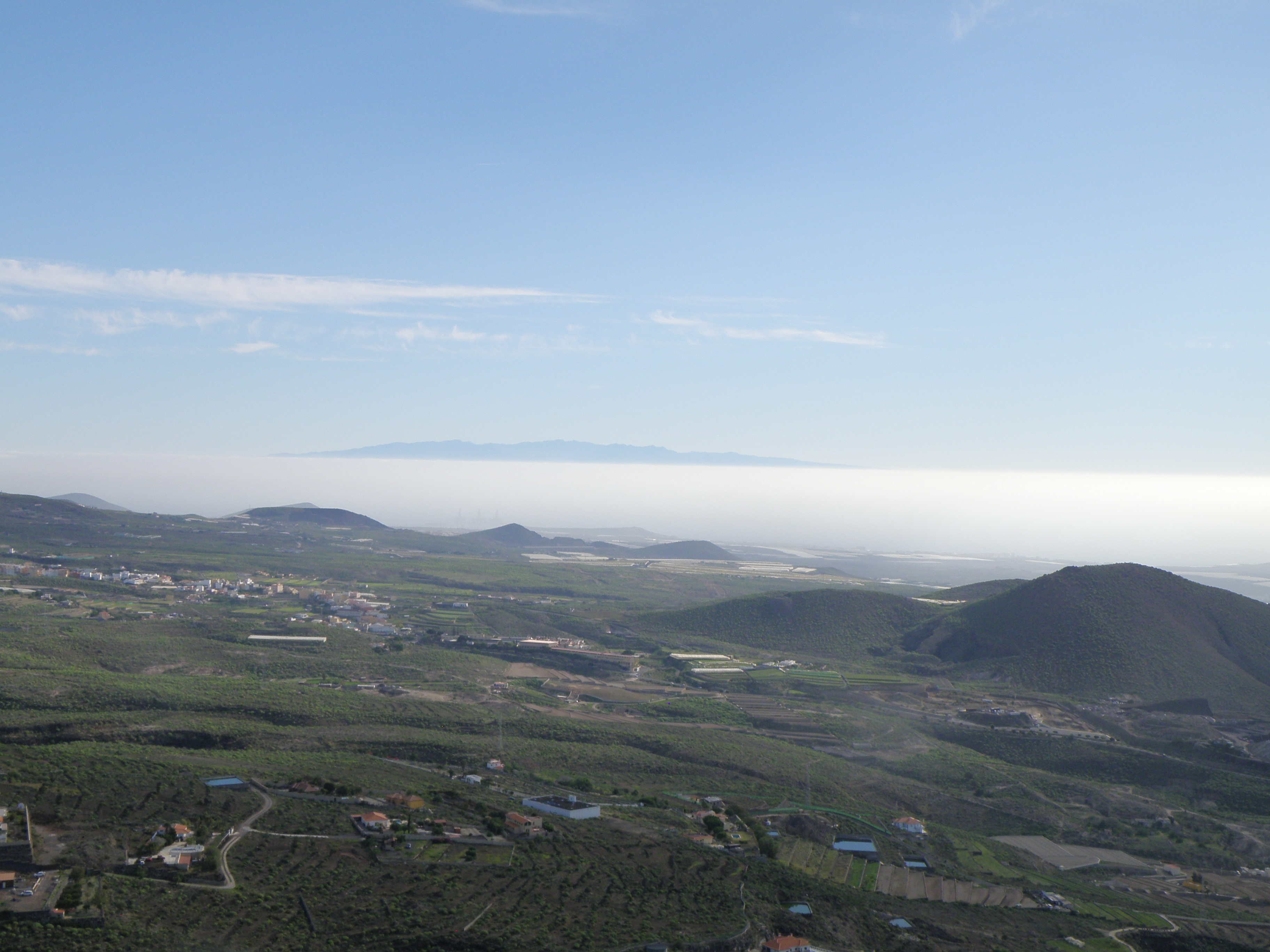
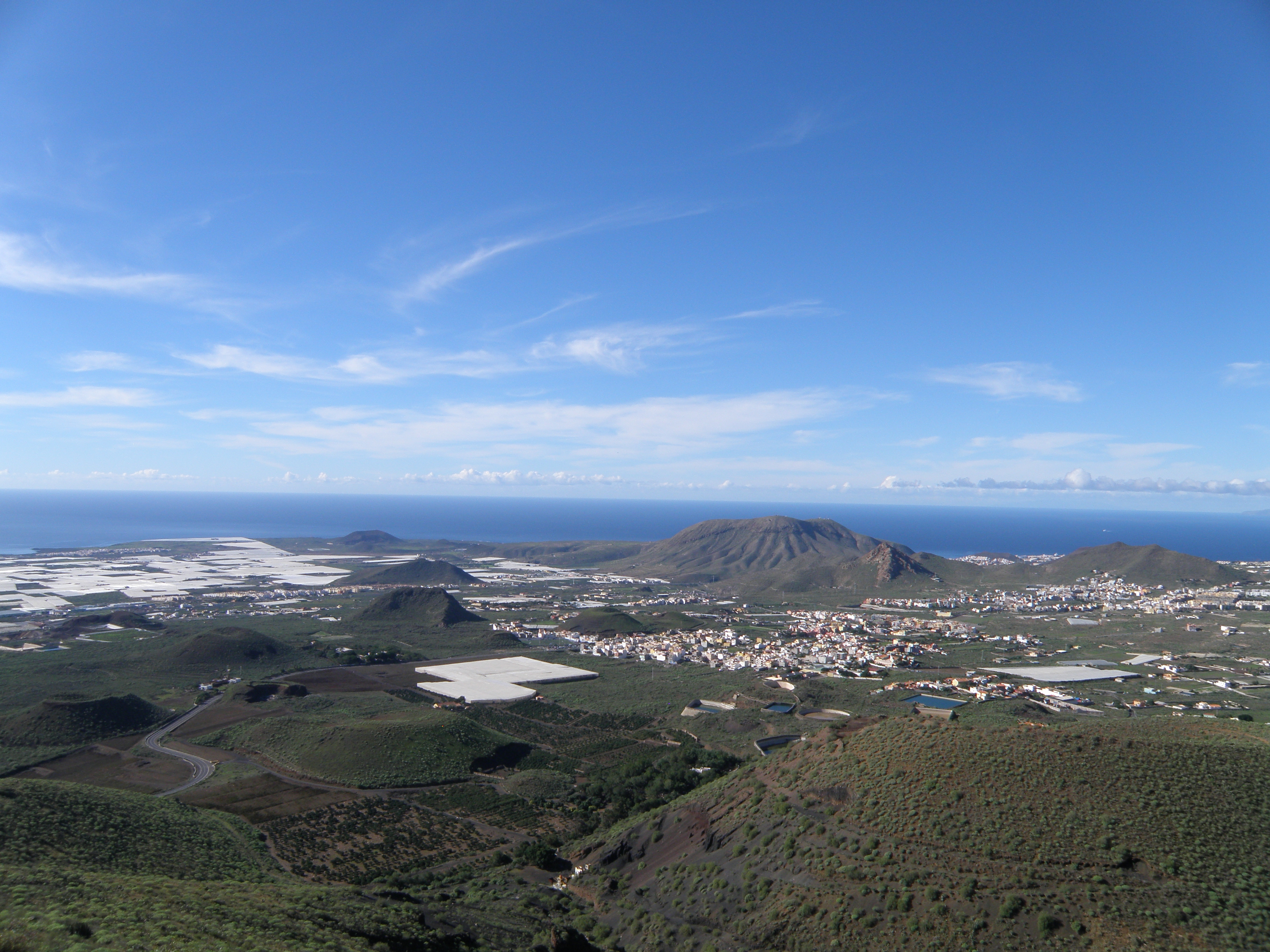
 Figure 1. General view towards the SW |
Tasks: at this location, we will first orient ourselves relative to the geology and geography of Tenerife. We will then try to identify and describe volcanic features in the landscape, and focus on selected examples in detail. We will also look at land use. As well as your notebook, use the 360° panorama to make your observations. You can download it in various different formats, and annotate it either on a printout or in the software:
|
Easy to annotate - zoom in to see detail |
|
|
OpenDocument Presentation (.odp) |
Easy to annotate - zoom in to see detail |
| Large file, high resolution |
The photos are your outcrops, and you'll need to spend time studying them in detail, and working out the relationships between them.
Photos on this page are by Roger Suthren and Adrian Watson.
![]()
The View
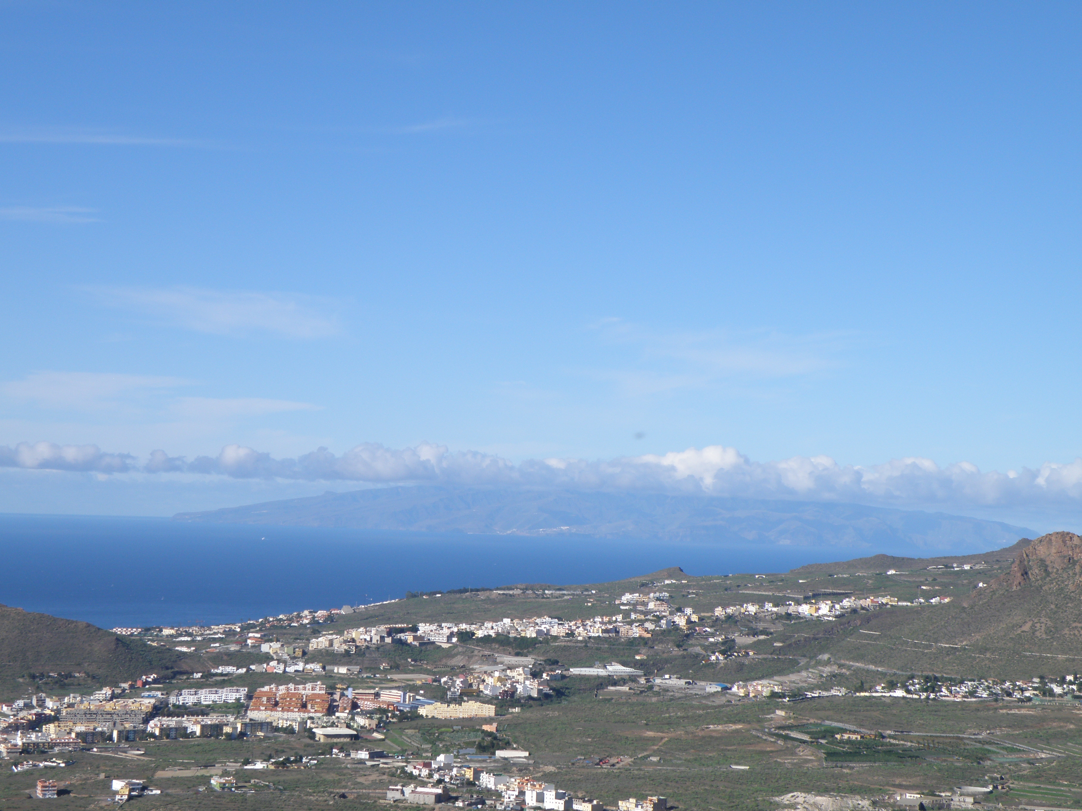
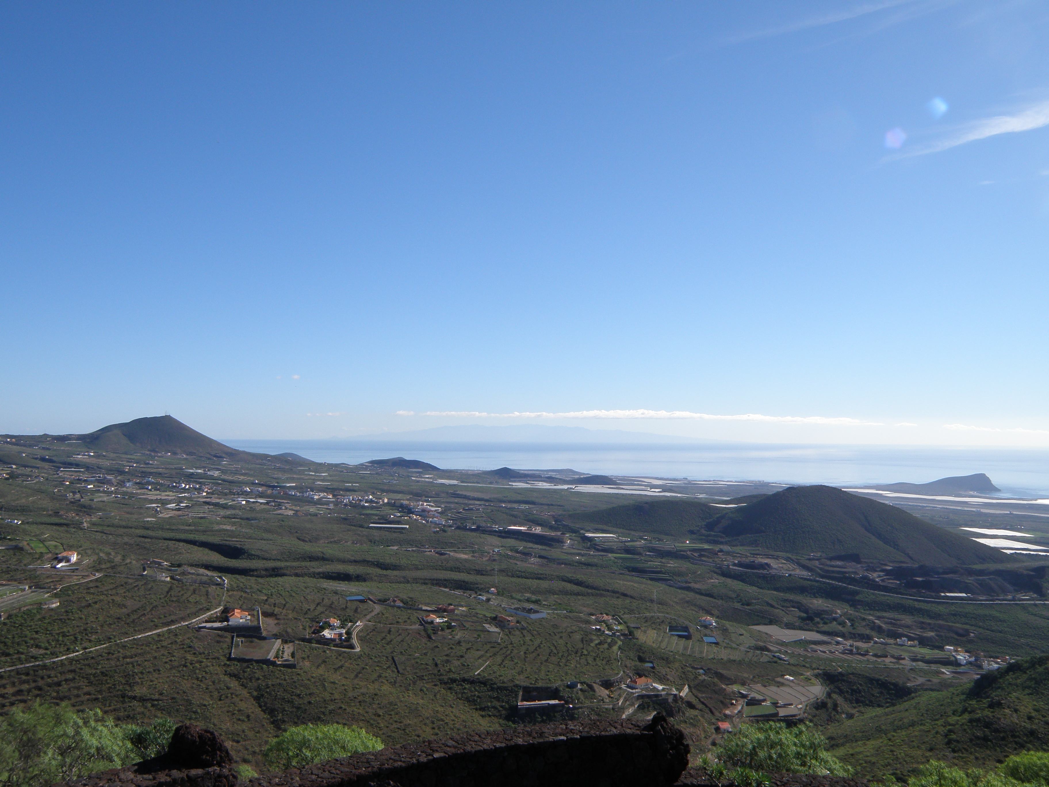
This is a good viewpoint to see at least two of the other islands in the Canaries archipelago. Don't forget that each of the islands is just the subaerial part of a much larger volcanic edifice built up from the ocean floor by earlier submarine eruptions.
Comprehensive descriptions of Canary Islands geology are to be found in this superbly illustrated book:
CARRACEDO, J.C. and TROLL, V.R. (2016). The Geology of the Canary Islands. Elsevier.
A useful recent article on the southern rift zone is:
KRÖCHERT, J. & BUCHNER, E. (2009). Age distribution of cinder cones within the Bandas del Sur Formation, southern Tenerife, Canary Islands. Geological Magazine 146: 161–172. Link to full text
Information on this page on compositions and radiometric ages has been obtained from these publications..
|
To the east, above a bank of trade-wind cloud, we can see the irregular, eroded top part of the island of Gran Canaria. |
A more complete view of Gran Canaria. Like Tenerife, the earliest subaerial eruptions were from basaltic shield volcanoes, dating from ~ 14 Ma ago. As the magmas evolved, phonolitic and trachytic lavas and pyroclastics built up stratovolcanoes, with episodes of caldera collapse. The most recent eruptions were basaltic, and occurred ~ 2000 years ago. |
To the west, there is a good view of the island of La Gomera. This is a basaltic shield volcano - look at the gently convex shape - deeply dissected by erosion. Subaerial eruptions date back to at least 11 Ma. The last eruption was ~ 2 Ma ago. |
![]()
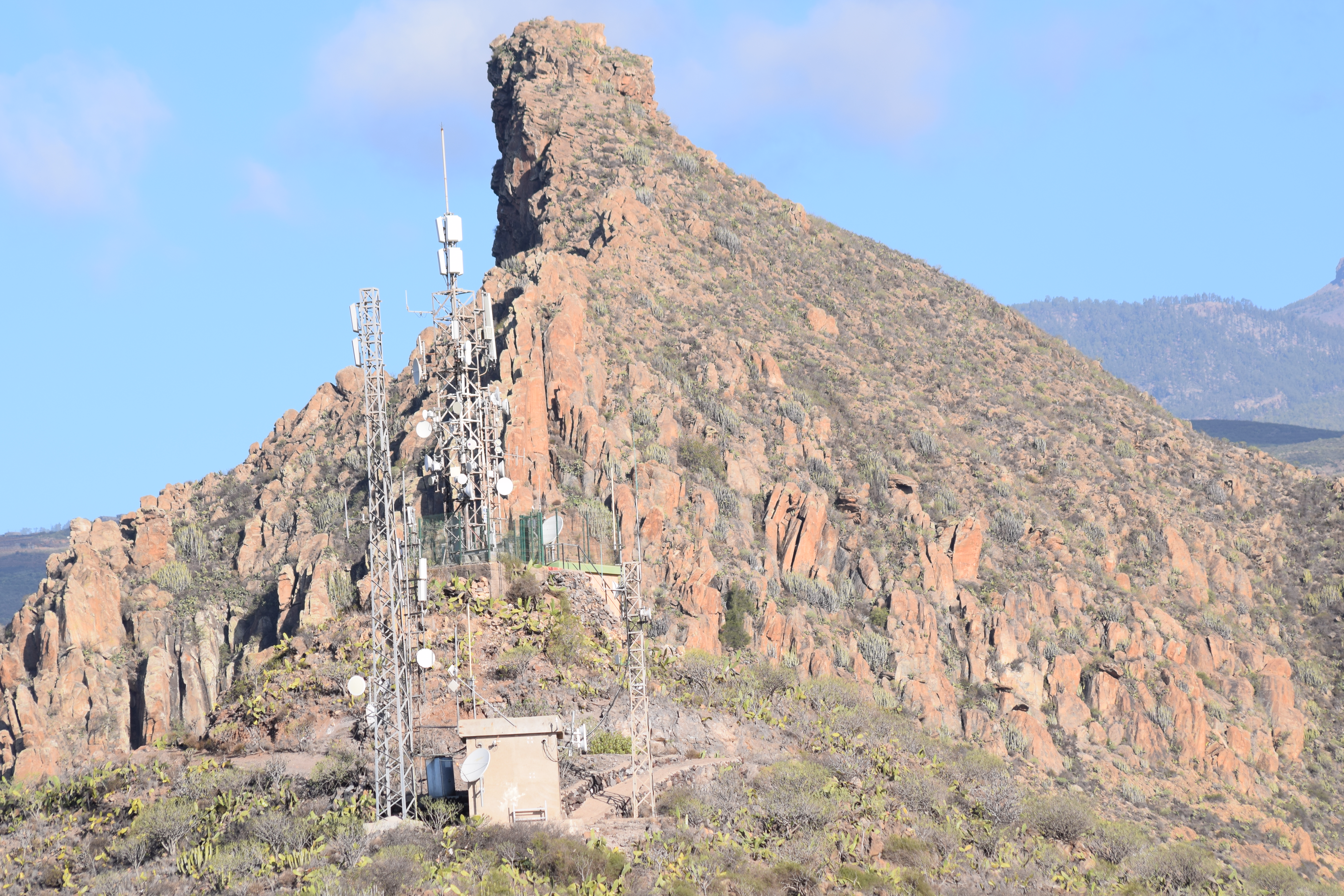
The Oldest part of Tenerife - Basaltic Shield Volcanoes
Deeply eroded remnants of the Roque del Conde basaltic volcanics (8.5 to 12 Ma old) stand up as jagged ridges through a cover of younger volcanic rocks. Latest research suggests that this was part of a large central shield volcano, forming the earliest part of the island as it emerged above sea level.
|
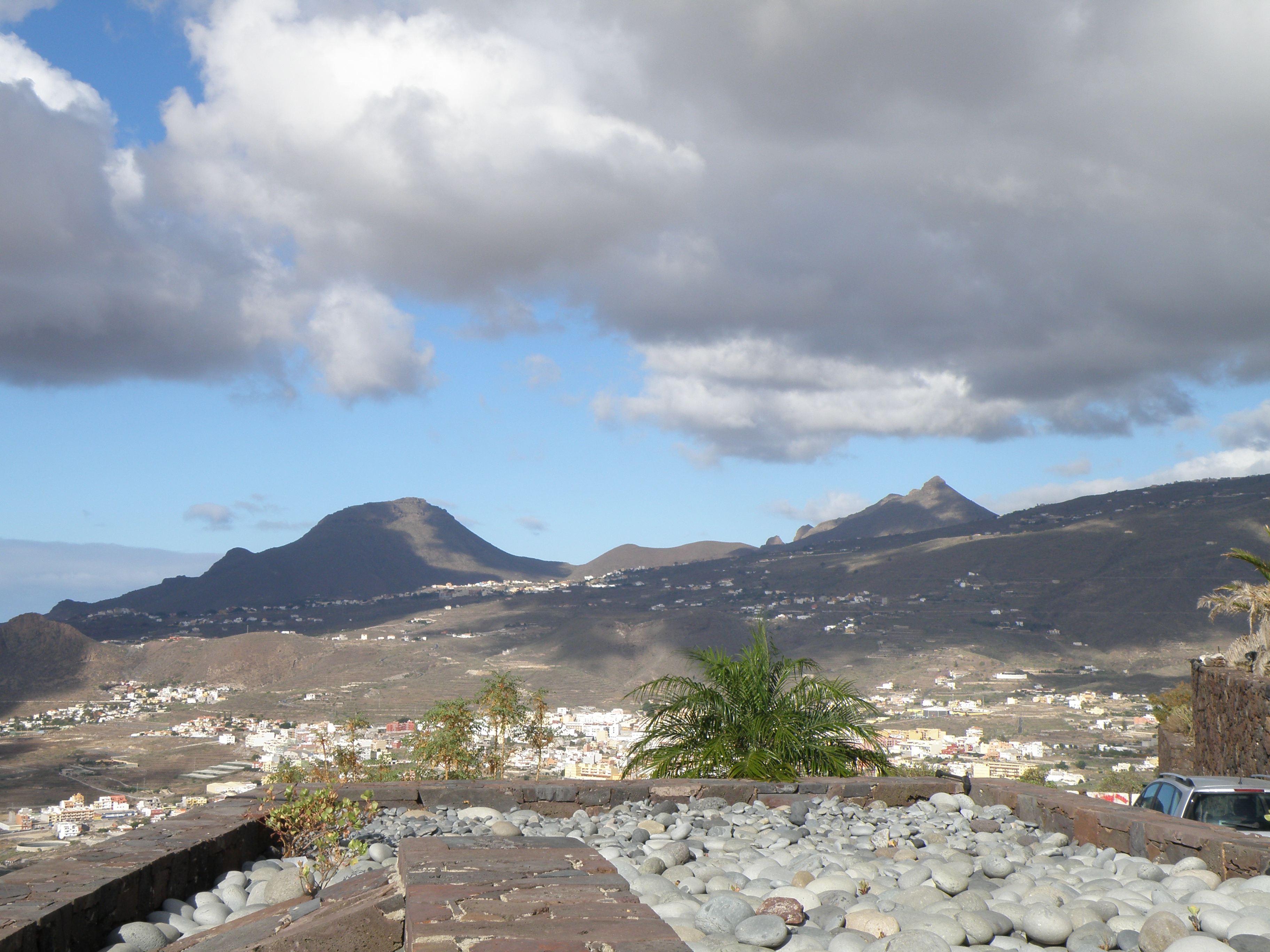
The hill on the left is Roque
del Conde; the peak on the right is Roque Imoque. The uniform slope which
forms the skyline on the right and follows the base of the two hills represents
the southern flanks of the Las Cañadas stratovolcanoes, which overlie
and infill the erosion surface on top of the older shield volcano. |
|
|
|
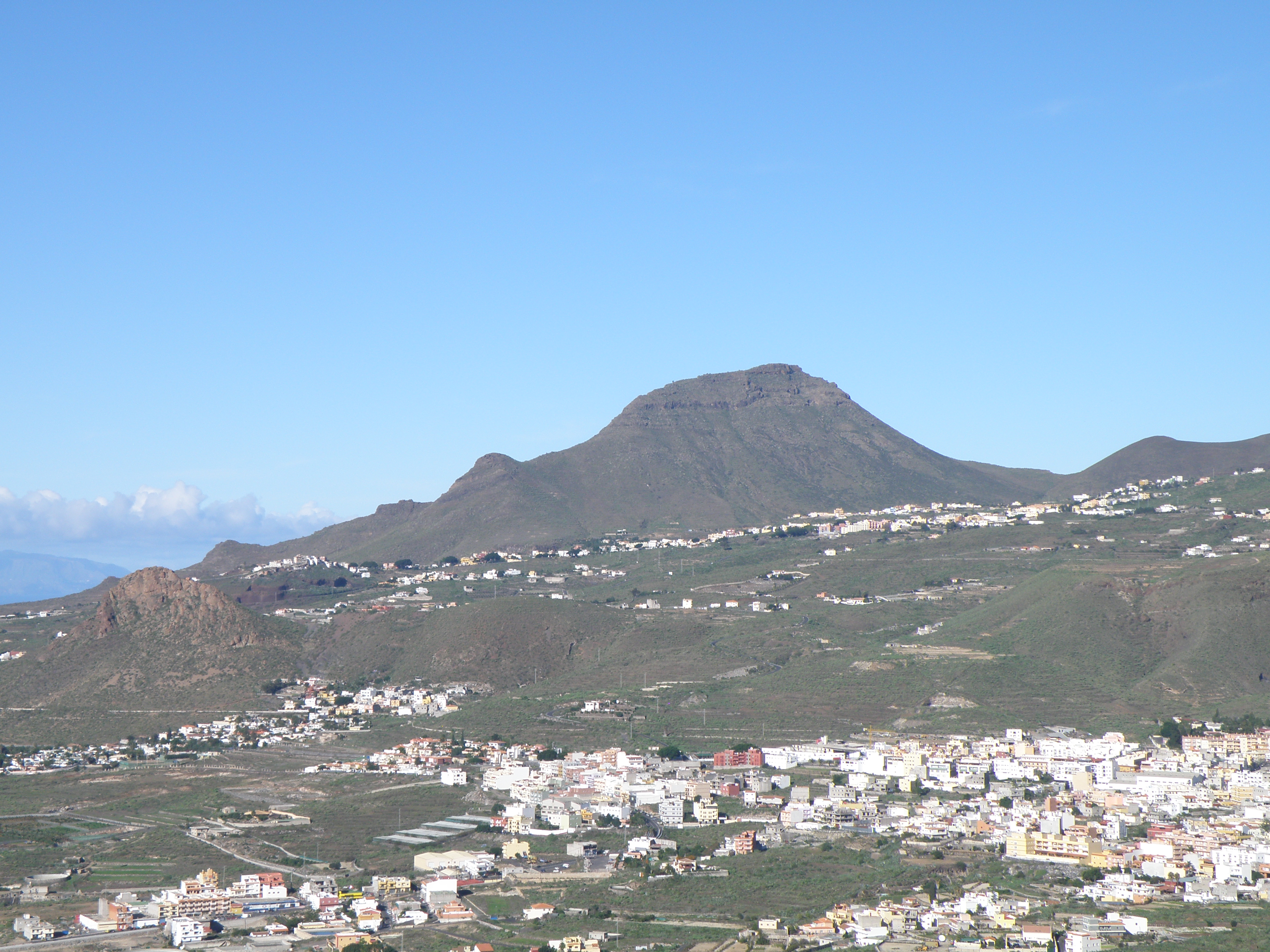
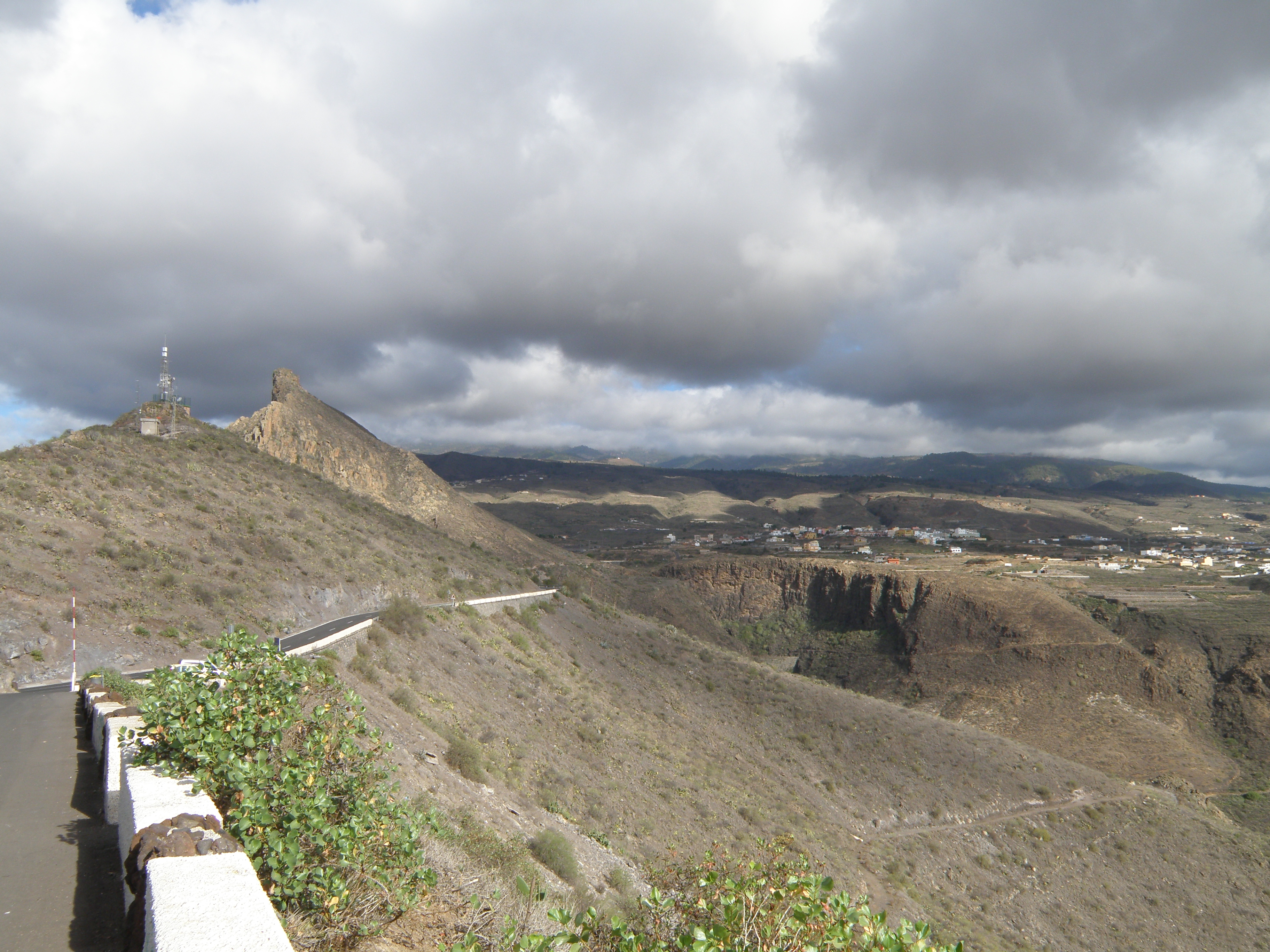 Figure 9. View to N: Roque de San Miguel (2nd peak from left). |
|
|
![]()
The Las Cañadas Stratovolcanoes
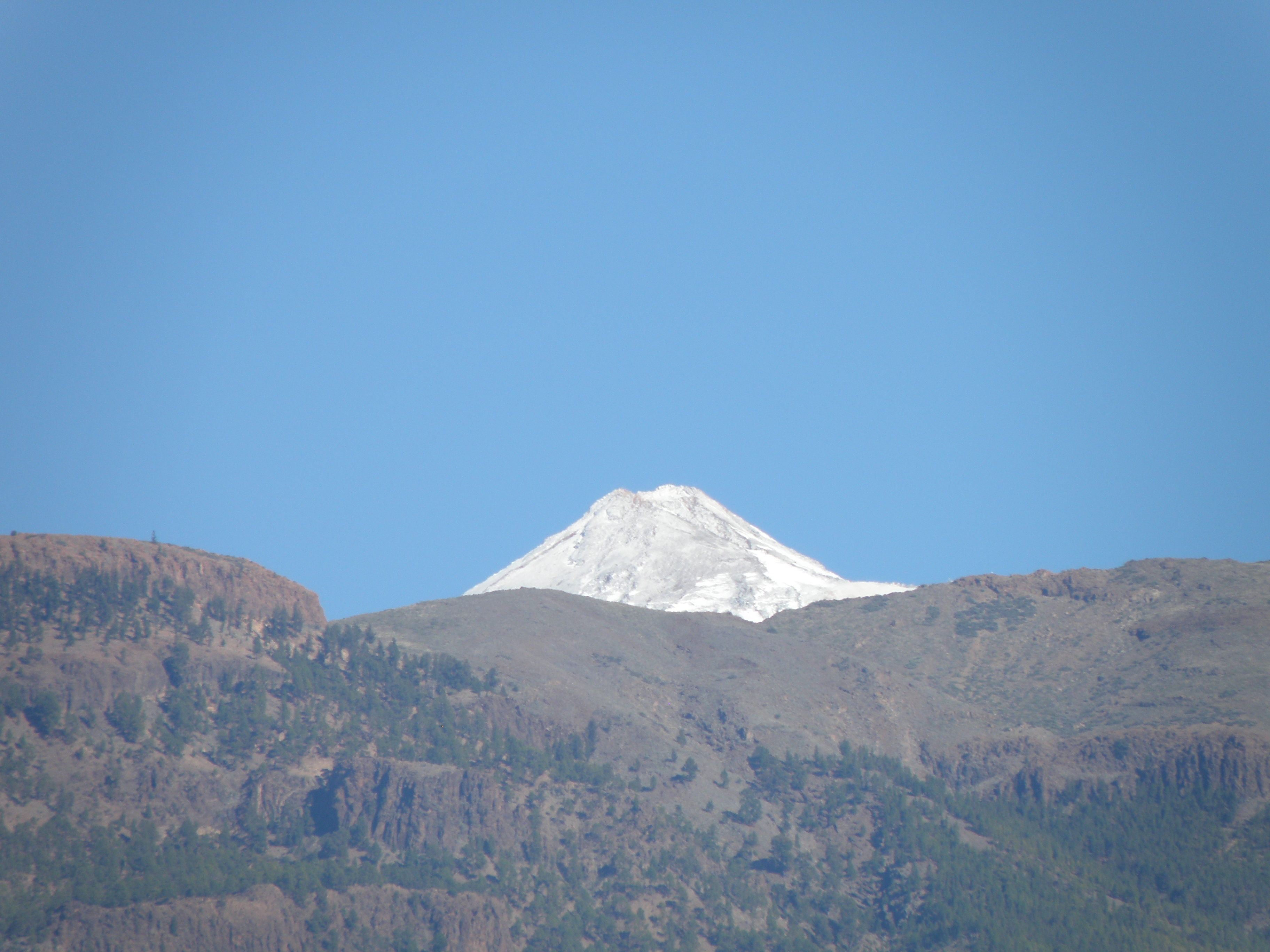
The stratovolcanoes were constructed on the highly irregular, deeply dissected erosion surface (a landscape unconformity) developed on the shield basalts, starting around 3.5 Ma ago, and going through a series of major explosive eruptions, flank and caldera collapses until about 0.169 Ma (169,000 years) ago. After the last caldera collapse, the Teide and Pico Viejo stratovolcanoes built up from the caldera floor, mainly by eruptions of phonolitic lava. Teide last erupted around 1150 years ago, and still has active fumaroles at its summit.
|
The irregular skyline is the outside rim of the Las Cañadas caldera complex. The caldera wall faces north, so cannot be seen in this view. On the left, the snowy summit cone of Teide volcano can be seen. The sloping skyline on the right, and the sloping ground in the middle ground, represent the southern flanks of the huge Las Cañadas stratovolcanoes. |
Close-up of the cliff section seen in the foreground in Figure 11. The colour and overall appearance suggest that this is a lava of phonolitic or trachytic composition. It has been cut by a deep barranco (ravine), as a result of a long period of ephemeral river activity.
|
Above the caldera rim, the snow-covered summit cone of Teide appears.The lava flows seen in this view are from the most recent eruption. The bulk of the active stratovolcano is hidden - it sits inside the deep caldera complex. Teide is the highest mountain in Spain, at 3718 m. |
![]()
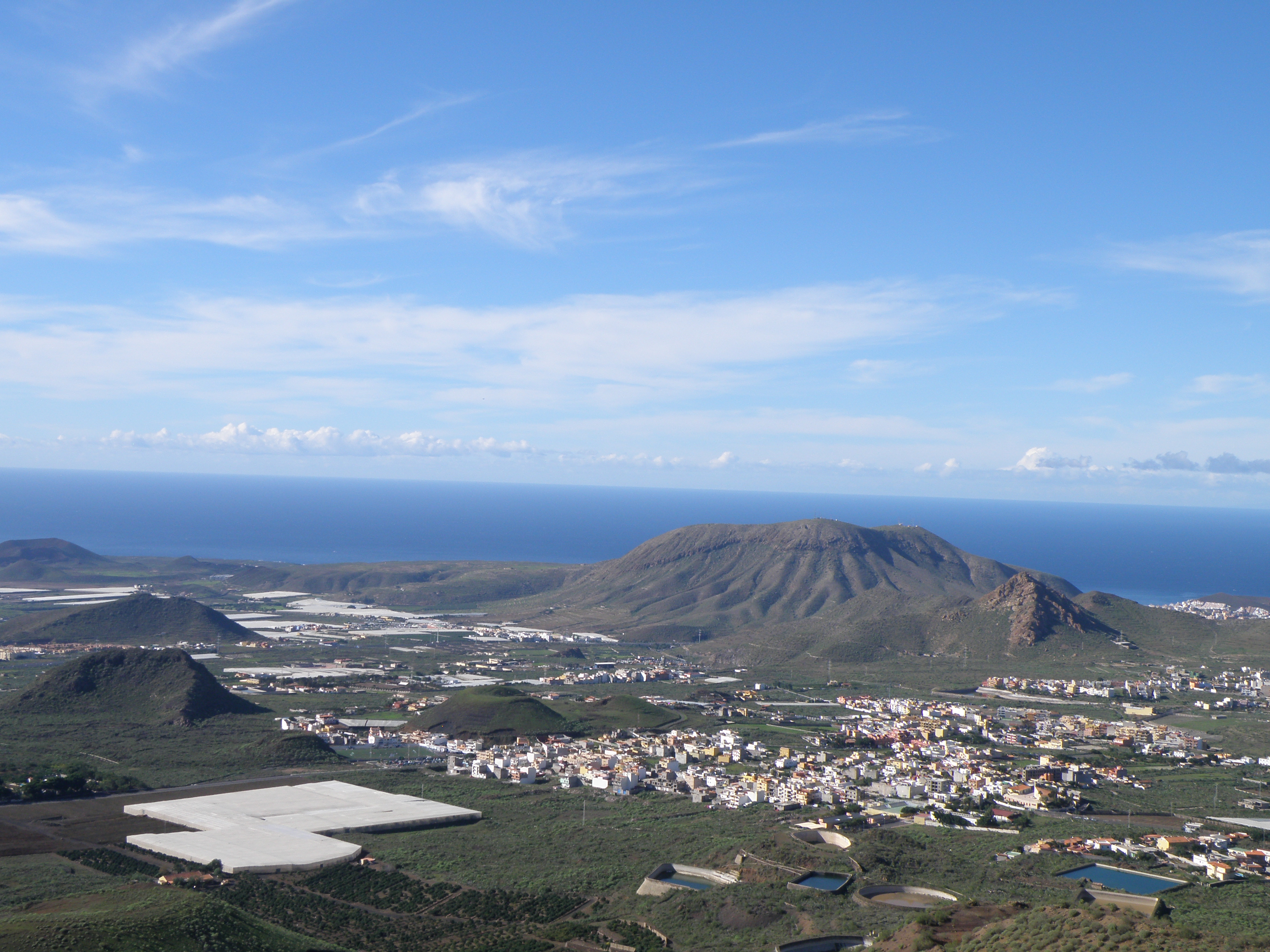
The Southern Rift Zone
Local, mainly monogenetic volcanic activity in the southern rift zone, also known as the San Lorenzo Volcanic Field, was going on at the same time as later stages of central volcanic activity from the Las Cañadas stratovolcanoes. The products of both are included in the Bandas del Sur Group. Eruptions in the Southern Rift Zone took place episodically from 0.948 Ma ago until around 0.096 Ma ago.
|
A general view of the eastern part of the San Lorenzo Volcanic Field. At left is Montaña Gorda (0.3 Ma old) and at right, on the coast, is Montaña Roja (0.948 Ma).
|
General view of the western part of the San Lorenzo Volcanic Field. Montaña de Guaza is the large hill at centre-right.
|
A close-up of some of the cones seen in Figure 15. They are basaltic in composition. Describe the main characteristics of these cones, and try to determine what type of activity they represent.
|
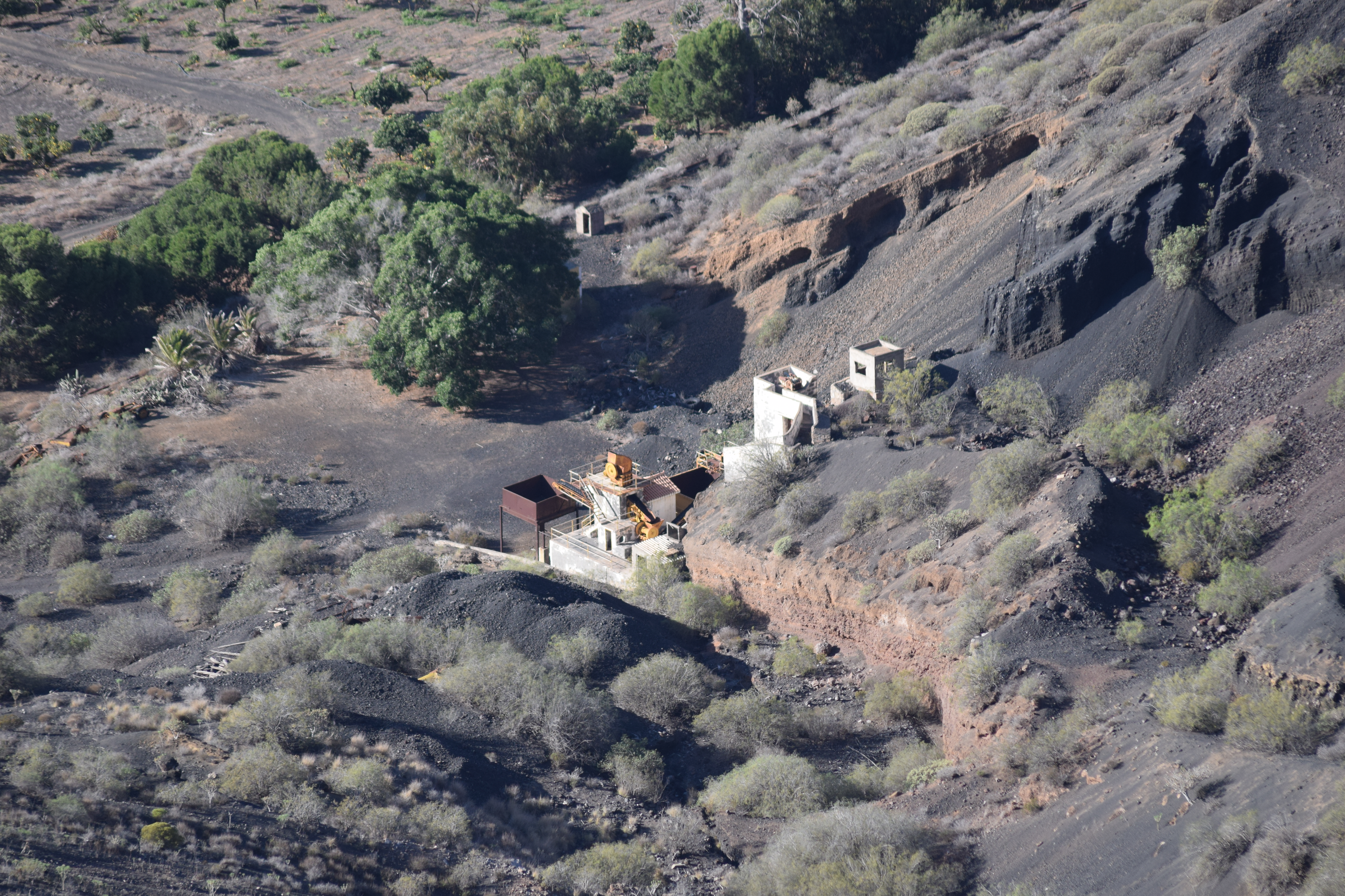
Another cone of the same type as Figure 16. Small-scale quarrying reveals some of its internal structure.
|
|
The foot of the cone seen in the foreground of Figure 15.
|
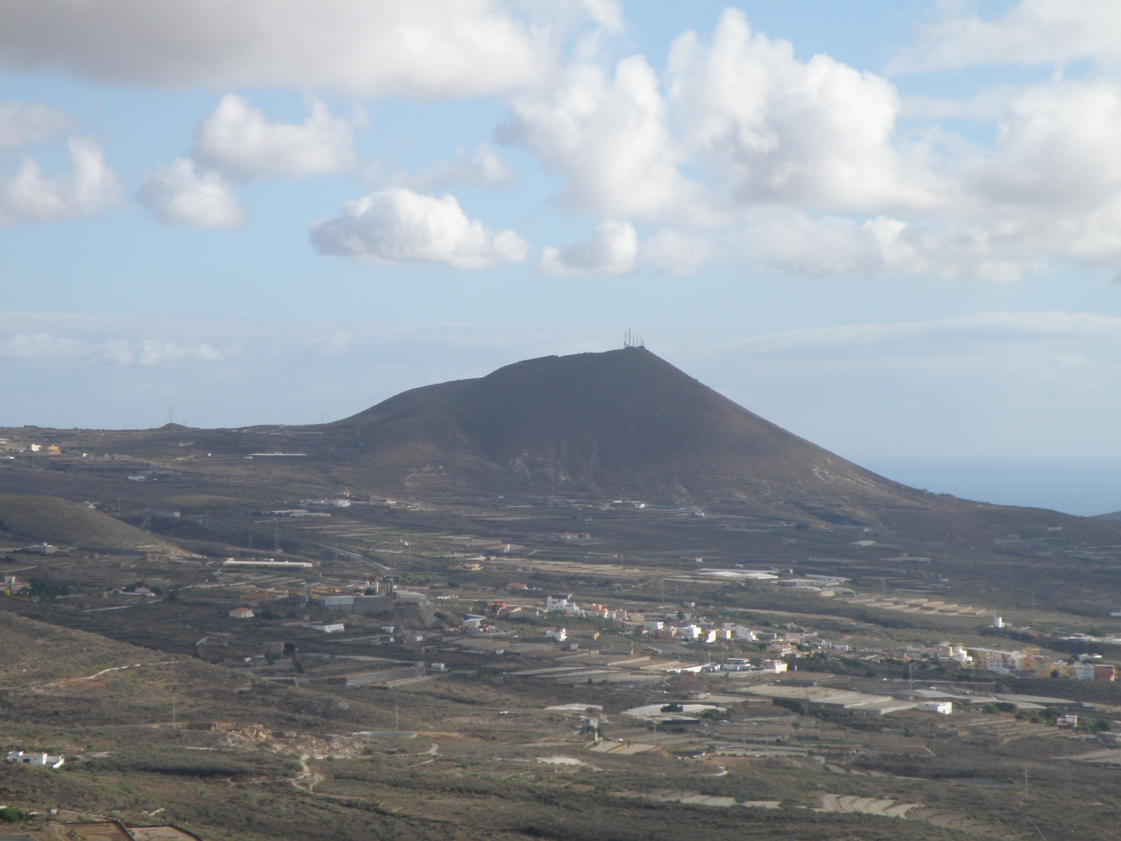
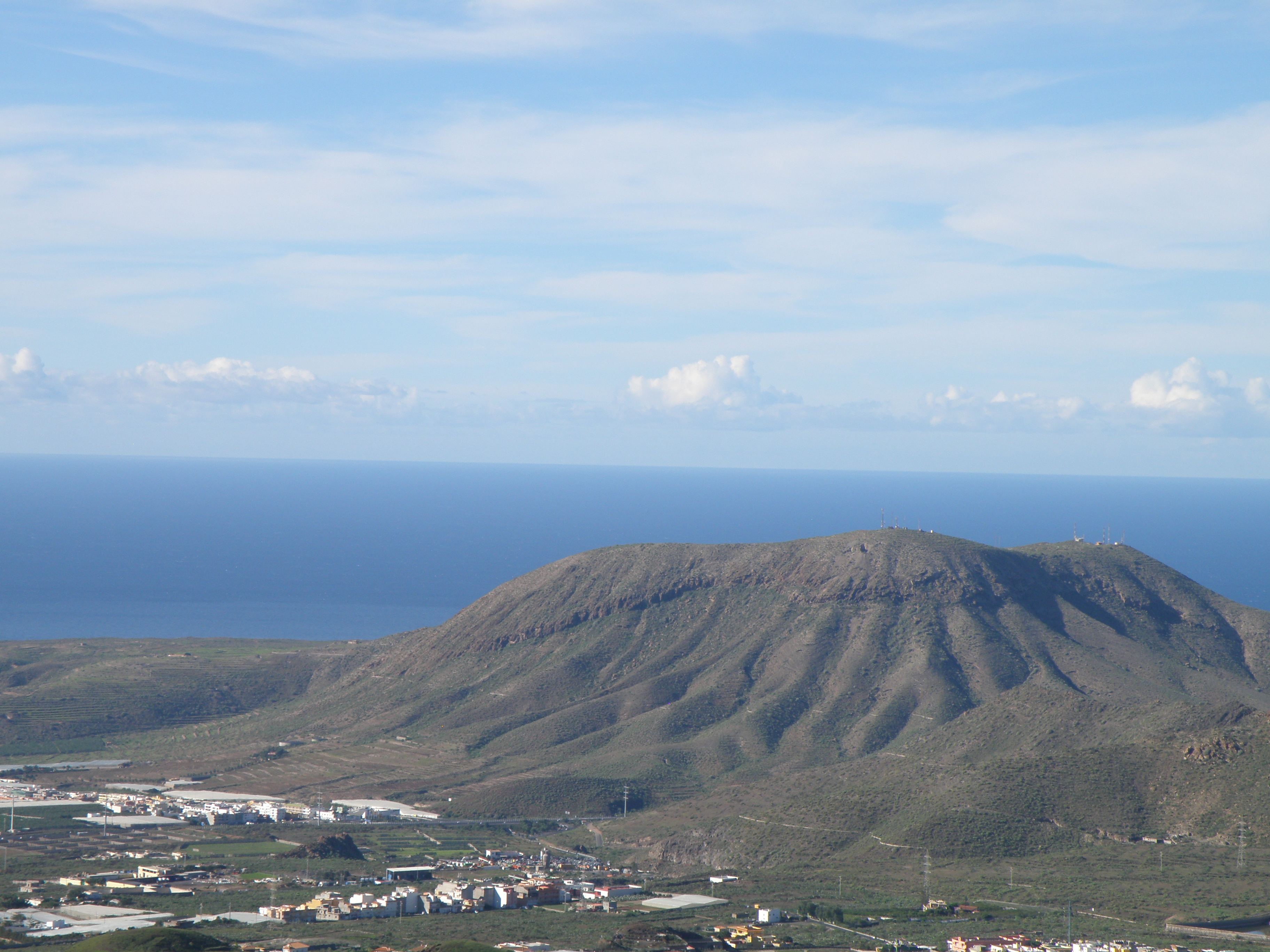
Montaña Gorda (0.3 Ma old) is a larger version of the types of cone seen in Figures 16 and 17, somewhat modified by erosion.
|
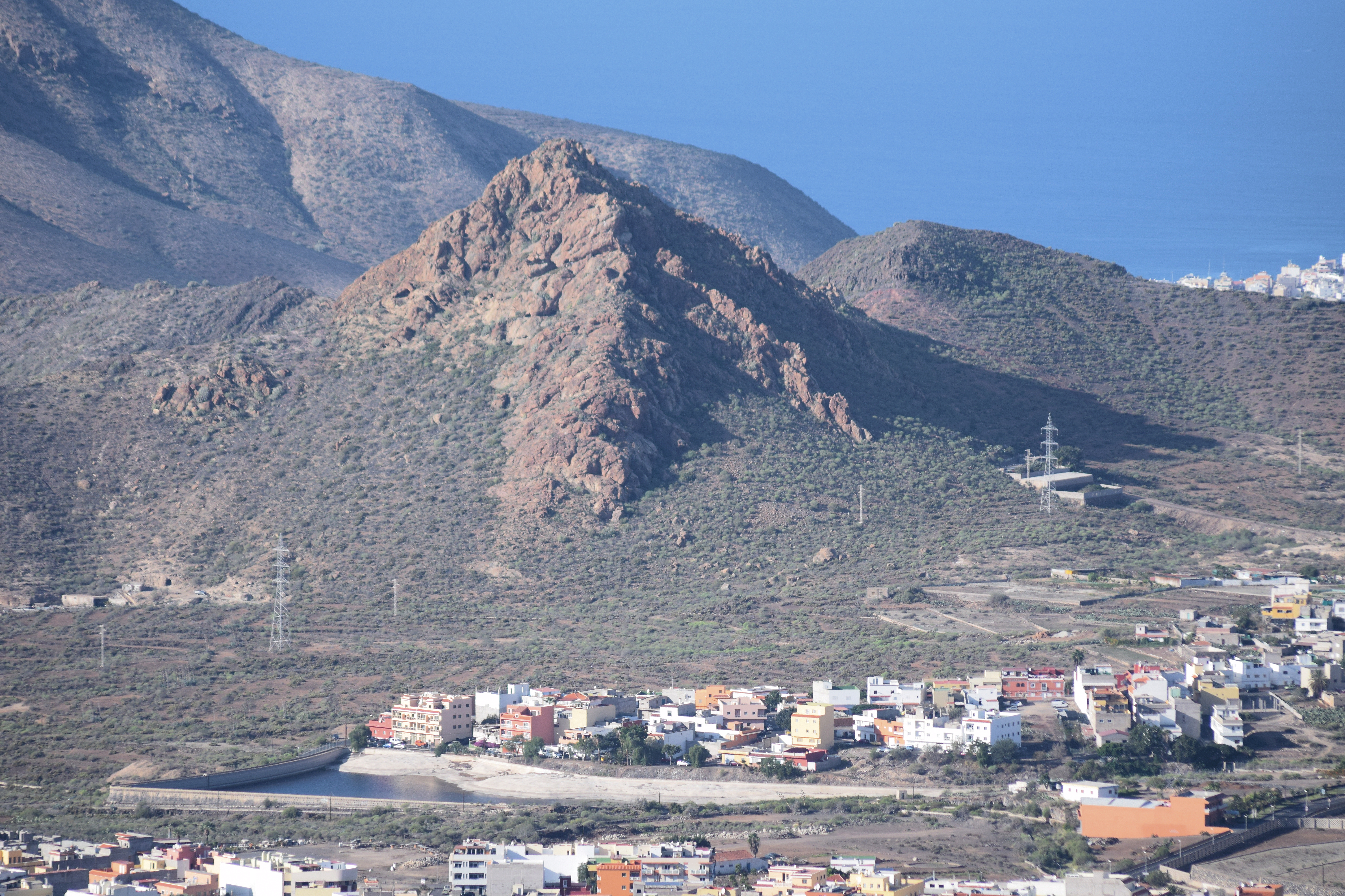
Montaña de Guaza is a 0.926 Ma old cone, 425 m high. Its eruptive products have a trachyte composition. On its right is the smaller Roque Igara.
|
A closer view of Montaña de Guaza. Look at the lower and upper parts of the cone, which have quite different appearances. Try to explain the geology.
|
|
|
![]()
Land Use
In spite of its semi-arid climate, there is large-scale agriculture in southern Tenerife, using water mined from galerias (tunnels several km long) higher on the volcanic island. Some examples of land use and utilization of the volcanic products are shown in the images below.
|
In the left foreground we see the neat rows of citrus orchards. To the right of them are several reservoirs for the temporary storage of irrigation water, brought in by aqueducts fed by the galerias. Large areas are covered by plastic greenhouses (screenhouses) in the middle and far distance: here tomatoes, bananas, peppers and other crops are being grown all year round. The primary function of the screenhouses is to protect crops from the wind. |
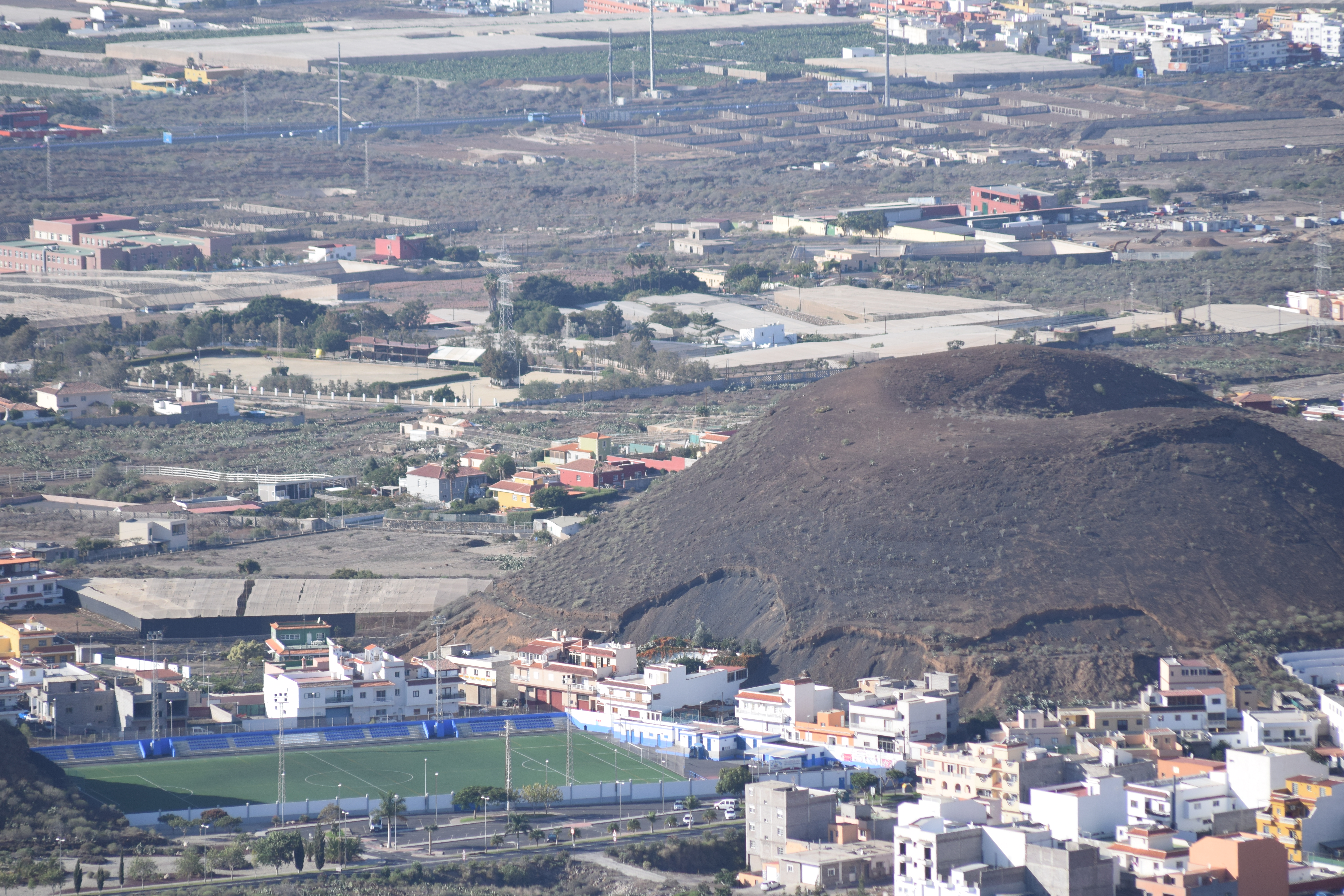
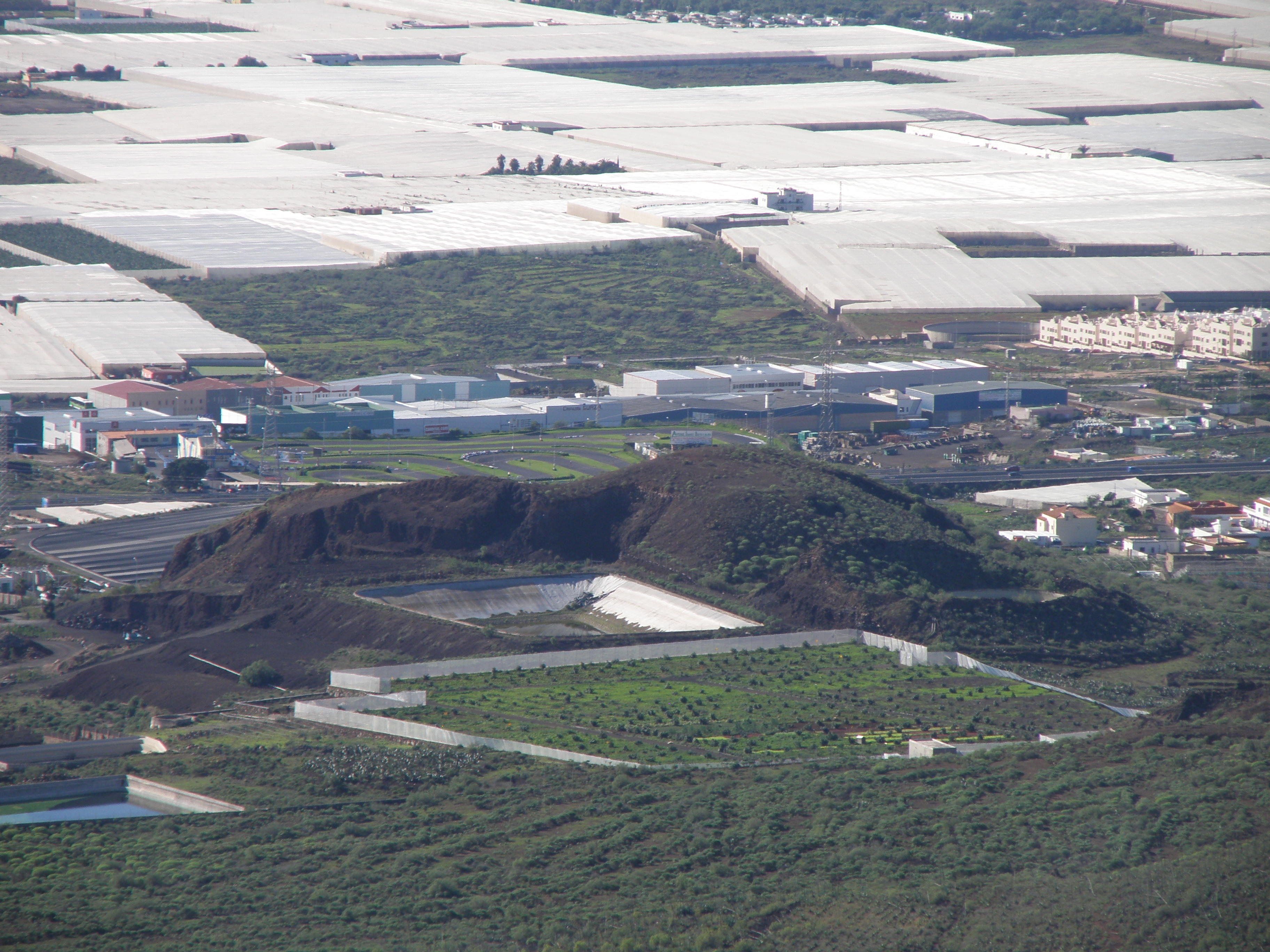
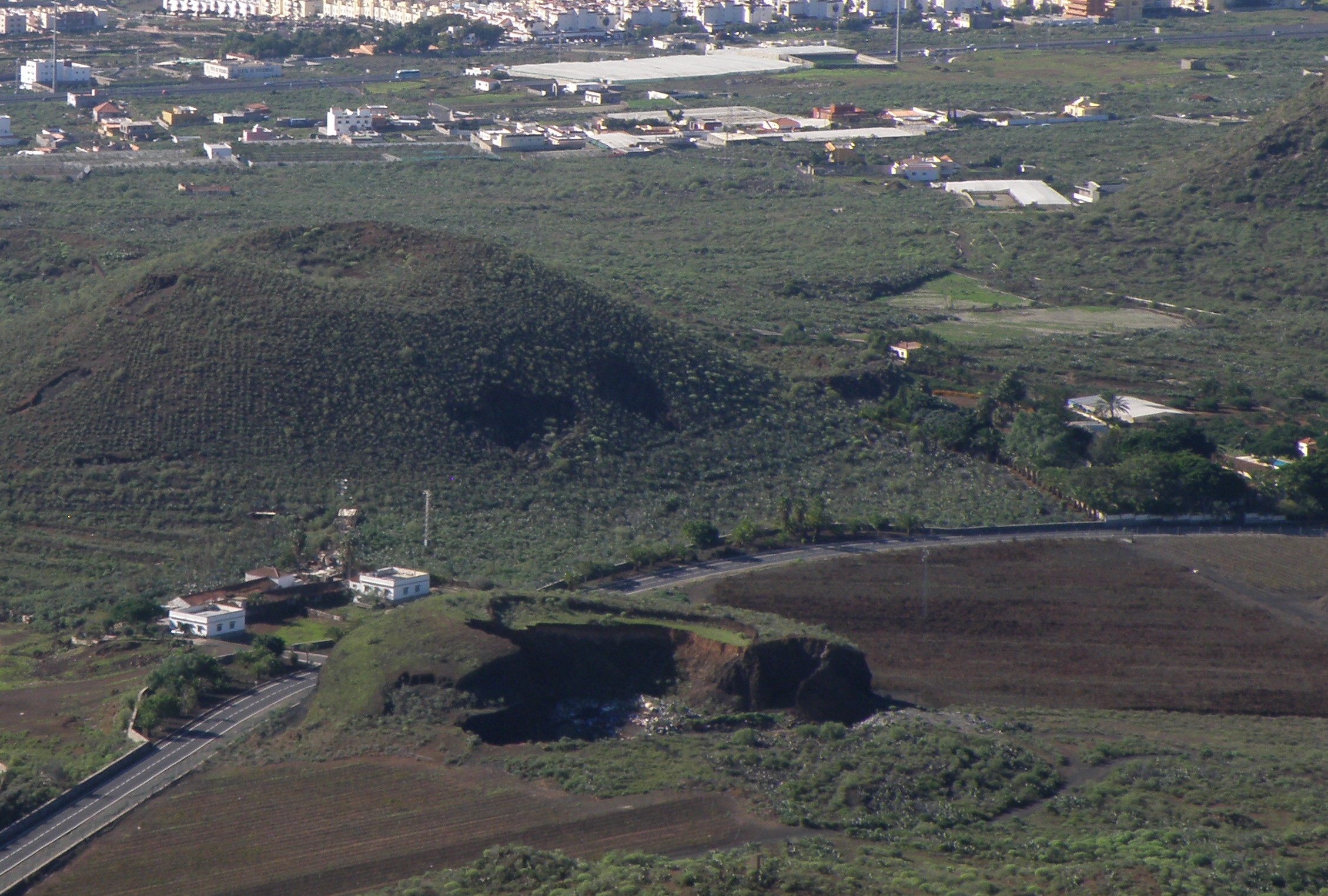
In the distance, large areas of the coastal plain are covered by screenhouses - this is a common sight in much of the southern mainland of Spain too, and clearly there are issues in terms of sustainability and visual amenity. In the centre, one of the basaltic cones is being quarried for lightweight aggregate. |
Before the industrial-scale horticulture on the coastal plain, much of the cultivation took place in terraced fields on the south-facing slopes of the Las Cañadas stratovolcano. Potatoes are still grown in this traditional manner, but most of the terraces in this view have been abandoned. |
Abandoned terraces and a fenced citrus orchard in the foreground. Behind this, large parts of a basaltic cone have been removed by quarrying, and a reservoir to store irrigation water has been installed in the former quarry. Behind the industrial area, the vast sea of plastic-covered screenhouses begins. |
|
The small basaltic cone in the foreground has largely been removed by quarrying.
|
|
![]()
Make sure you've completed all the work for this locality. Now we can get back on the virtual coach and head off to our next stop.
![]()
This page is maintained by Roger Suthren. Last updated 15 March, 2021 10:15 AM . All images © Roger Suthren unless otherwise stated. Images may be re-used for non-commercial purposes.