It is important that you access this location on a laptop or desktop PC.
Click on any image to enlarge it - you will need to zoom in to see sufficient detail.
The photos are your outcrops, and you'll need to spend time studying them in detail, and working out the relationships between them.
![]()
This location is the NW-SE trending wooded ridge just west of the village of Villegailhenc, to the north of Carcassonne. Explore the location in Google Maps. The ridge can be seen in Streetview.
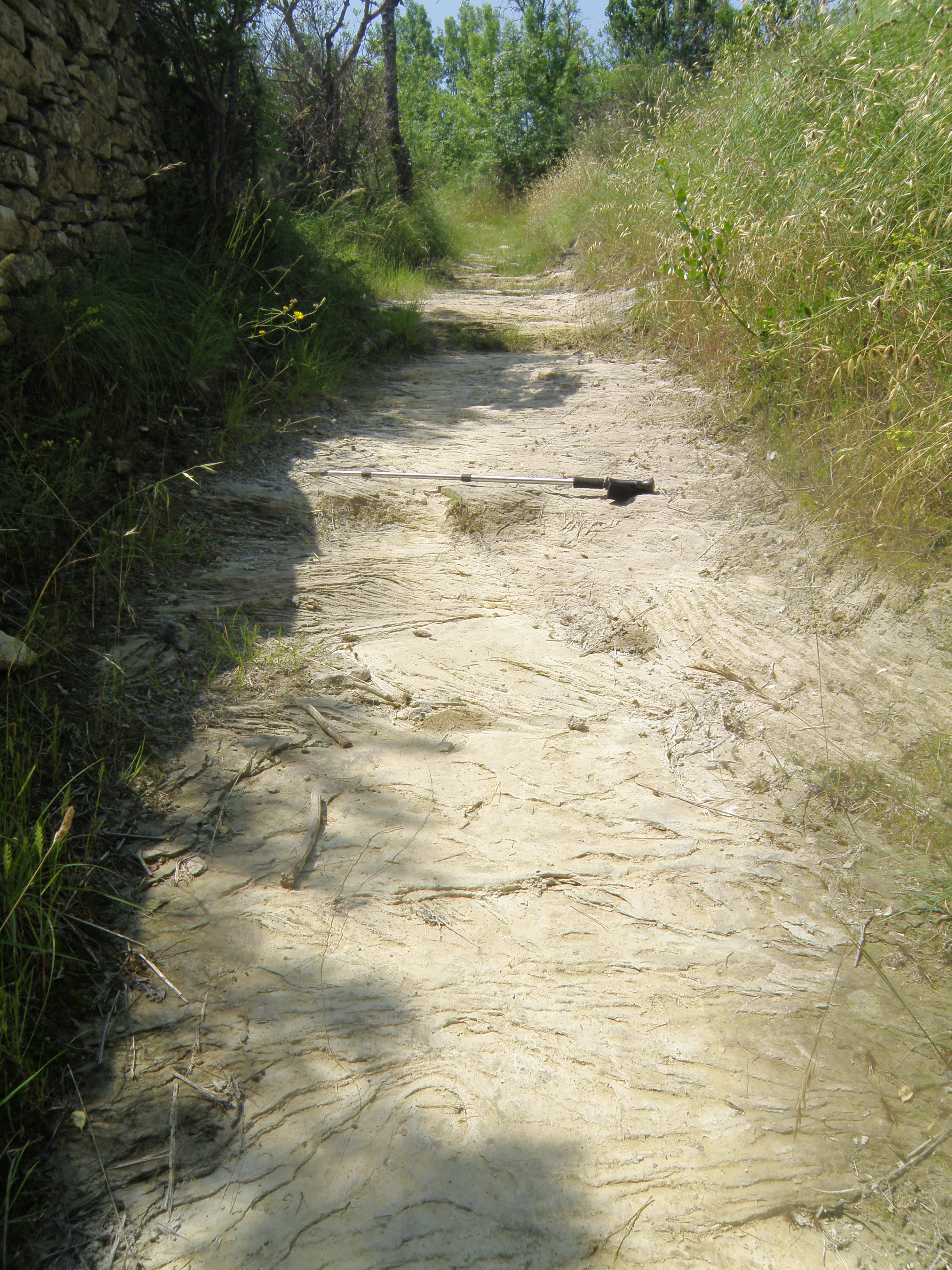 Figure 9.1. Ascending the path to the ridge. Sandstone with sedimentary structures is exposed in the path. |
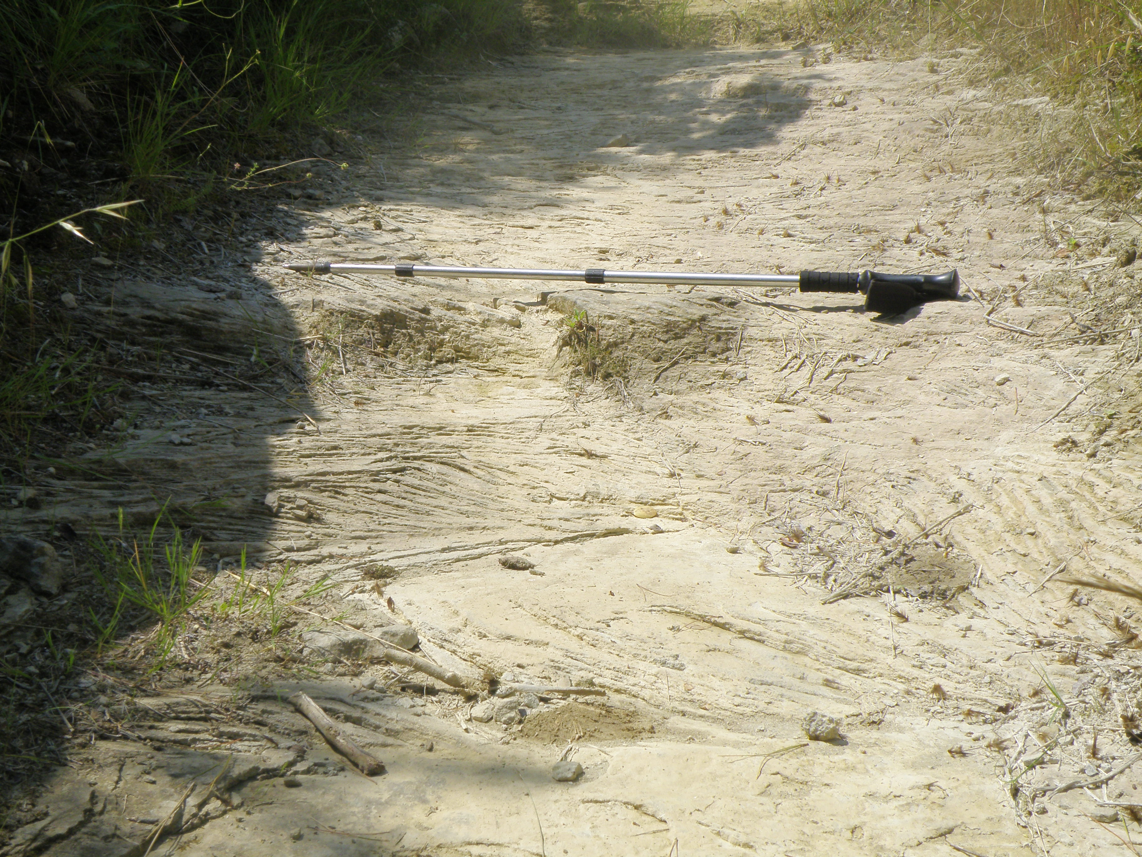 Figure 9.2. A close-up of the structures, seen in oblique plan view. Pole is ~1m long. |
Make sure you've completed all the work for this locality. Now continue your investigations, or return to the Aigues-Vives home page.
![]()
This page is maintained by Roger Suthren. Last updated 10 May, 2021 5:26 PM . All images © Roger Suthren unless otherwise stated. Images may be re-used for non-commercial purposes.