It is important that you access this location on a laptop or desktop PC.
Click on any image to enlarge it - you will need to zoom in to see sufficient detail.
The photos are your outcrops, and you'll need to spend time studying them in detail, and working out the relationships between them.
![]()
This location is just east of the D57 road, a short distance southeast of locality AV04. Explore the location in Google Maps and Streetview. Thinking about the geology, can you relate this location to Location AV04?
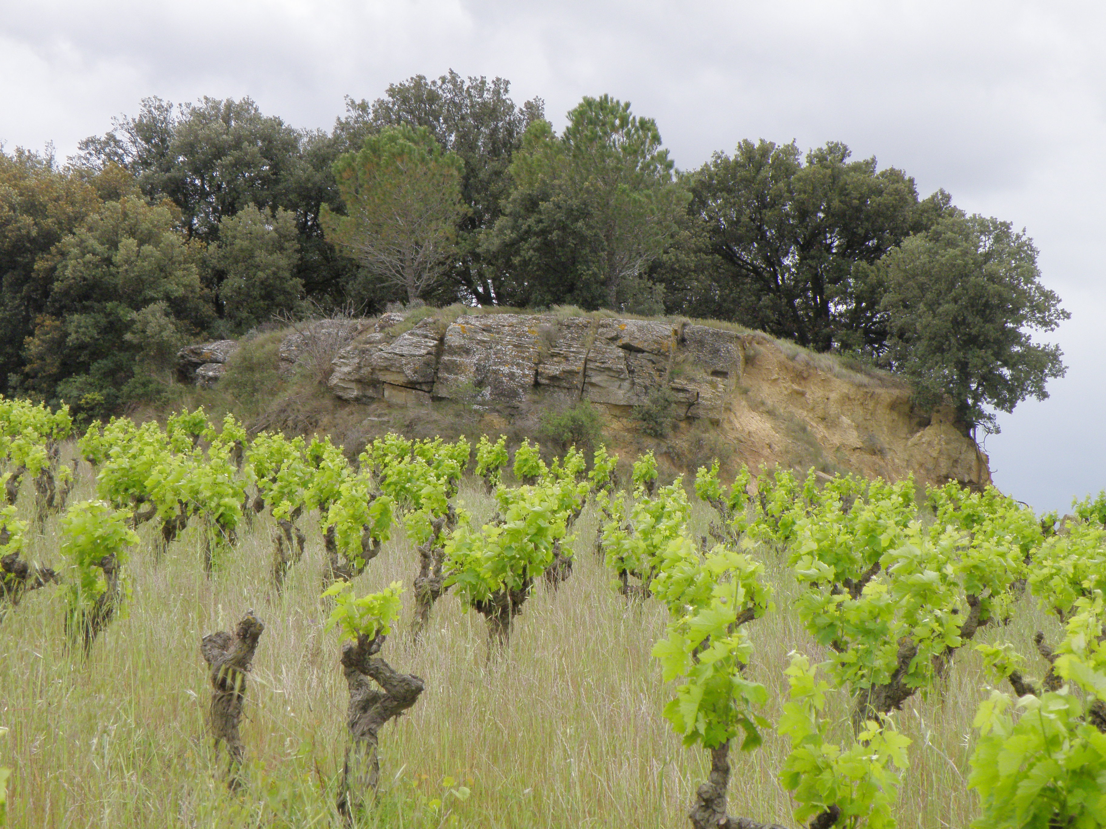 Figure 5.1. General view of the west side of the outcrop, which appears to have been quarried. Note the contrast between the ridge and the softer lithologies underlying the vineyards. |
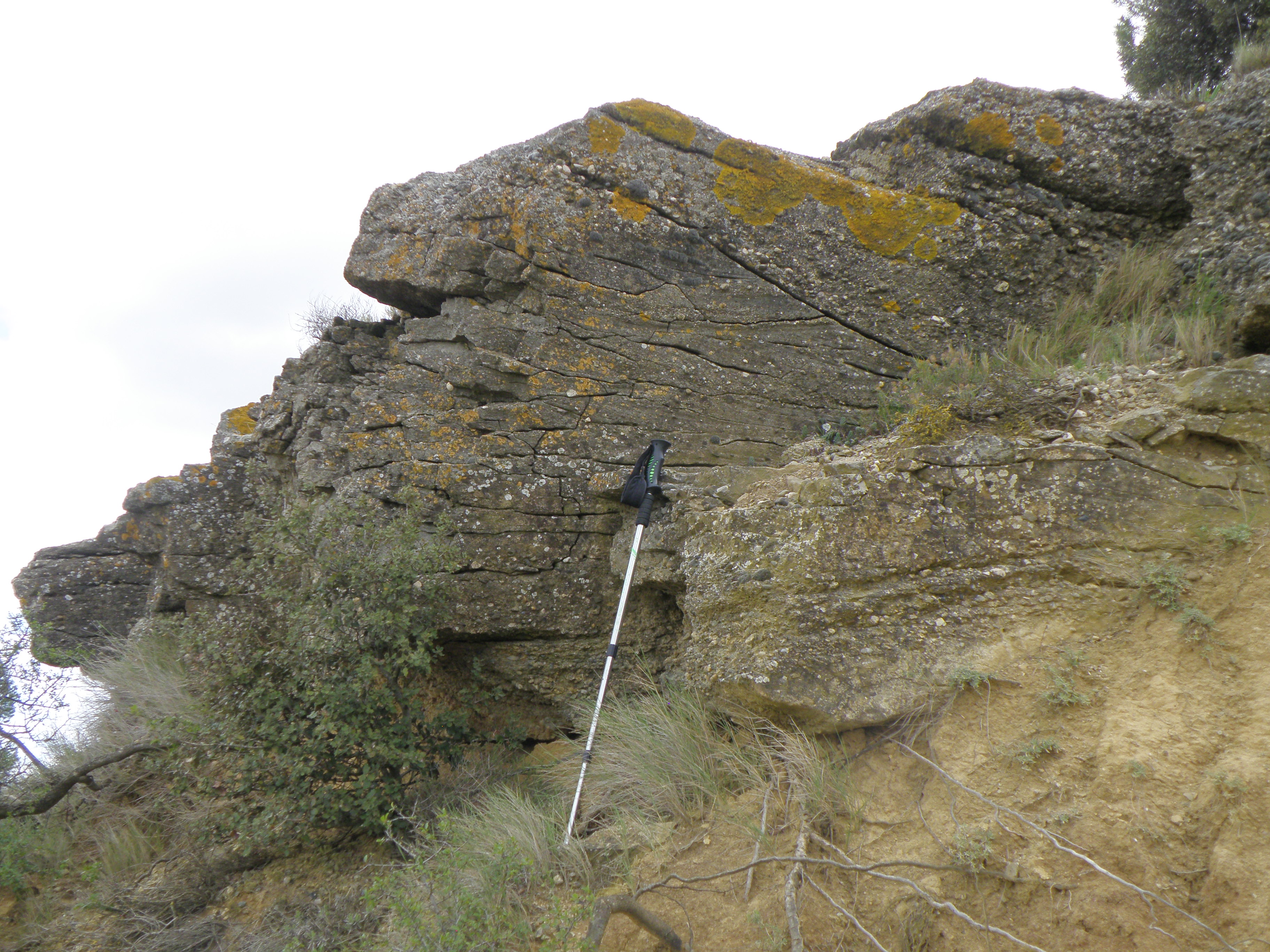 Figure 5.2. Close-up of the rock face. |
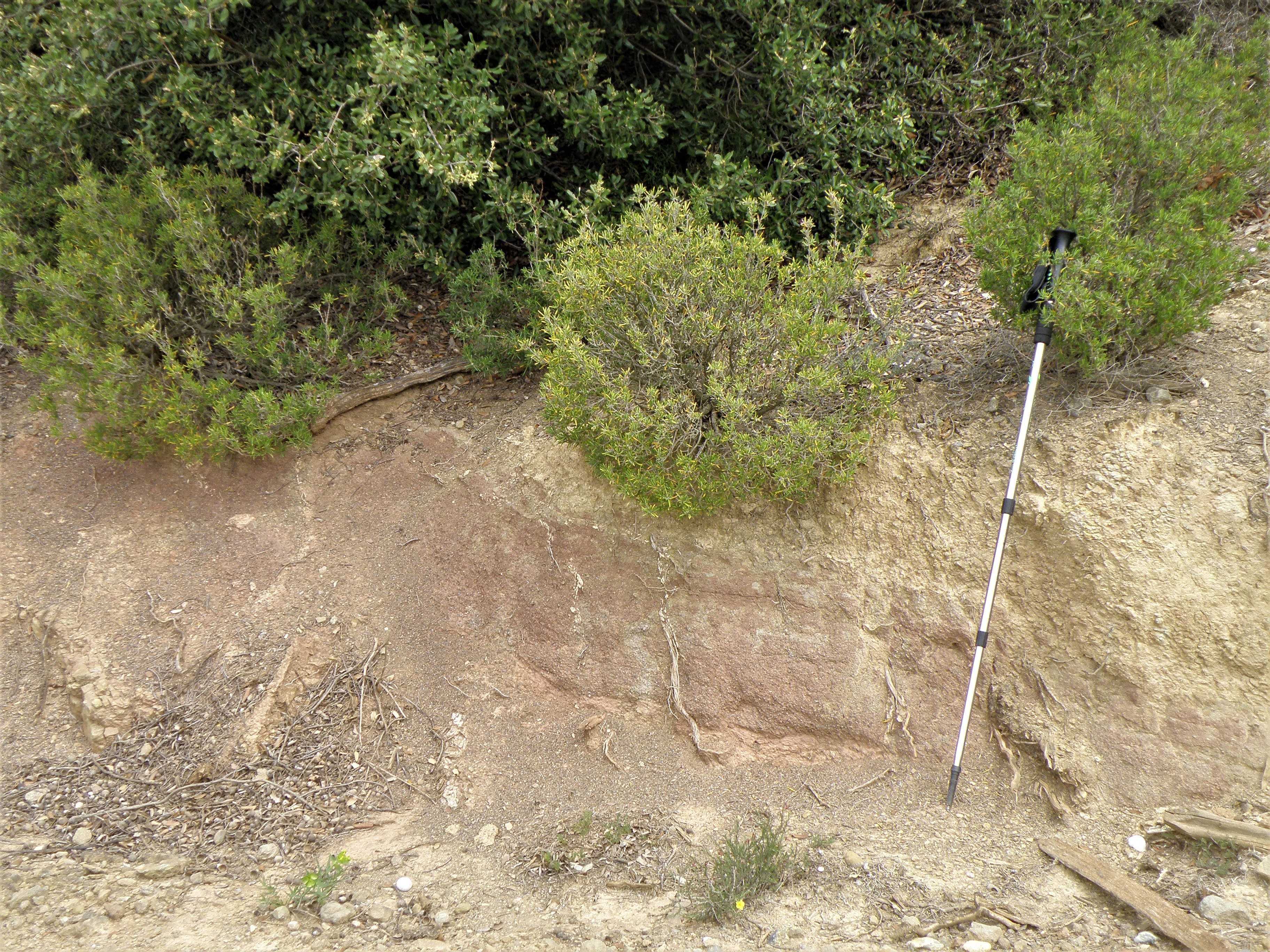 Figure 5.3. Details of the softer lithology below the ridge. How are colours distributed in this rock, and what is the significance of that? |
|
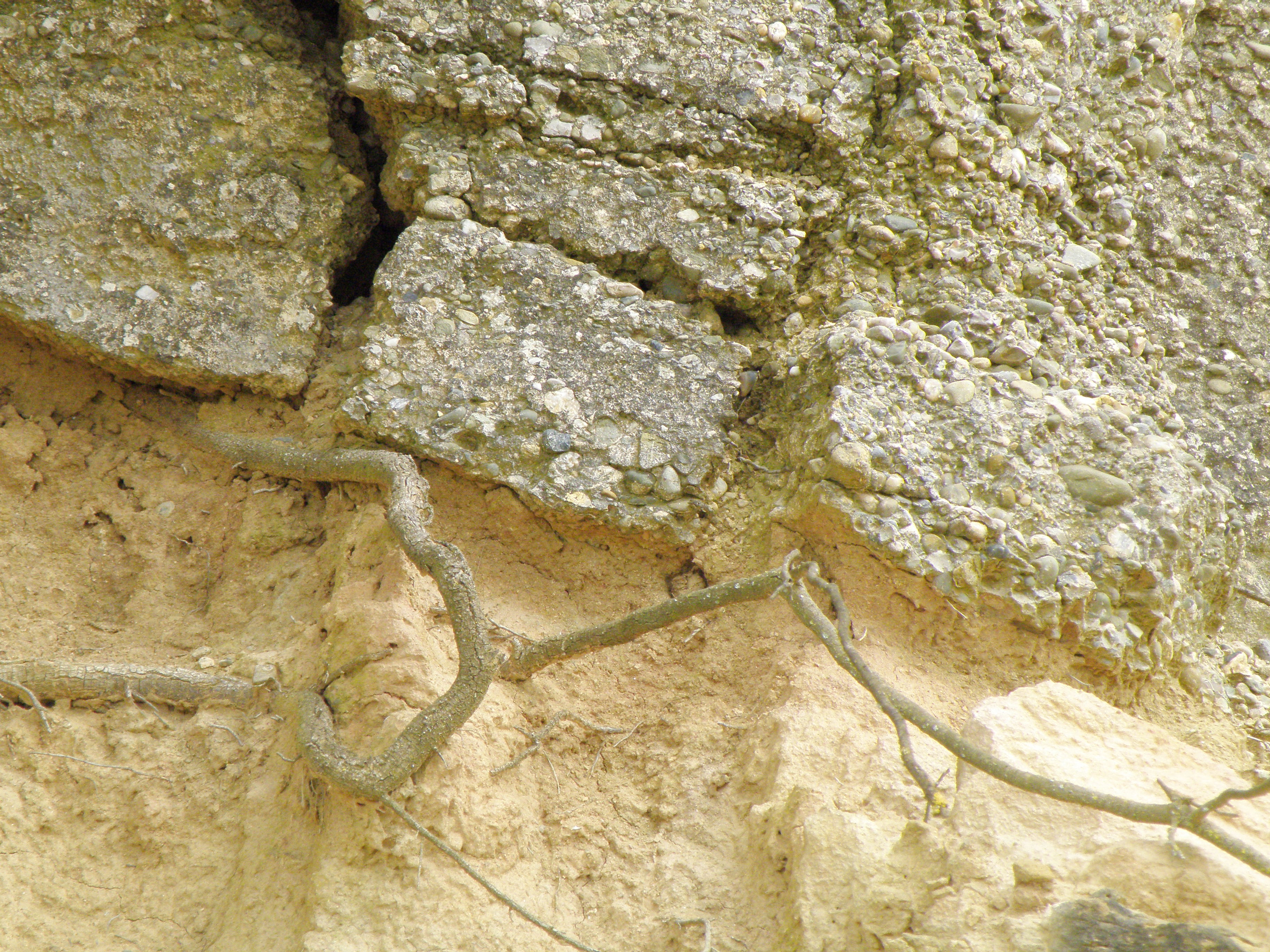
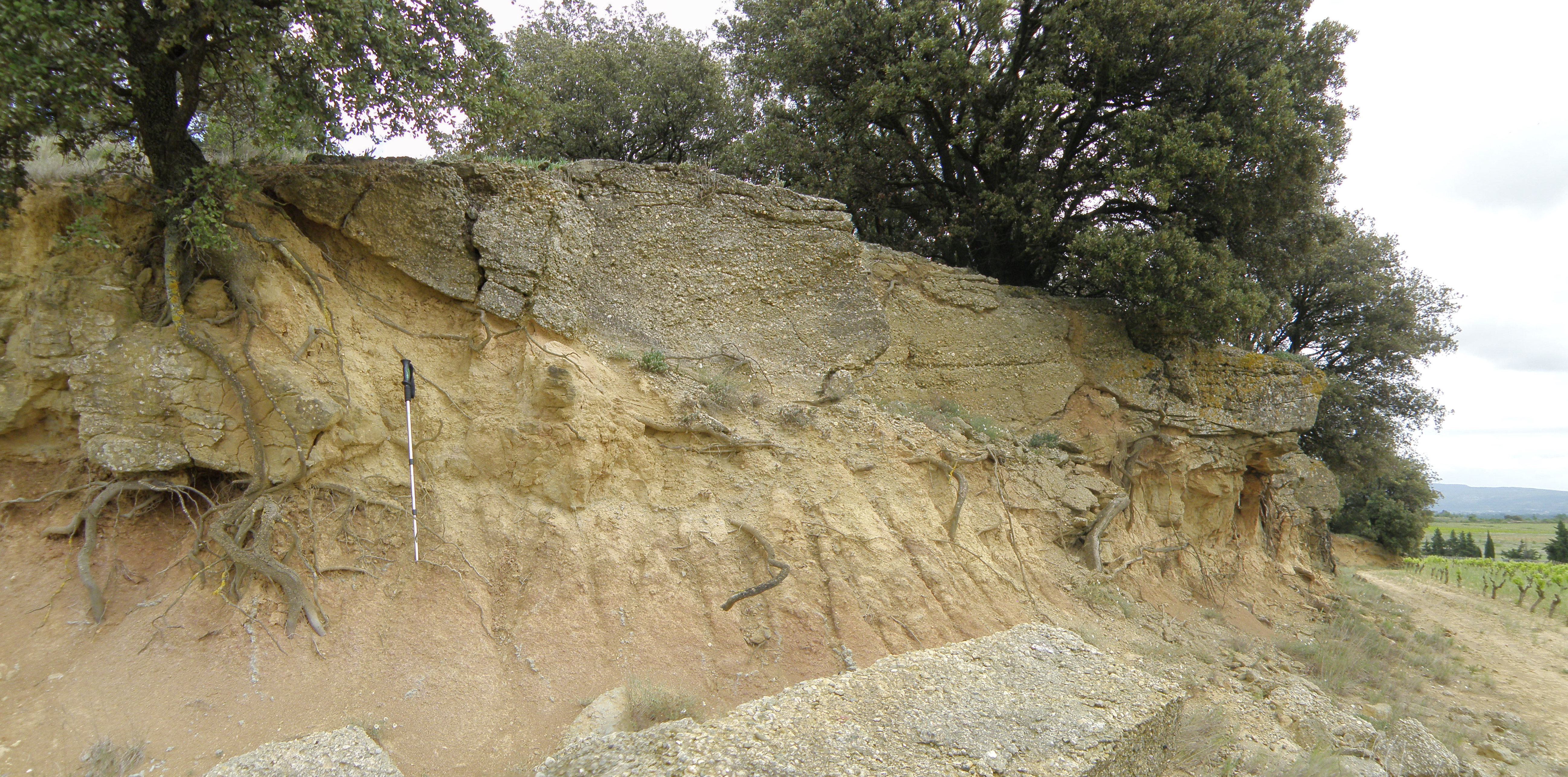 Figure 5.4. The basal contact of the ridge lithology. |
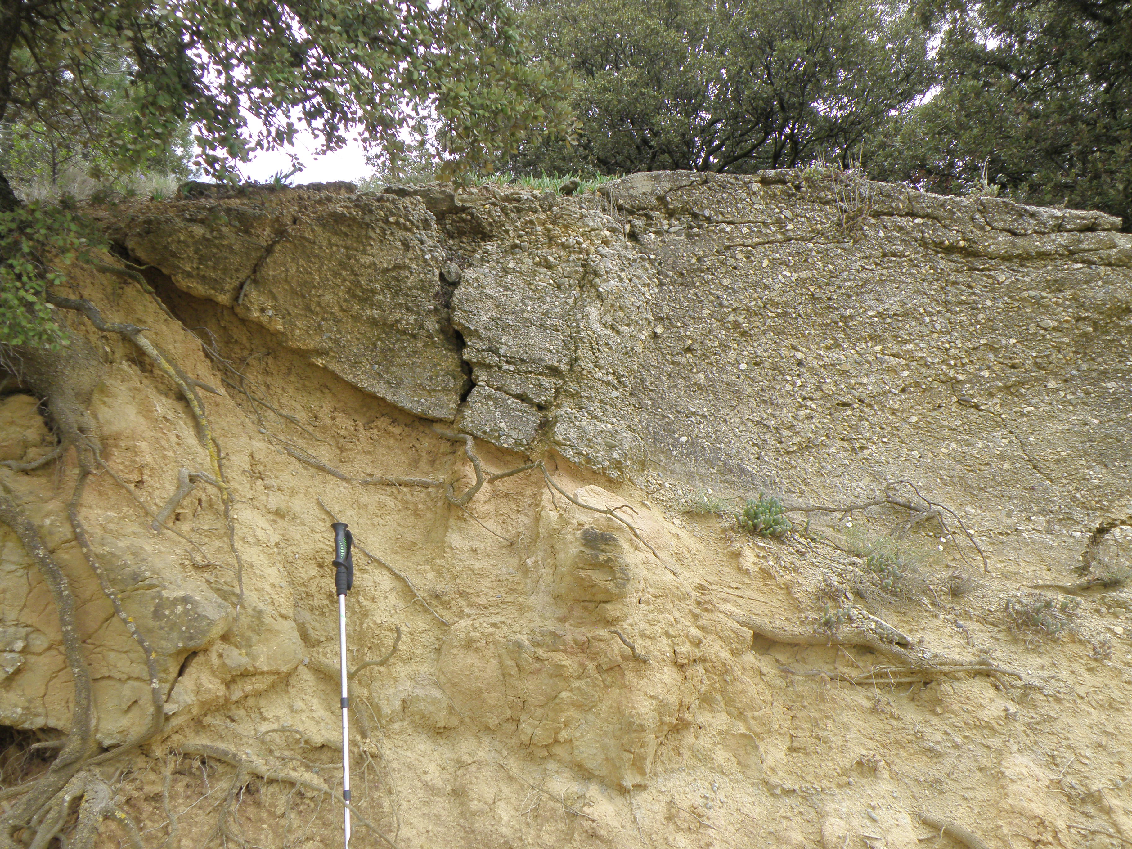 Figure 5.5. Close-up of Figure 5.4. |
|
|
|
|
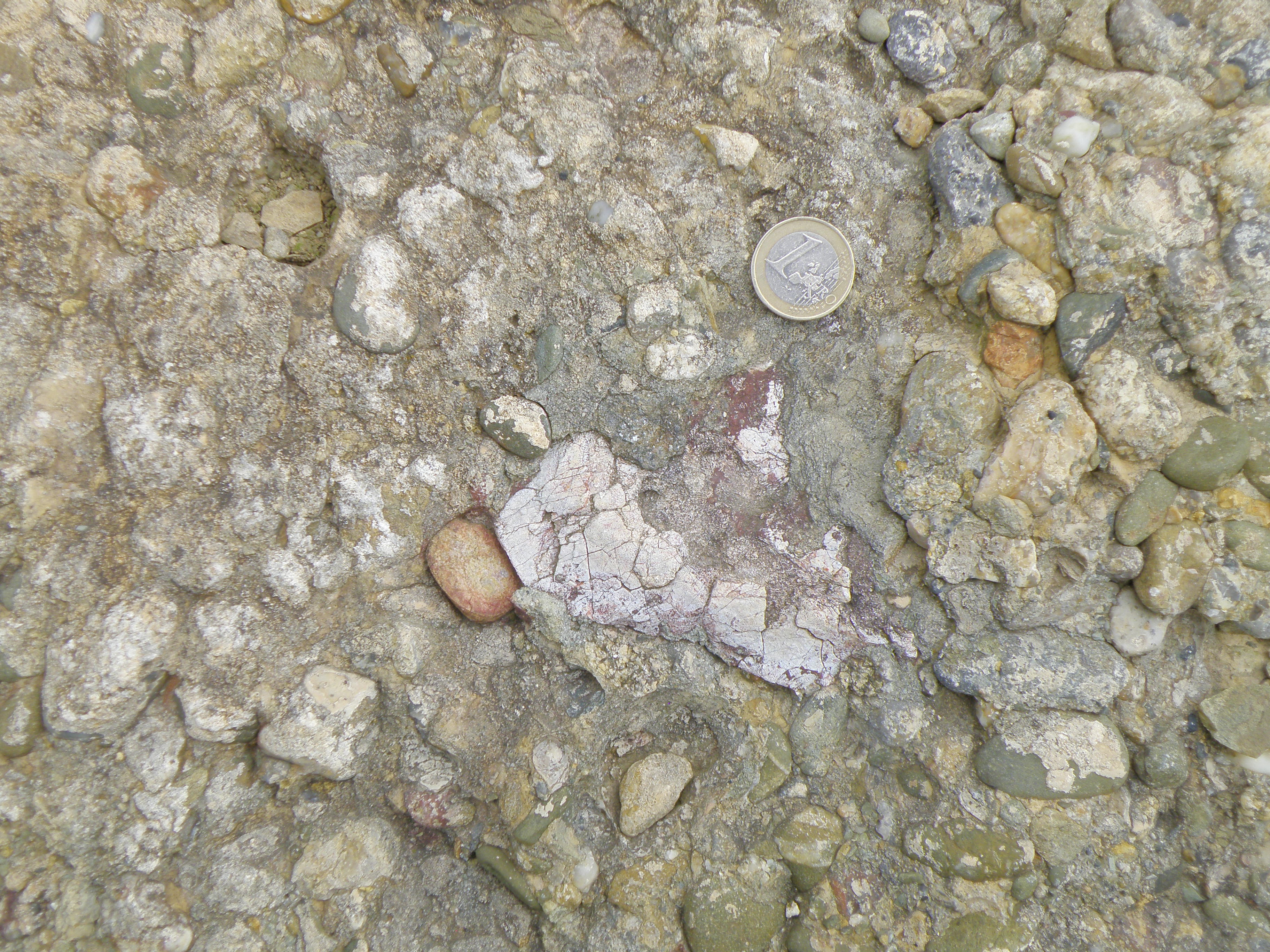 Figure 5.8. |
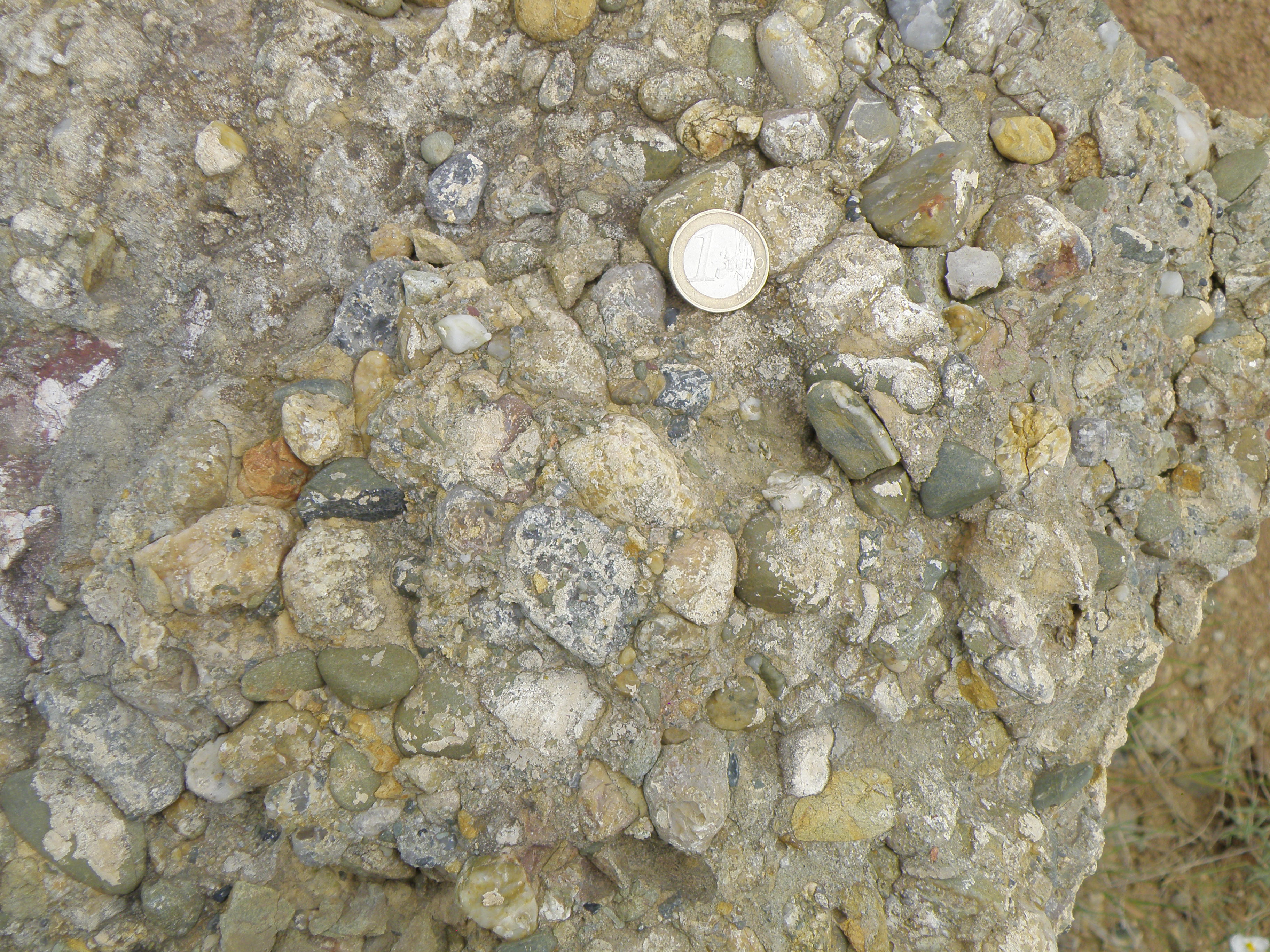 Figure 5.9. |
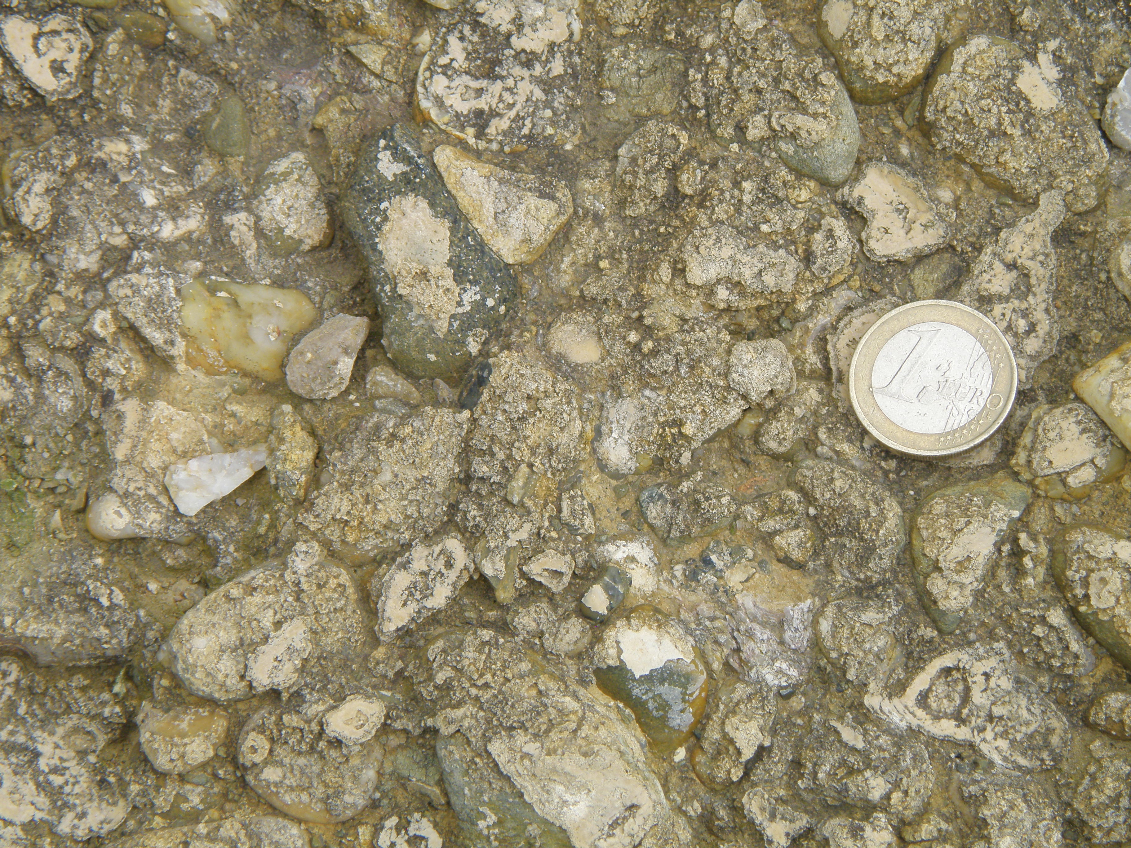 Figure 5.10. |
![]()
Make sure you've completed all the work for this locality. Now continue your investigations, or return to the Aigues-Vives home page.
![]()
This page is maintained by Roger Suthren. Last updated 11 May, 2021 9:19 AM . All images © Roger Suthren unless otherwise stated. Images may be re-used for non-commercial purposes.