fluvial channel
 |
|
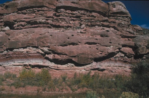
| Fluvial channel
eroded into parallel-bedded floodplain sediments. What was the direction of flow of the river which cut and filled this channel? |
|
| image credit: Roger Suthren. Near Capitol Reef NP, Utah | |
![]()
![]()
sedshots
-- images of sediments and sedimentary rocks at virtual-geology.info
This page is maintained
by Roger Suthren. Last
updated
9 March, 2006 17:05