It is important that you access this field trip on a laptop or desktop PC. Click on any image to enlarge it.
Explore the area in Google Maps and Streetview.
Handout: refer to the handout for today, which contains essential diagrams and information. Don't forget to use the information in the Field Guide too. Both are available in Course Resources.
Tasks: See today's handout.
![]()
Before we hit the rocks, this is another great place to study modern sedimentary processes. We'll spend a little time looking at the shallow streams running across the beach.
Here are some short movies of sediment transport made by University of Derby students:
![]()
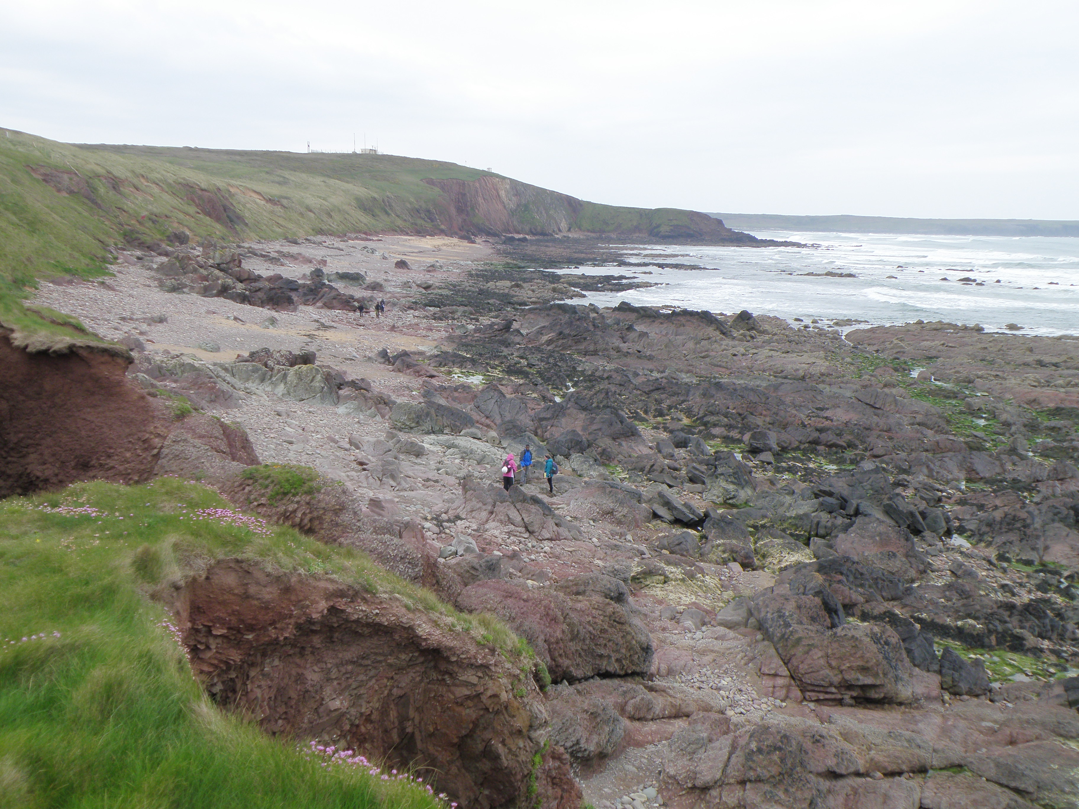
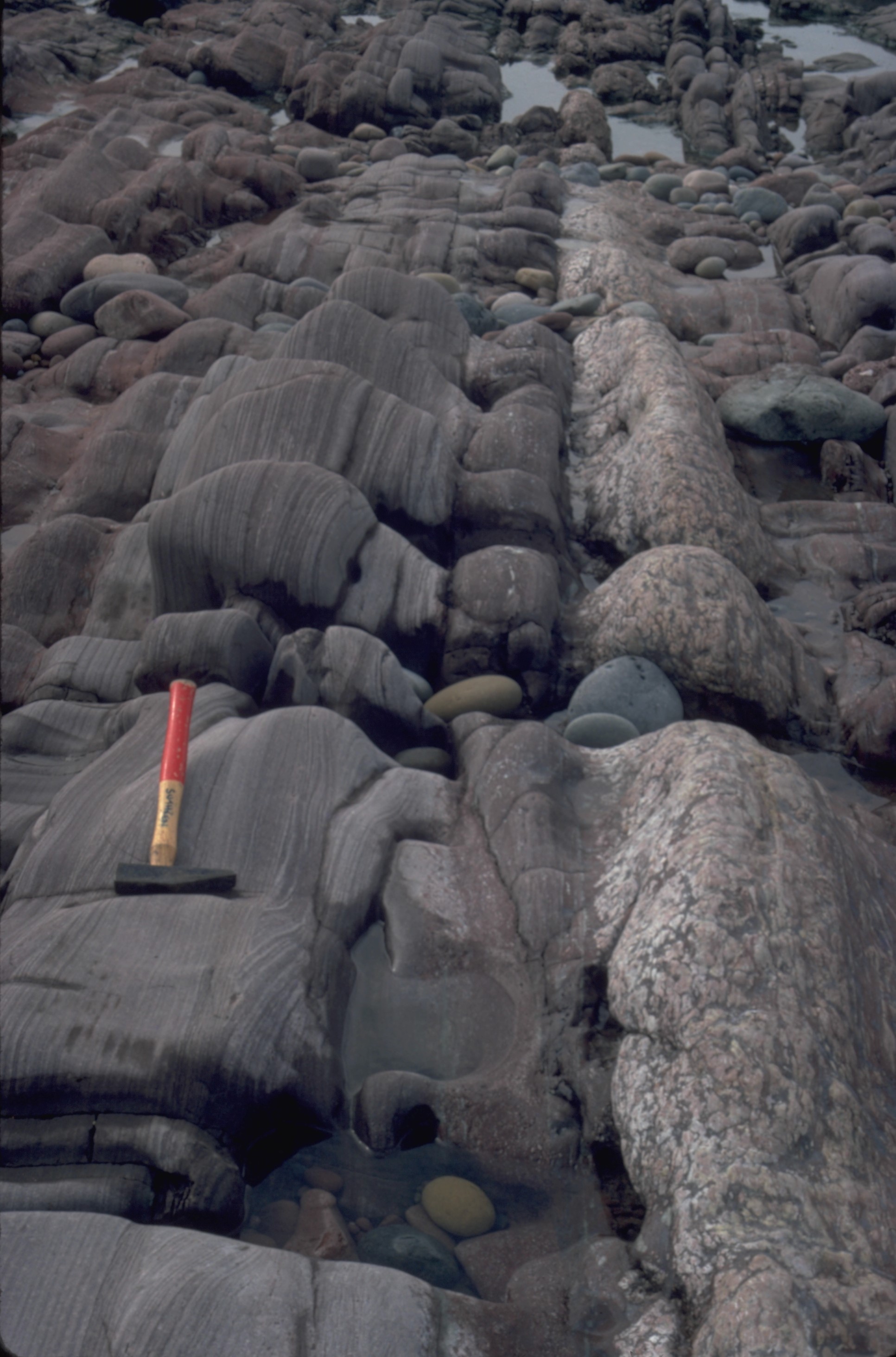
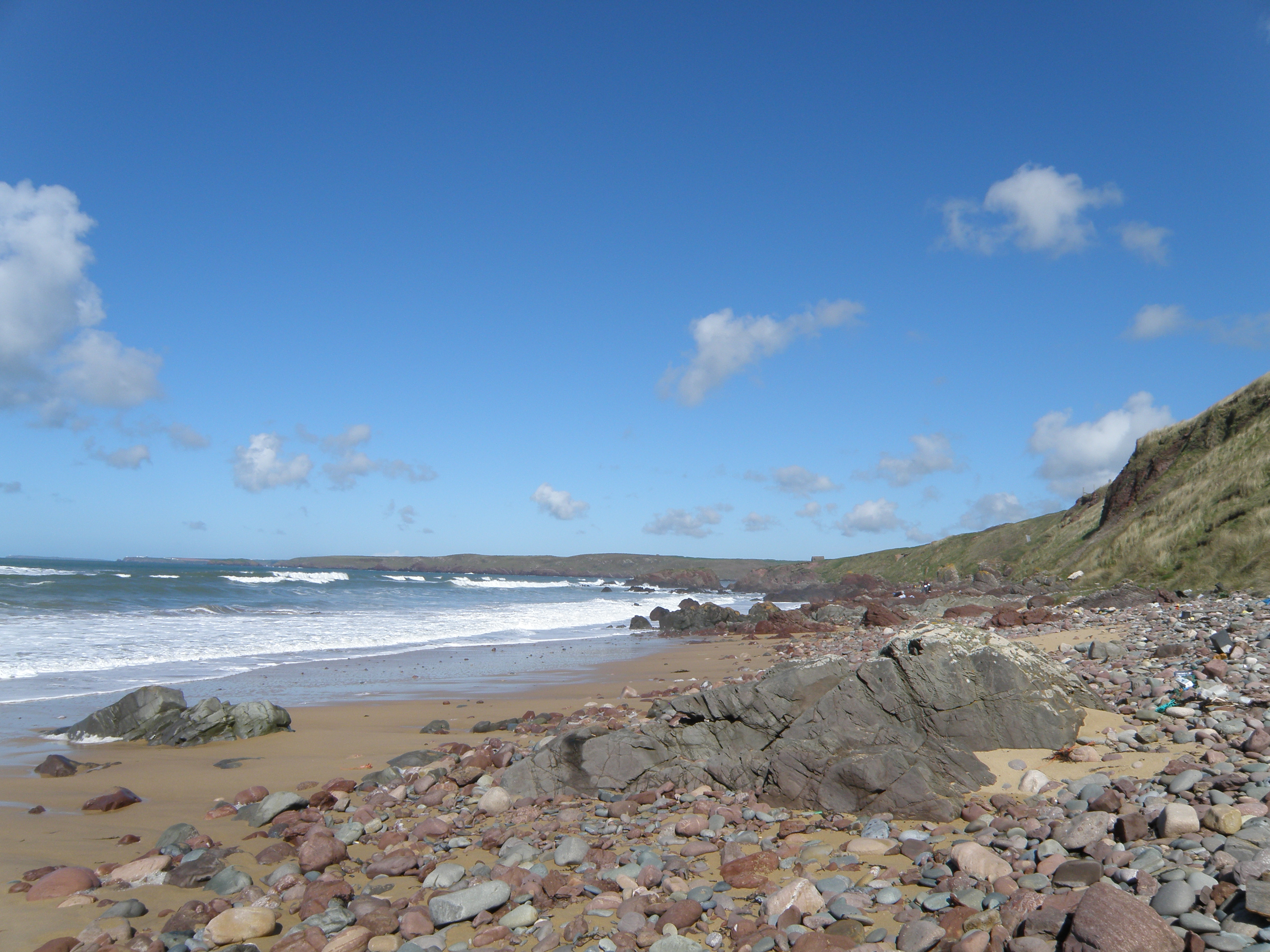
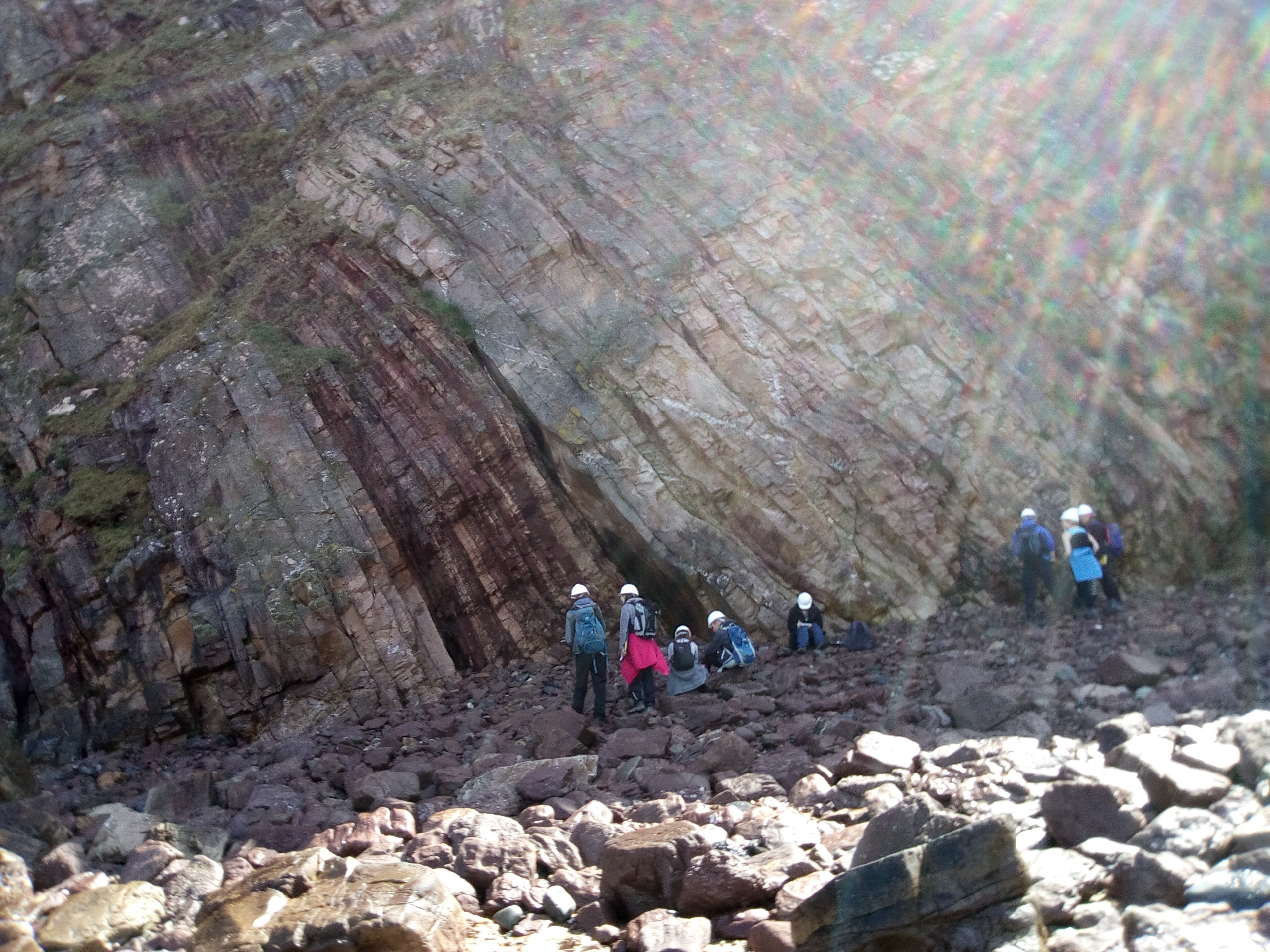
This is one of the classic sections in the Old Red Sandstone of South Wales. There is a continuously exposed section of steeply dipping strata over a distance of nearly 1km. There's a lot to see and do at this location, and we usually spend most of the day here.
|
|
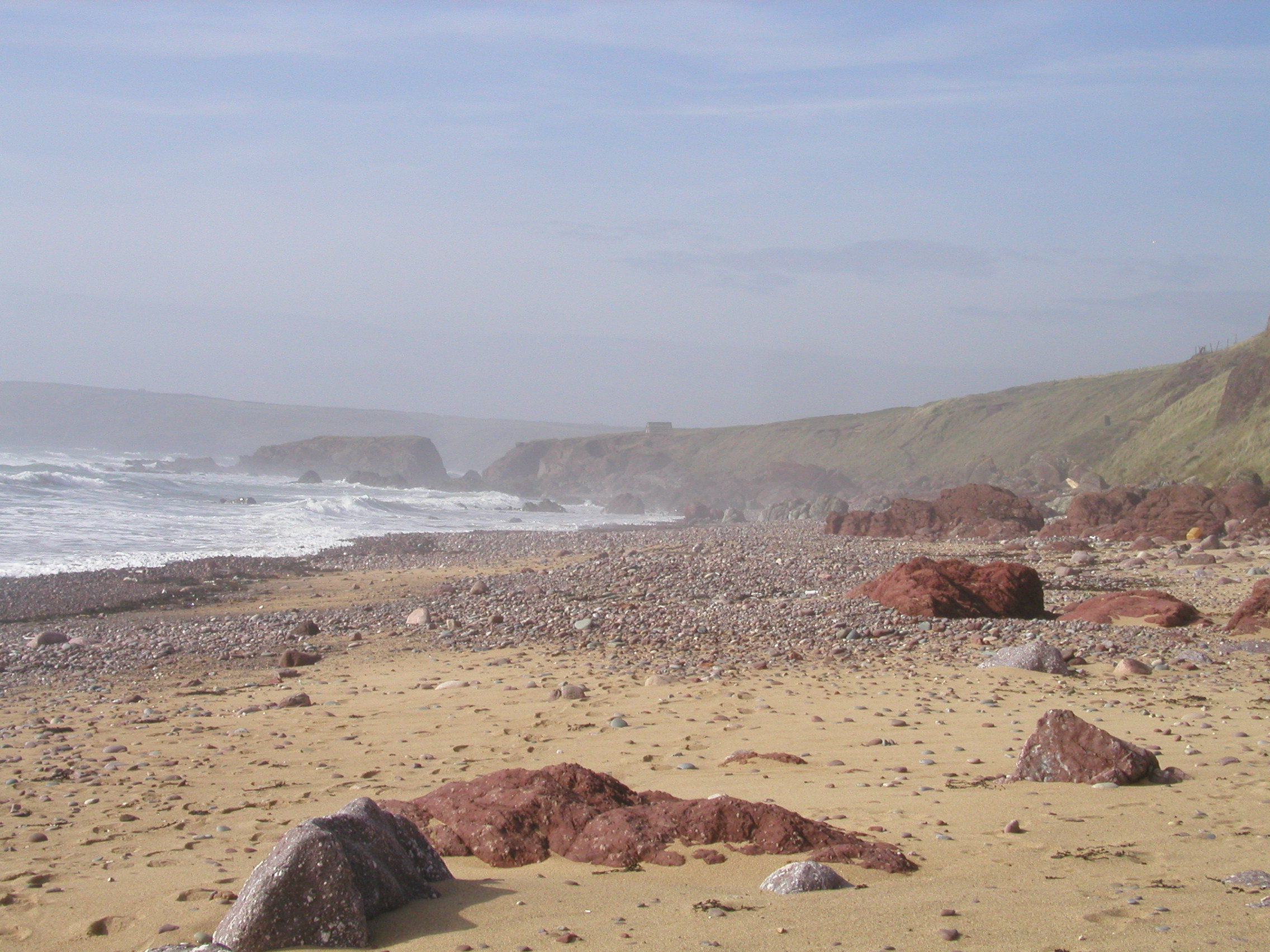
 B. View north along the beach, with outcrops of the Milford Haven Group in the foreground. Little Furzenip is the gap in the middle distance. |
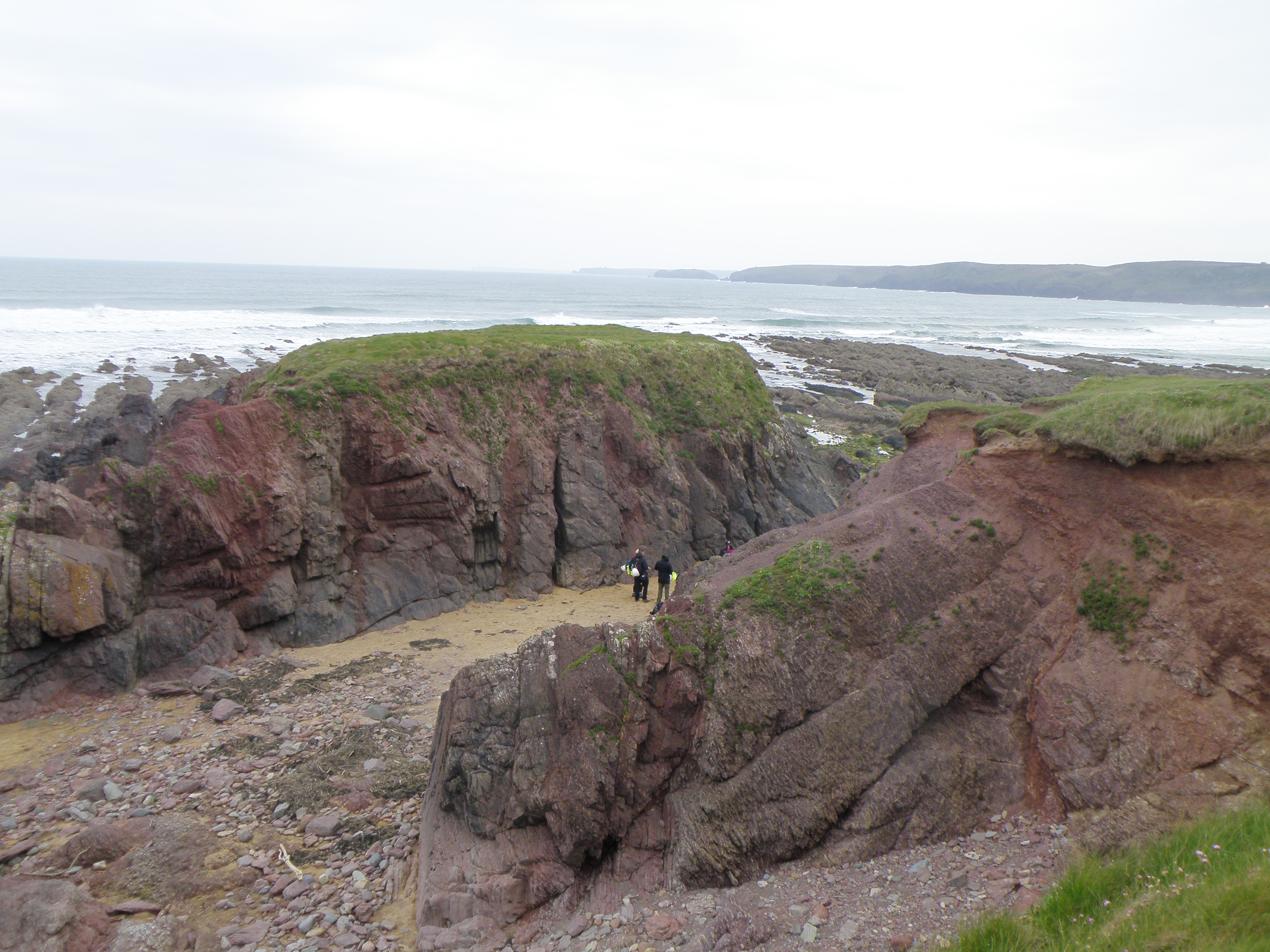 C. At Little Furzenip, looking northwest across the Flimston Bay Fault, which runs N-S through the gap where the geologists are. Locate the fault on the map in today's handout. |
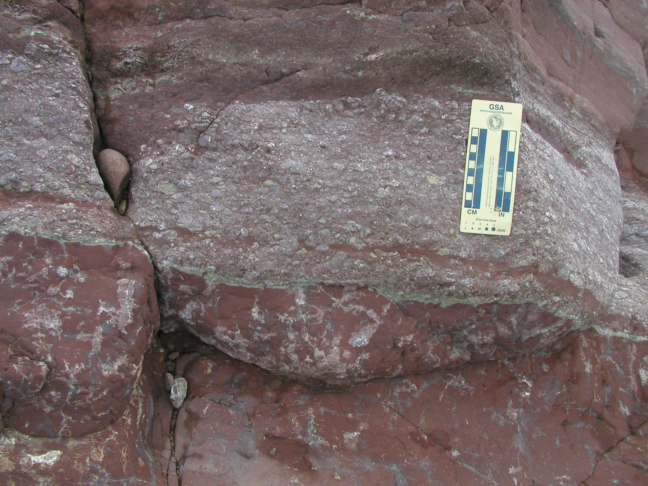
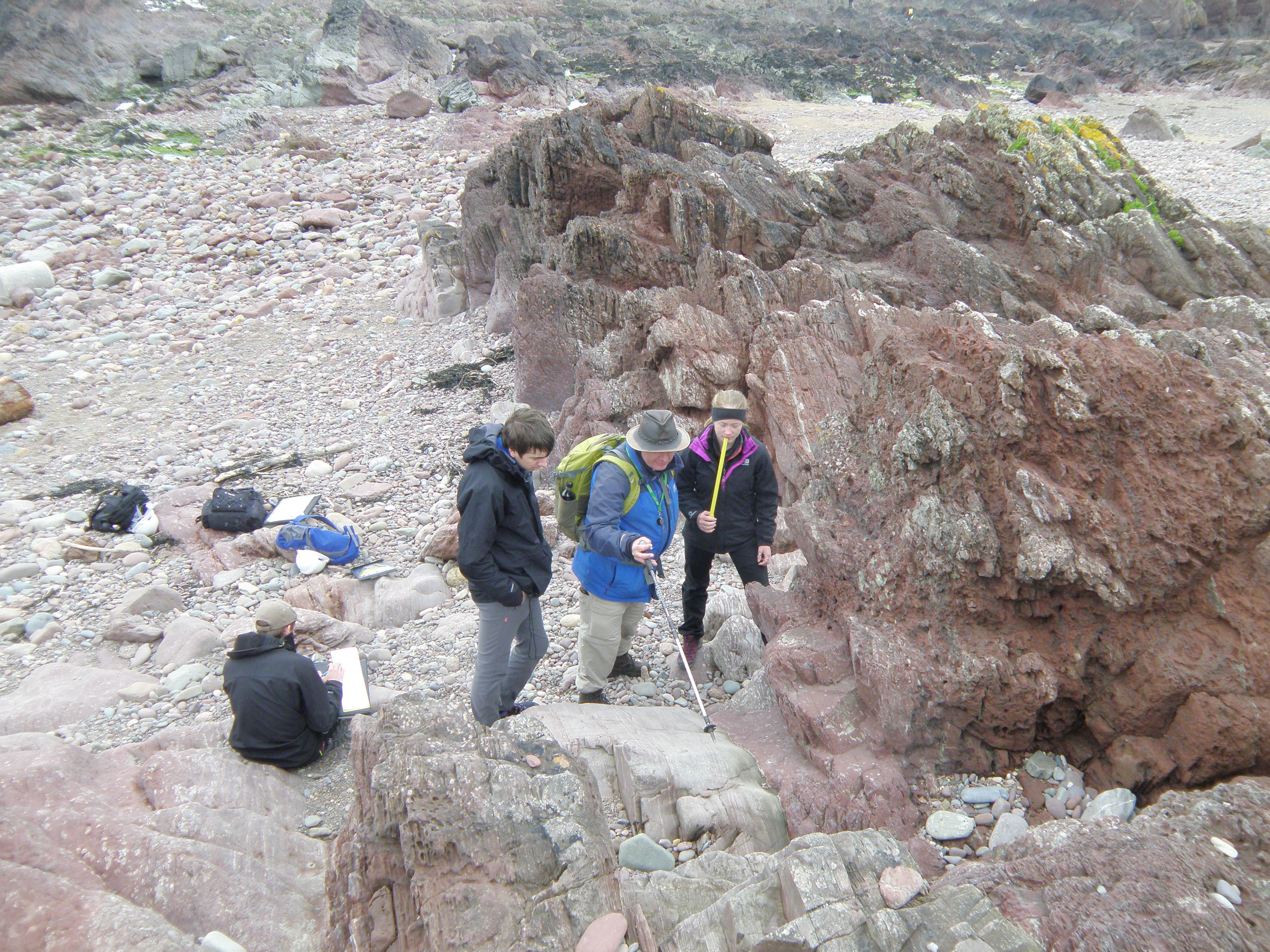 D. Logging the section: checking contacts between units. The section youngs to the south (left). Ian is pointing to a sharp contact where a green sandstone overlies a red siltstone. Think about why the sandstones are often green, and the siltstones often red. There is a chemical explanation for this - some of the close-up photos below may help to answer this question. |
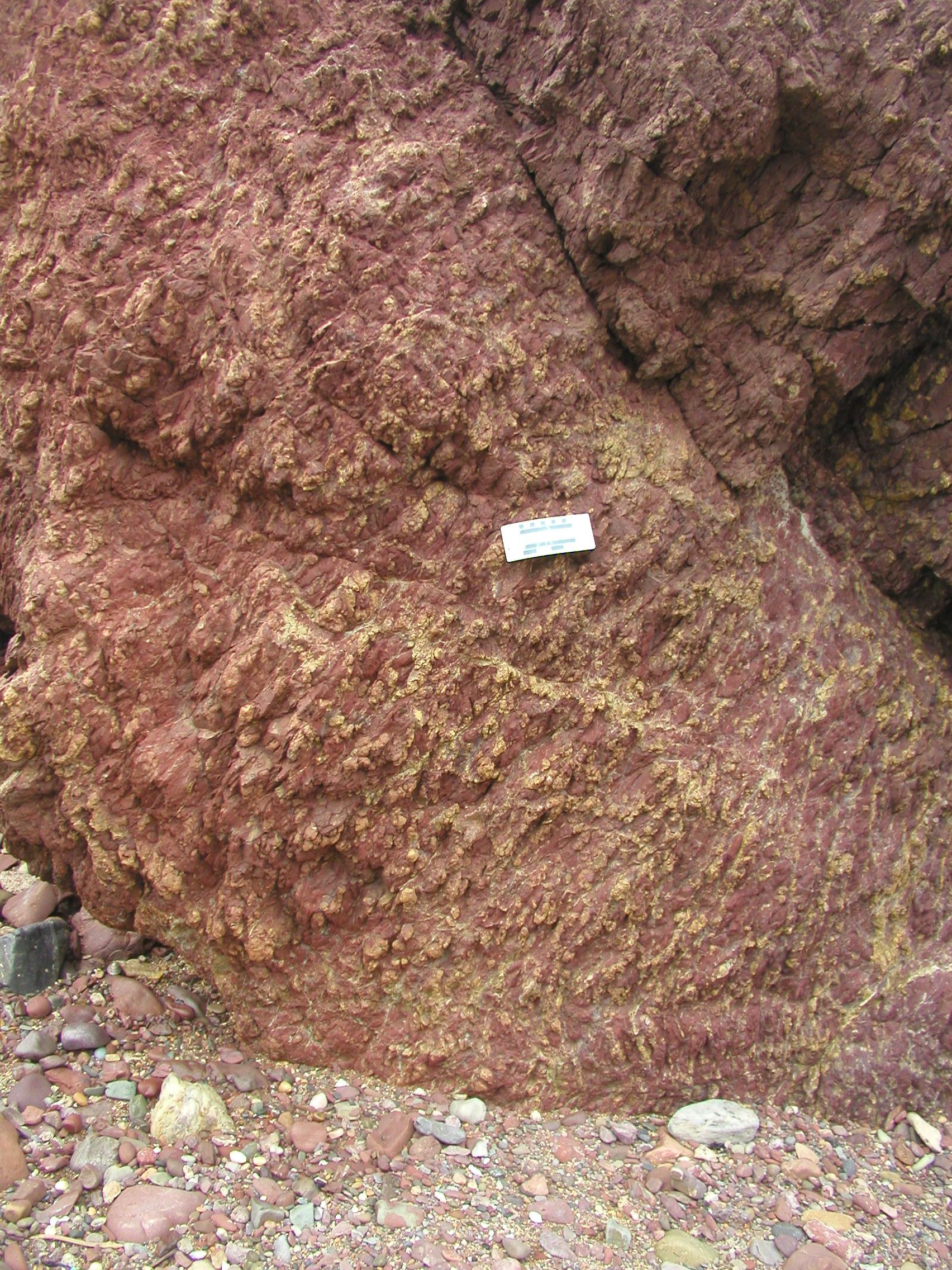
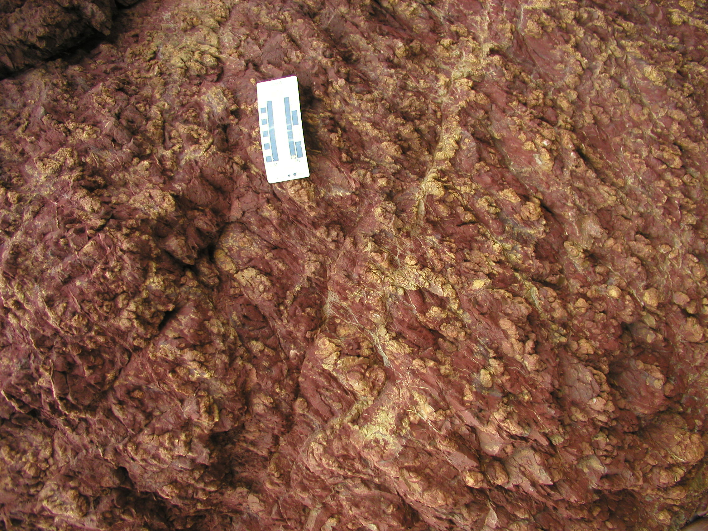
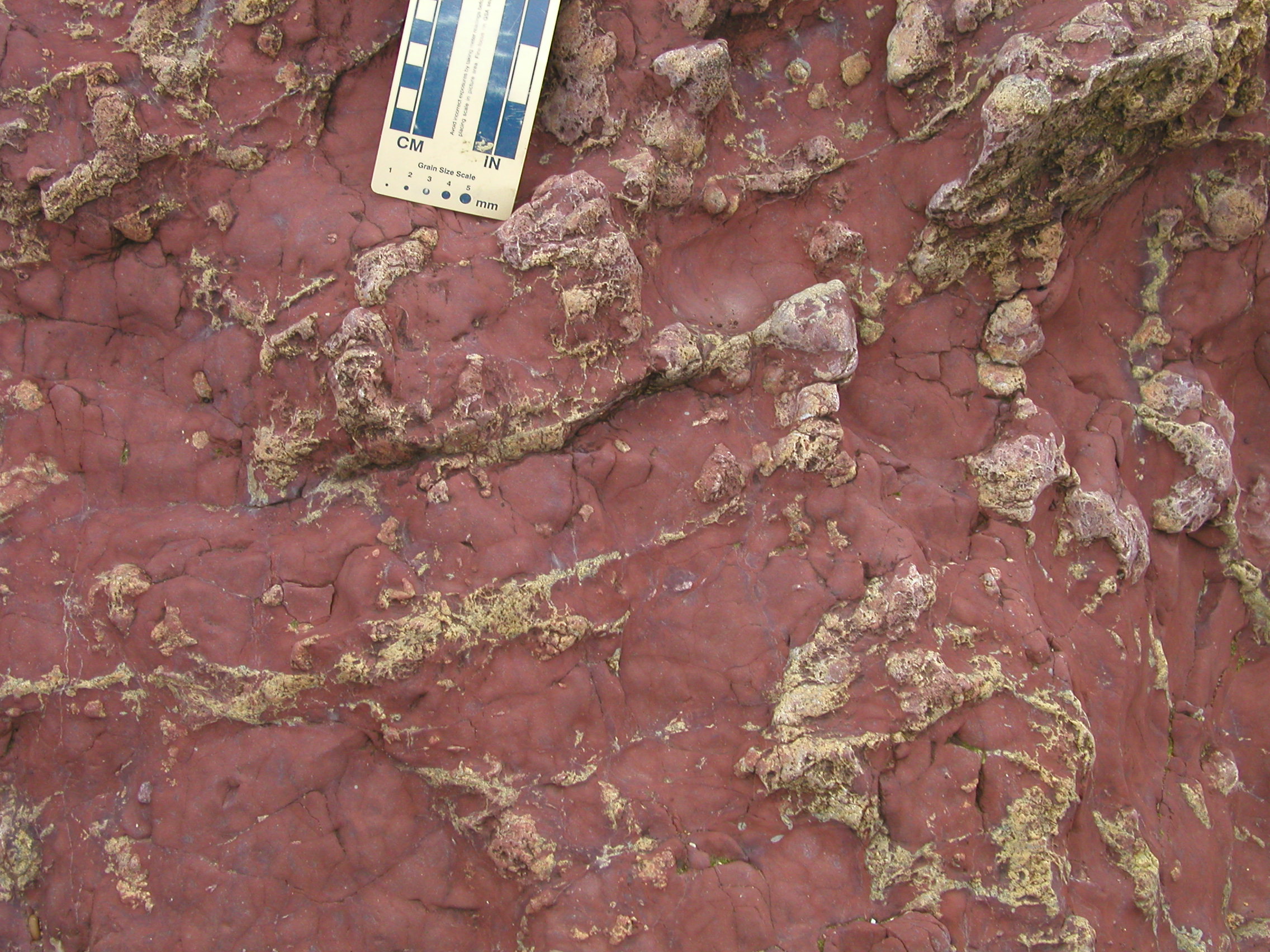
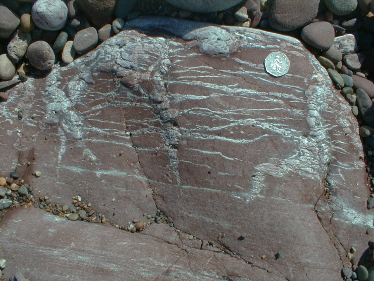
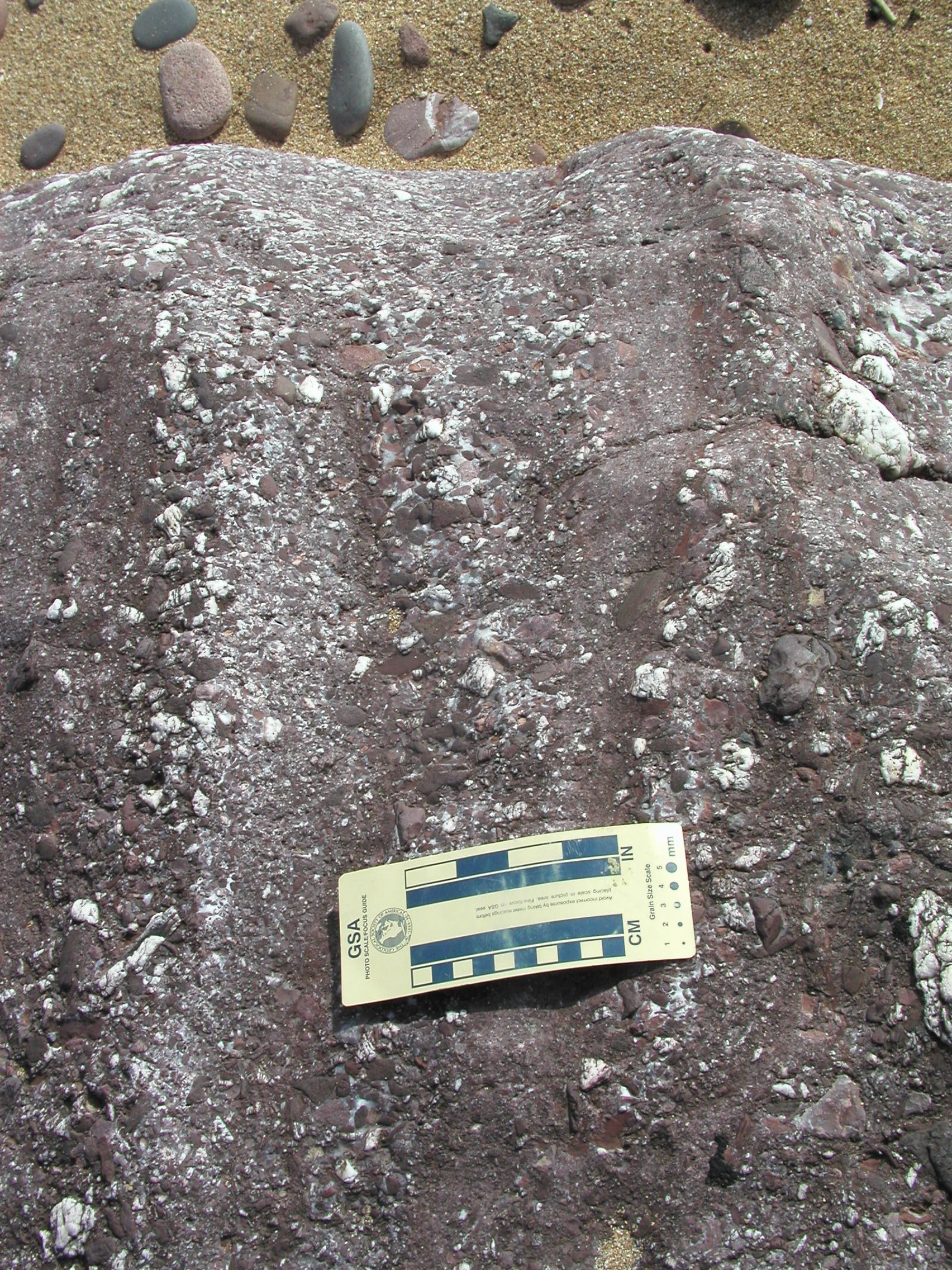
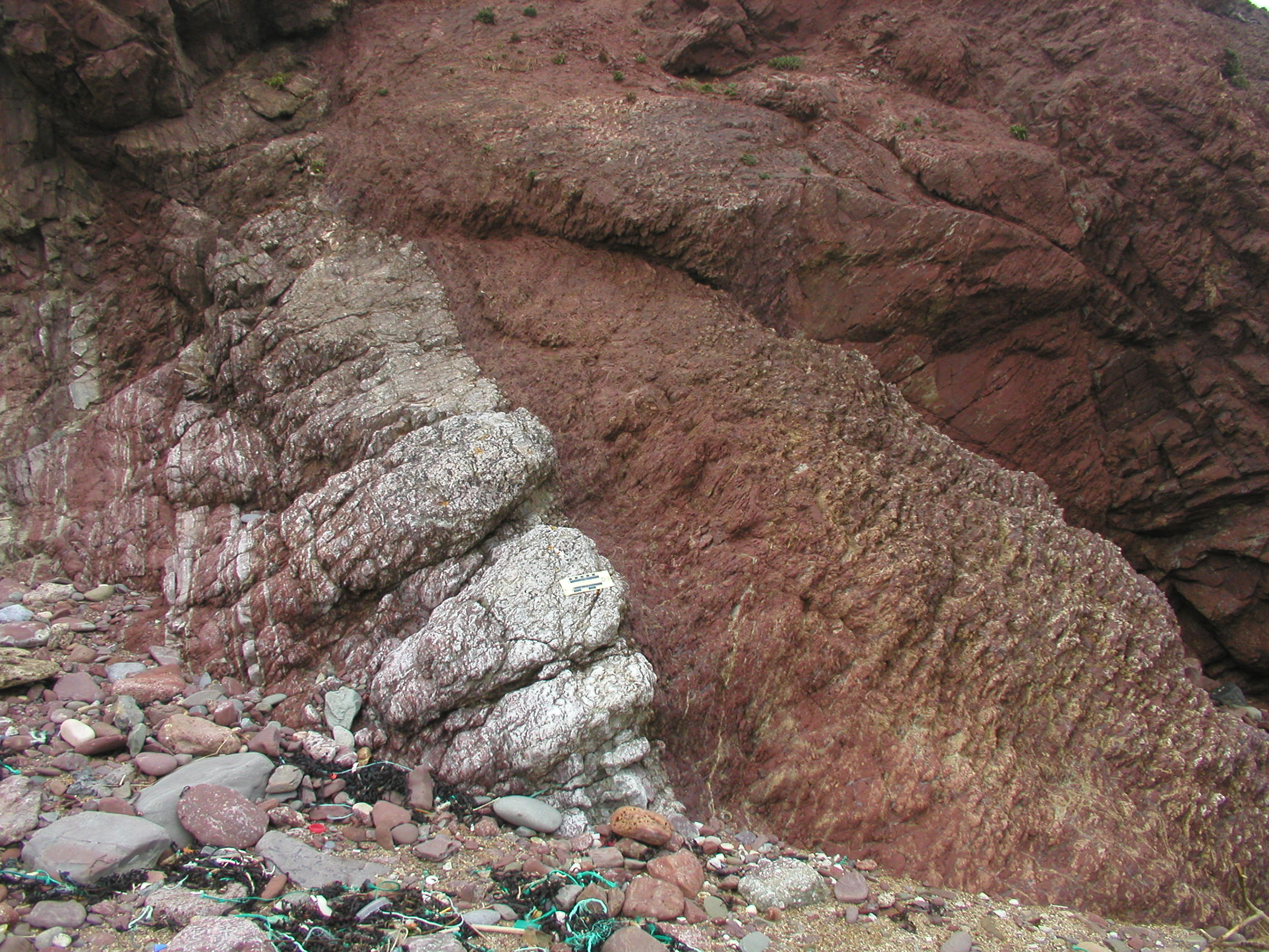
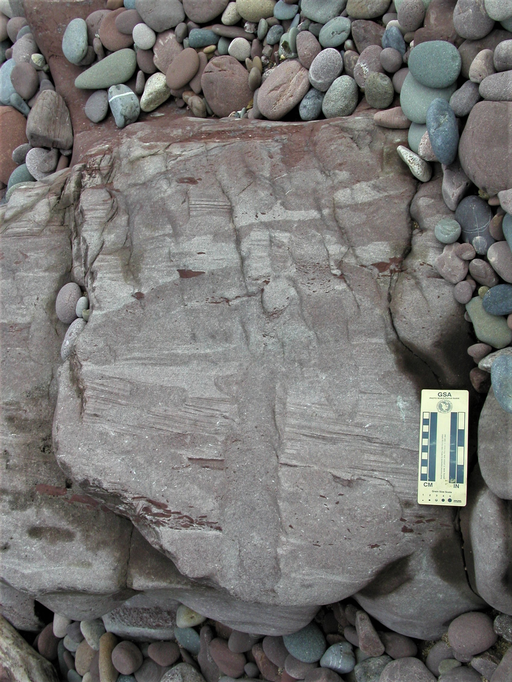
At this location, we encounter some rather strange-looking rocks, with highly irregular white or yellow material, usually surrounded by a red siltstone or very fine to fine sandstone matrix. Let's take a closer look.
|
Can you observe any pattern to the distribution of the yellow material in relation to the bedding? |
Describe the morphology of the yellow material. What is the relationship between the red siltstone and the yellow material - could the latter be transported fragments? If not, how could this material have been emplaced in the siltstone? |
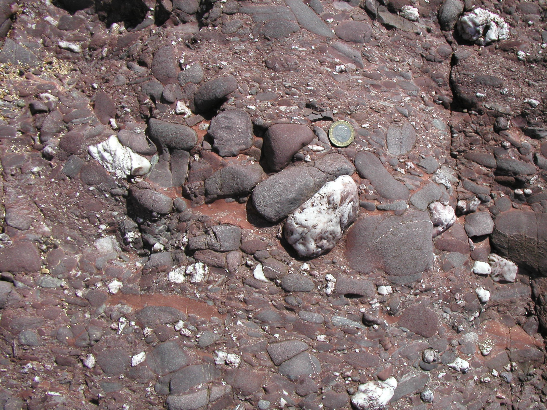
Describe the form of the carbonate in this image. |
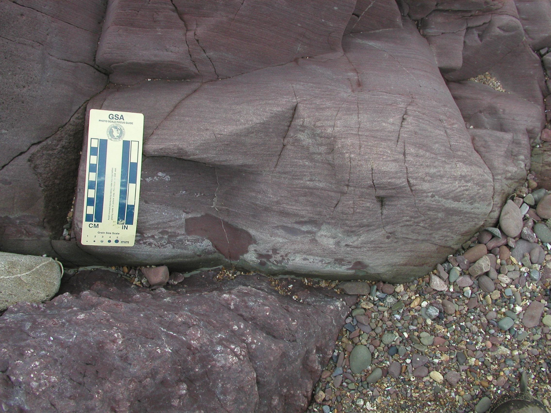
 H. These rocks dip and young to the right. The white unit with the scale near its top is at least 90% calcium carbonate. How does carbonate content change upwards through the white unit? What can you deduce about changing carbonate content in the red siltstone bed above. |
What could these represent? What has happened later to these vertical carbonate bodies? (This is a structural geology question!). |
The features of these rocks, with strong colour mottling and highly irregular distribution of calcium carbonate sheets, filaments and irregular nodules, are characteristic of a particular type of palaeosol know as calcretes. What is a palaeosol? What is a calcrete? Check the reference section in the Field Guide, and the module text books. Under what conditions do calcretes (also known as caliches) form - where in the world would you find modern ones? What does this tell us about the likely climate at the time these rocks were deposited?
For more information, see the article by Tucker and Wright (1991).
Here are some short movies made by University of Derby students logging sections in the Milford Haven Group. They are useful as an introduction to some of the main rock types and structures.
Log description: a geologist has partly logged the section for you. The section is described from the base upwards. The photographs and text below provide information for you to record in your notebook, and then transfer to your log. Try to interpret each unit as you log it. See today's handout and the logging instructions in the reference section of the Field Guide. Where information is missing from the log description, you should be able to obtain it from the photos.
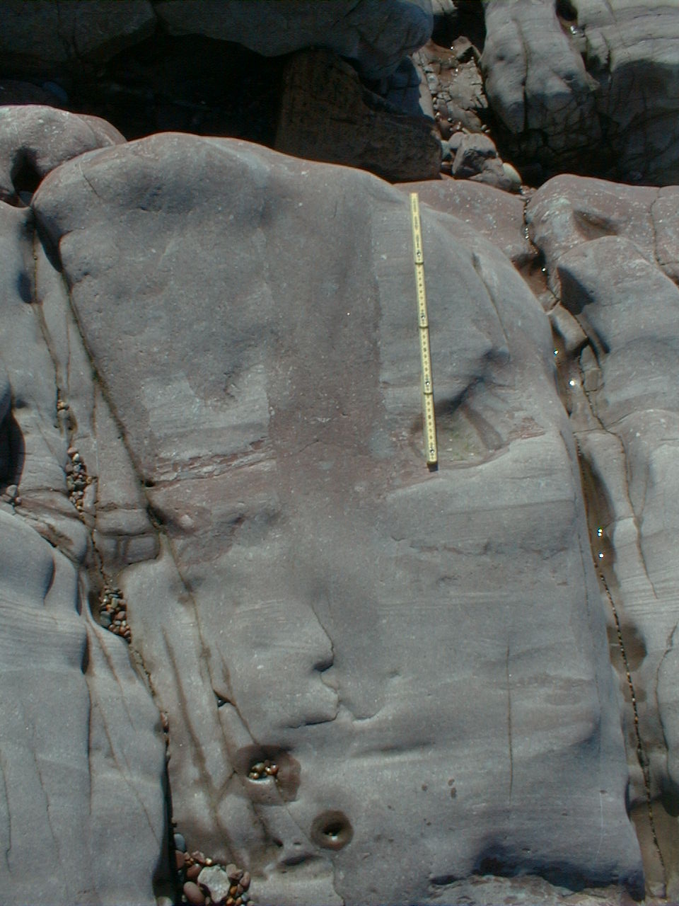
The strata dip steeply to the south. Some photographs show the true dip; others are taken parallel to bedding, so that sedimentary features are more obvious. Pay particular attention to field relationships - contacts between units, how units change as you trace them laterally, etc.
| Bed number | Base of bed | Thickness (cm) | Photo | Description |
| 1 | not seen | 25 (minimum) | Red-brown siltstone with green, irregular reduction spots and irregular carbonate nodules up to 5cm diameter. | |
| 2 | 110 |
|
Photo shows top of bed 1 & basal contact (just below scale) and lower part of bed 2. Note the variations in lithology and sedimentary structures. Similar lithologies and structures continue to the top of Unit 2. |
|
 K |
10m along strike from photo J, and at a height of 20 - 43 cm above the base of Unit 2. Describe the grain size and sedimentary structures in the lower and upper parts of the photo. |
|||
 L |
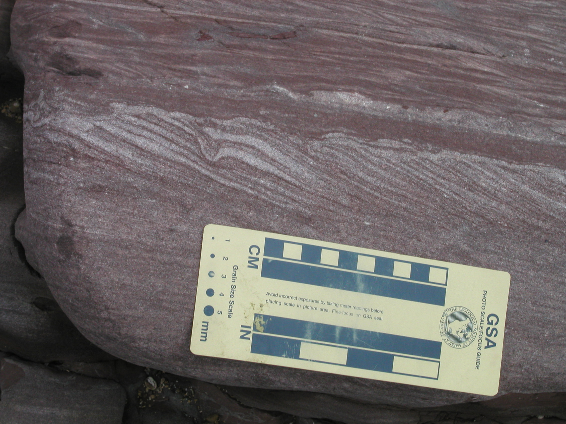
Hand specimen photo of the sandstone near the base of Unit 2. | |||
| 3 | gradational | 83 | 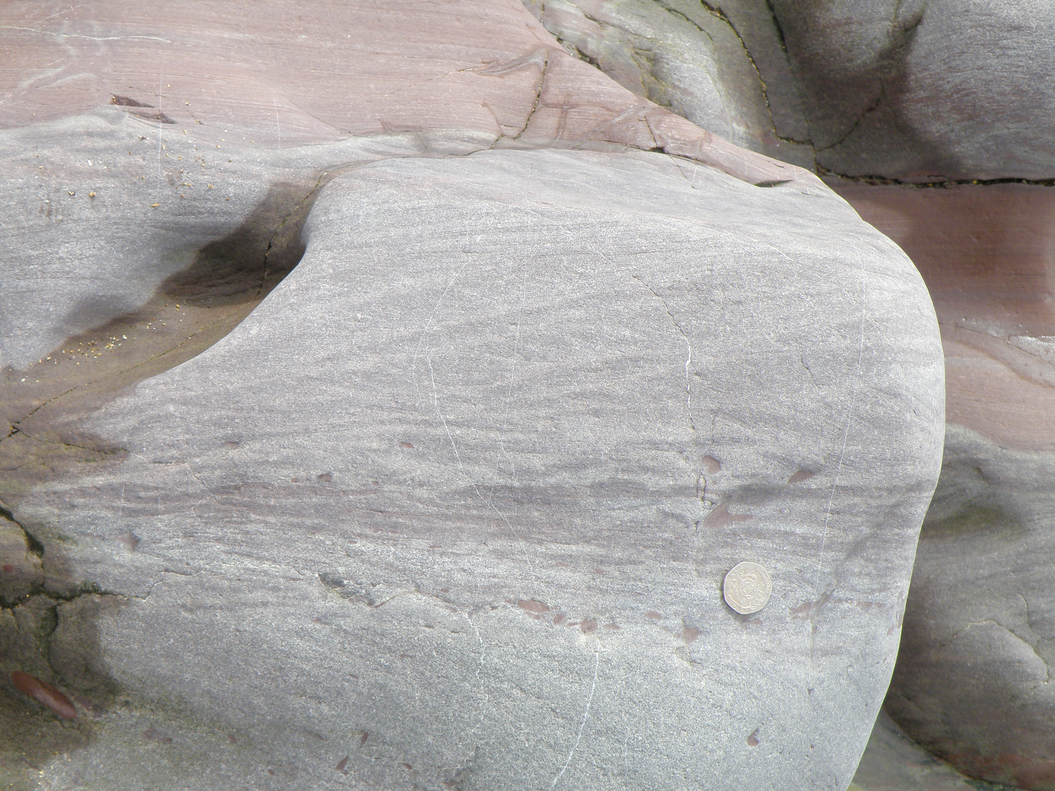 M |
20p coin for scale. Shows Unit 3 from ca, 40 to 65 cm above its base. Look closely at the sedimentary structures. |
| 4 | gradational | 171 | 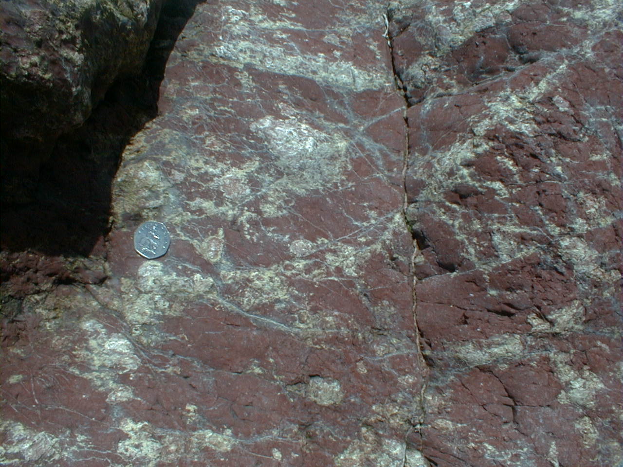 N |
50p coin for scale. Most of this unit consists of structureless red very fine sandstone to siltstone, showing a strong tectonic cleavage. In the top 40cm, the unit contains the features shown in the photo. The yellow-white areas react strongly with dilute HCl. |
| 5 | 68 |
|
Photo shows the top of Unit 4 and the basal contact of Unit 5. The white clasts in unit 5 react strongly with dilute HCl. Think about their origin. | |
 P
P |
Sub-vertical dip; beds young to the right. Scale in cm. Photo shows the middle and upper part of unit 5. The gradational contact with Unit 6 is indicated approximately by the dashed line. | |||
| 6 | gradational | 130 |
|
The lower part of Unit 6. the contact with Unit 5 is just below the field of view. Scale in cm. Bedding runs from left to right. Describe the structures cutting across the bedding. What is their 3D shape? How could they have formed? |
 R
R |
The top of Unit 6. Looking down on strata with sub-vertical dip. Similar structures to those seen in photo Q. The contact with Unit 7 (red) is near the top of the photo - Unit 7 is mostly obscured by beach pebbles. Most of Unit 7 consists of red siltstones and very fine sandstones, showing cleavage. Variable amounts of irregular veins and nodules of calcium carbonate are present. |
|||
| 7 | 55 | 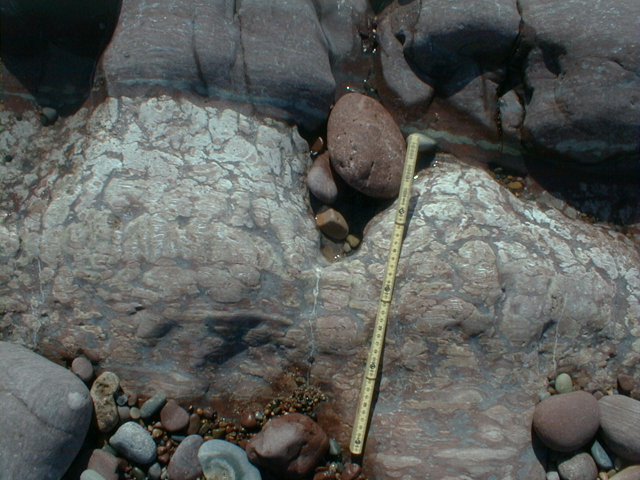 S |
Scale in cm. The white material at the top of Unit 7 reacts strongly with acid. The contact with Unit 8 is seen near the top of the photo, at the top end of the tape. | |
| 8 | 114 |
|
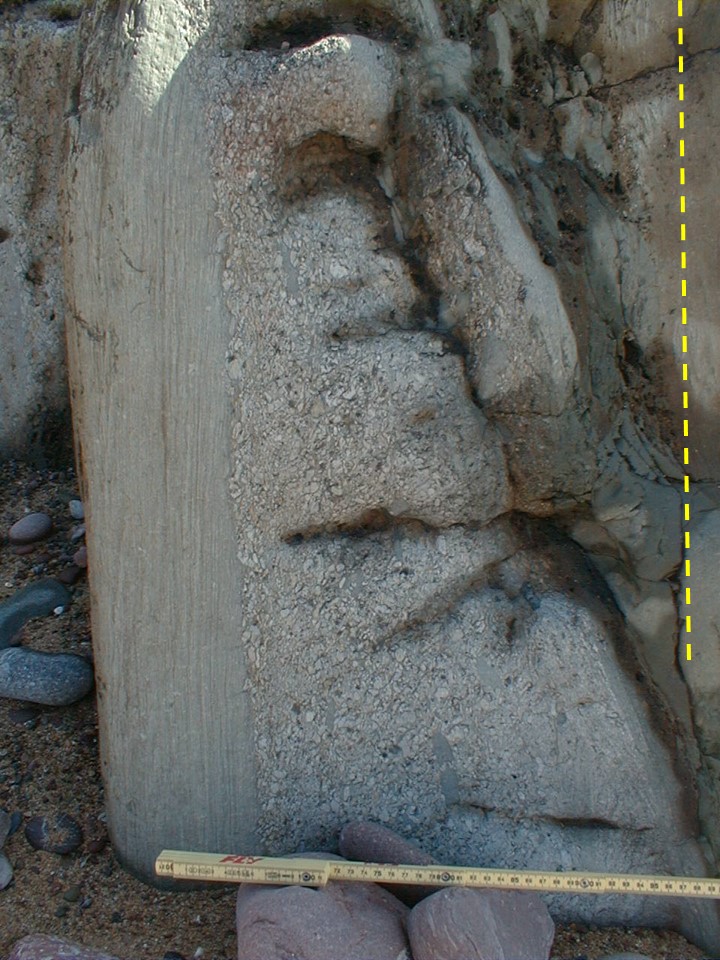
Another view - this time along the strike - of the contact of Unit 7 (right, white) and Unit 8 (left, red-brown). Hammer shaft is 30cm long. | |
 U |
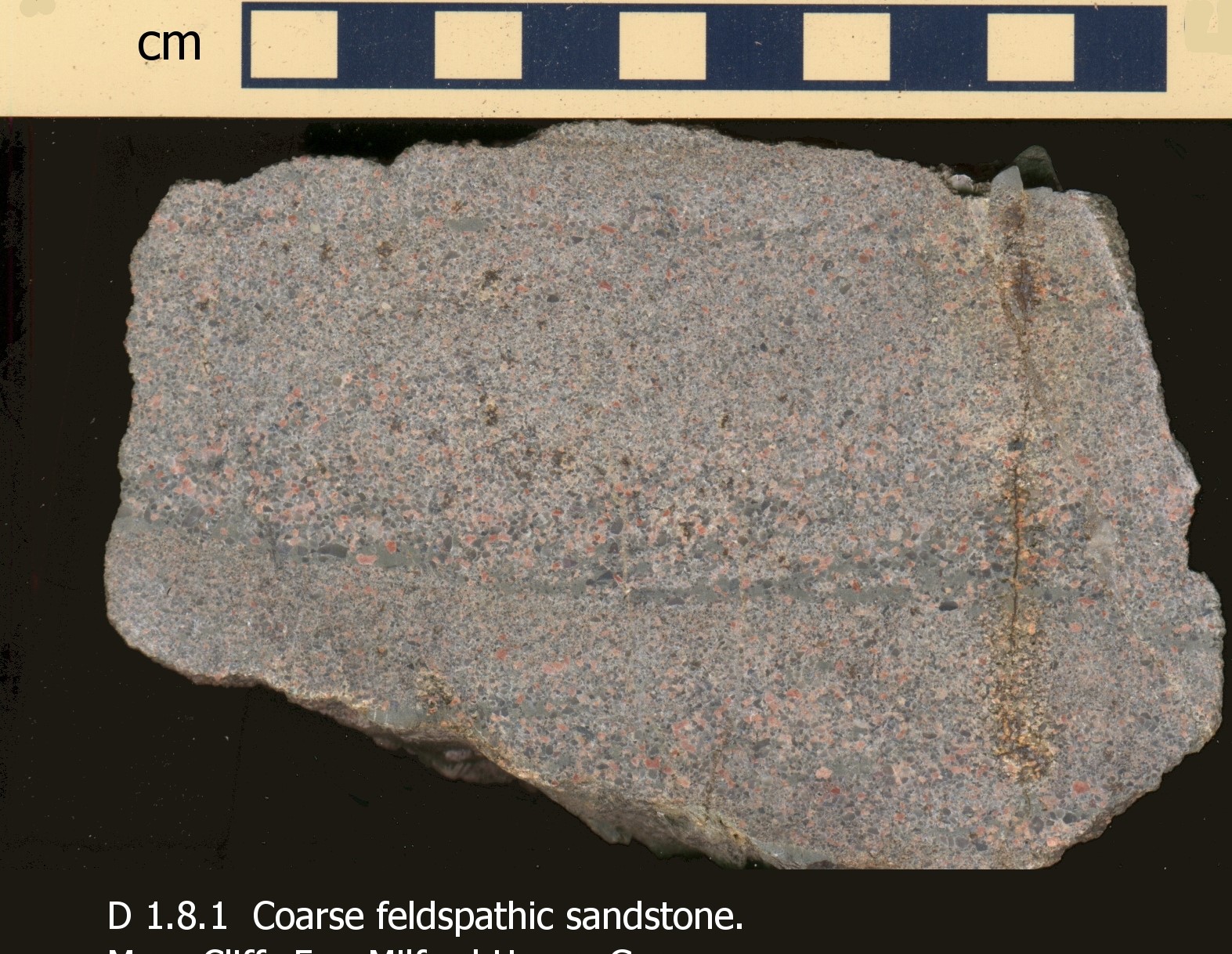
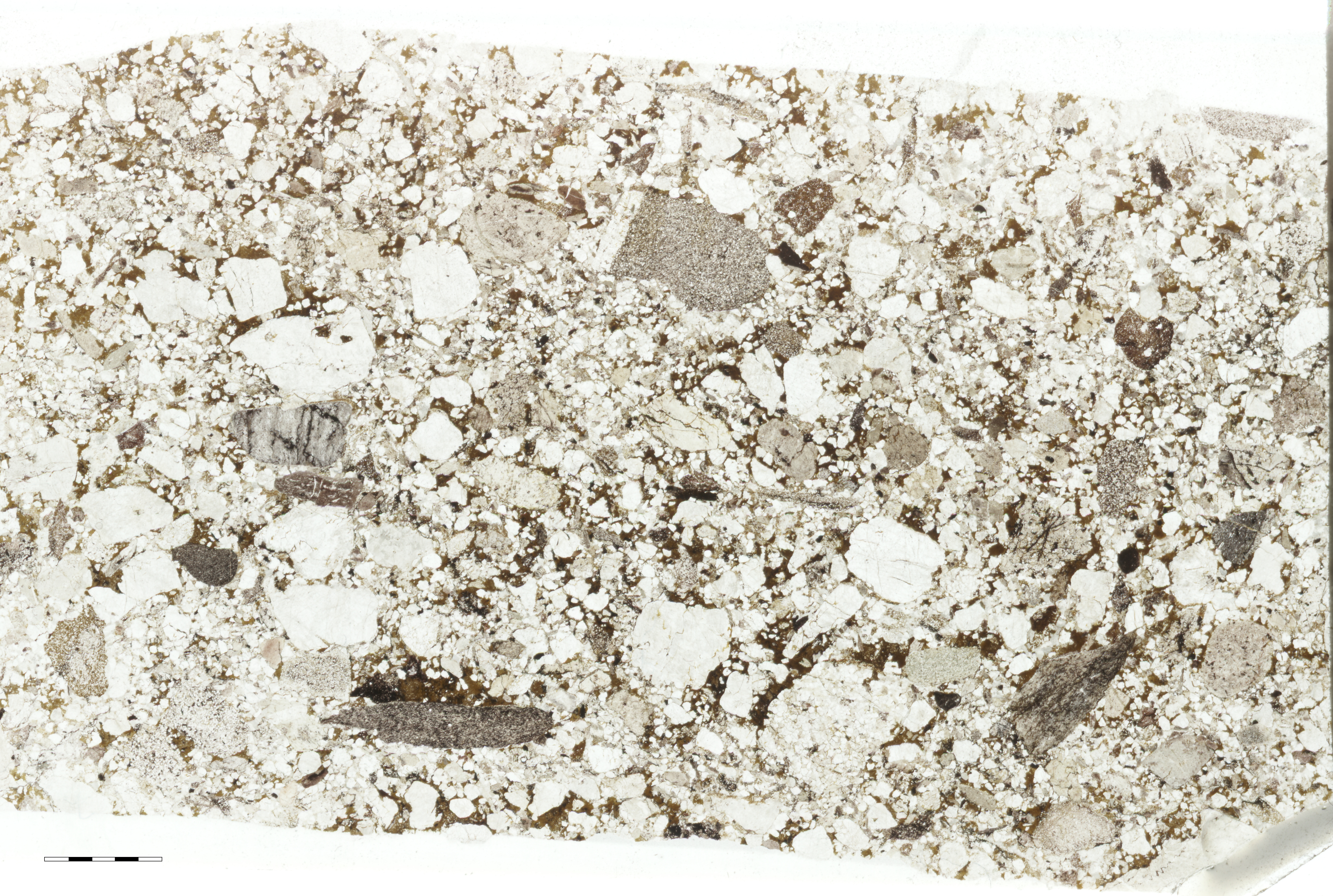
Thin section photograph of sandstone from Unit 8 in plane-polarized light. Scale bar in mm. Describe the main textural and compositional features of the sandstone, and give it a name using the Folk classification. | |||
 V |
About 60cm above the base of Unit 8 (left of the hammer handle in photo T), the thin parallel beds of medium-coarse micaceous sandstone show this structure on bedding planes. What is the structure, and what does it tell us about flow conditions? | |||
| 9 | gradational | 122 | 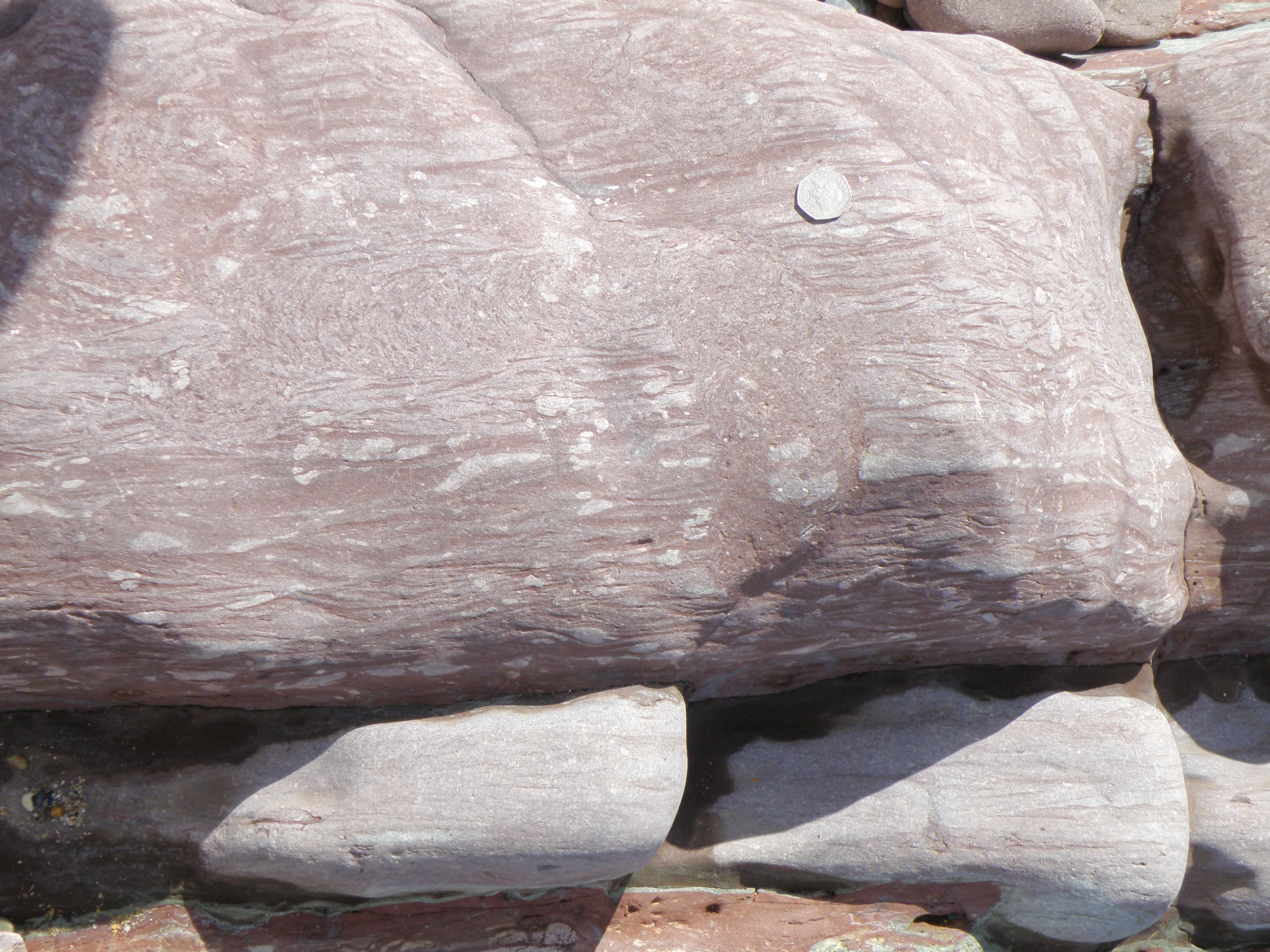 W |
Photo shows unit 9 from about 45 to 95 cm above its base. 50p coin for scale. Describe and interpret all the sedimentary structures present. |
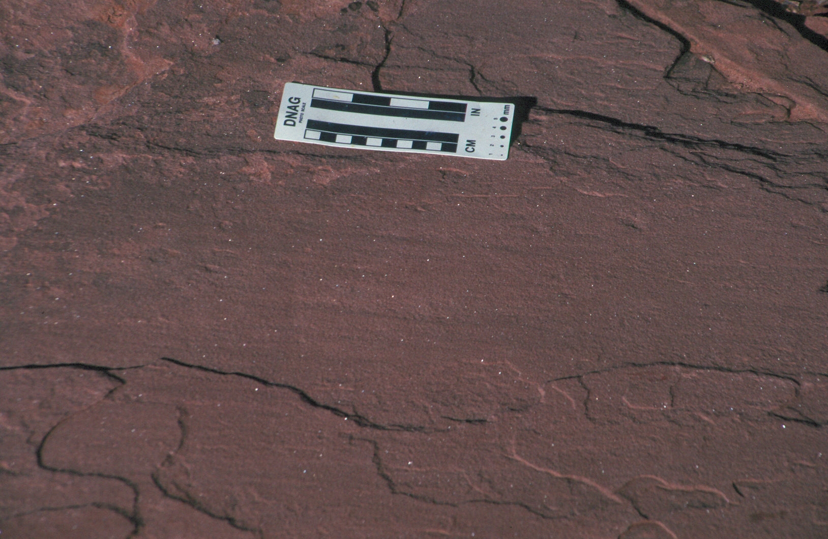
| 10 | sharp, planar | 145 | 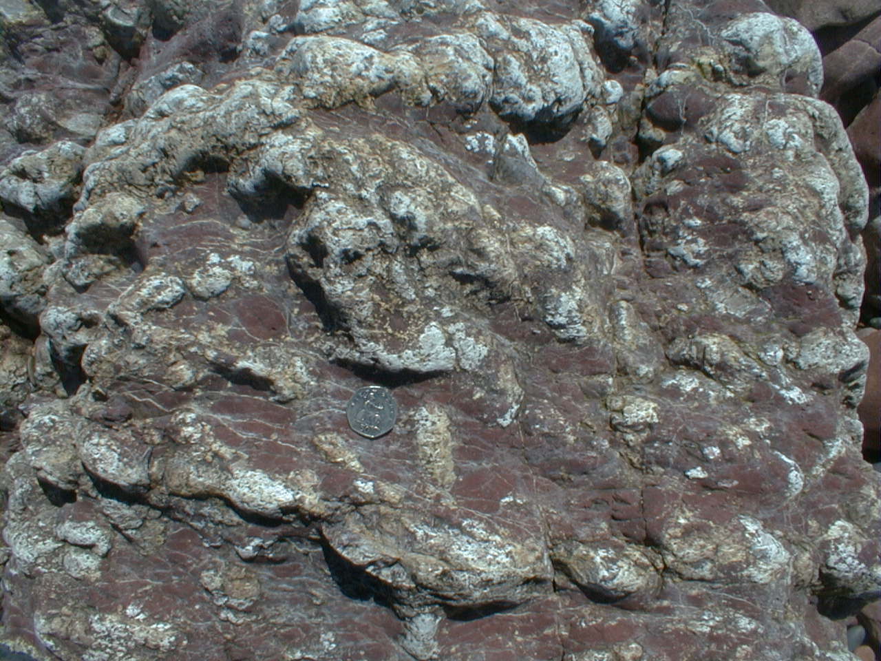 X |
Unit 10 consists mostly of red-brown siltstone. Photo taken towards the top of Unit 10. 50p coin for scale. |
| 11 | sharp, erosional | 30 (minimum); top not seen | Coarse to very coarse green-grey sandstone, showing parallel bedding and planar tabular cross bedding in 15cm thick sets.. |
Here are a few questions and hints which may be useful in identifying and interpreting the outcrops on the log:
Interpreting the field evidence
You have now acquired a variety of different types of data on the sedimentary sequence shown in the log. This should include lithologies, sedimentary structures and field relationships. Your task now is to interpret the data.
![]()
We are now near the top of the Lower Old Red Sandstone.Clast lithologies in the Ridgeway Conglomerate are often dominated by vein quartz (white).
 Y1. View south to Little Furzenip, with outcrops of Ridgeway Conglomerate (conglomerate and underlying red siltstone with calcrete nodules) in the foreground. |
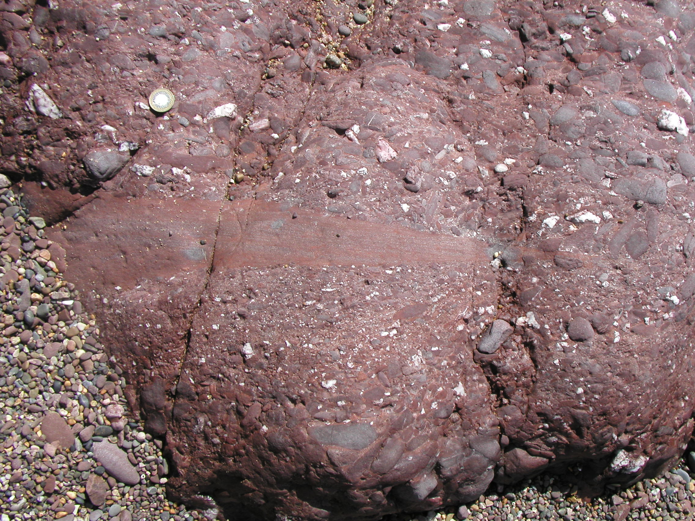 Y2. £1 coin for scale. Section through several beds of the Ridgeway Conglomerate. |
|
What structure is seen here? Try to identify clast lithologies. |
In your virtual notebook:
![]()
There is a major unconformity (not obvious at this locality, because of the lack of angular discordance) at the top of the Ridgeway Conglomerate. A large time gap is represented, following the last phase of the Caledonian Orogeny. Thr Skrinkle Sandstones were deposited on this erosion surface.
Z. These rocks are well
exposed in the cliff at the south end of the beach, near Great Furzenip. The
dips are still steep here, and the section youngs towards the south (right).
What can you see in this general view of the section? We will study the Skrinkle Sandstones in more detail at the next location - the two sections overlap.
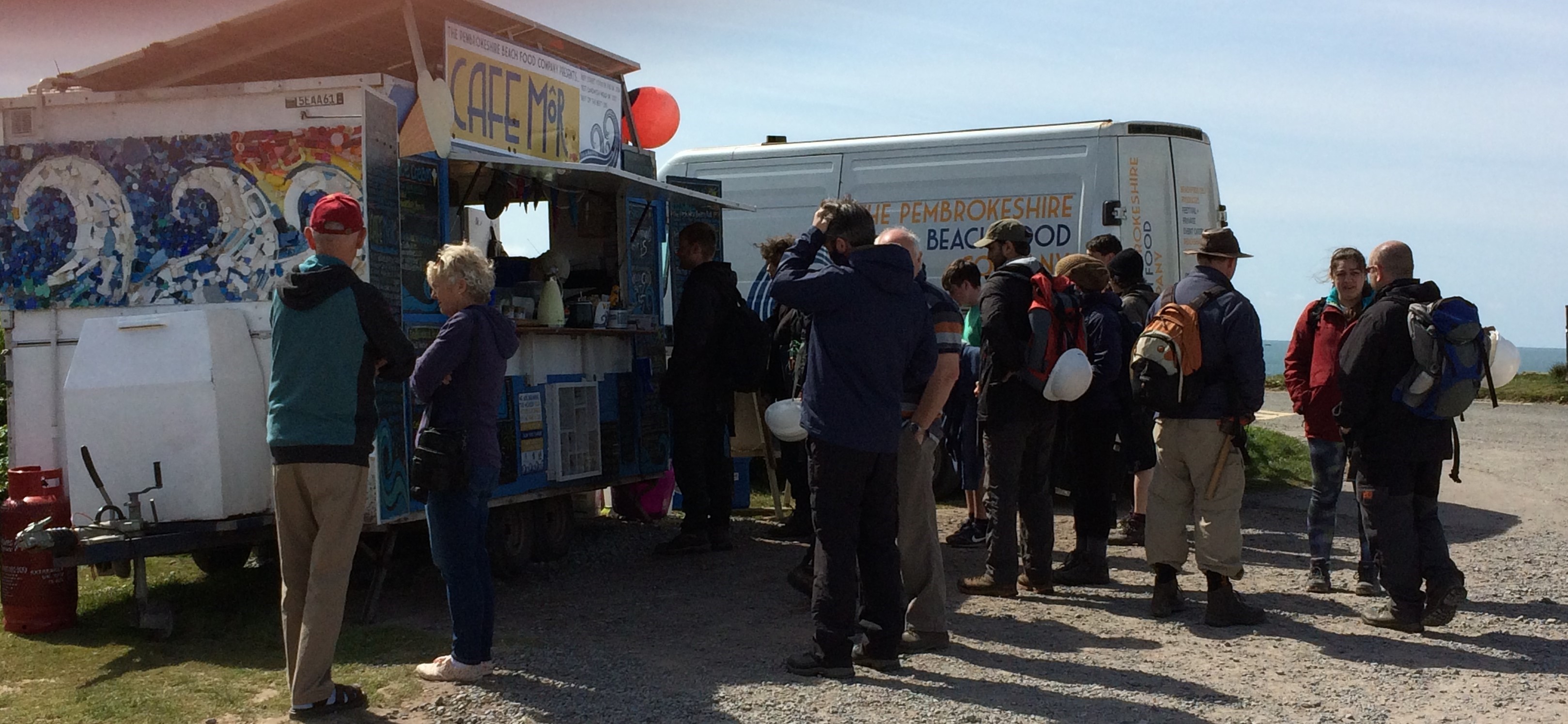
Let's grab lunch at Café Môr - well worth a visit when you're down this way, and want to try some really tasty local food.
 |
 |
 |
 |
 |
 |
![]() Film quiz: which well-known films had scenes shot at Freshwater West?
Film quiz: which well-known films had scenes shot at Freshwater West?
![]()
Make sure you've completed all the work for this locality. Now we can get back on the virtual coach and head off to Skrinkle Haven, our next stop.
![]()
This page is maintained by Roger Suthren. Last updated 19 May, 2021 2:26 PM . All images © Roger Suthren unless otherwise stated. Images may be re-used for non-commercial purposes.