It is important that you access this field trip on a laptop or desktop PC. Click on any image to enlarge it.
SAFETY: if you visit this location, note that rock falls are frequent, and there has been a recent fatality. Do not approach the cliffs without first making a careful risk assessment, and wear a hard hat. This section is tide dependent - consult local tide tables, and only proceed eastwards beyond the harbour on a falling tide. Rocks on the foreshore are often slippery - wear suitable walking boots, and take care.
Where are we? At this location, we will study the Staithes Sandstone Formation of Pliensbachian age (Middle Lias - Lower Jurassic). Explore the area in Google Maps and Street View.
Click on the images to enlarge them.
There is superb exposure, both in
the foreshore at low tide, and in the cliff section. There's a lot to see and
do at this location, and we usually spend about 3 hours here.
The aim of this exercise is to synthesize
information of a variety of different types - for example lithology, thickness
and geometry of sedimentary units, sedimentary structures and palaeocurrents,
fossils and trace fossils (or absence thereof), lateral and vertical changes
etc. From these observations, you should be able to attempt interpretations
of the the processes and environments involved in the formation of the section.
This integrated approach, using all available sources of information, is very
important in sedimentology. We also need to consider the properties of each
unit in terms of potential reservoir rocks, so we need additional information
on, for example, connectivity and fractures.
![]()
Recording and interpreting the field evidence
The photographs below show the outcrops in more detail. Study and describe them, making notes, and use them as evidence on which to base your interpretations. You will use this information to construct a field log of one part of the outcrop. Pay particular attention to:
|
|
Q3. What are these structures, and what do they tell us about conditions of deposition?
|
Q4. What do the fossils tell us about the depositional environment? |
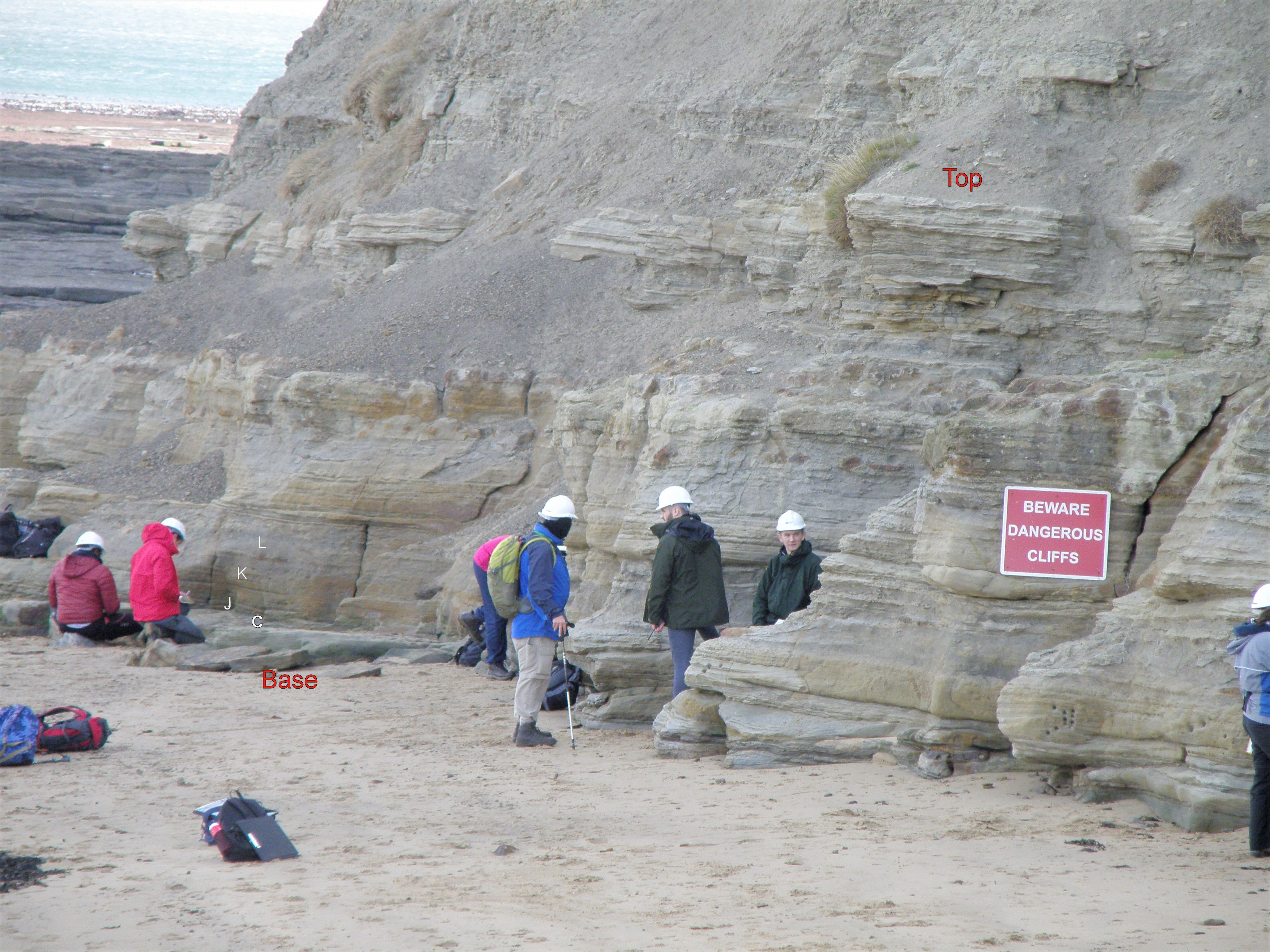 F. A general view of the section to be logged, showing an alternation of rather clean fine sandstones (light colour) with intervals containing more siltstone (darker). Positions of Photos C, J, K, L are indicated - click to enlarge. |
|
Q5. How many lithofacies would you define in this section? |
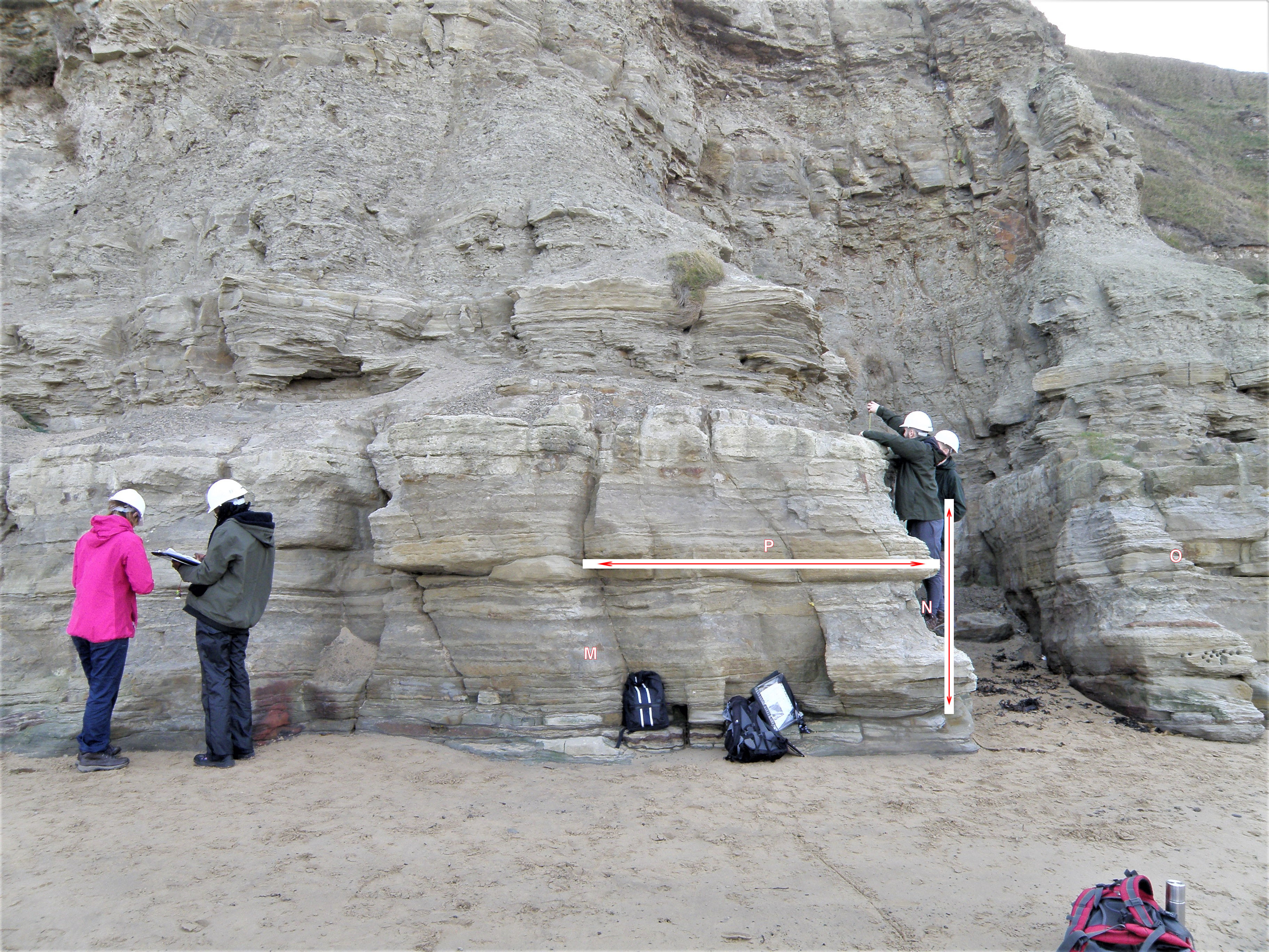 H. Another view of the section. Positions of Photos M, N.,O, P are indicated - click to enlarge. |
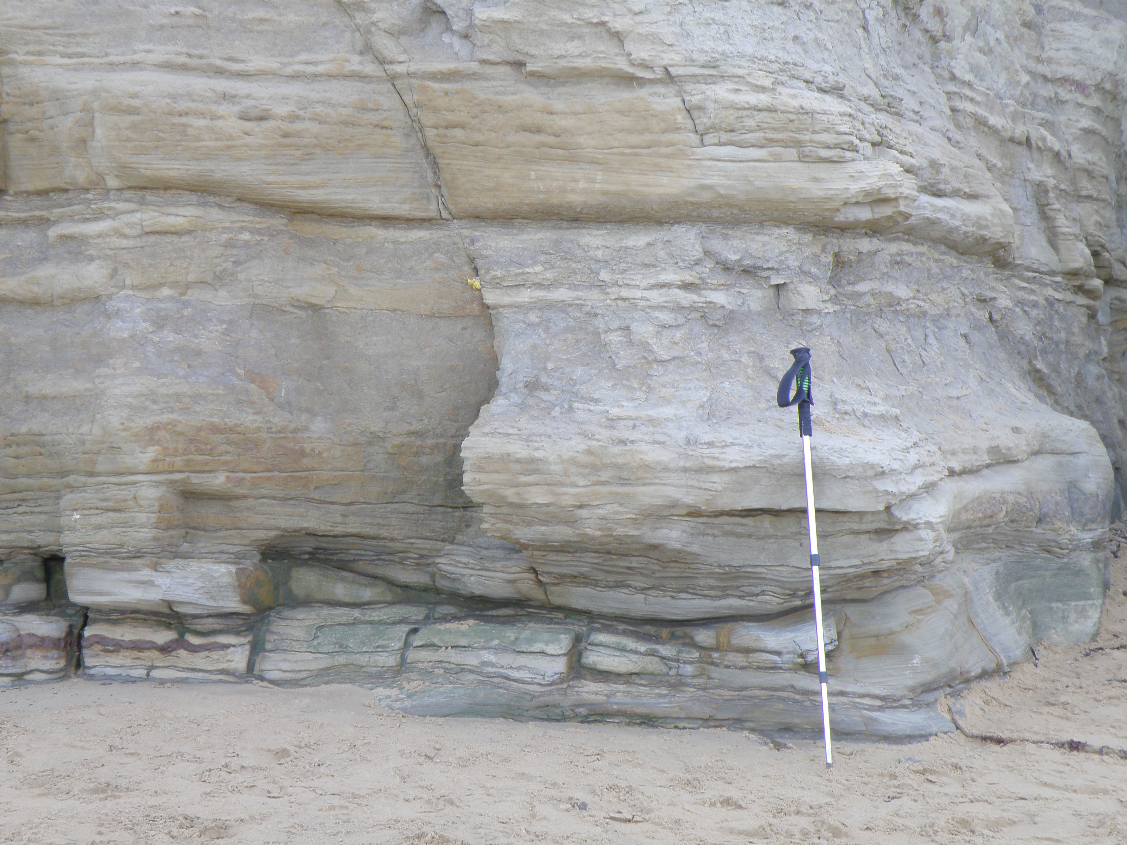 I. Close-up of the base of the section immediately left of the gully in Photo H. Pole ~ 1m long. |
Q6. Describe the basal contact of the sandstone. |
|
Q7. Describe and identify the structures in the sandstone in Photos J & K. |
Q8. Identify the structures in the bed at the level of the coin. What do they tell us about conditions of deposition? |
Q9. Describe and interpret the changes in sedimentary structures from base to top of the photo. |
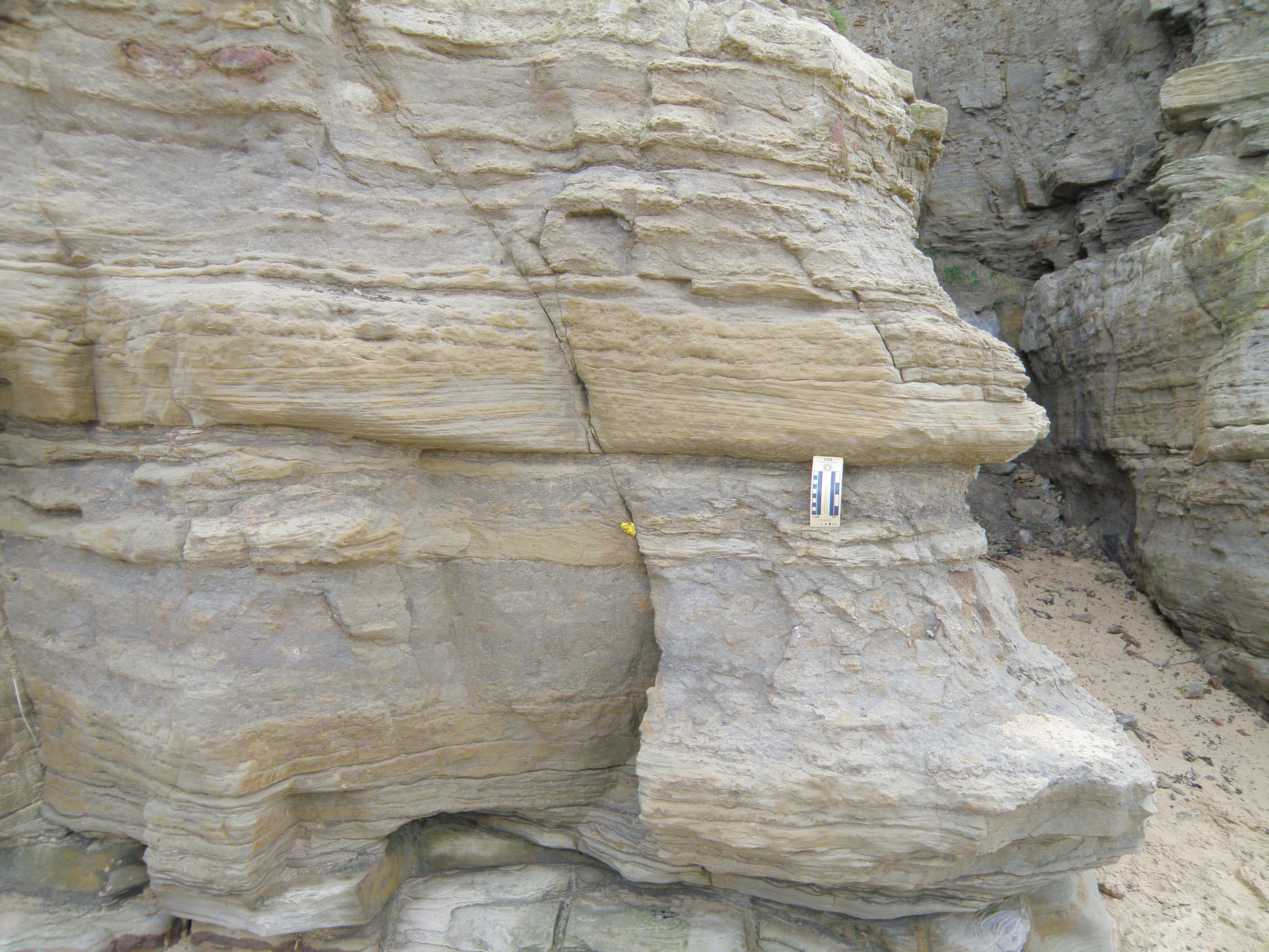 N. Partly overlaps with section in Photo I. Left side of scale is in cm. |
 O. A continuation to the right of the prominent sandstone bed in Photos N & P. Pen is 15cm long. |
|
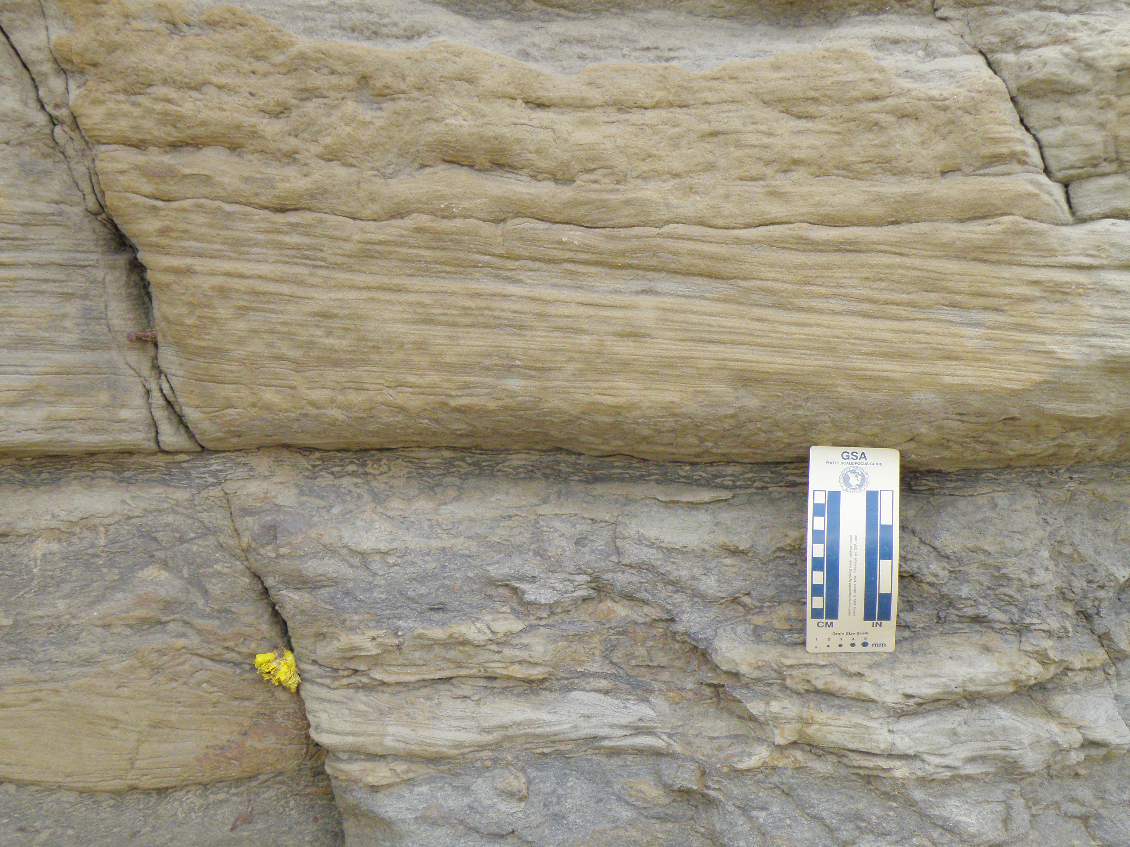 Q. Detail of right side of photo P. |
|
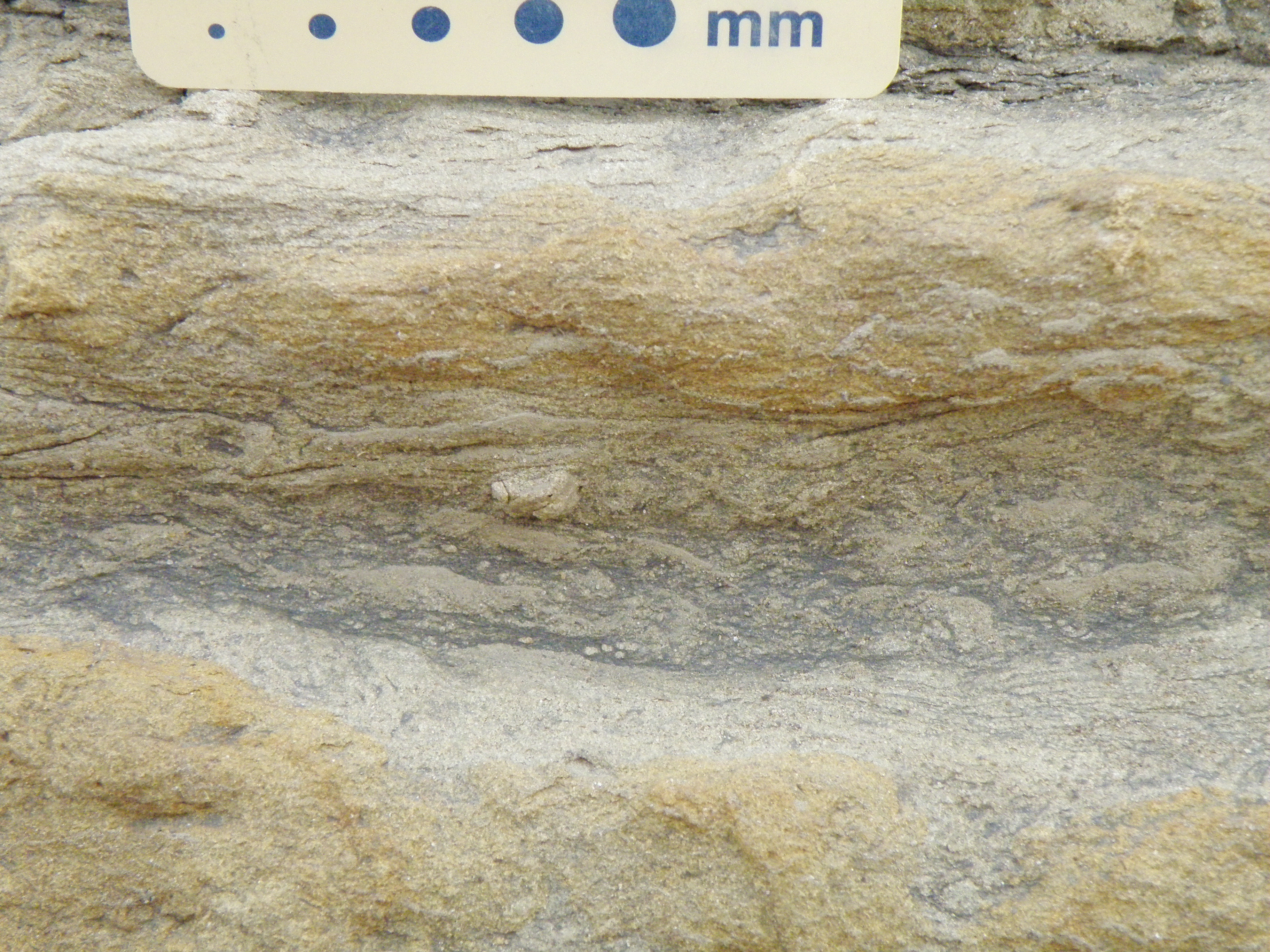 S. Detail of area immediately below scale in Photo P. |
Q10. Study Photos N to S. Describe all aspects of this sandstone bed, including its base, the sedimentary structures within it, and how they change upwards through the bed. What could this bed represent? |
Constructing a log and interpreting the section
Captain James Cook (1728 - 1779) lived part of his early life in Staithes, and is commemorated at various points in the village and surrounding area. By coincidence, my Canadian relative, Victor Suthren, is a Captain Cook scholar.
![]()
This page is maintained by Roger Suthren. Last updated 16 November, 2020 8:02 PM . All images © Roger Suthren unless otherwise stated. Images may be re-used for non-commercial purposes.