| home | virtual field trips | regional geology | images | e-learning | links |
|
NASA image |
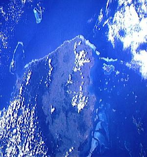
This exercise is based around the modern fringing reef on the south coast of Viti Levu, the largest of the Fiji islands.Viti Levu is at bottom left in the satellite image on the left. Click to enlarge. |
 |
Space shuttle view of Viti Levu, courtesy of NASA. South is at the top of the picture. Much of the south coast has a fringing reef. At the west (right) end this passes into offshore barrier reefs. Move the cursor over the picture to see the features listed below: K is Korotongo, the
case study area for this exercise What is the meteorological reason for this subdivision into wetter and drier sides?
|
|
|
|
Contrast with this view at high tide
|
|
|
|
|
This page is maintained by Roger Suthren
![]()
This page is maintained by Roger Suthren. Last updated 15 February, 2017 9:27 PM