It is important that you access this field trip on a laptop or desktop PC.
Click on any image to enlarge it - you will need to zoom in to see sufficient detail.
Where are we? Let's get some more information on the Granadilla Formation, which we studied in detail north of Chimiche. There are good road cuttings and small quarries along roads TF-28 and TF-636, west of Chimiche. Visit the following locations in Streetview, and make notes and sketches, paying particular attention to the geometry and basal contacts of the units. This additional information will help you in interpreting your log. Remember that these are very young rocks, and have not been affected by folding or tectonic tilting.
![]()
The section west of the school at Los Blanquitos
Explore the outcrops north of the road in Streetview. The outcrop next to the track is in Unit G1, whose base is not exposed here. There used to be access to good exposures through the Granadilla Formation in the quarry behind, but it is now occupied by a house. The photos below were taken several years ago.
Pay particular attention to field relationships - contacts between units, how units change as you trace them laterally, etc.
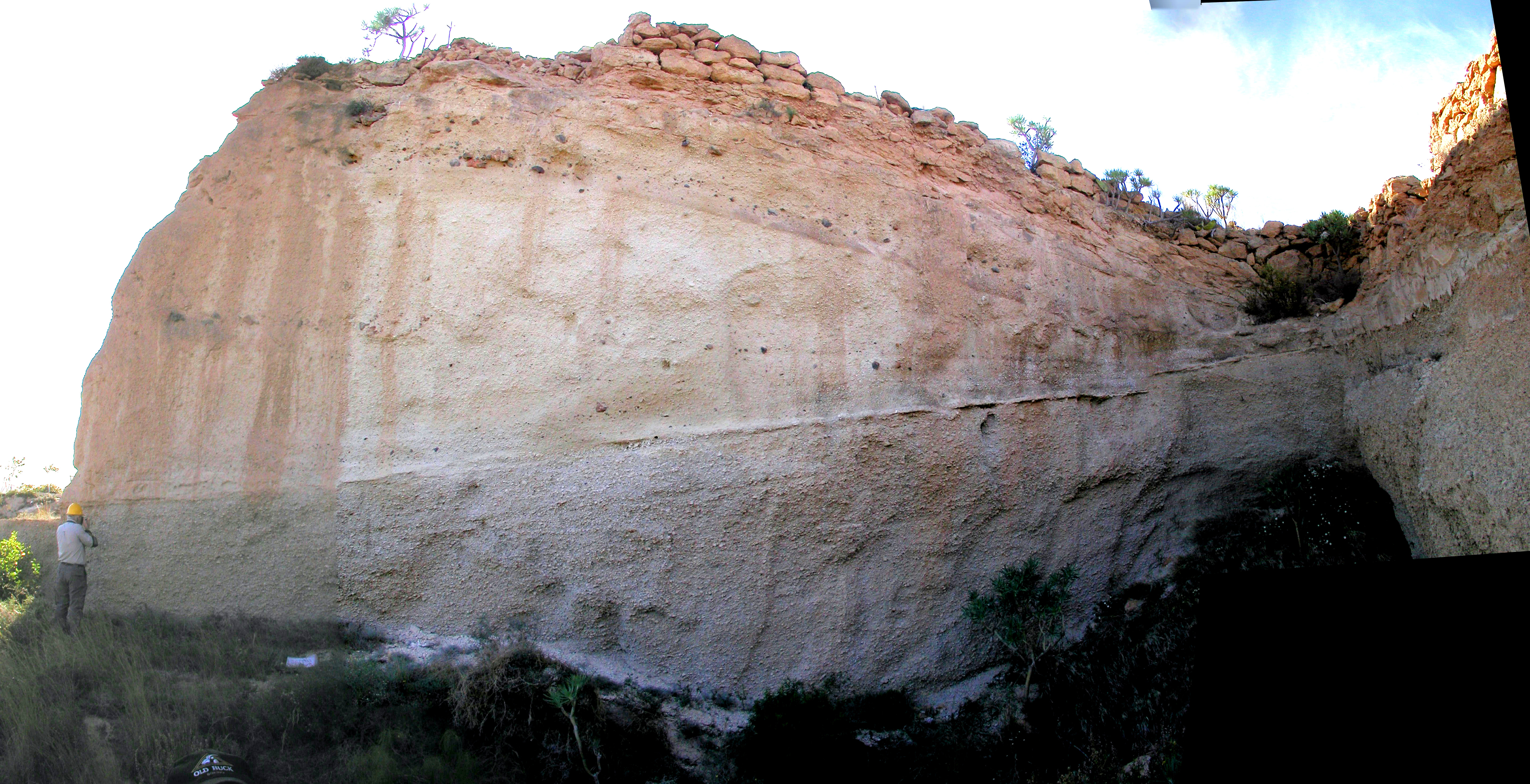
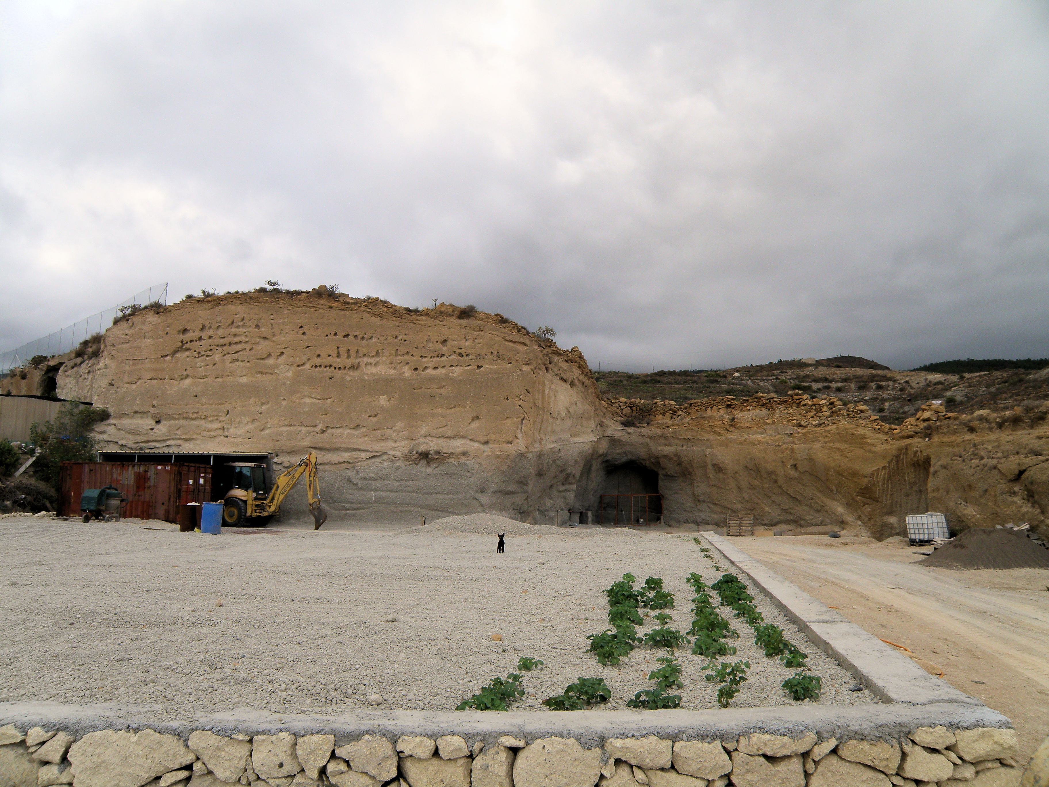 Figure 1. The quarry during construction. View to north. Unit G1 is the grey material at the base; Unit G2 stands out as a thin, harder bed; Unit G3 forms the yellowish upper two thirds of the face; it is overlain by bedded deposits (Unit H) right at the top, as in the Chimiche section. |
 Figure 2. Part of Unit G1 in the track section leading to the quarry. Pen is 15 cm long. There are several thin, fine ash beds within the pumice deposit at this location. How might they have formed? |
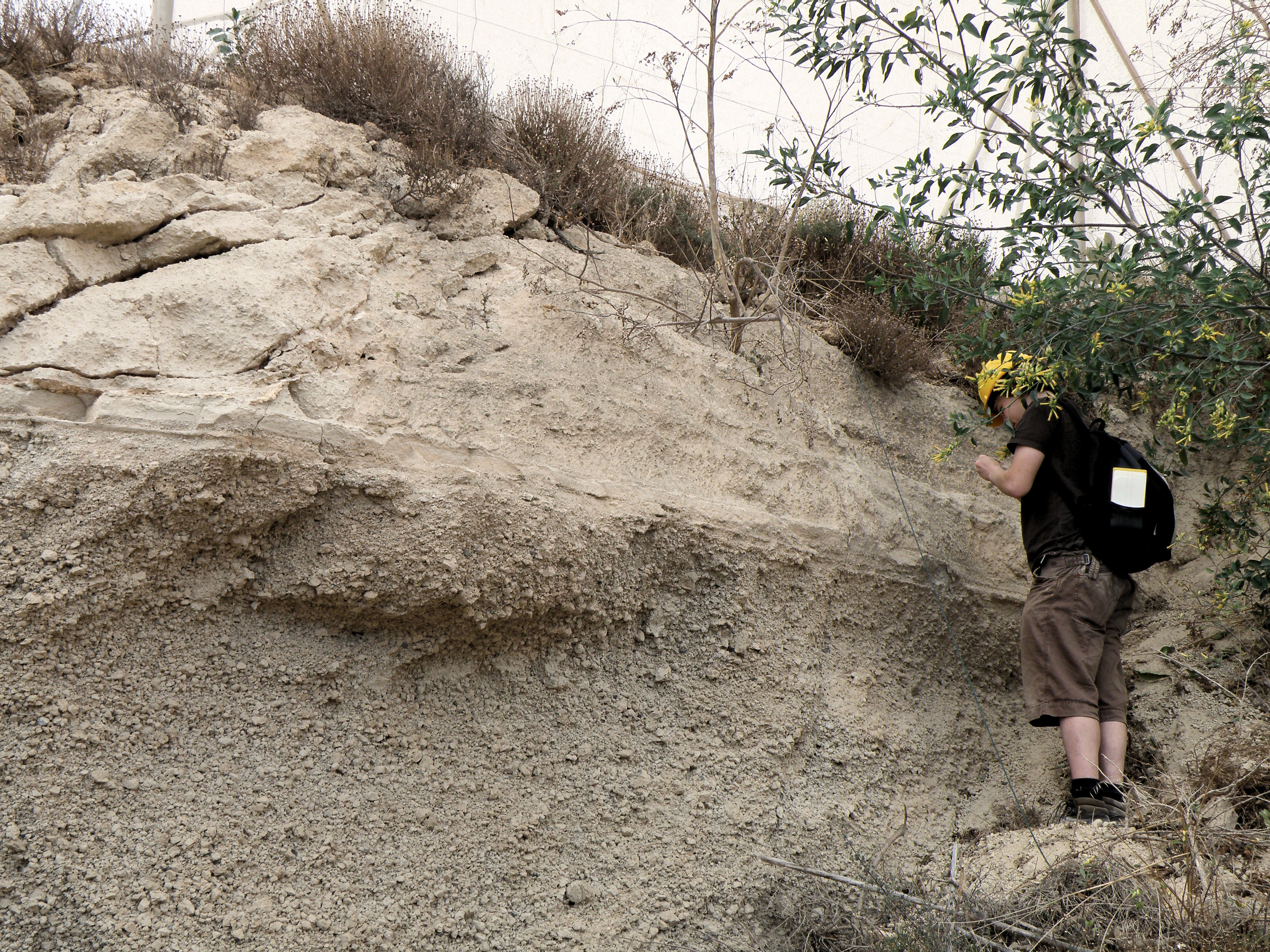 Figure 3. Above the track section. The top of Unit G1 is overlain by G2, which is thin and bedded, then the lower part of G3. |
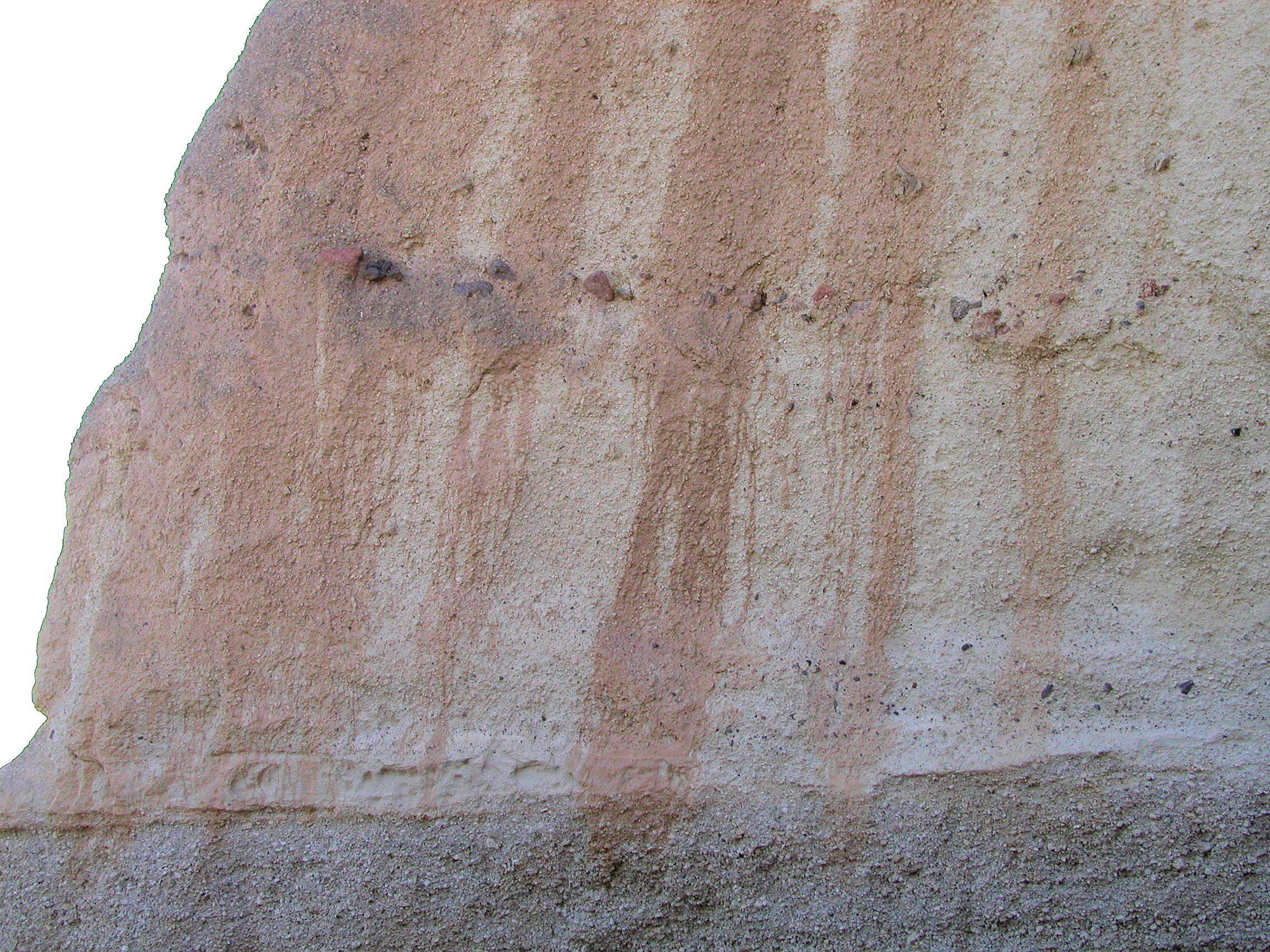
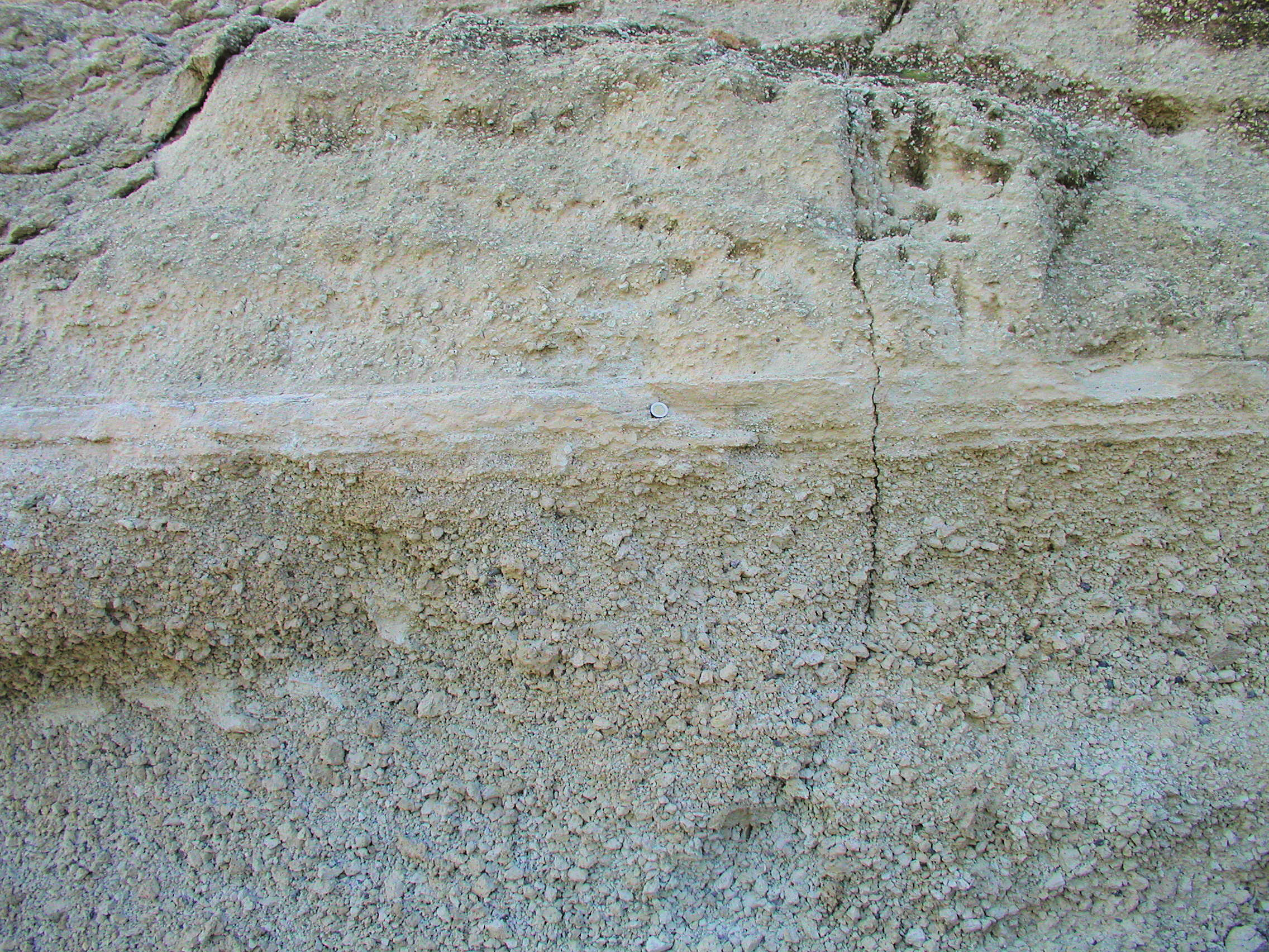 Figure 4. Close-up of Figure 3, showing the bedding in Unit G2. Coin is 23 mm diameter. |
|
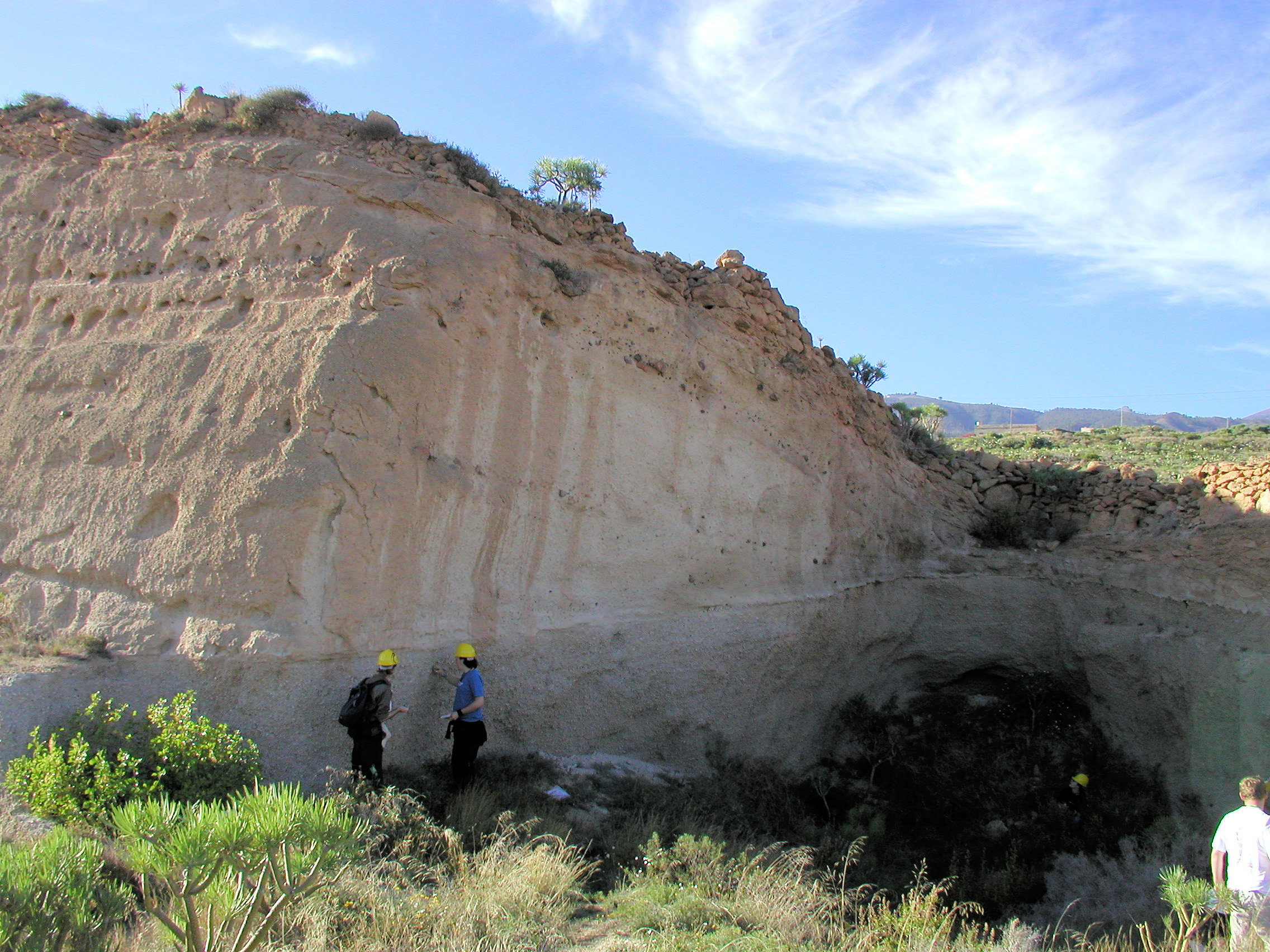
Figure 5. Compare with Figure 1, which shows a broader view of the same area. Identify Units G1, G2 and G3, and describe and draw the field relationships. |
|
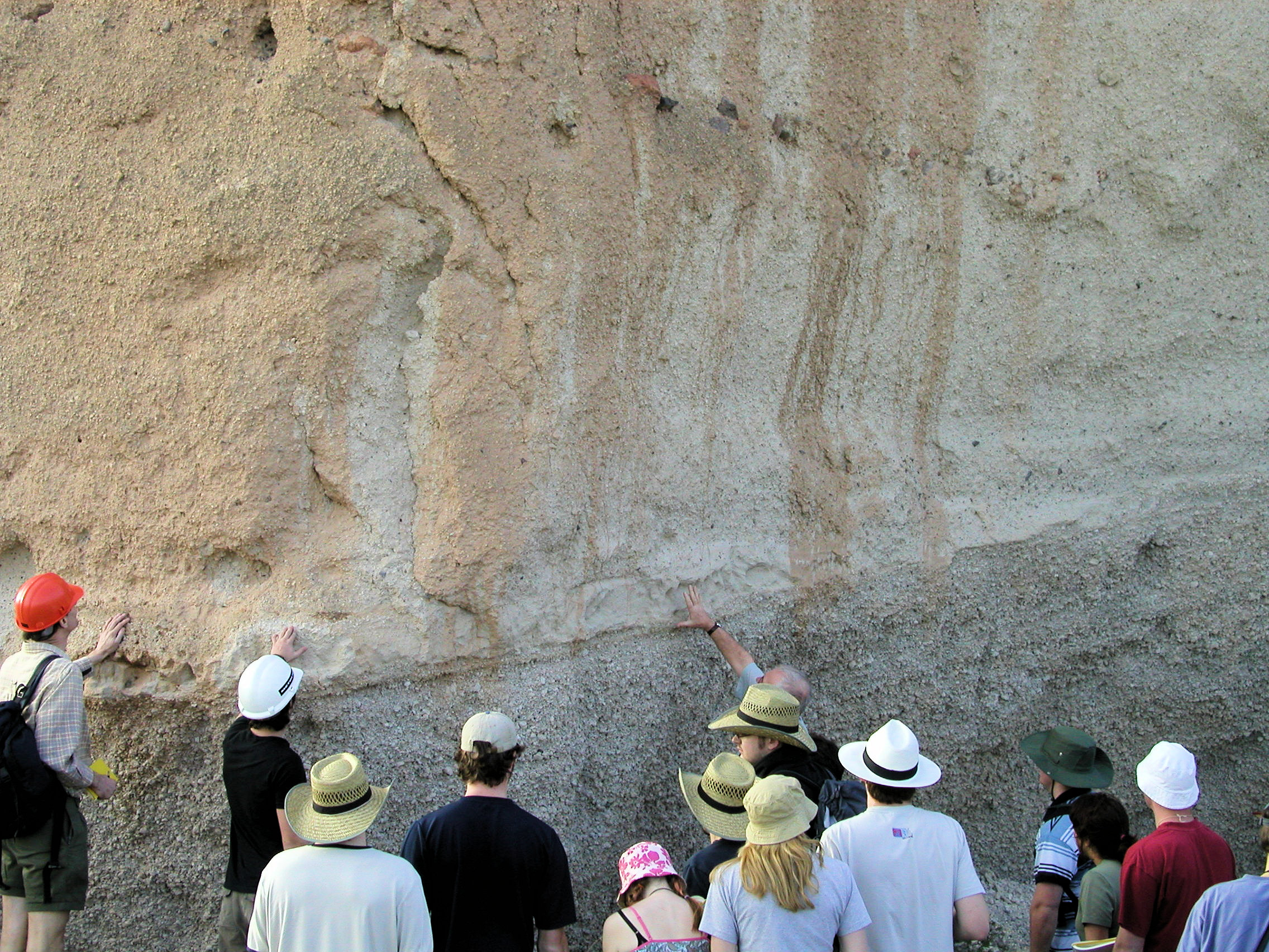 Figure 7. Close-up of the left side of Figure 6, showing the junction of 2 quarry faces. The geologist's thumb is aligned along the base of Unit G2. |
|
Return to the main locality for the Granadilla Formation north of Chimiche, and make sure you've completed all the tasks, including additional information you have acquired from the outcrops on this page.
![]()
This page is maintained by Roger Suthren. Last updated 8 March, 2021 2:38 PM . All images © Roger Suthren unless otherwise stated. Images may be re-used for non-commercial purposes.