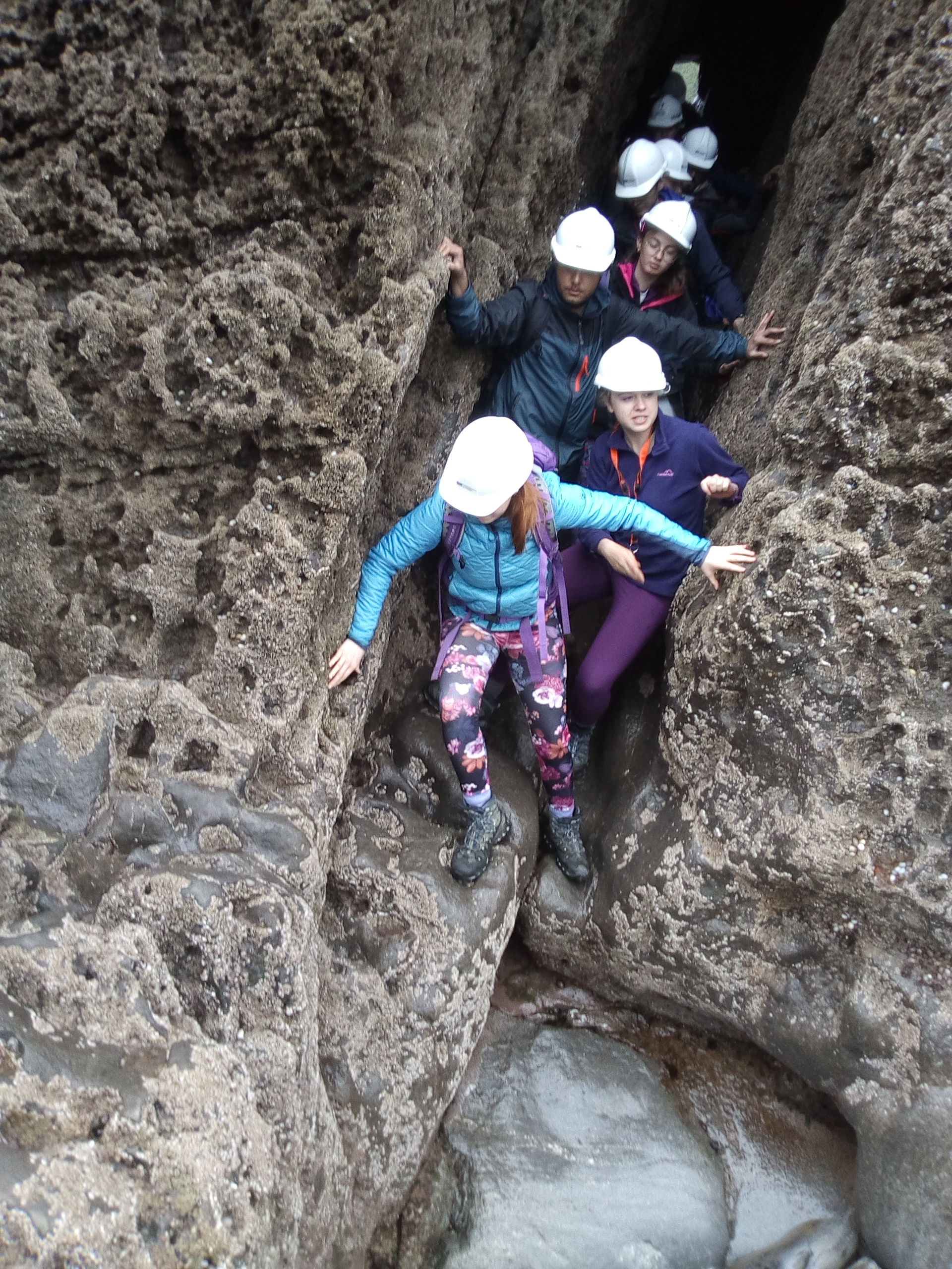
It is important that you access this field trip on a laptop or desktop PC. Click on any image to enlarge it.
Where are we? At this location, we will continue to explore the Upper Old Red Sandstone and study changes as the section passes up into the Lower Carboniferous. Study the area in Google Maps and Streetview - there are some nice views from the coast path, and panoramas on the beach.
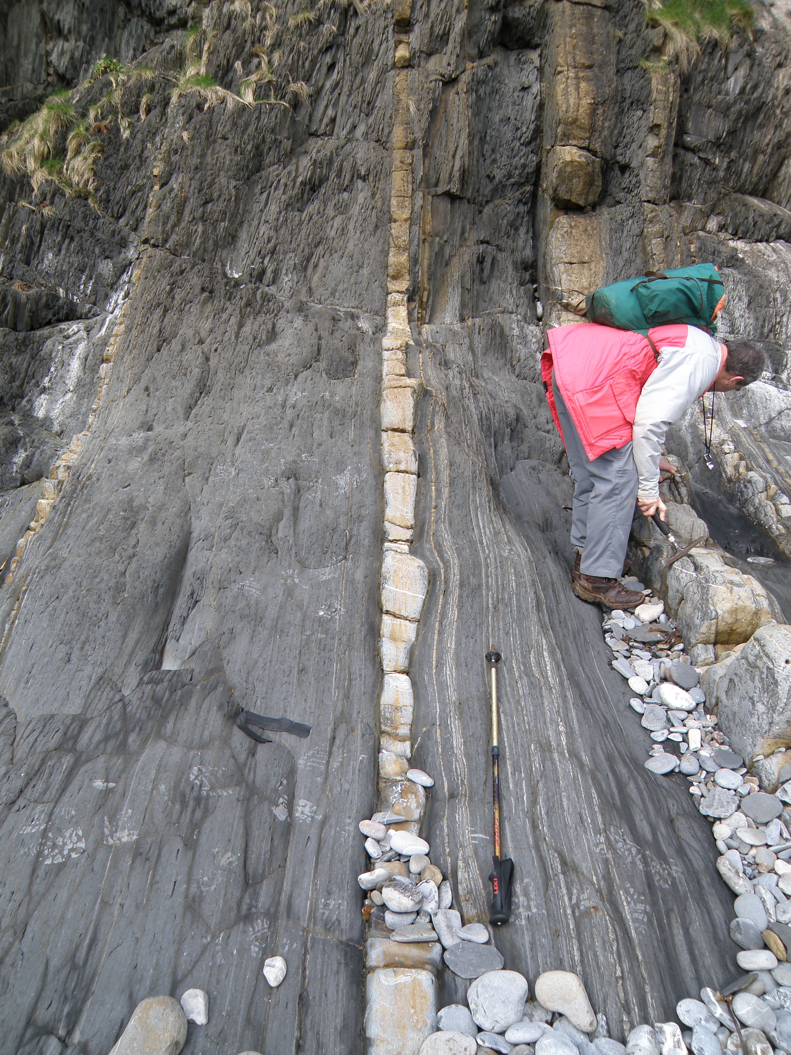
The strata are vertical to slightly overturned, which is ideal for our purposes of measuring thicknesses and observing sedimentary facies through a thick sequence.
Handout: refer to the handout for today, which contains essential diagrams and information. Don't forget to use the information in the Field Guide too. Both are available in Course Resources.
Tasks: See today's handout. At this location, most of the information is in the images, and in your accurate observation of them. There's a lot to see and do at this location, and we usually spend most of a day here.
|
|
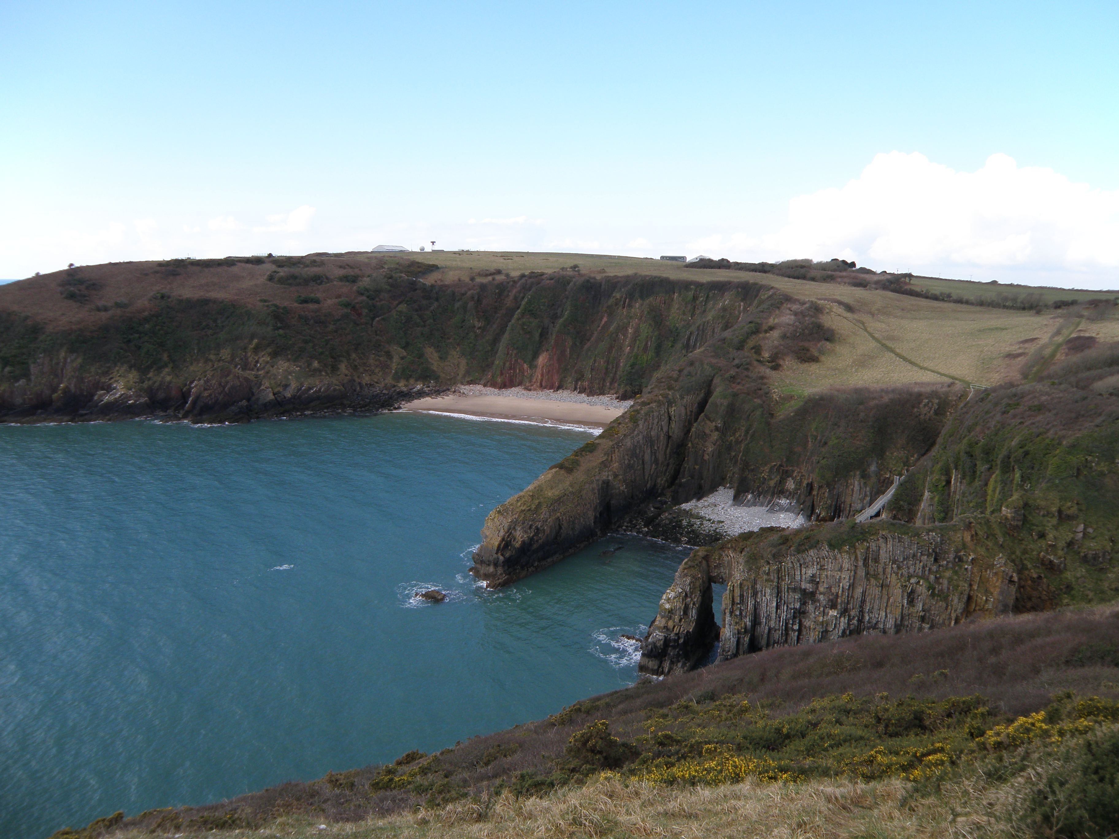
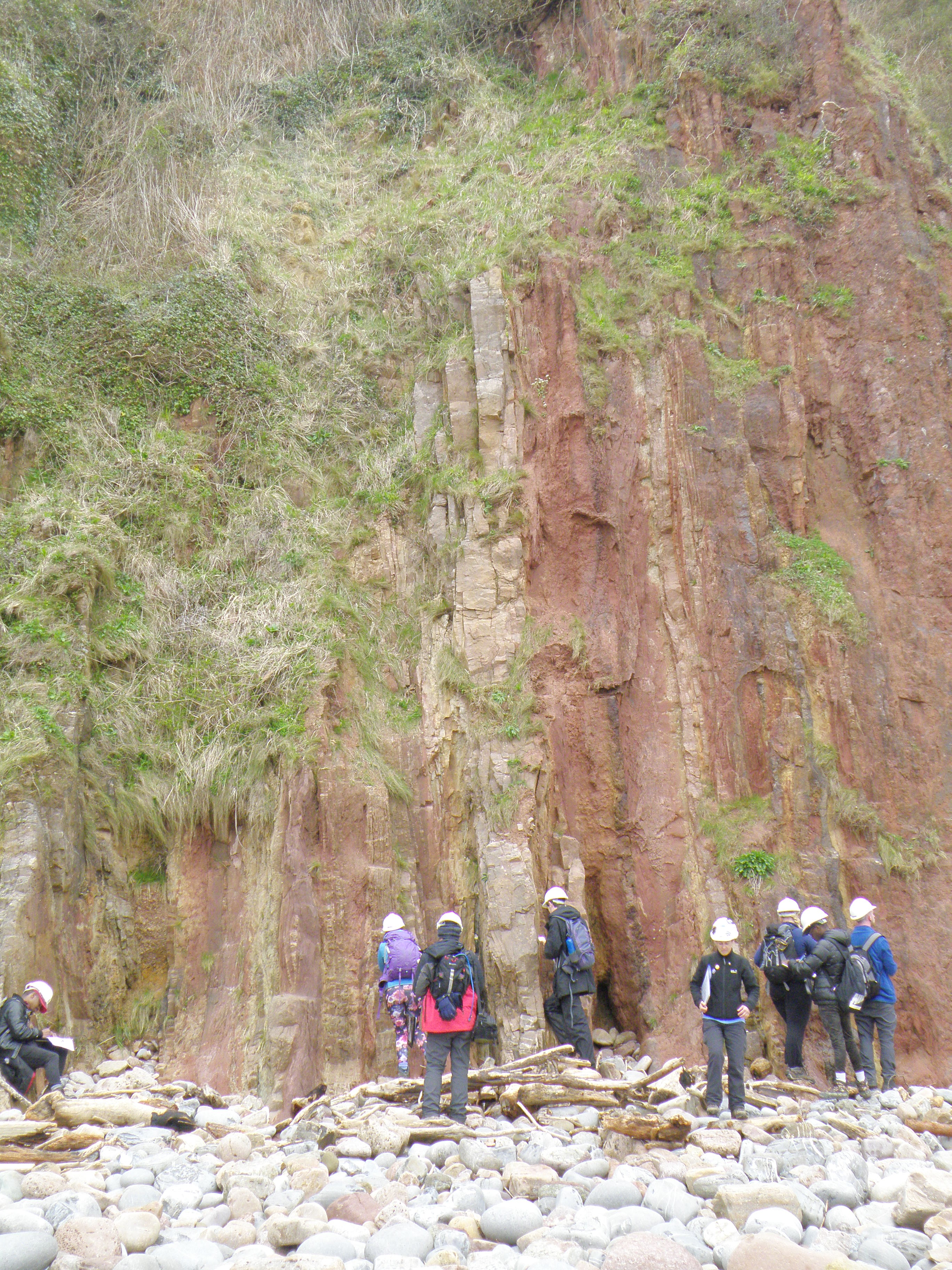
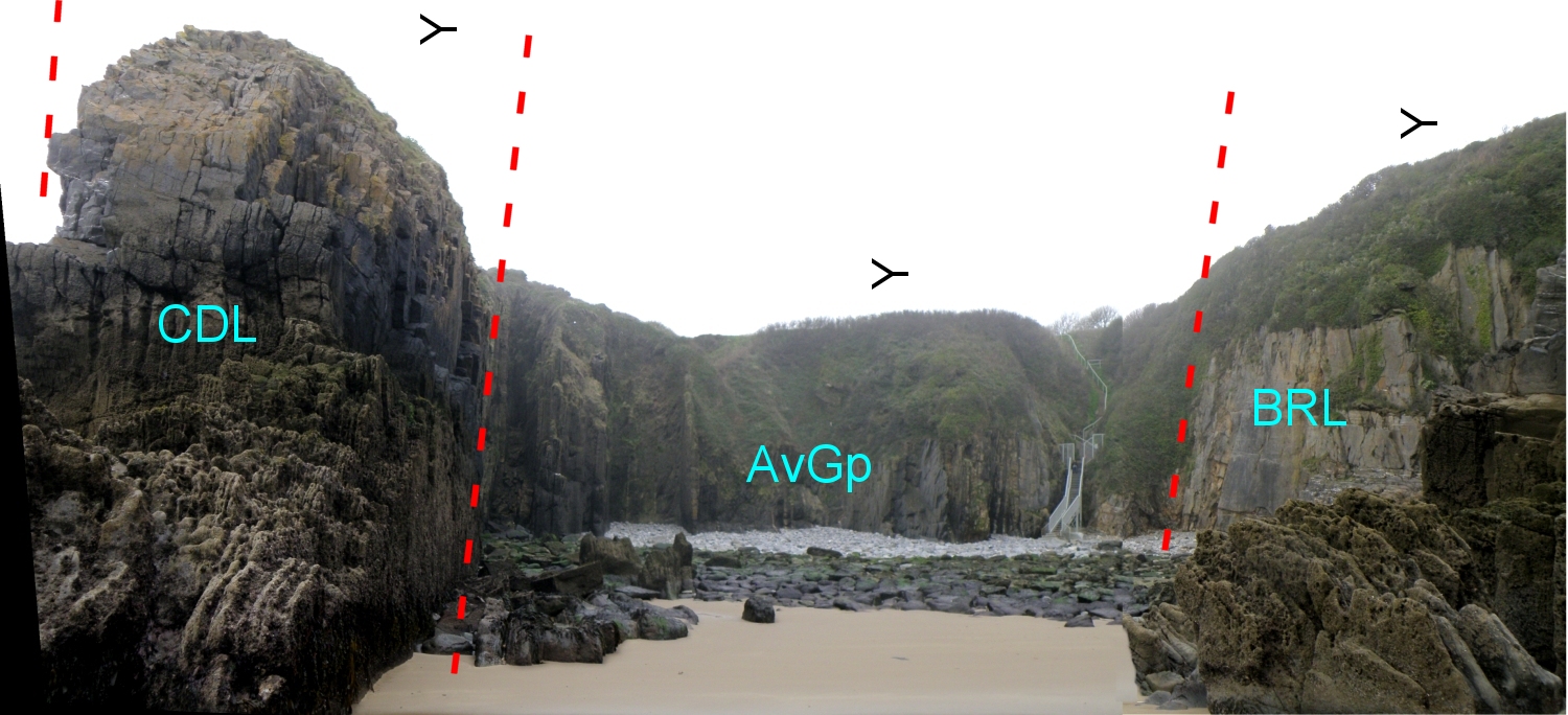
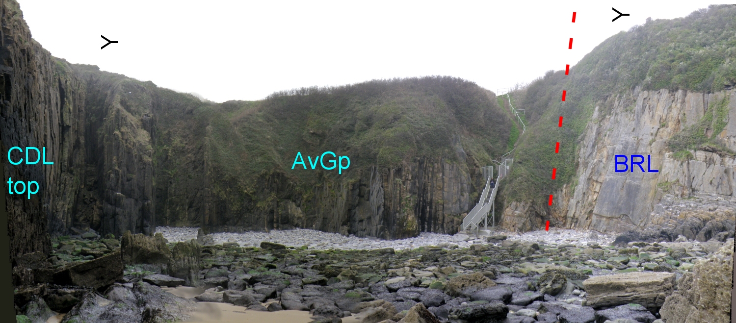
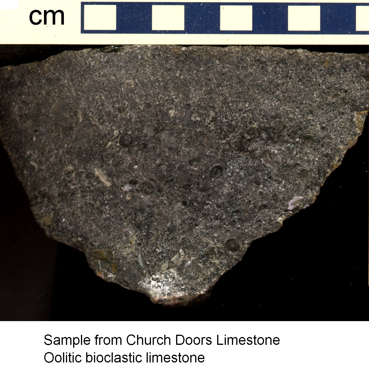
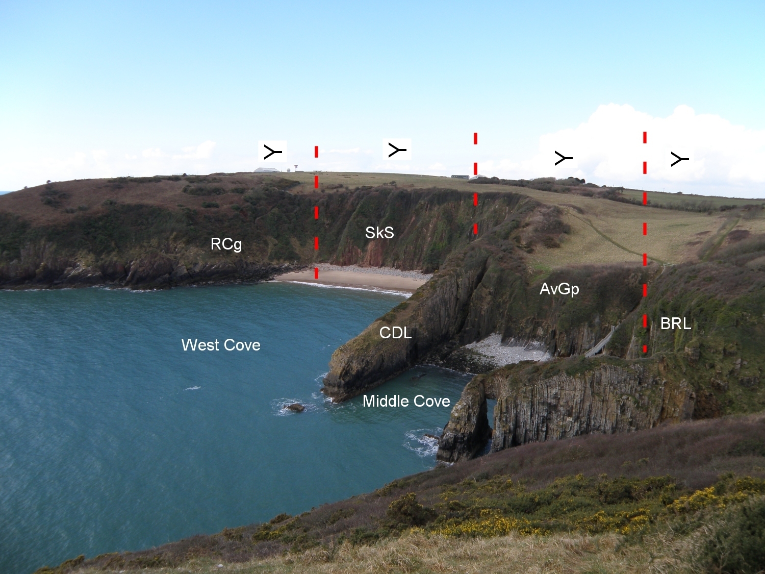 A2. RCg Ridgeway Conglomerate (Lower ORS); SkS Skrinkle Sandstones (Upper ORS); AvGp Avon Group (Lower Carboniferous); CDL Church Doors Limestone (a unit within the AvGp); BRL Black Rock Limestone - the lowest unit of the Pembroke Limestone Group (Lower Carboniferous) |
|
|
|
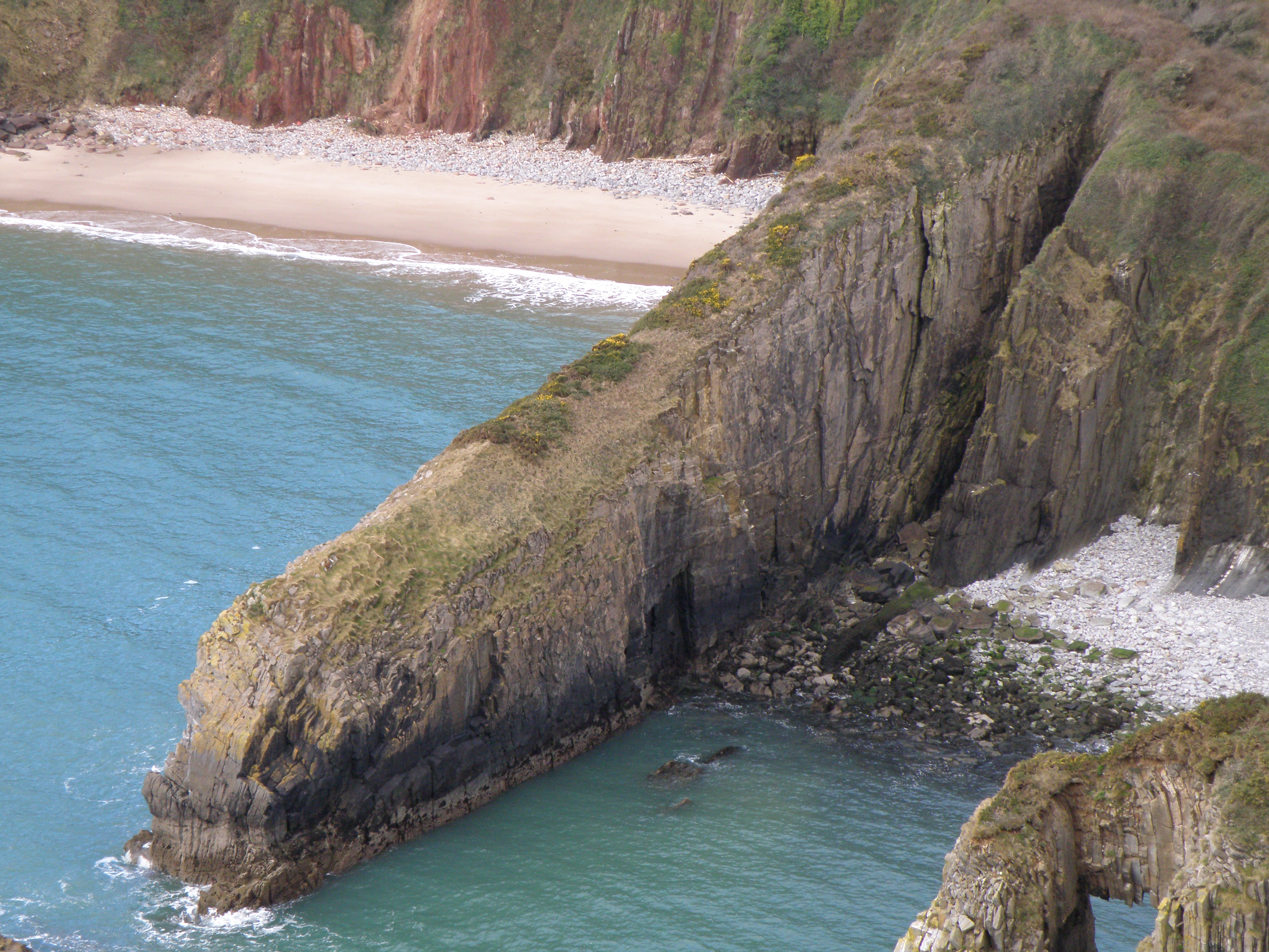
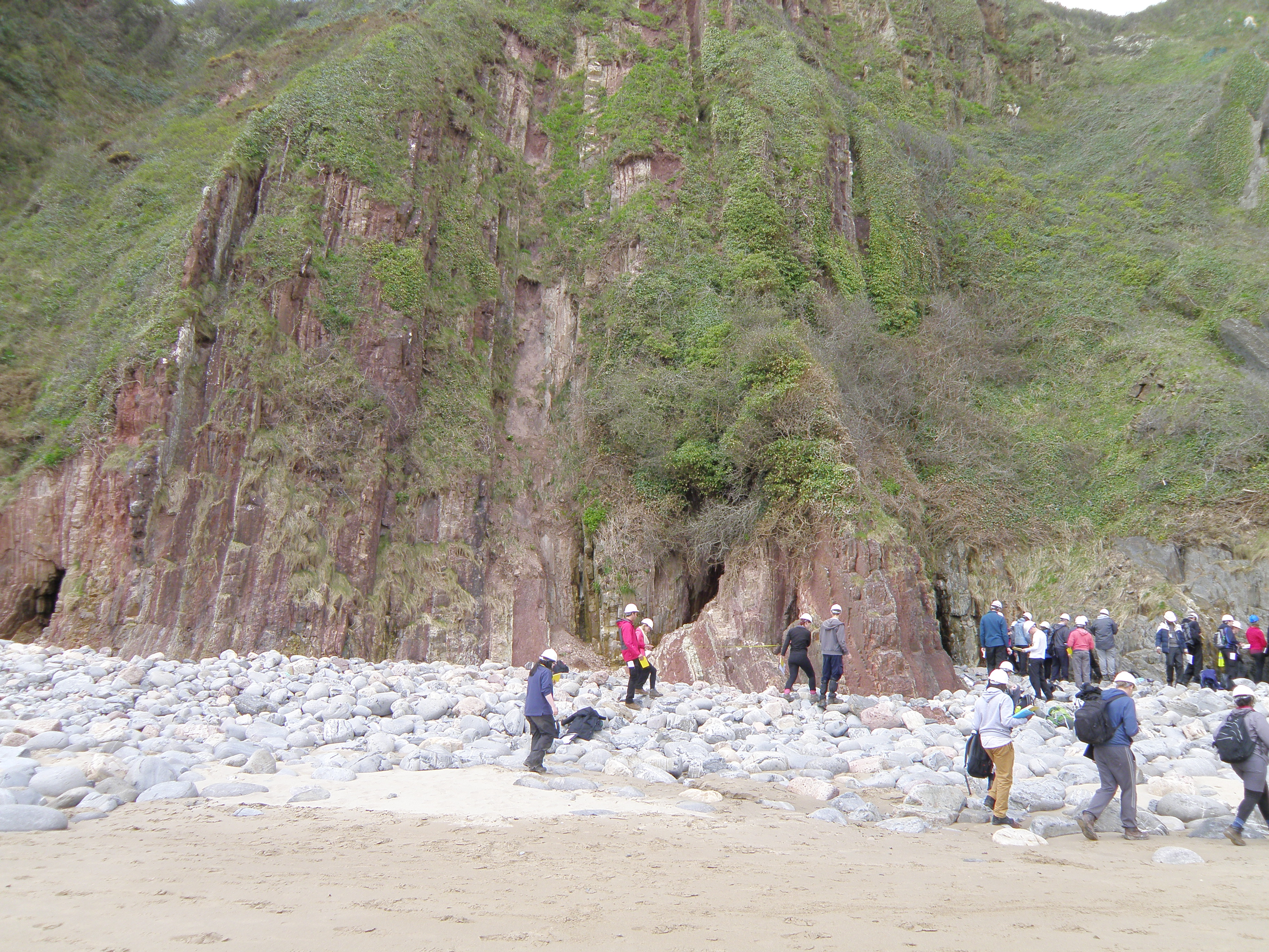
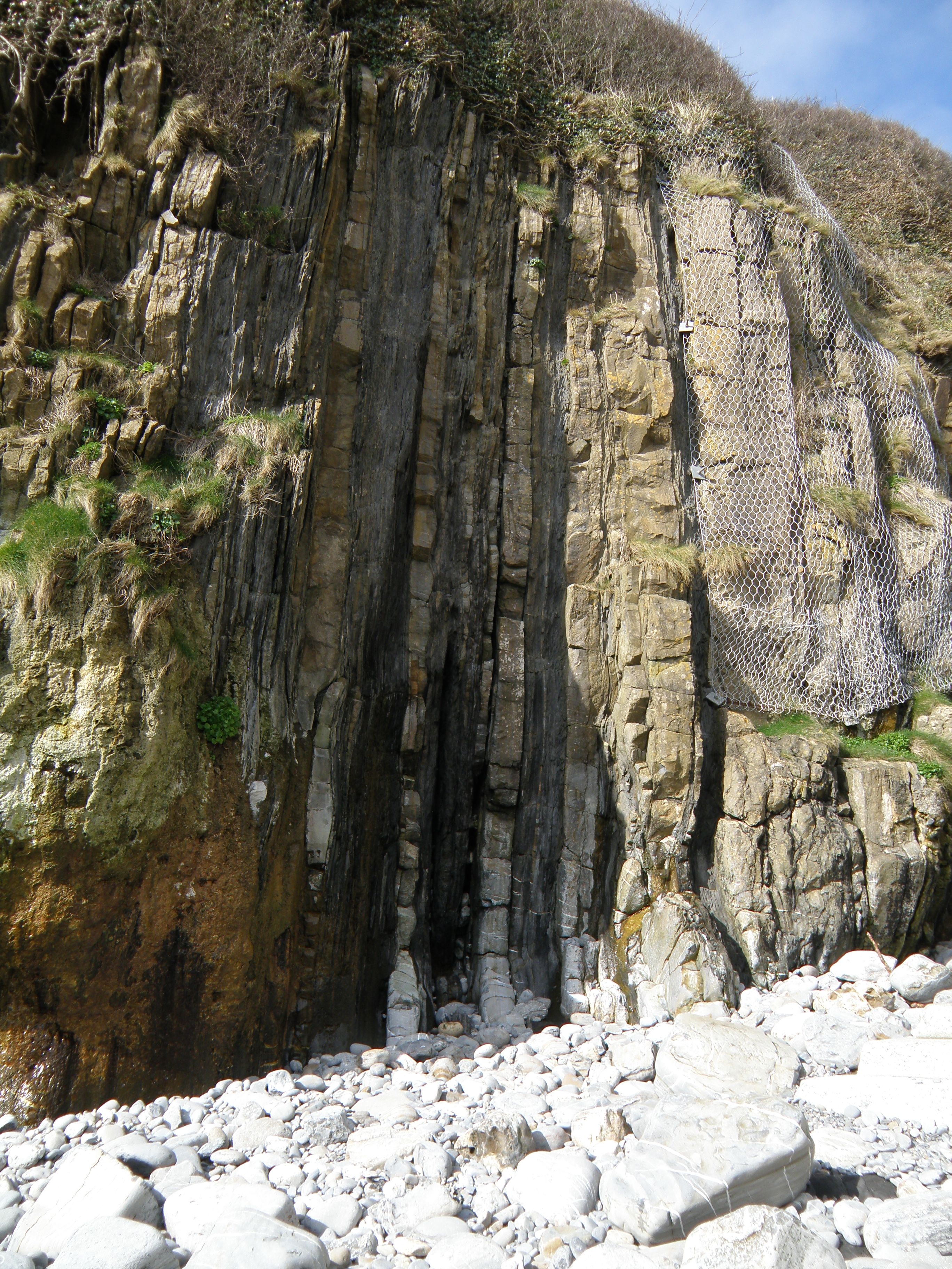
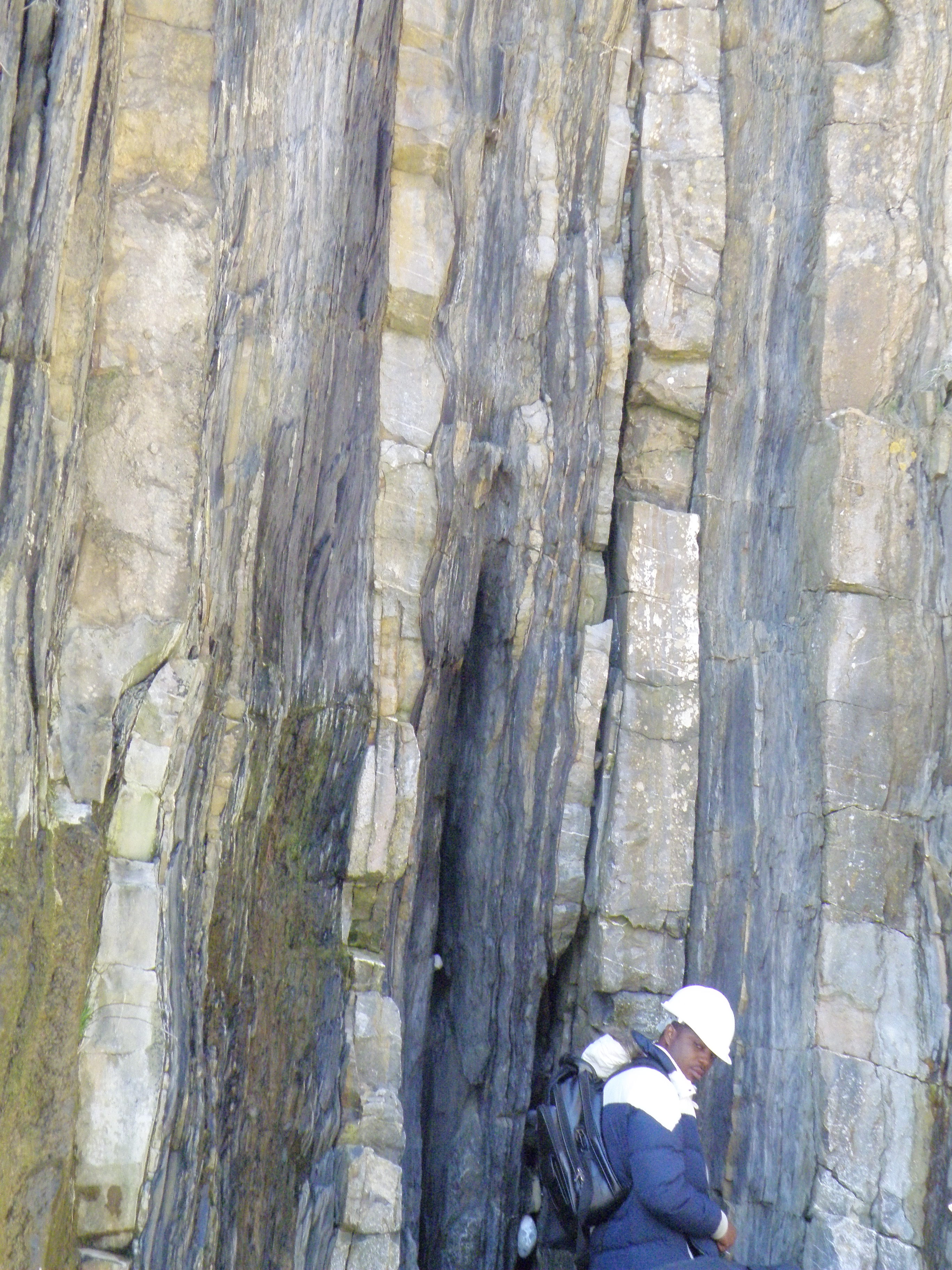
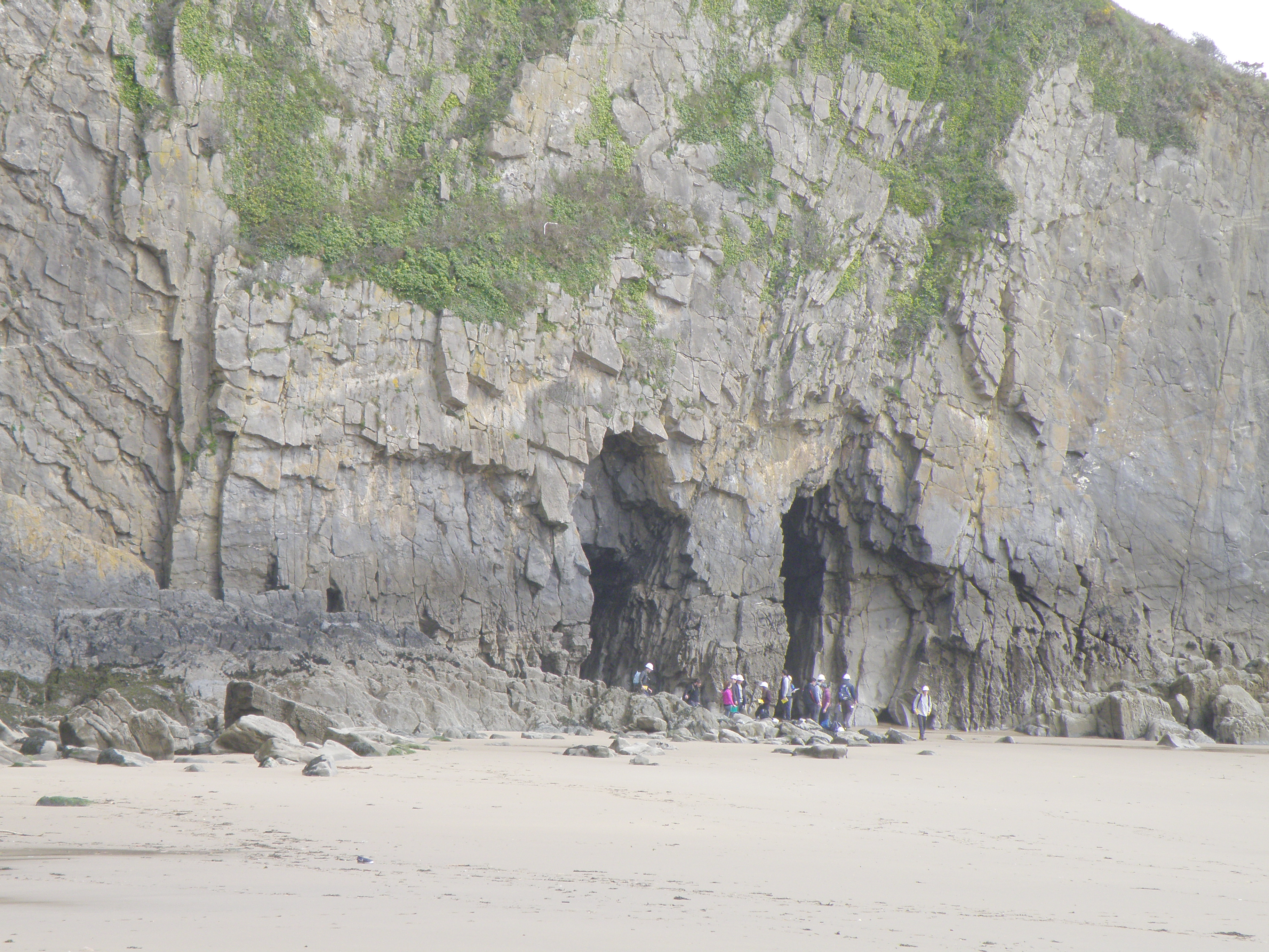 B3. These are the Church Doors - sea caves eroded in the south side (base)
of the vertical Church Doors Limestone ridge.
B3. These are the Church Doors - sea caves eroded in the south side (base)
of the vertical Church Doors Limestone ridge. |
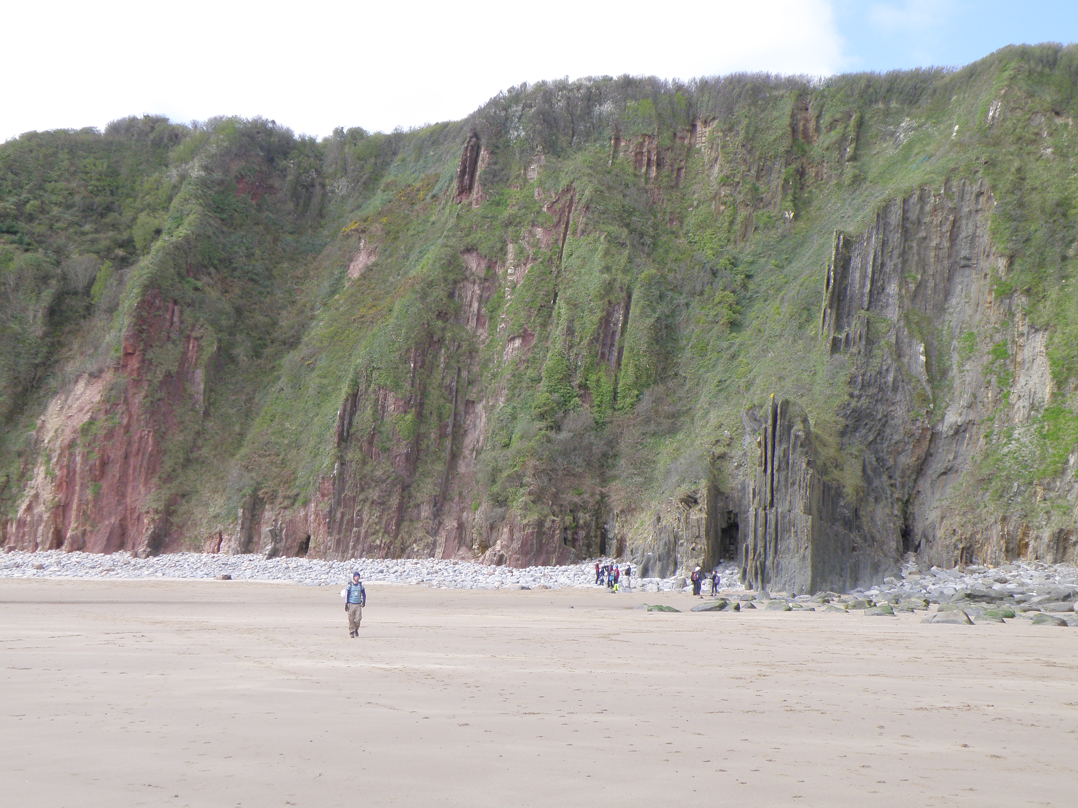
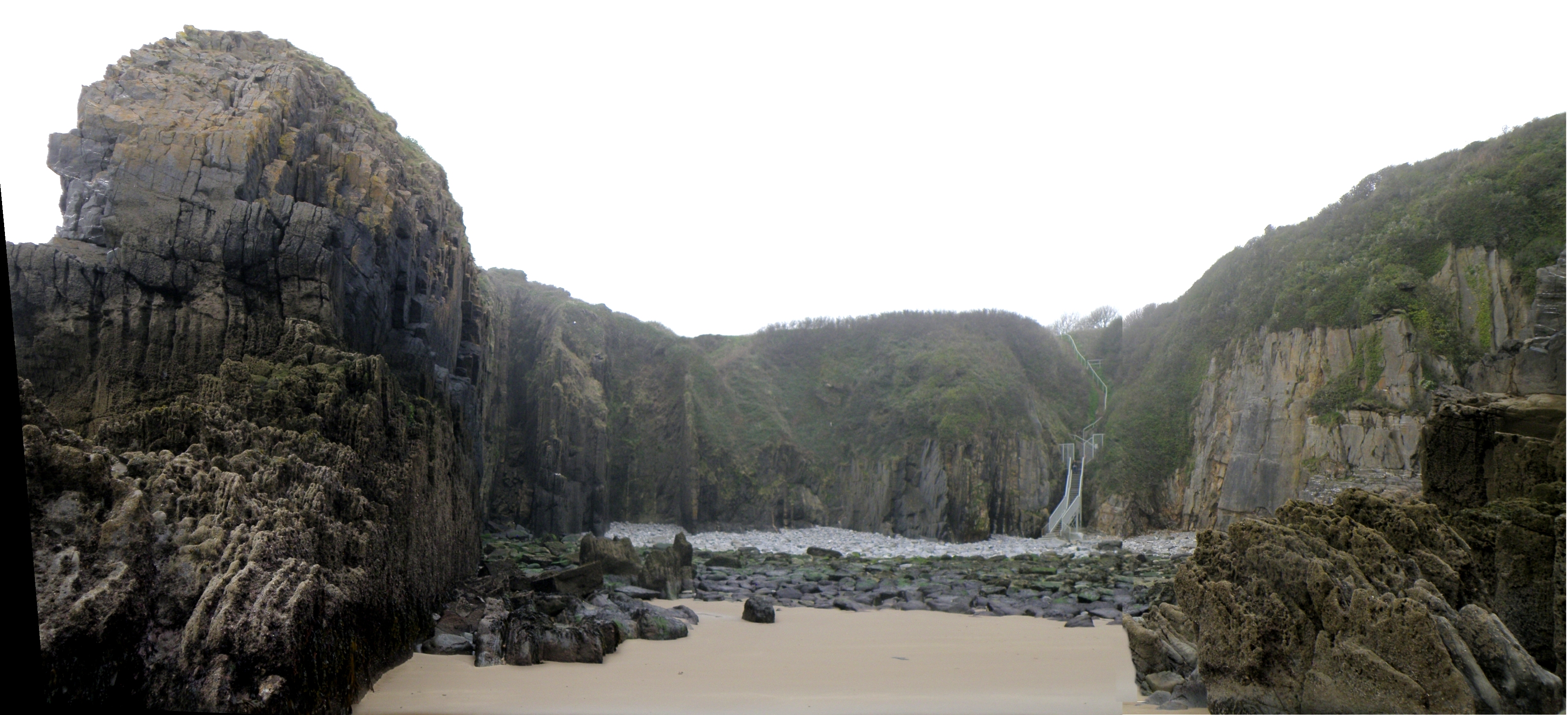
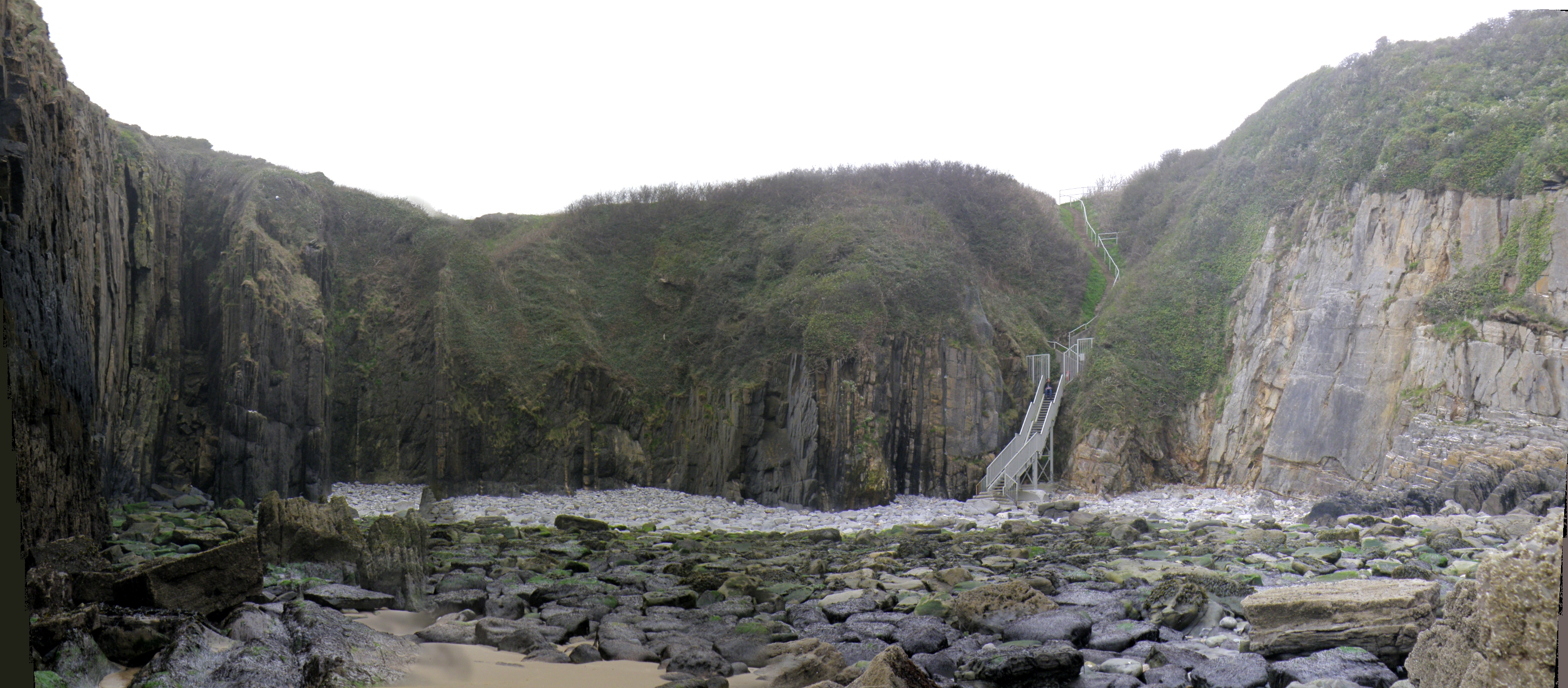
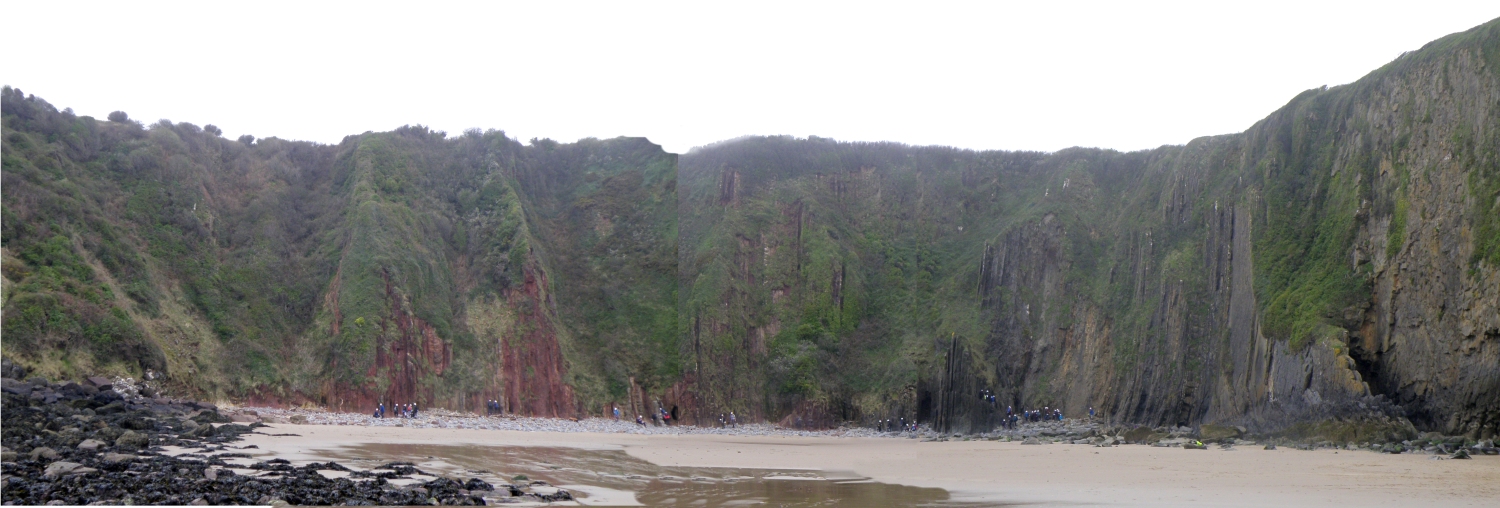 C1. Panorama of the west cove. The top of the Ridgeway Conglomerate is in the rubbly slope on the left, and its contact with the overlying Skrinkle Sandstones is obscured by boulders, |
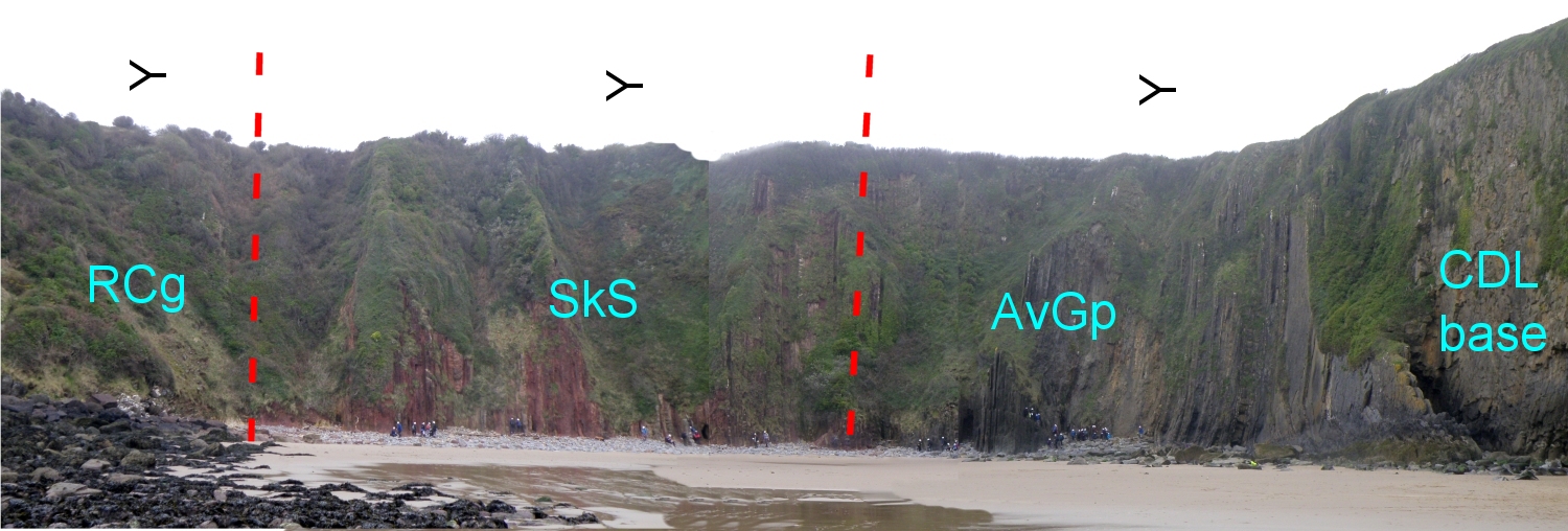 C2. Annotated panorama - same abbreviations as photo A2. Vertical to slightly overturned dips; younging to the right, as shown by symbols. Note the colour change in the passage from SkS to AvGp. |
The aim of this exercise is to synthesize information of a variety of different types - for example lithology, thickness and geometry of sedimentary units, sedimentary structures and palaeocurrents, fossils and trace fossils (or absence thereof), lateral and vertical changes etc. From these observations, you should be able to attempt interpretations of the the processes and environments involved in the formation of the section. This integrated approach, using all available sources of information, is very important in sedimentology. You have seen a similar section in a practical earlier this semester.
Identifying and interpreting sedimentary structures, fossils and trace fossils is an important part of this exercise. If you need to brush up on these, the best sources are the appropriate chapters in the set books.
Use the photographs below of outcrops and samples to complete tasks described in the handout for today. The strata dip steeply to the south. Some photographs show the true dip; others are taken parallel to bedding, so that sedimentary features are more obvious. Pay particular attention to field relationships - contacts between units, how units change as you trace them laterally, etc.
|
Compare it with the outcrops you saw at Freshwater West. |
|
 F. Bedding surface near the top of the Skrinkle Sandstones. Fossils are absent from these rocks, except near the top, where Lingula and small bivalves occur. |
 G. Towards the top of the Skrinkle Sandstones - note the colour change. |
|
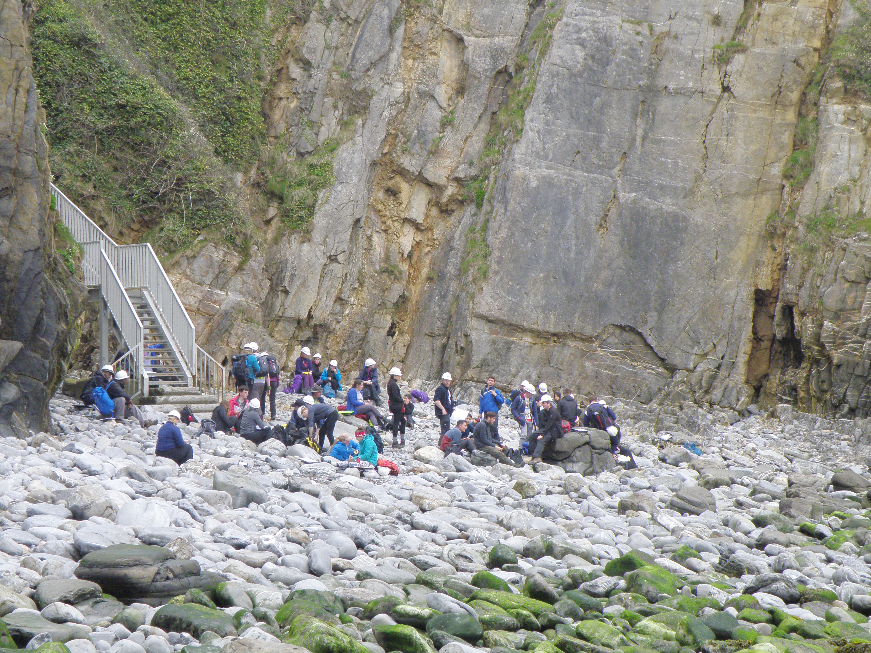
Photos I to K8 were all taken in the strata exposed in the north end of the west cove, in the two recesses at the right-hand side of photo H.
|
|
|
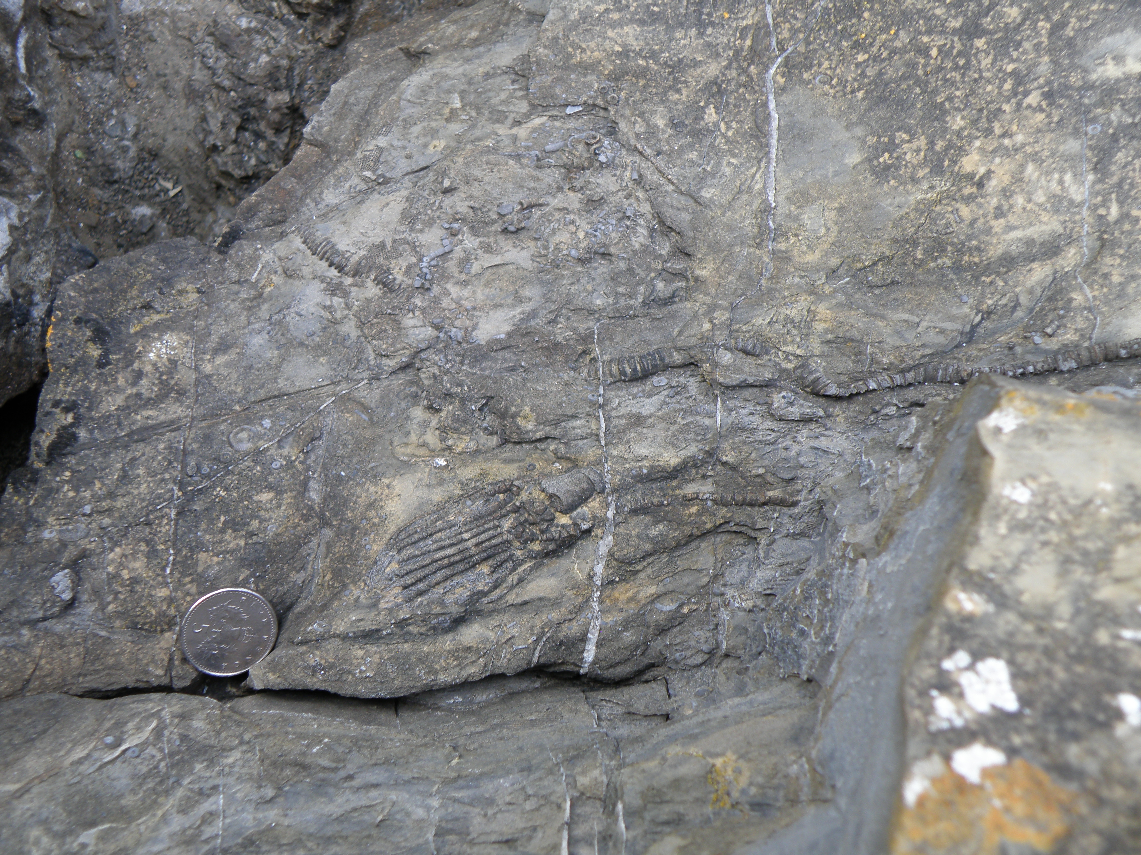
 K1. In photos K1 to K8, attempt to identify the fossils present. Comment on whether they are whole or fragmented, in life position or transported. How did each of these fossil groups live, and what does that tell us about conditions in the sedimentary environment? |
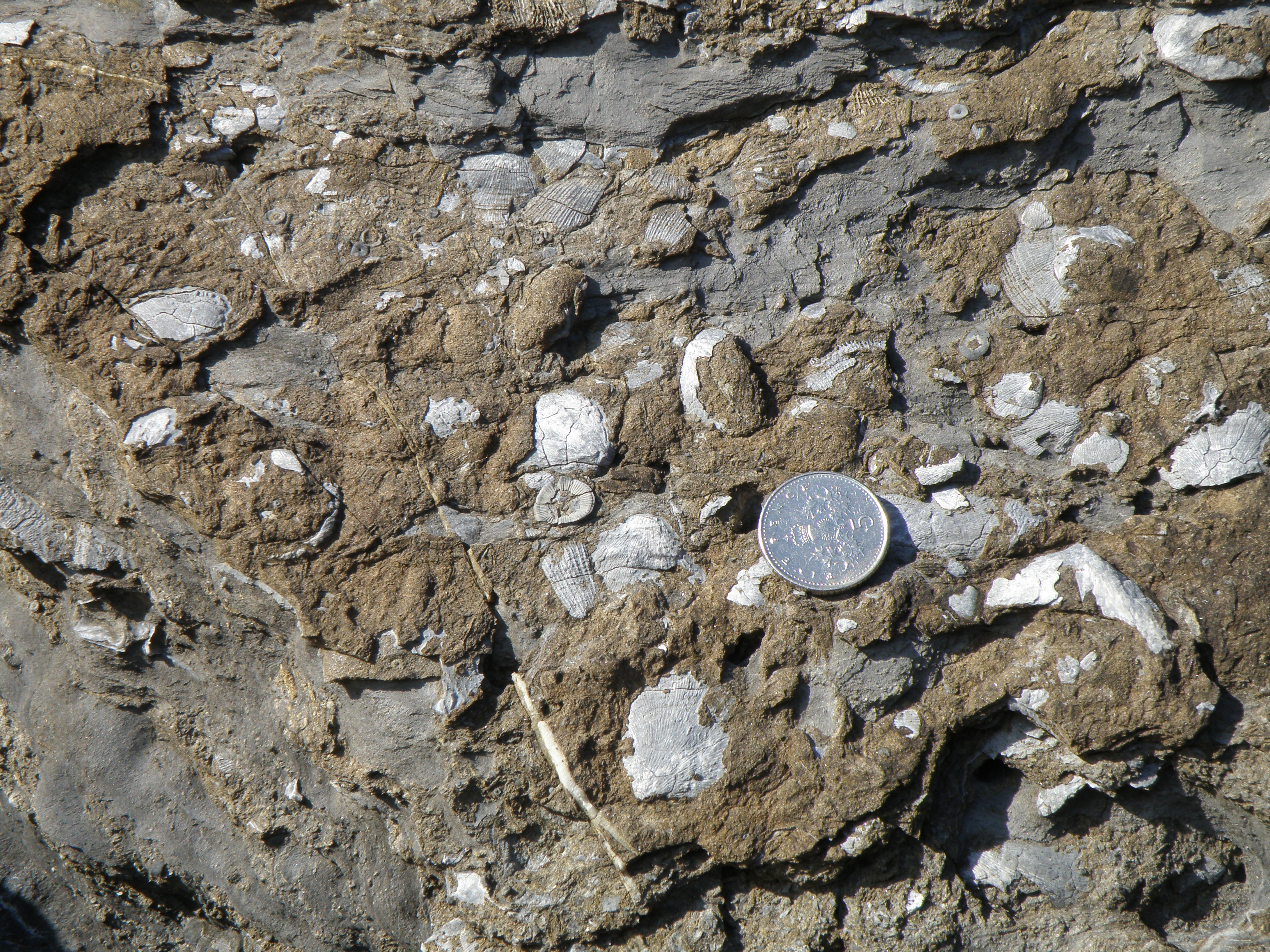 K2. Several different fossil types. |
 K3. The familiar shape just right of centre has acquired a black phosphate coating on the sea floor; this is seen on fossil fragments in other photos. |
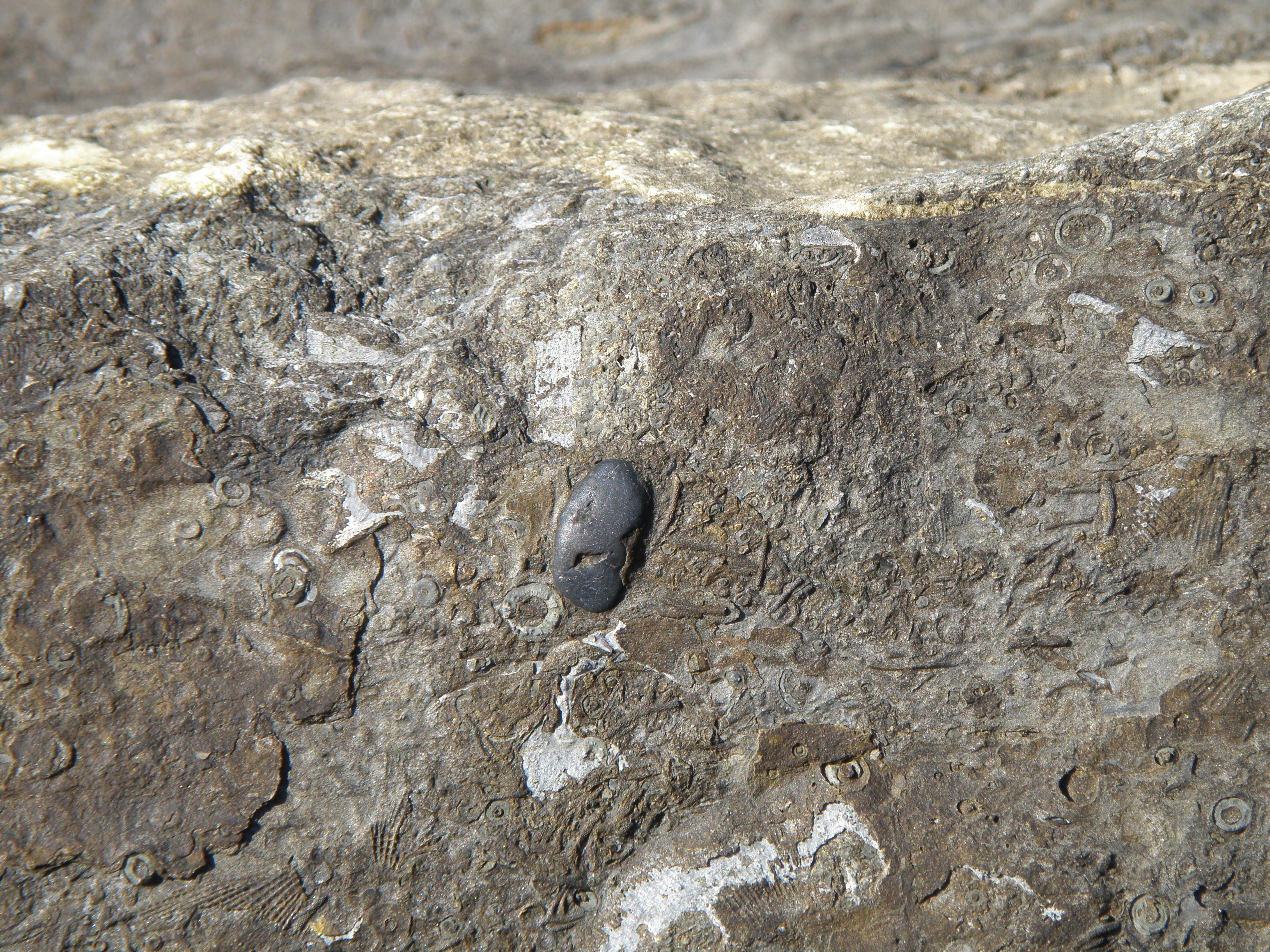
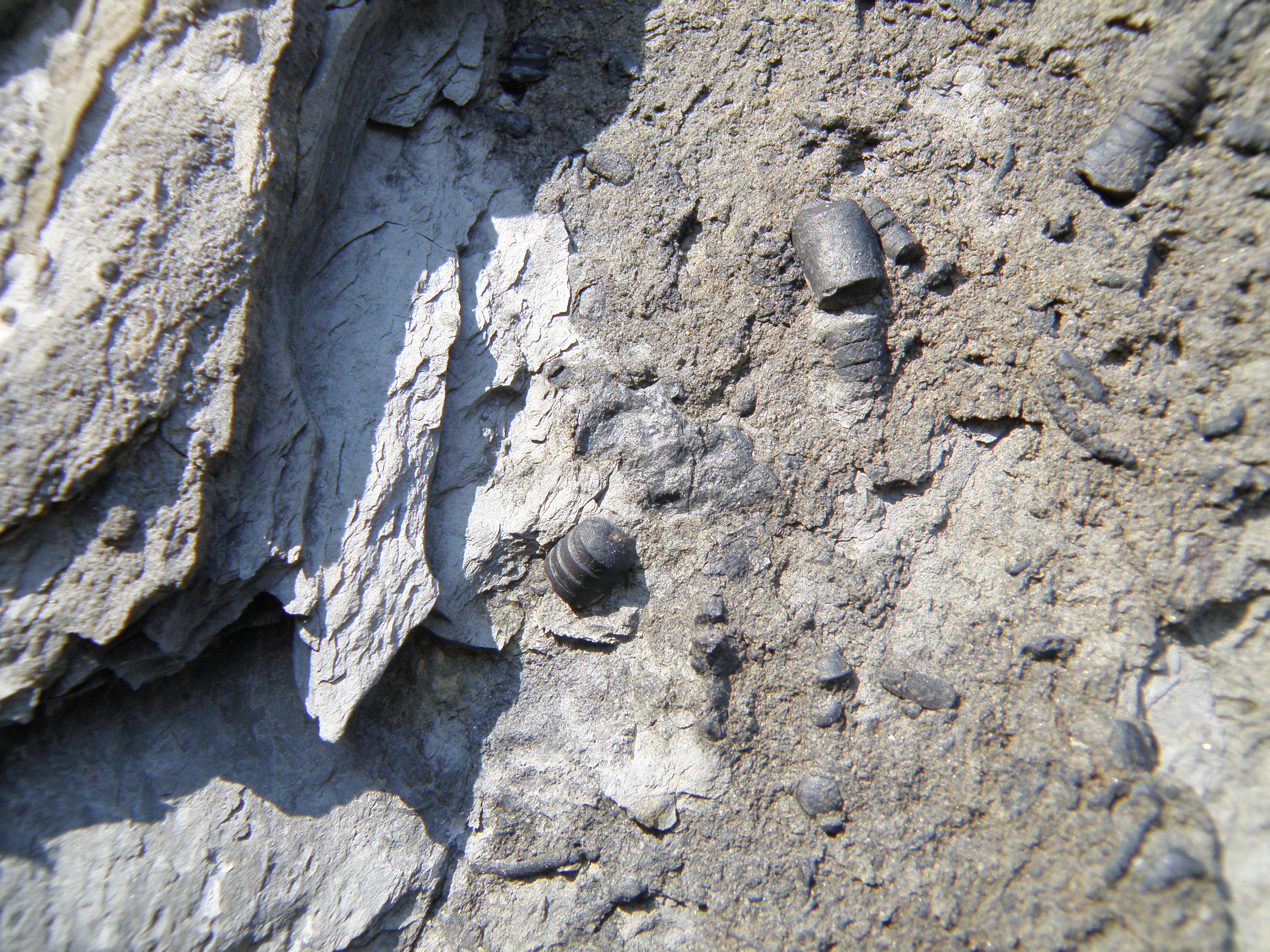 K4. These may be unfamiliar - they are small orthocone nautiloids, about 10mm in diameter, which were common in the Palaeozoic. Find out a bit more about them and how they lived. They have also acquired a phosphate coating - how does this happen? |
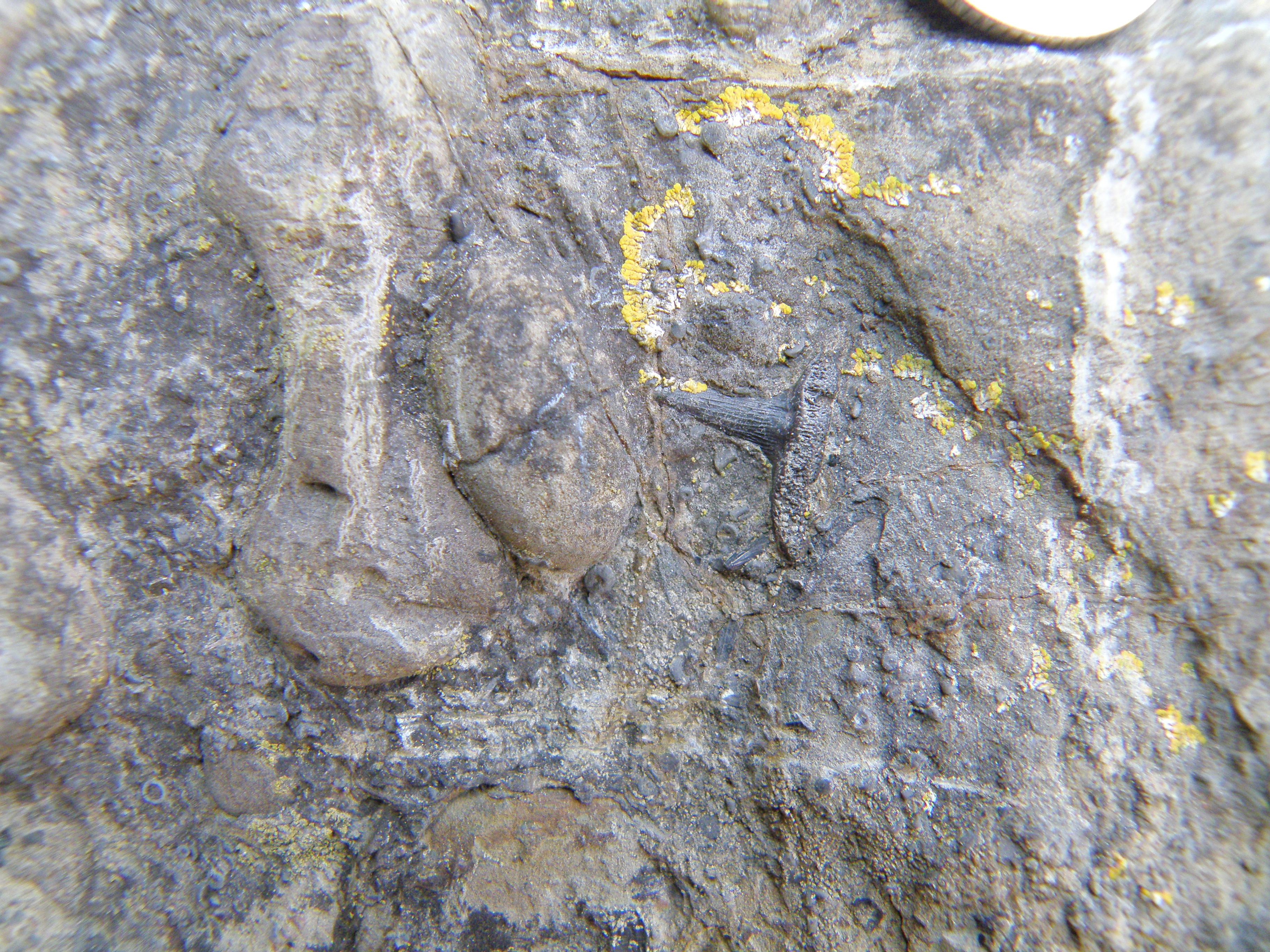
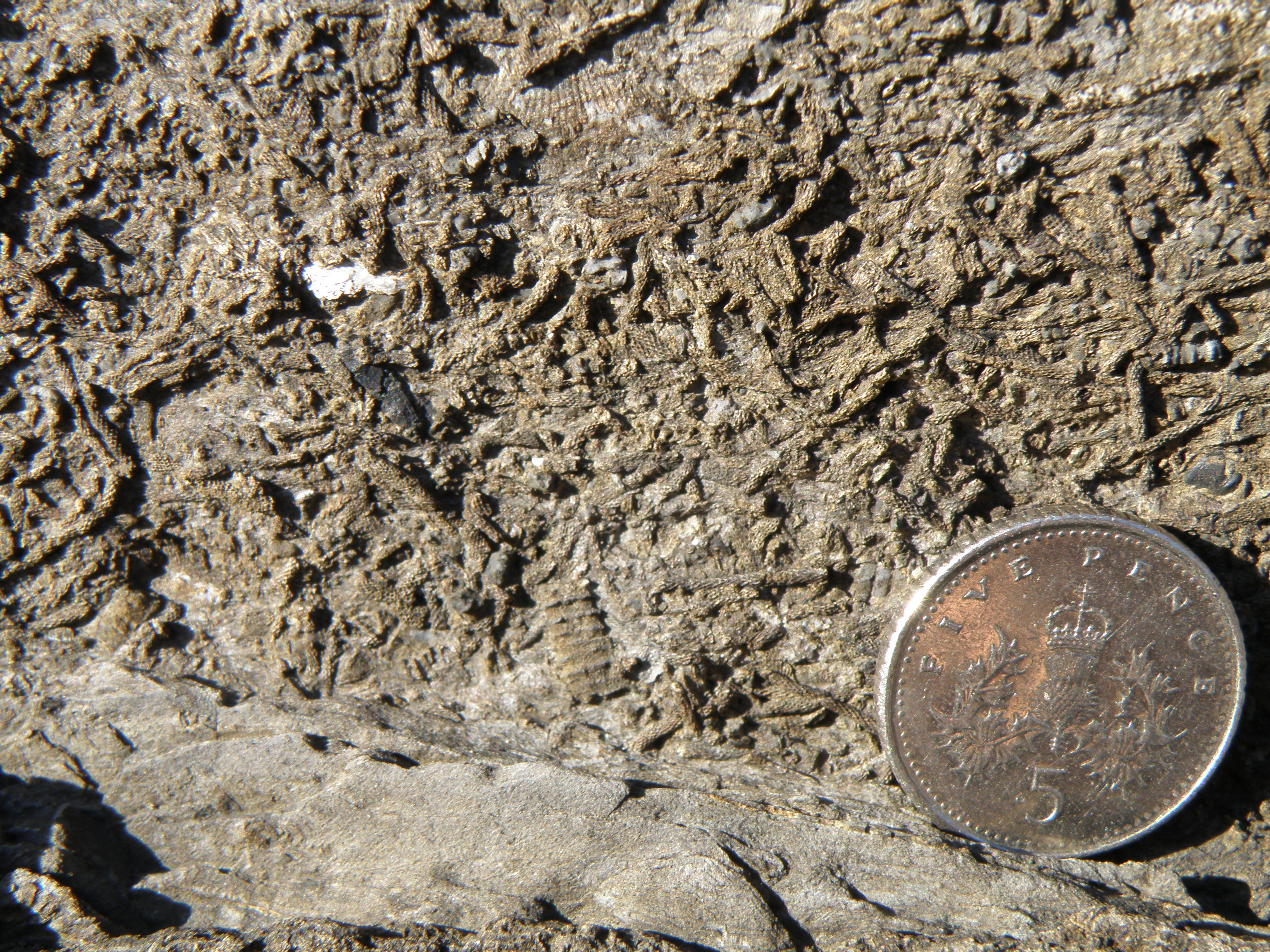 K5. The stick-like fossils here are close relatives of the network structures in the next two photos; what are they? |
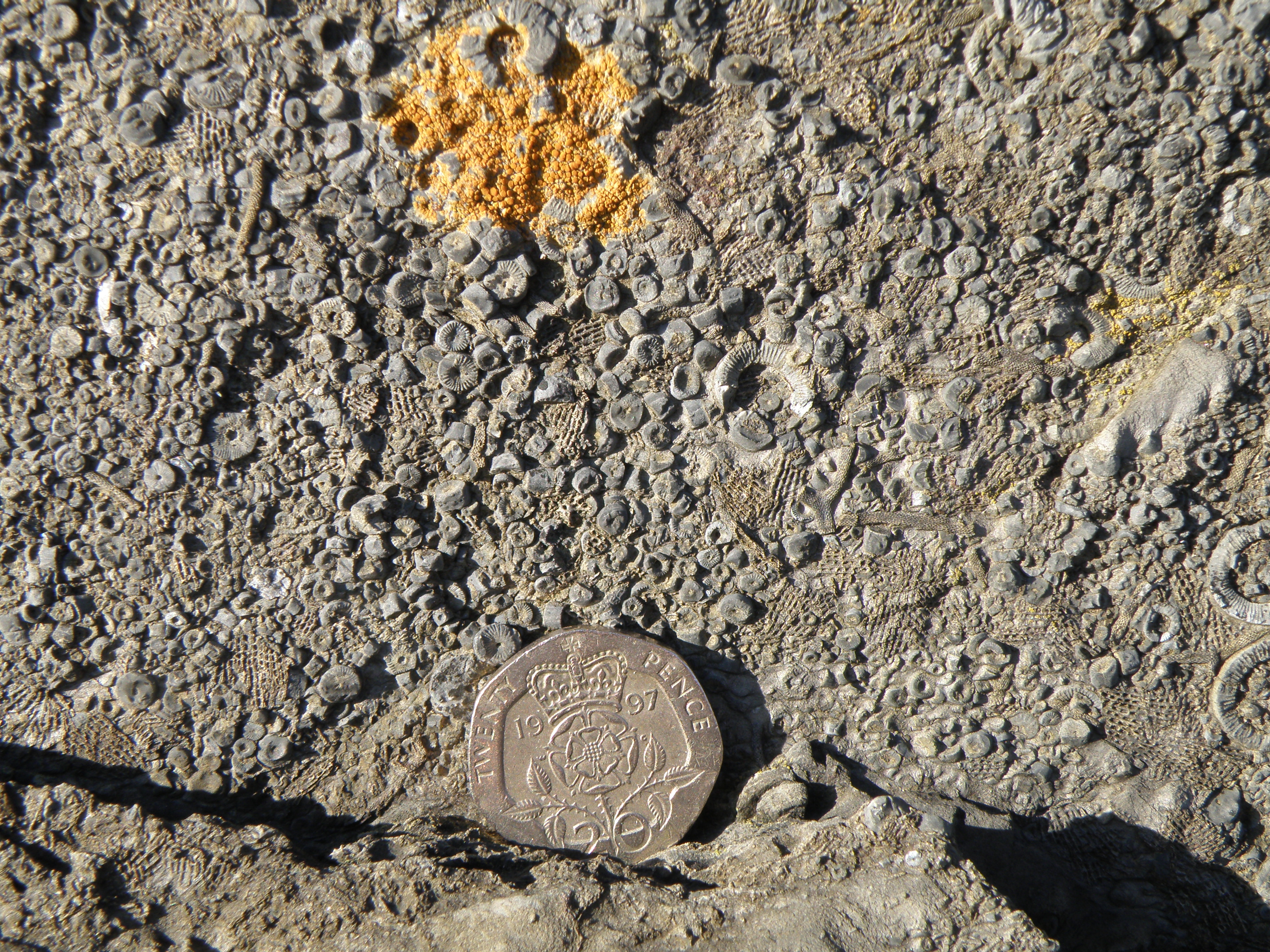 K6. Pay particular attention to the circular fossils here; what are they, and what do they tell us about salinity? |
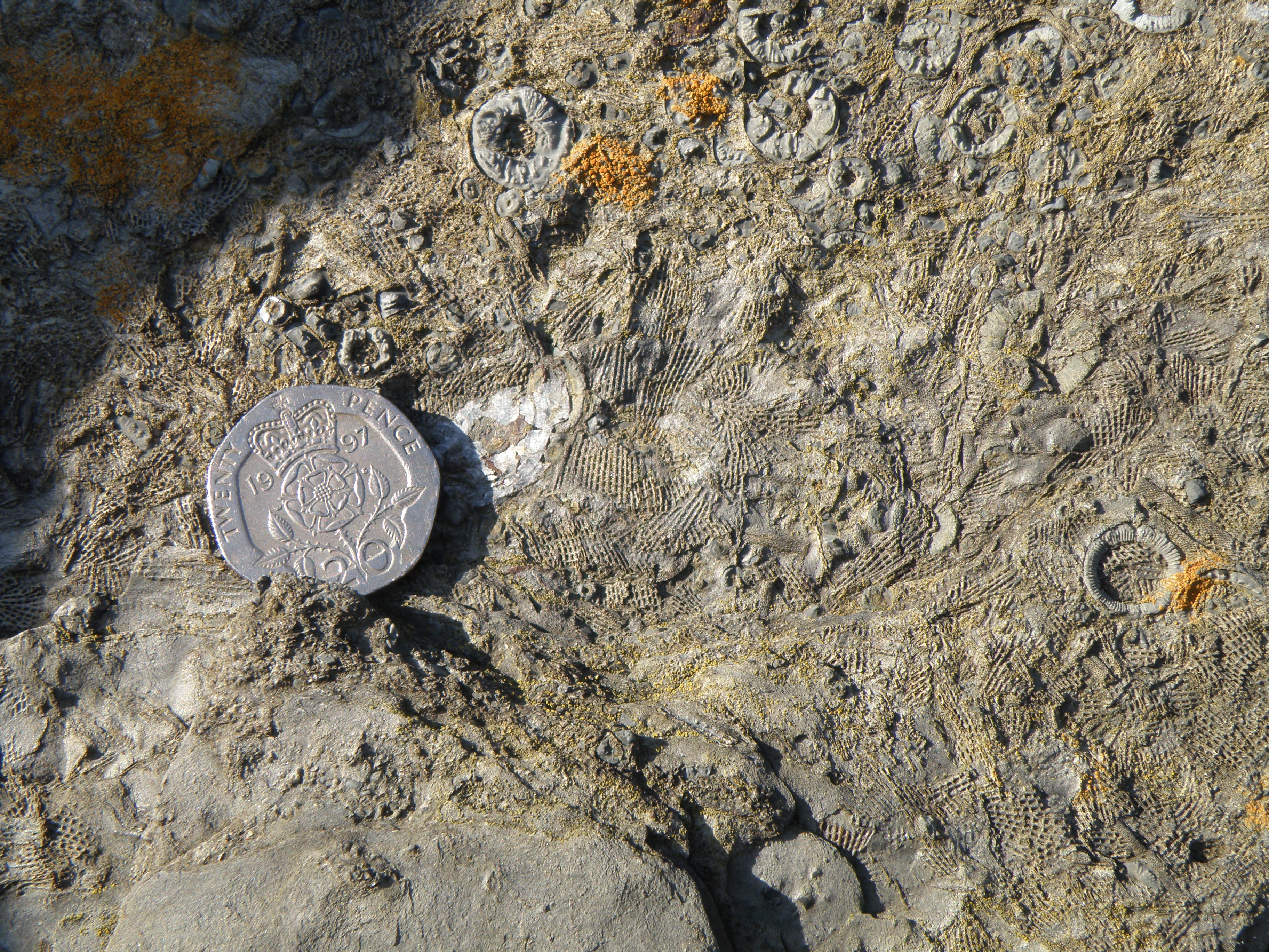 K7. See caption for K5. |
|
.
. |
|
|
|
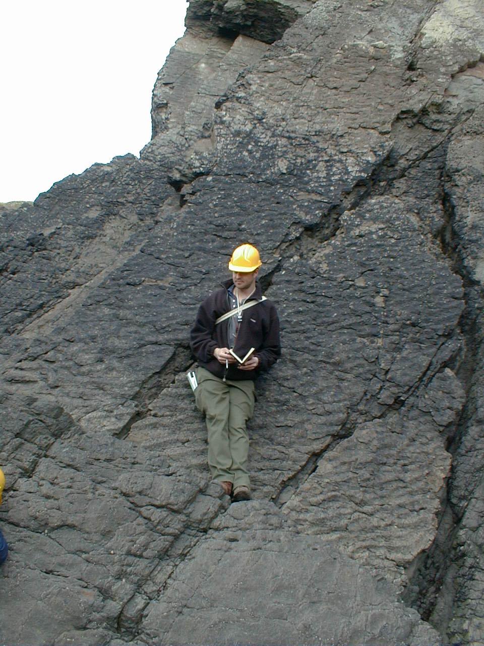
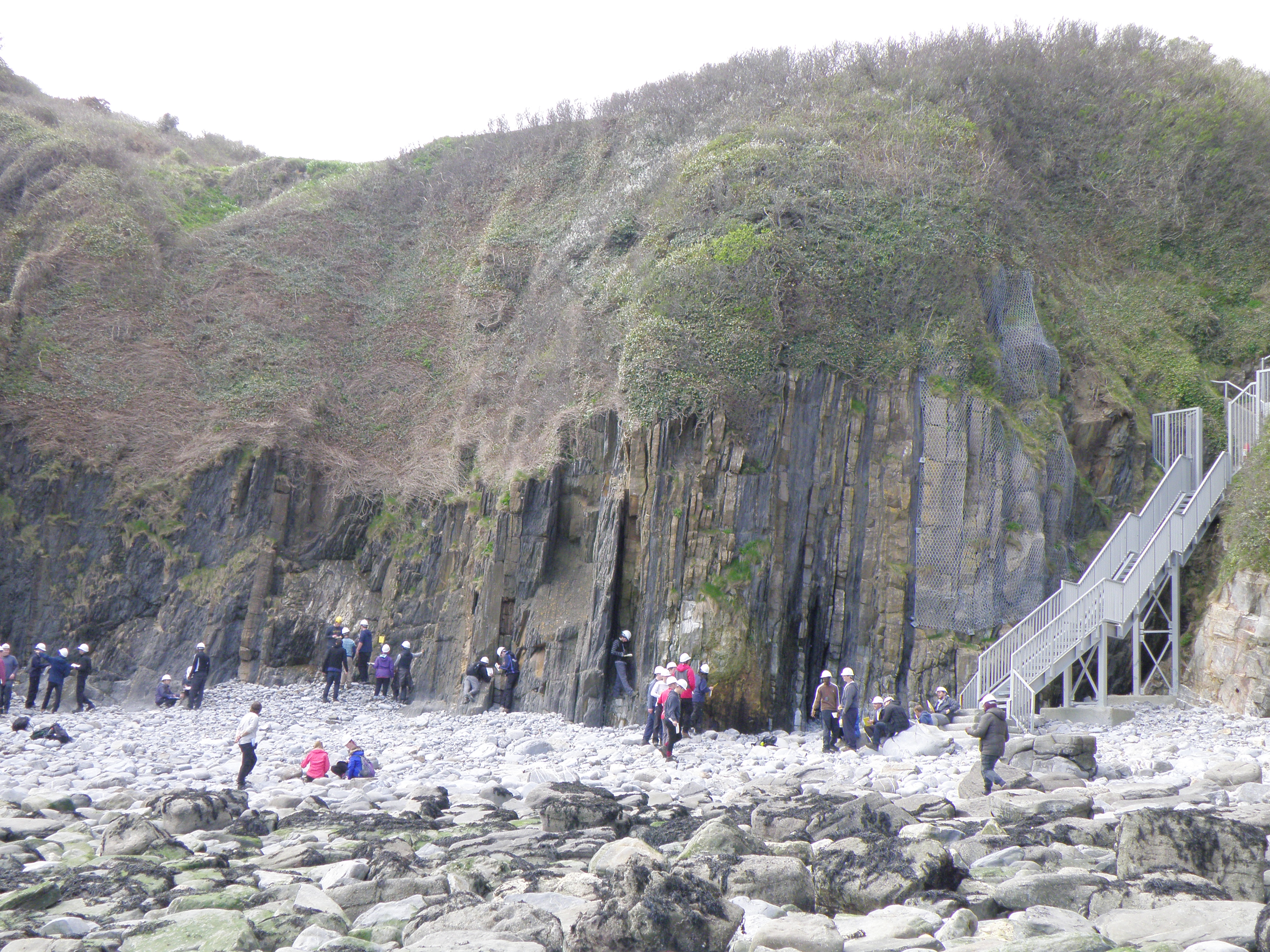
L2. Annotated view. Abbreviations as in photo A2. Beds are slightly overturned and young to the right (north). |
||
 M1. A slightly closer view of the middle cove, showing more detail. |
 M2. Note the alternating lithologies in the AvGp. |
||
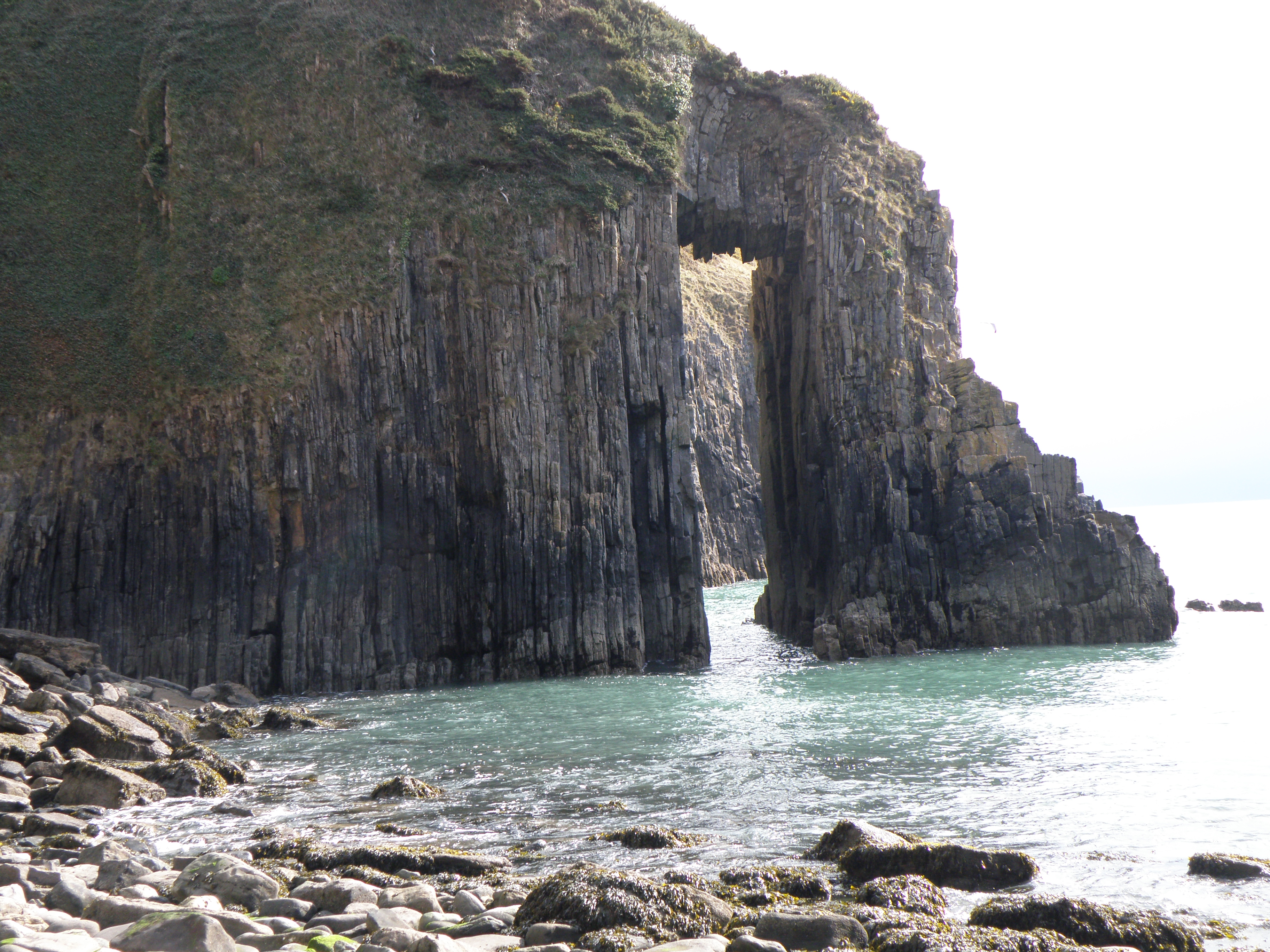
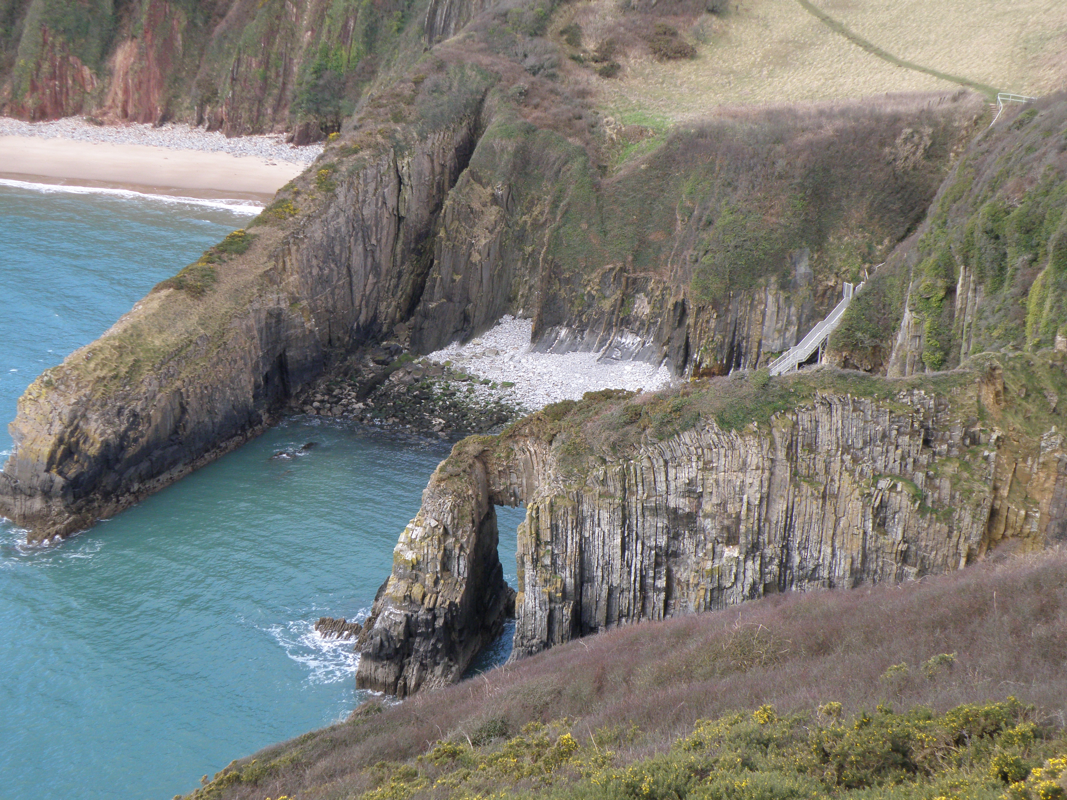 N. View SW from the coast path. The headland on the left is the Church Doors Limestone (CDL). The headland with the natural arch is in the Black Rock Limestone (BRL). The limestone is offset by steep minor faults. |
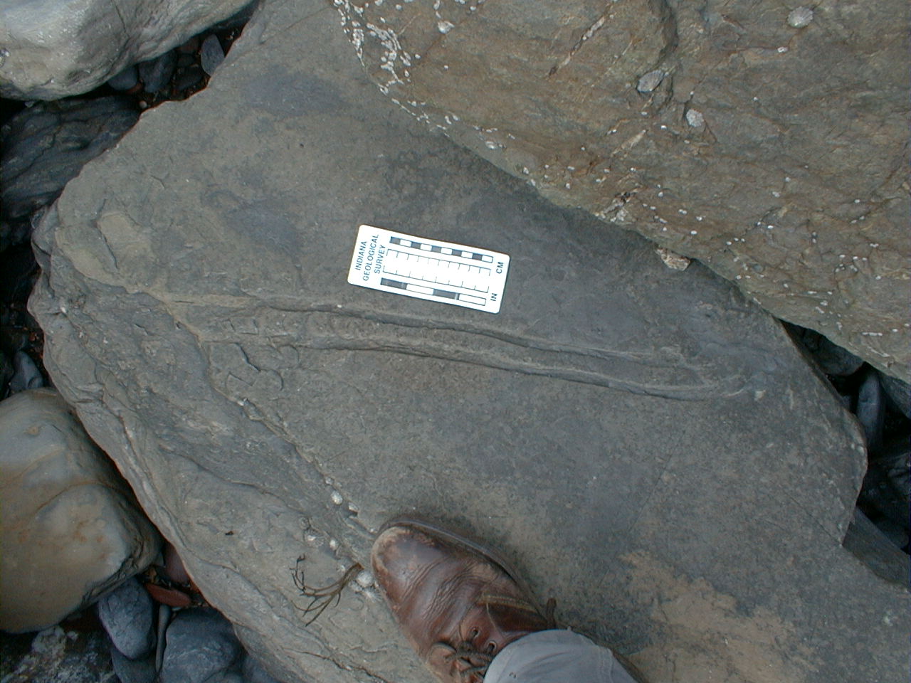
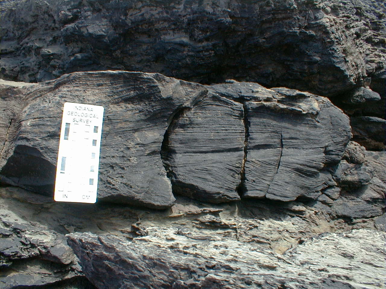
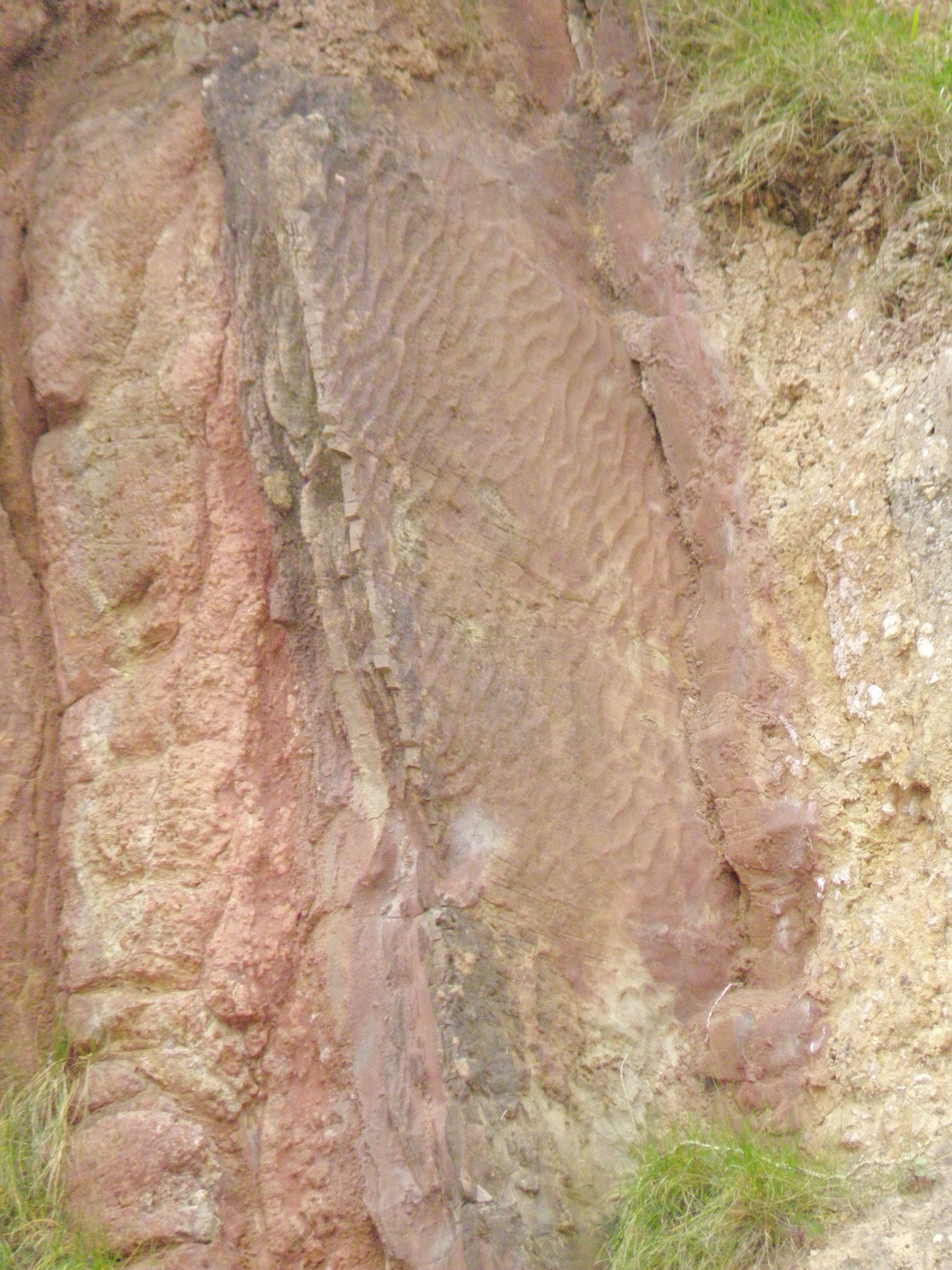
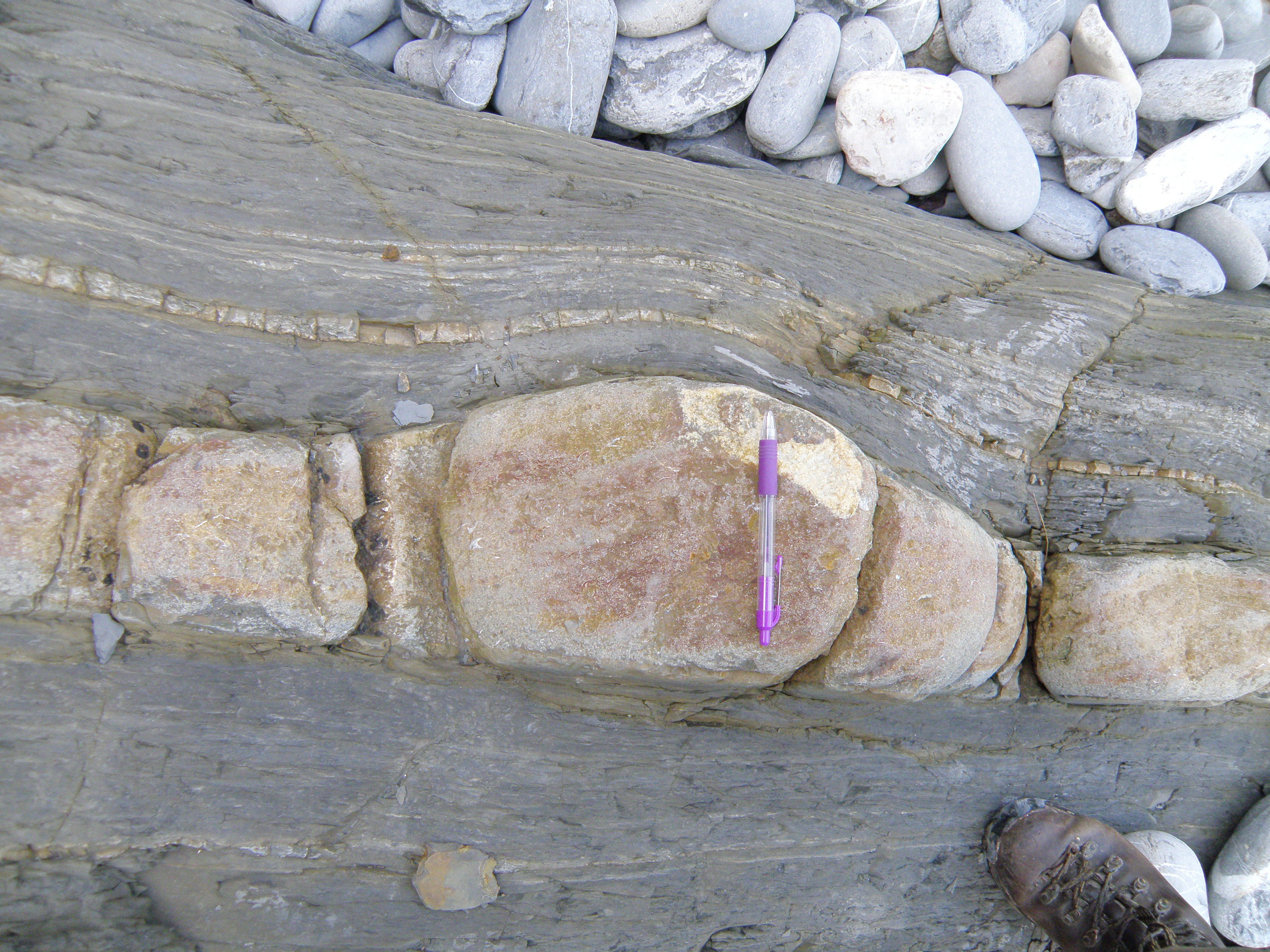
O. Rock sample - take a close look. In outcrop, ripple cross lamination is seen. |
Is it sharp or gradational? Where exactly would you place the contact? |
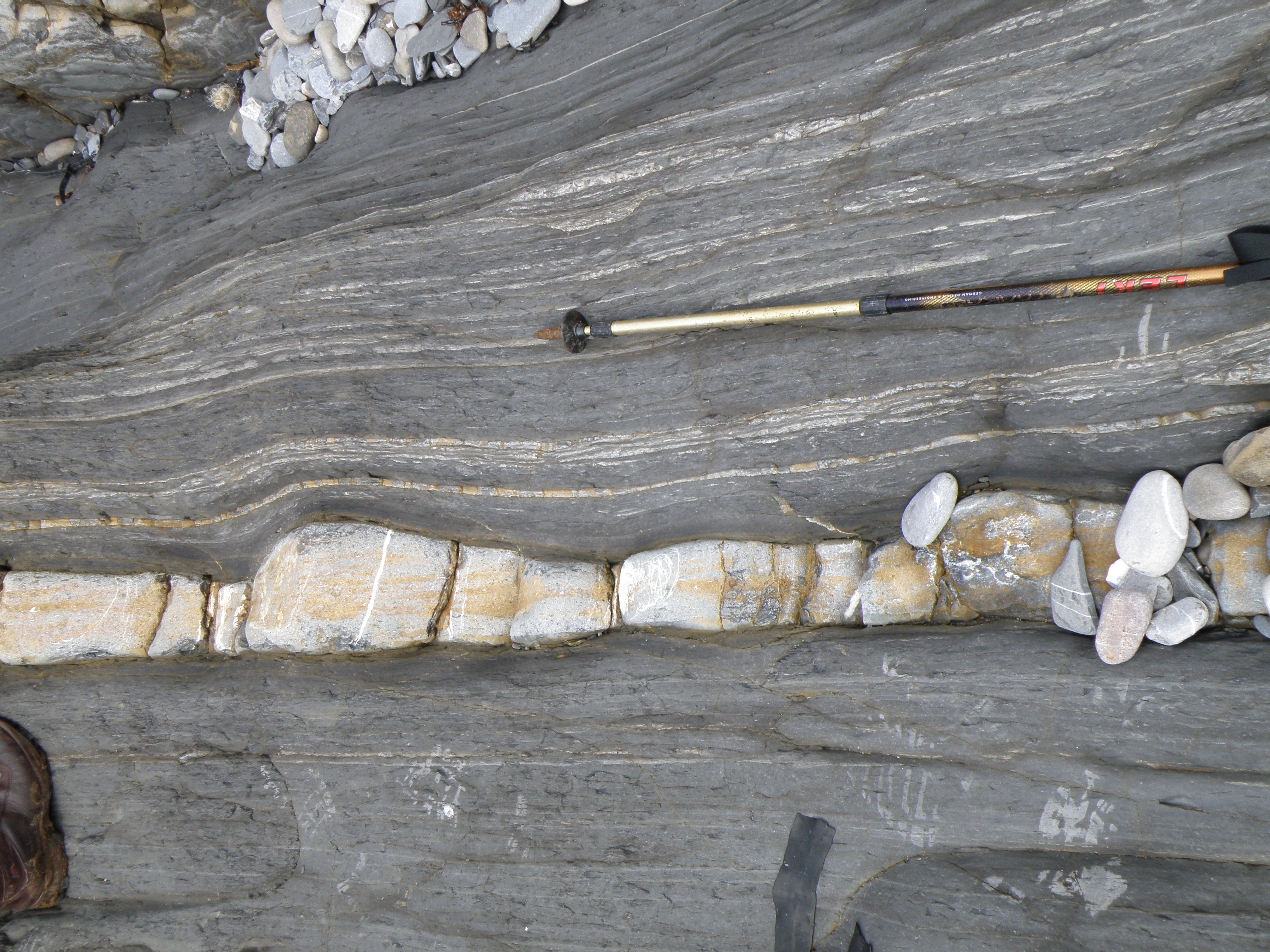
 Q. Closer view of the alternating lithologies in the upper part of the AvGp, just left of the steps. Younging is to the right. Mudstones weather in; sandstones and impure limestones stand out. All lithologies react with dilute HCl. Similar fossils are found to those in photos K1 to K8, and some beds are bioturbated. |
 R. Closer view of the beds in photo Q. |
S. Calcareous mudstones with thin calcareous sandstone beds which stand out. Younging is to the right. What can you say about the geometry of the bed immediately behind the geologist? Note particularly the basal and top contacts. |
What does the alternation of lithologies tell us about changing conditions? |
 U. Close-up of T. We can see the contacts, and a hint of internal structures within the bed. |
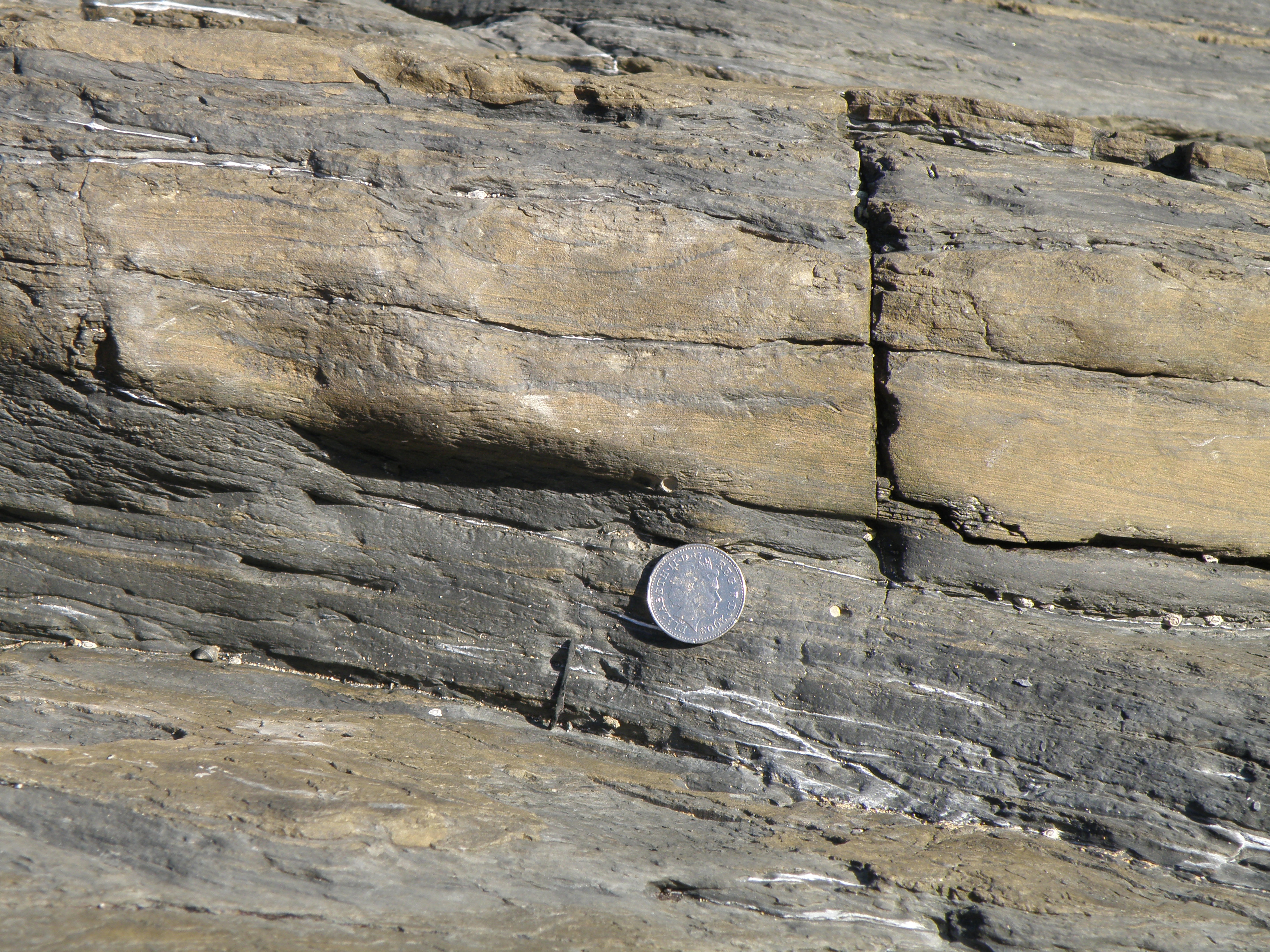 V. The brown bed above the coin is similar to those seen in photos S to U, but the internal structures are more obvious. |
W. Another similar bed - describe and identify the sedimentary structures, looking particularly at internal contacts. What is this structure? What does it tell us about processes and environments. Don't forget to use the reference section in the Field Guide, and the recommended texts. |
||
We'll study this briefly, as we'll be looking at a detailed section in the Pembroke Limestone Group (PLG) tomorrow.
|
|
|
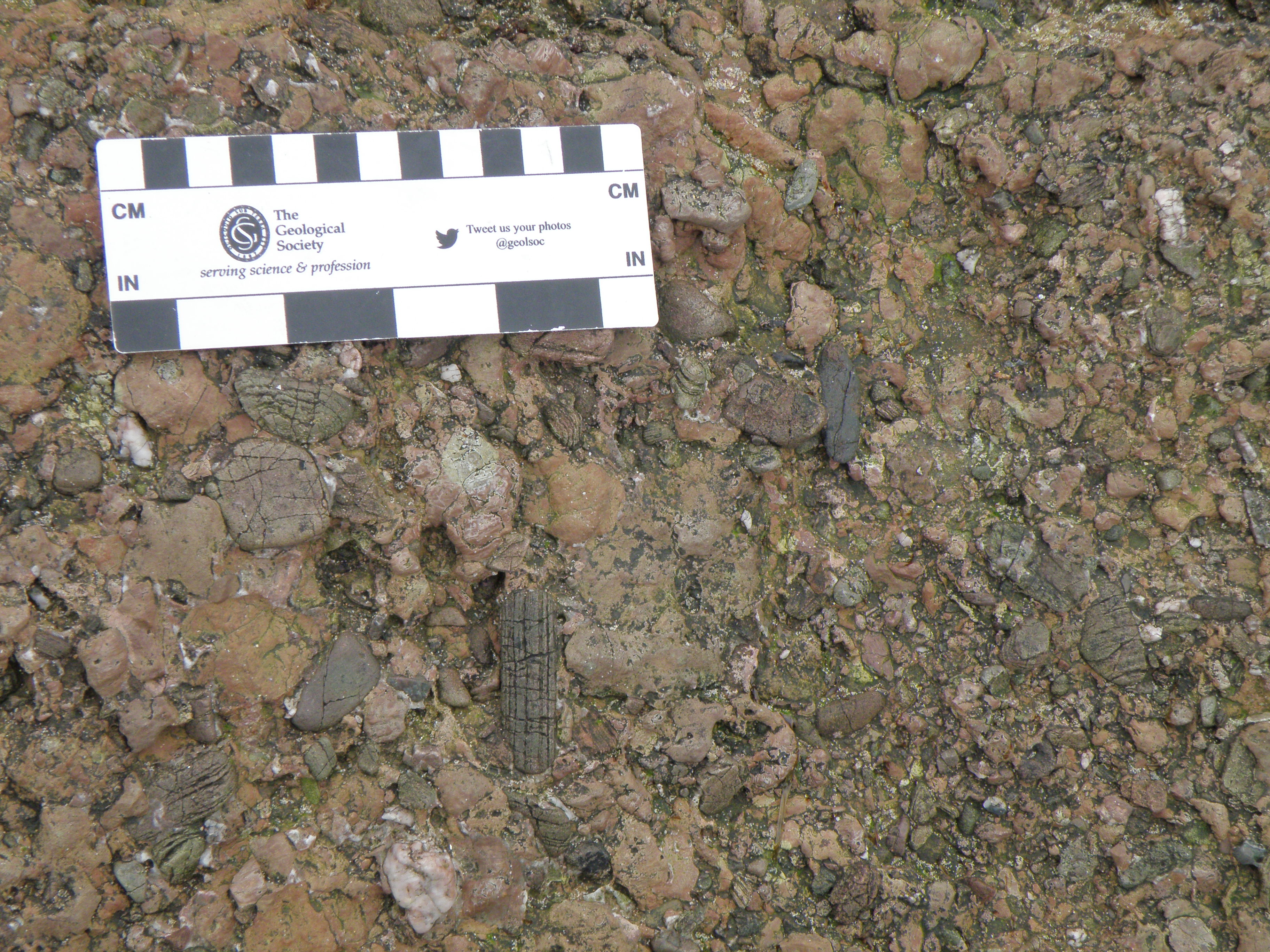
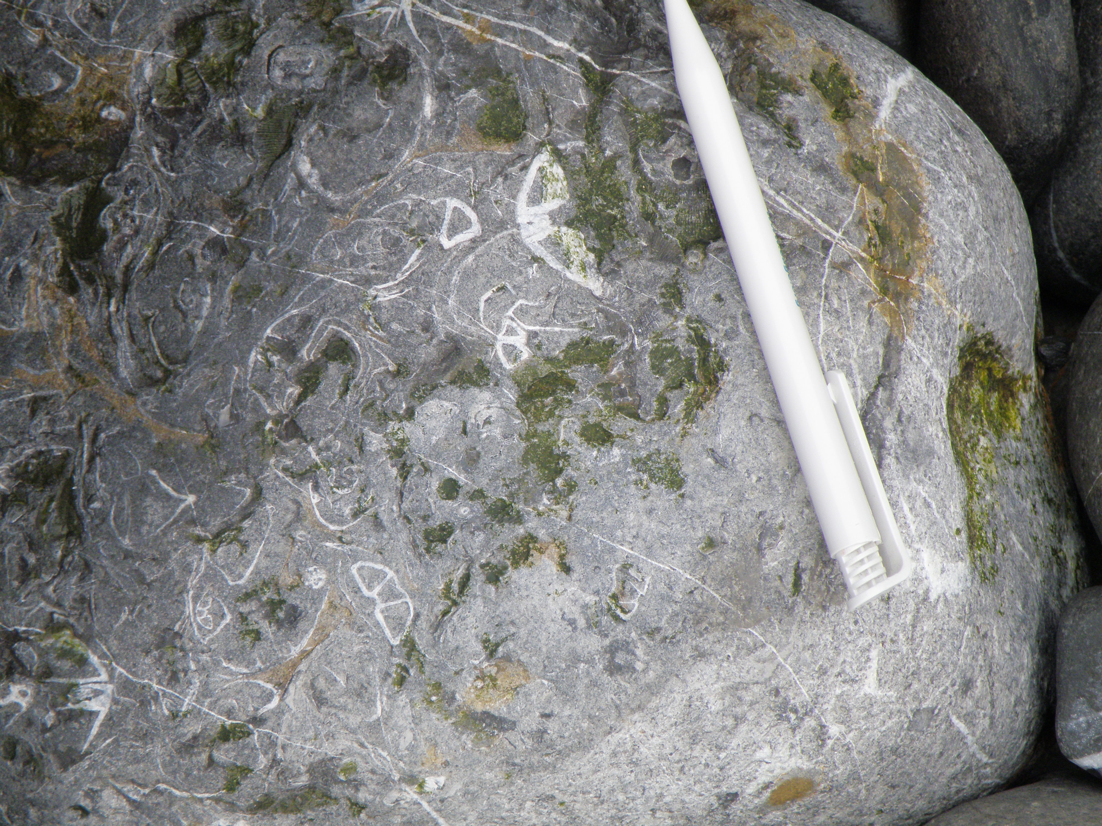 Z. Close-up of a BRL outcrop. Which group of fossils do these cross sections belong to? |
![]()
![]()
Make sure you've completed all the work for this locality. That's all our outcrops for today. Now we can climb back up the steps, catch our breath and enjoy the view from the cliff top, where we'll meet for today's picnic and Q & A session in Blackboard Collaborate at 5pm today (only available if you're a University of Derby student doing this field trip in real time on Tuesday 28 April, 2020!).
![]()
This page is maintained by Roger Suthren. Last updated 29 April, 2020 1:32 PM . All images © Roger Suthren unless otherwise stated. Images may be re-used for non-commercial purposes.