It is important that you access this field trip on a laptop or desktop PC.
Click on any image to enlarge it - you will need to zoom in to see sufficient detail.
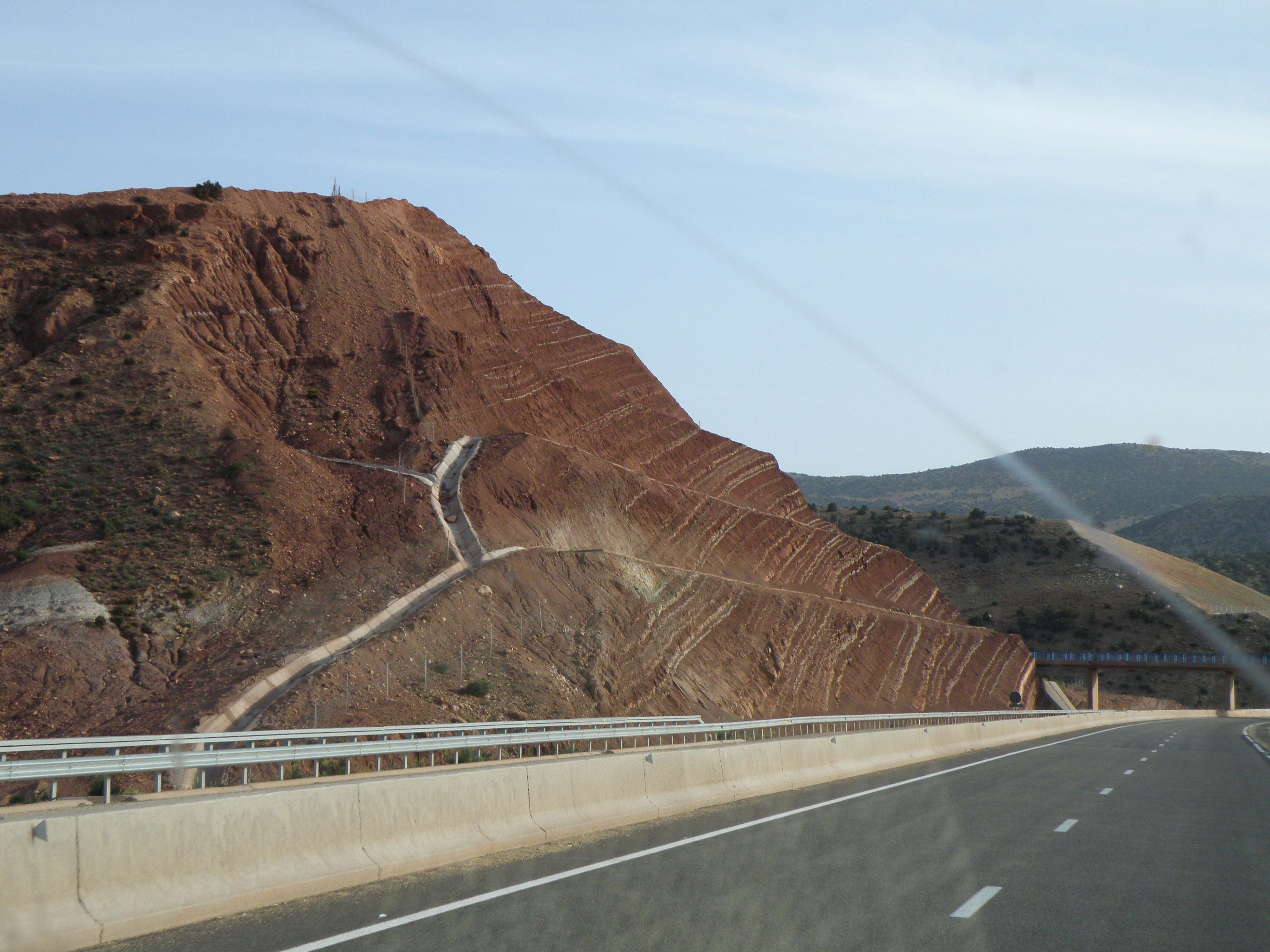
Where are we? A road cutting along the D50 road, southeast of the village of Durban-Corbières, in the Corbières wine region, and in the northern foothills of the Eastern Pyrenees. Take a good look around the area in Google Maps and Streetview (2011 images).
Link to the online geological map. Our locality is immediately to the right of the s at the end of the place name Durban-Corbières, within the t7-8 unit.
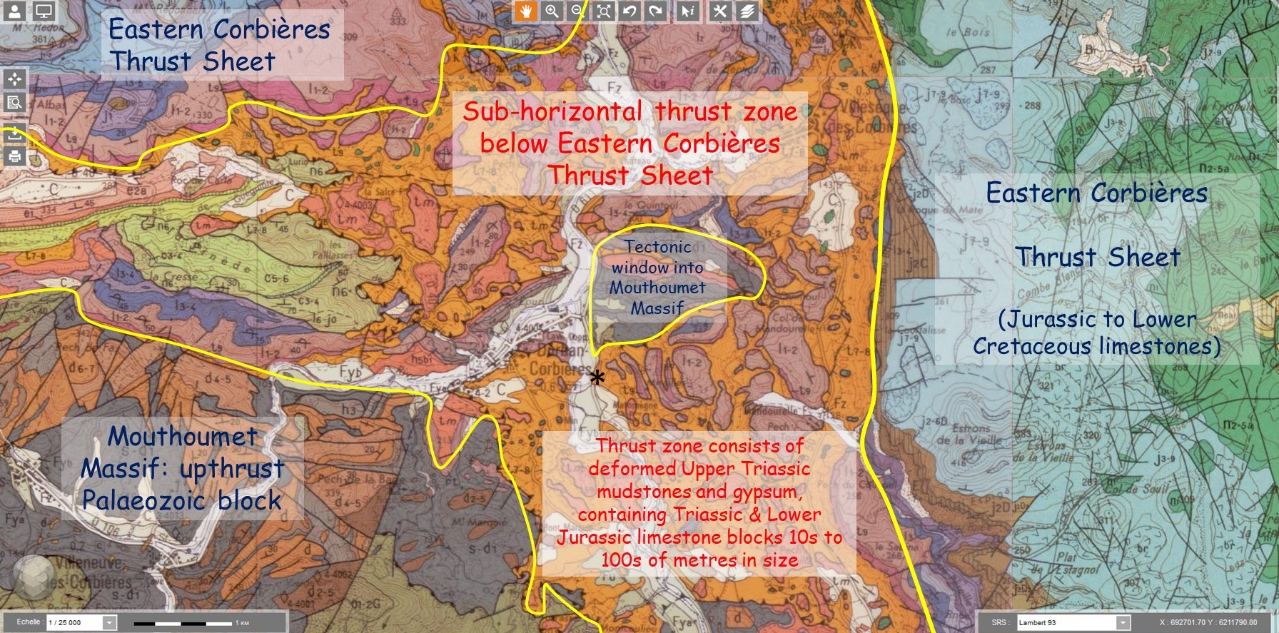 |
| Interpreted extract from Capendu and Tuchan sheets of the 1:50,000 Geological Map © BRGM. * marks the field location |
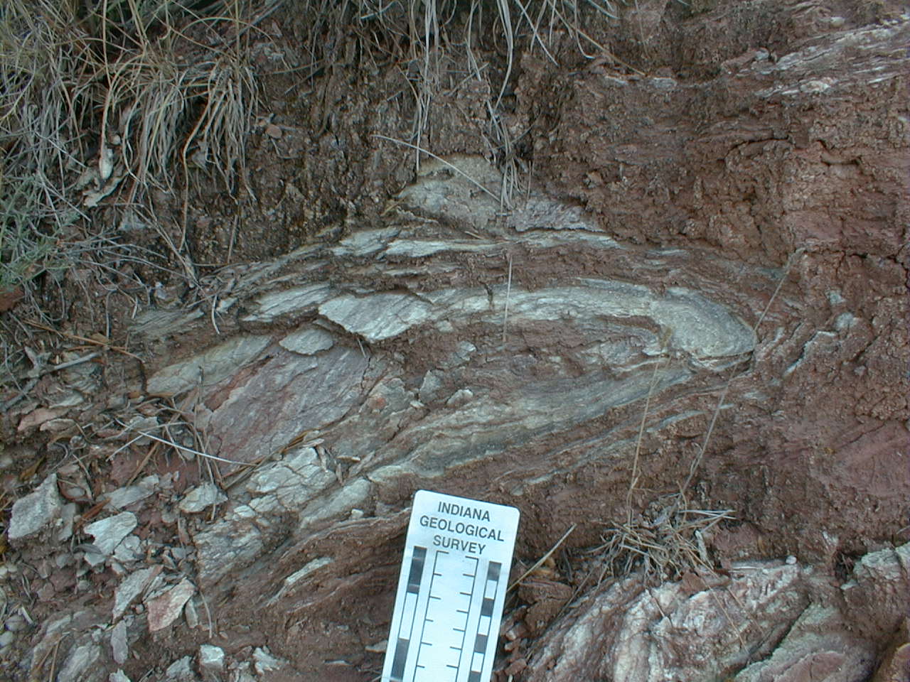
Stratigraphy: this section is located entirely within the Upper Triassic (Carnian-Norian) 'Keuper Marl'. The equivalent lithostratigraphic unit in the UK is the Mercia Mudstone Group (which is the bedrock for much of the city of Derby, and is seen from time to time in temporary outcrops during construction projects at the University of Derby's Kedleston Road site).
Tasks: describe the lithologies, field relationships and structures in this outcrop. Comment on the style(s) of deformation. How do the small-scale structures seen here relate to the large-scale tectonics of the Northern Pyrenees?
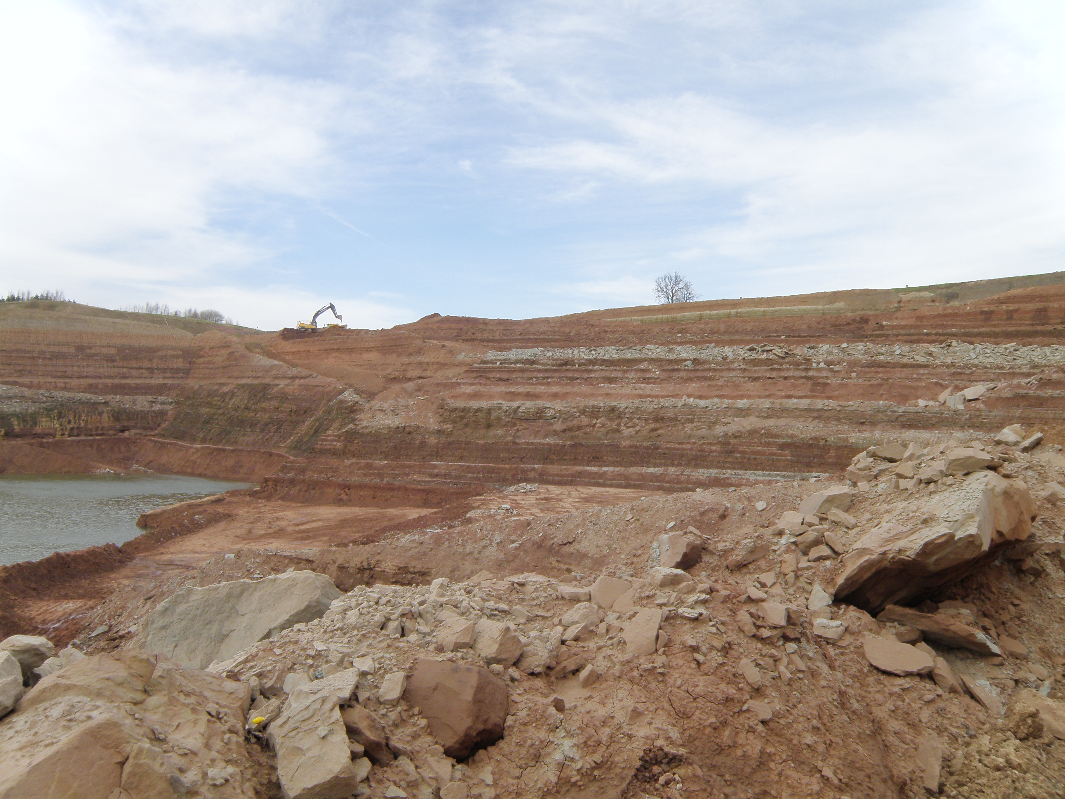
There's a lot to see and do at this location, and we usually spend up to 2 hours here. The photos below are your outcrops, and you'll need to spend time studying them in detail, and working out the relationships between them. These photographs were taken over a period of more than 20 years, and the outcrop has been much modified during that time by weathering and erosion of the soft lithologies.
![]()
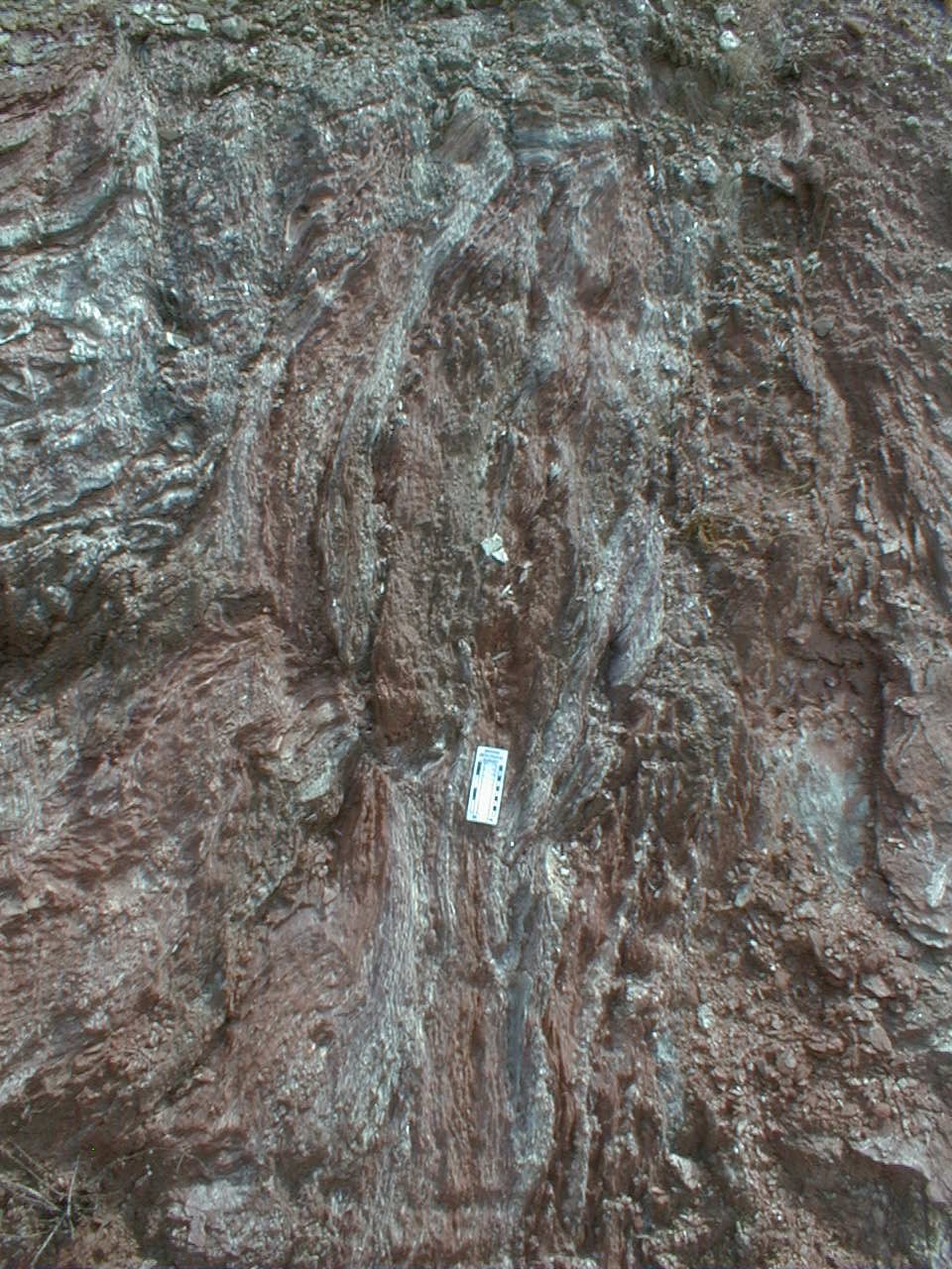
The outcrops - north end
These photographs start at the north end of the road cut (the left end of the Streetview image). Pay particular attention to field relationships
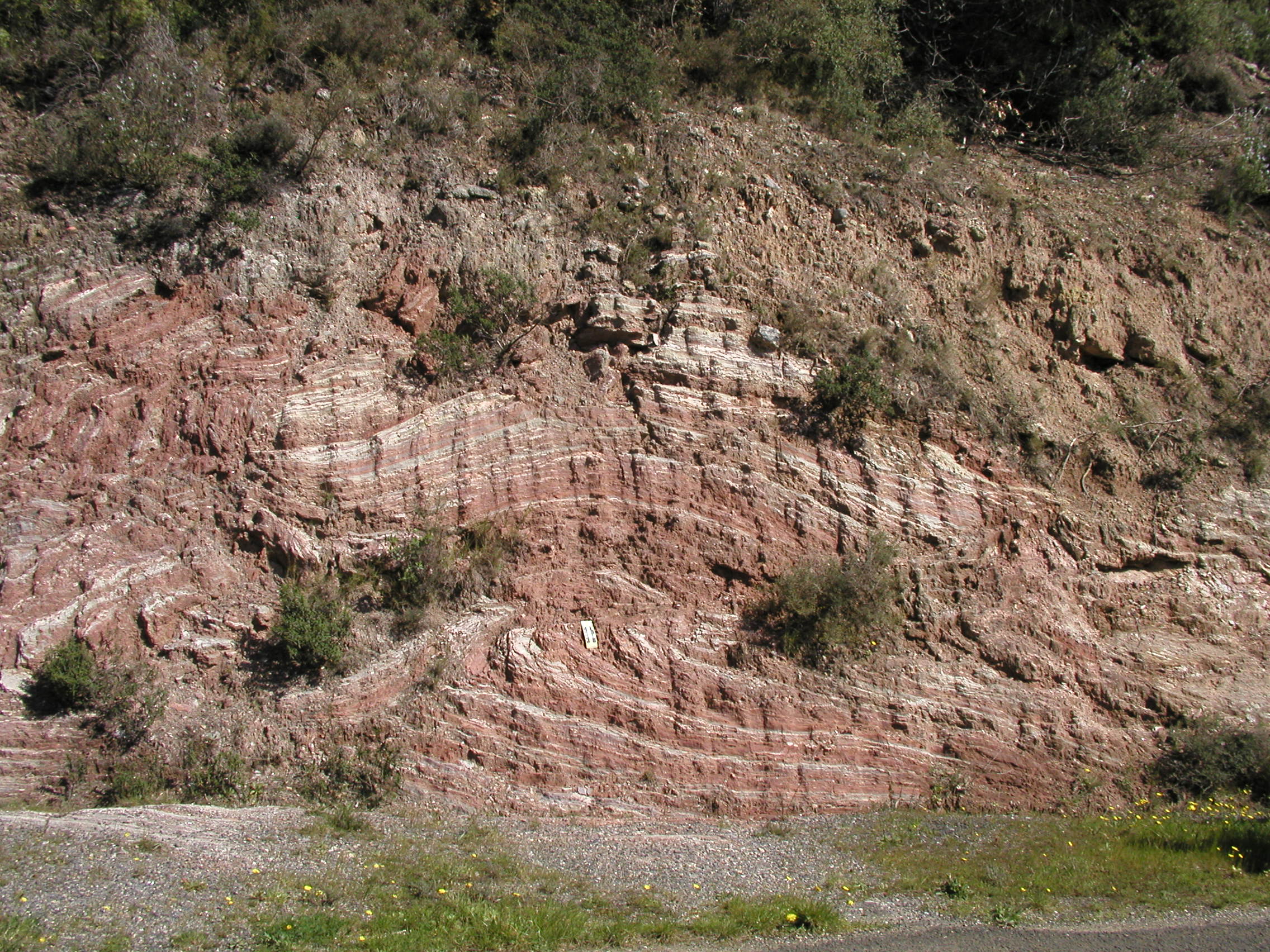
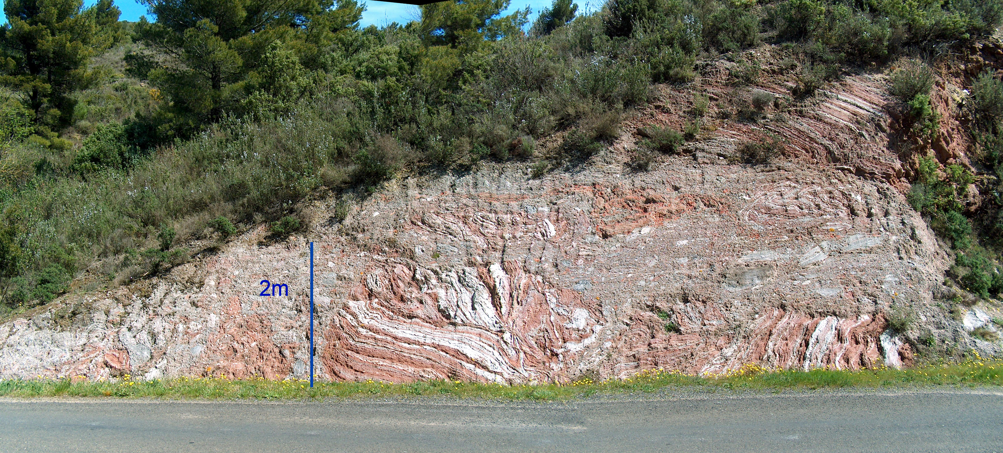 Figure 1. General view of the northern end of the outcrop. |
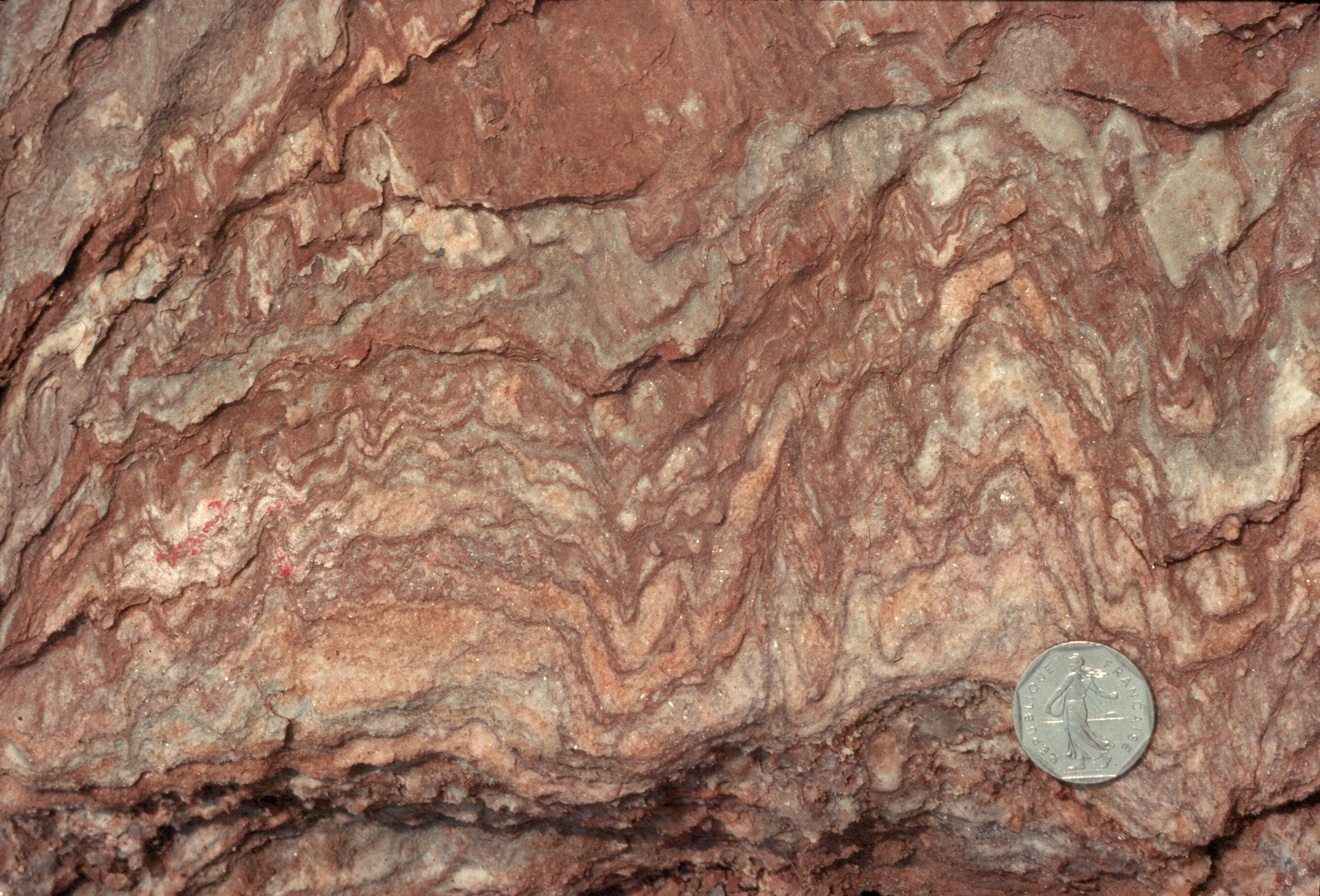
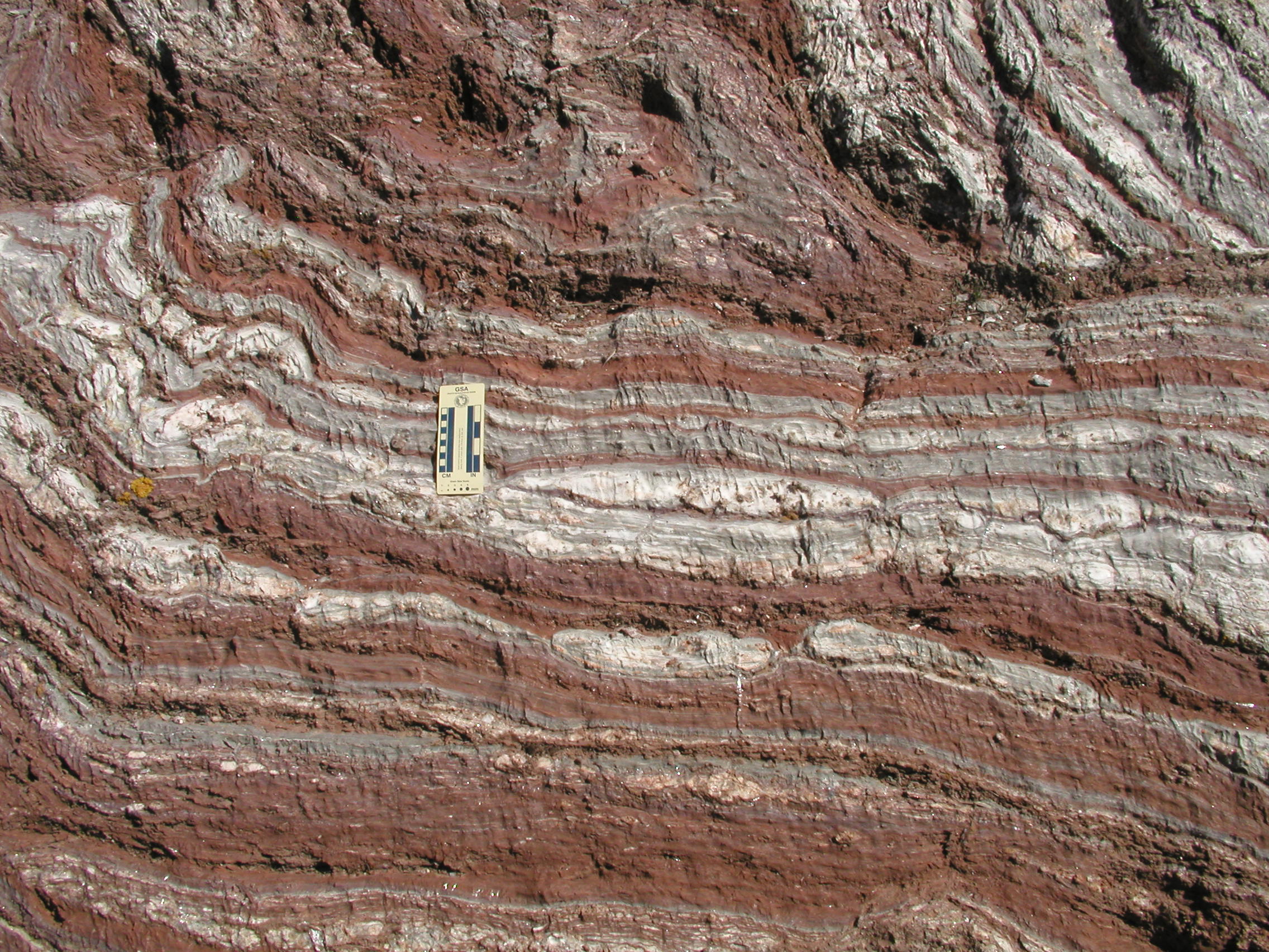
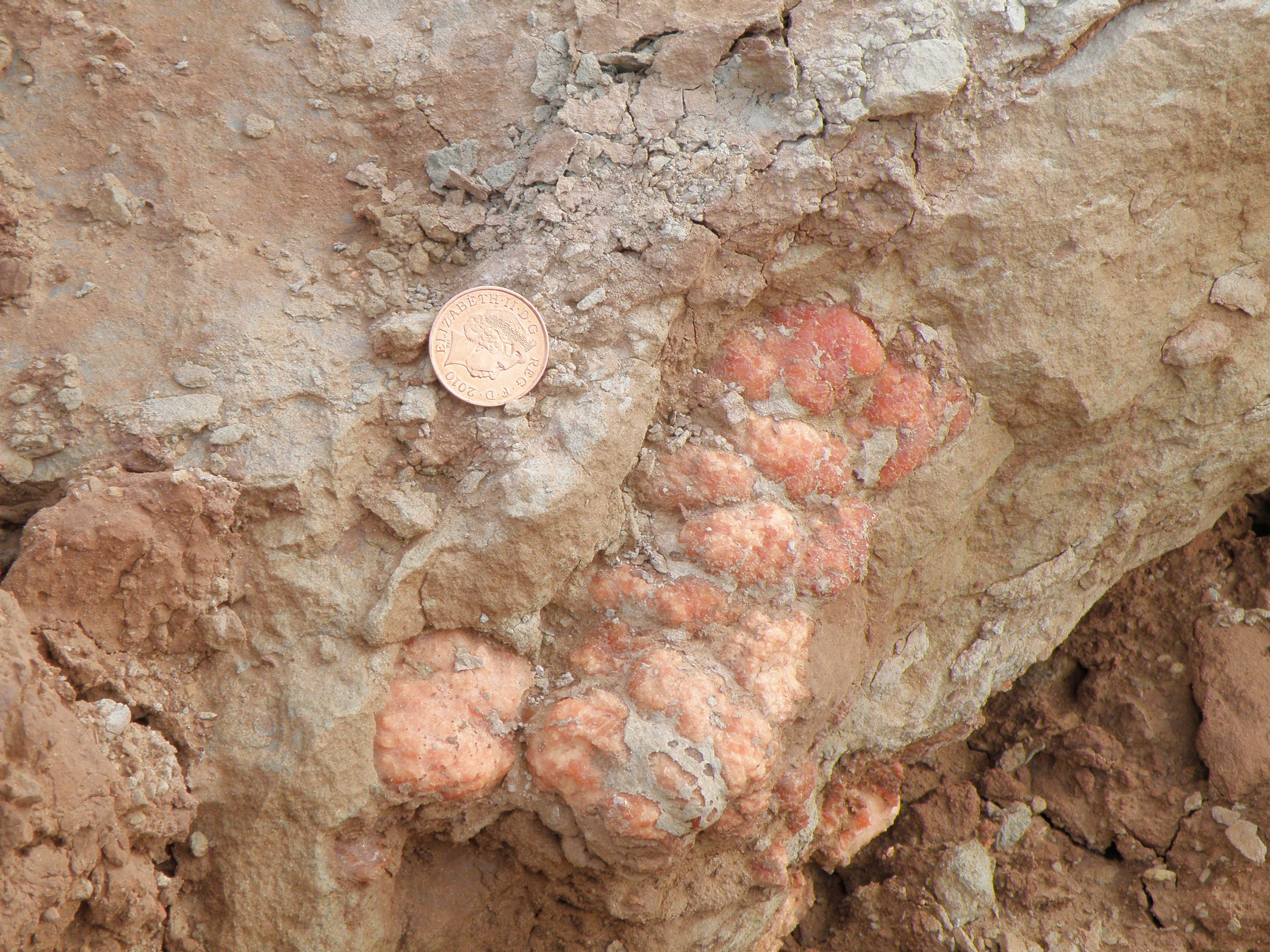
 Figure 2. Detail of the central part of Figure 1. White and grey material is gypsum; red is mostly siltstone. |
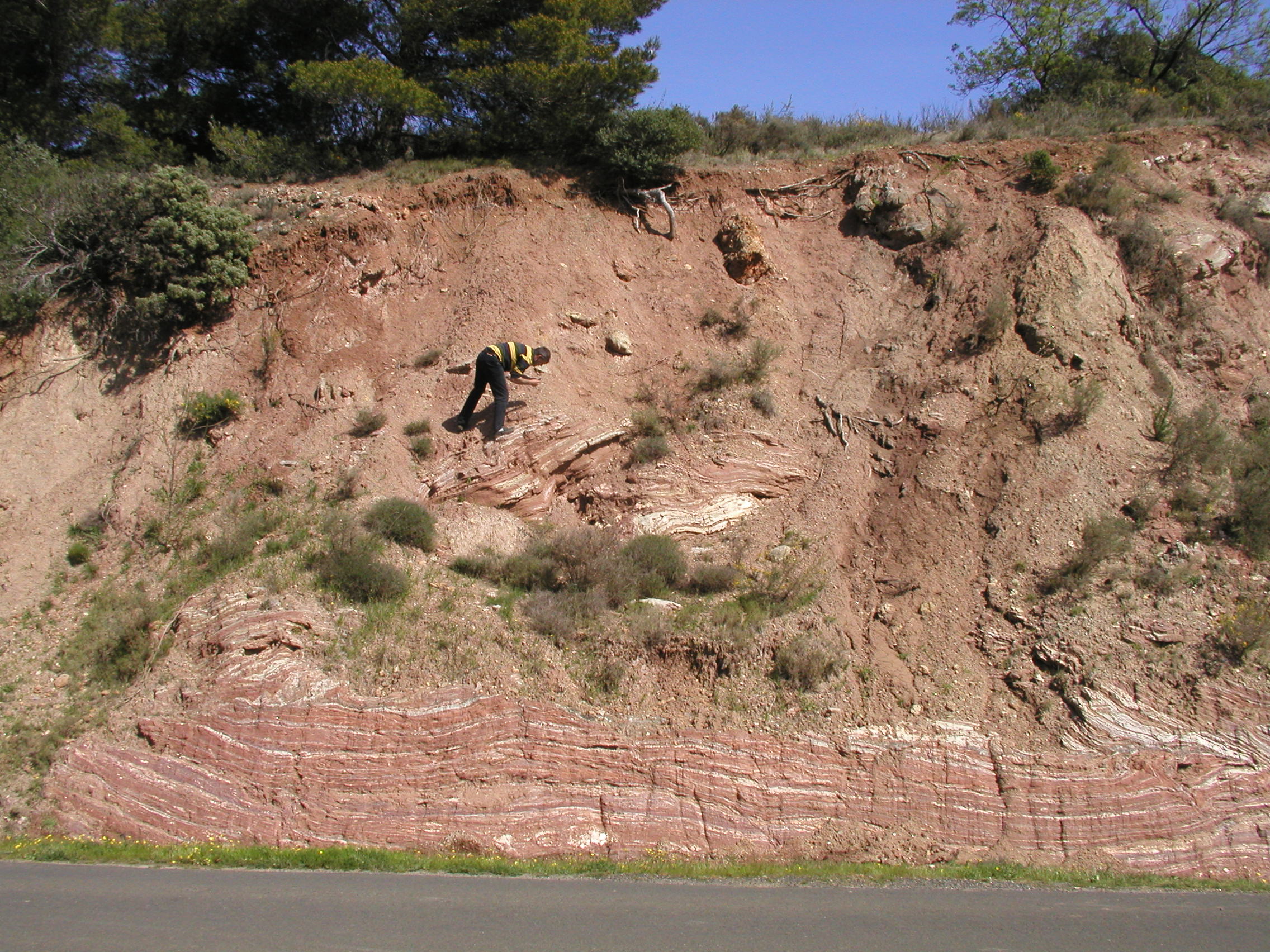
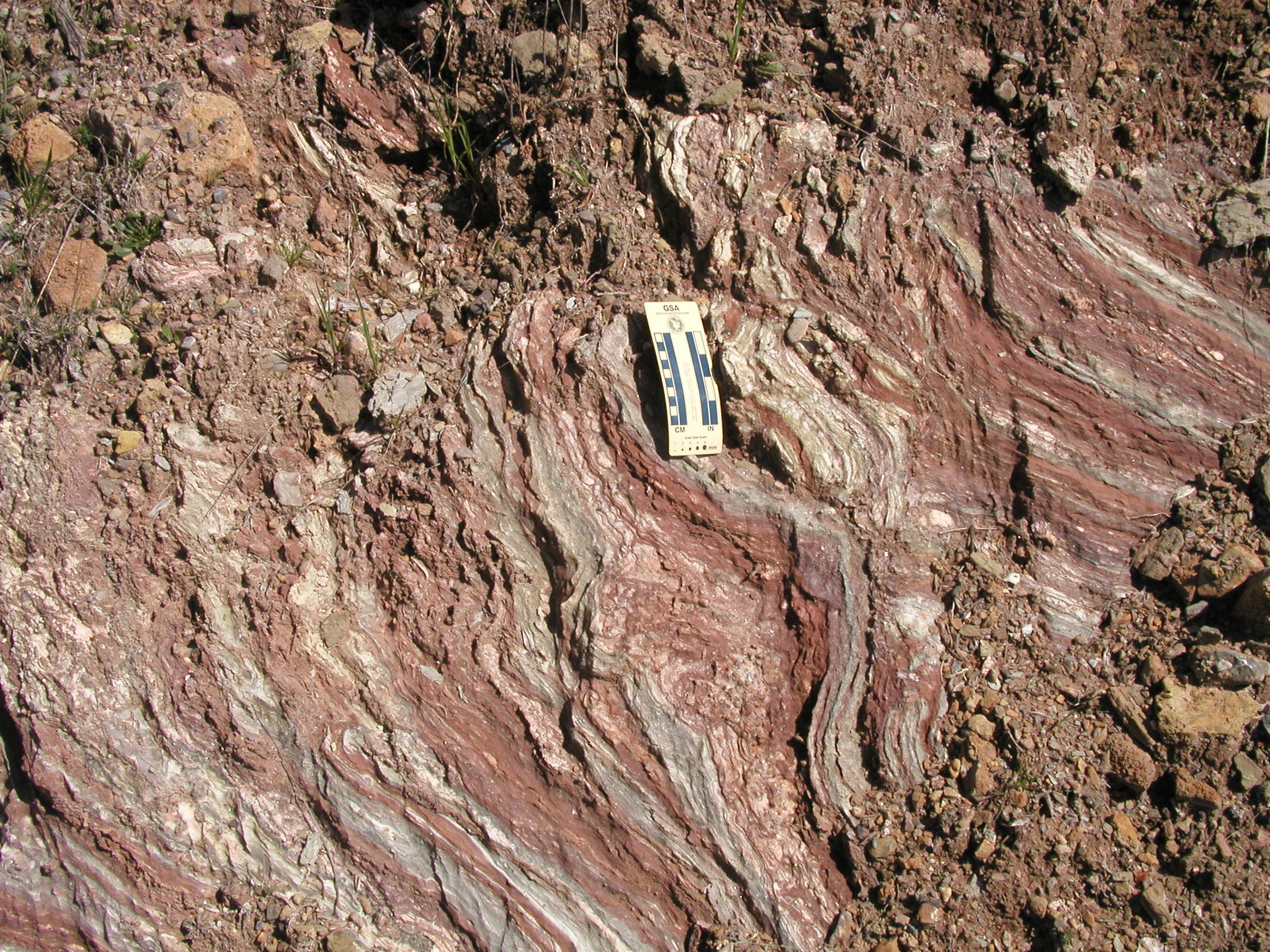
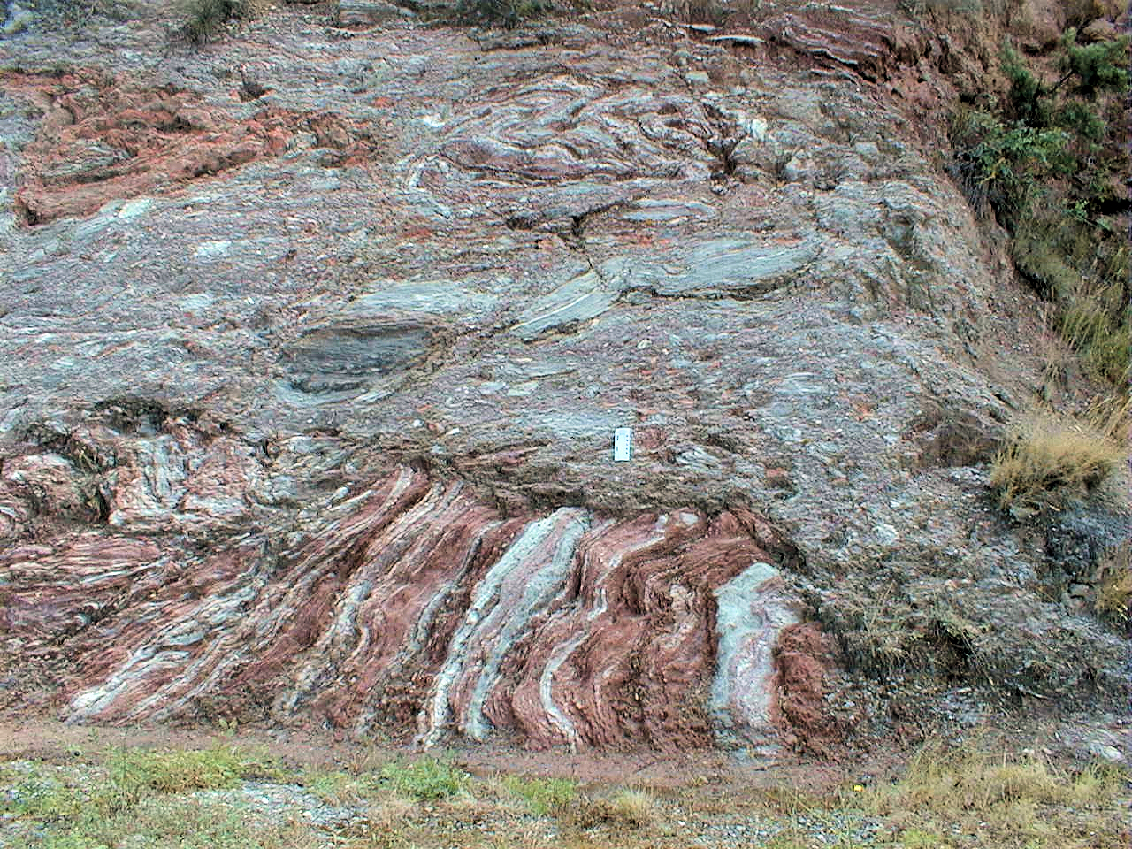 Figure 3. Closer view of the right-hand end of Figure 1. Describe and explain the differences between the lower and upper parts of the outcrop. |
|
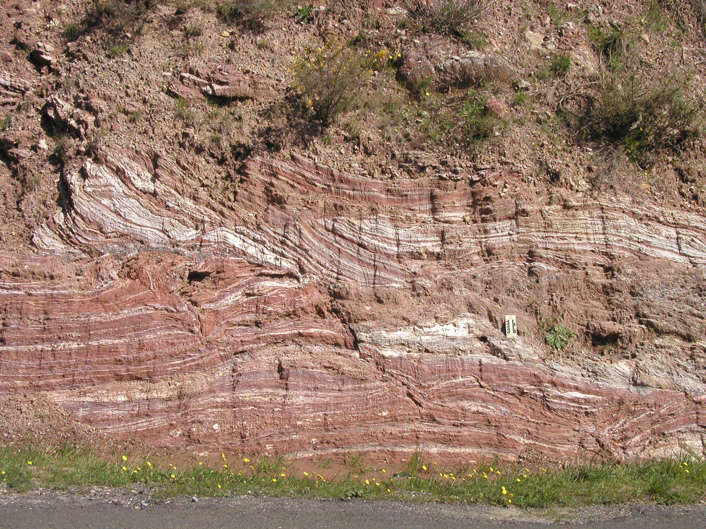
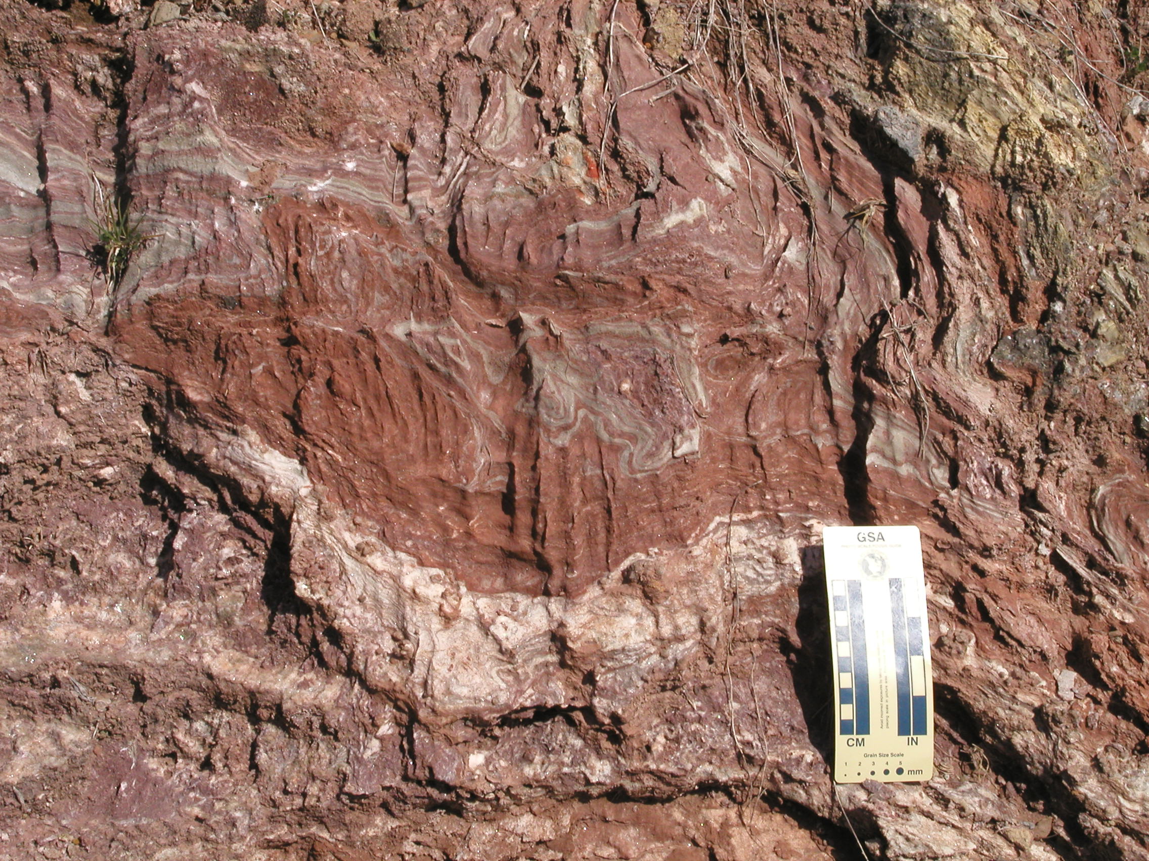
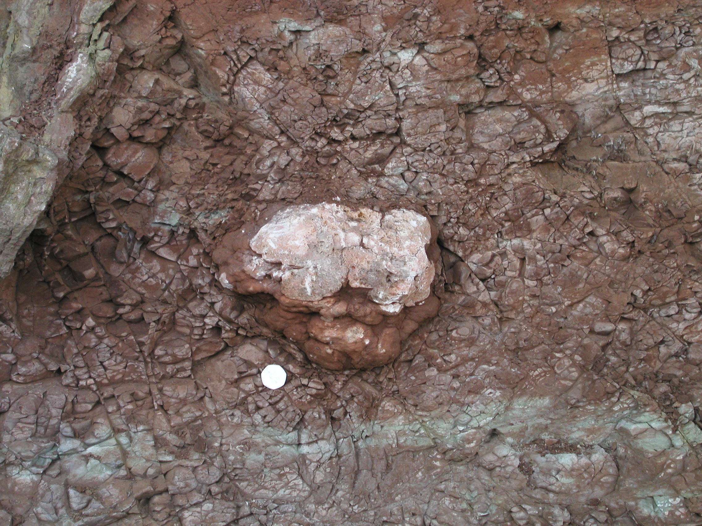
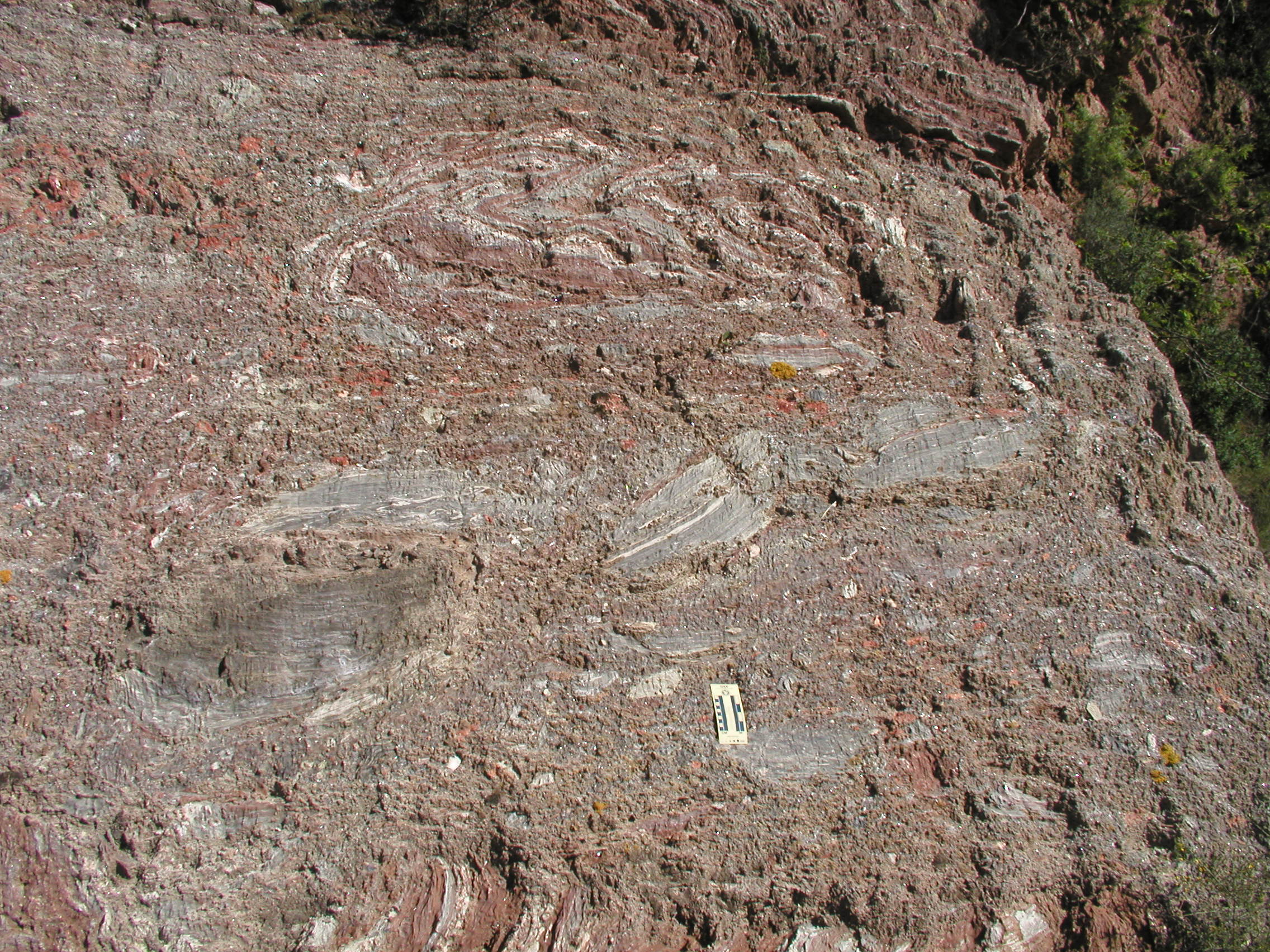 Figure 4. Detail of Figure 3. Grey and bright red are gypsum; dull red is siltstone. |
|
|
|
The outcrops - centre
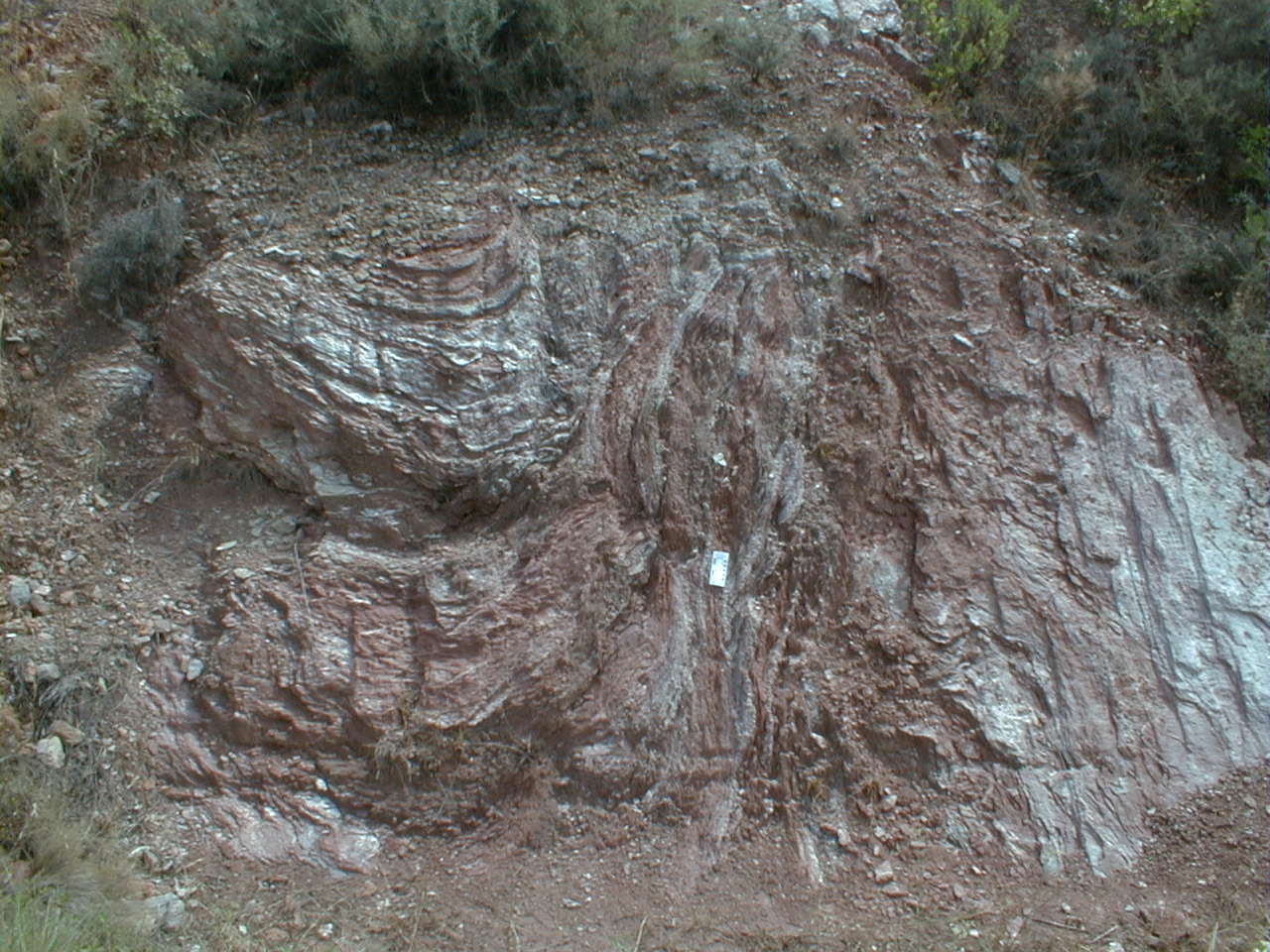
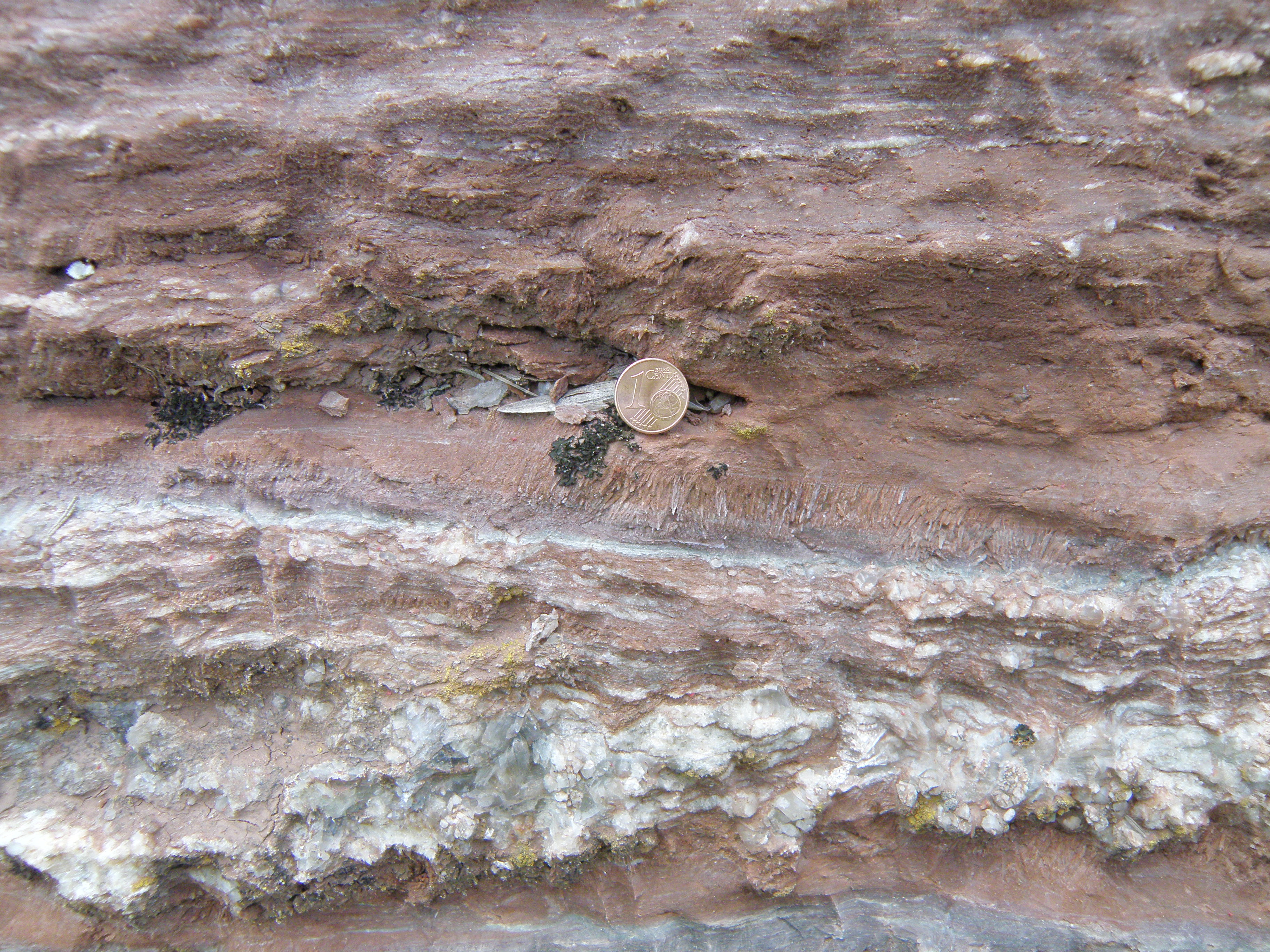
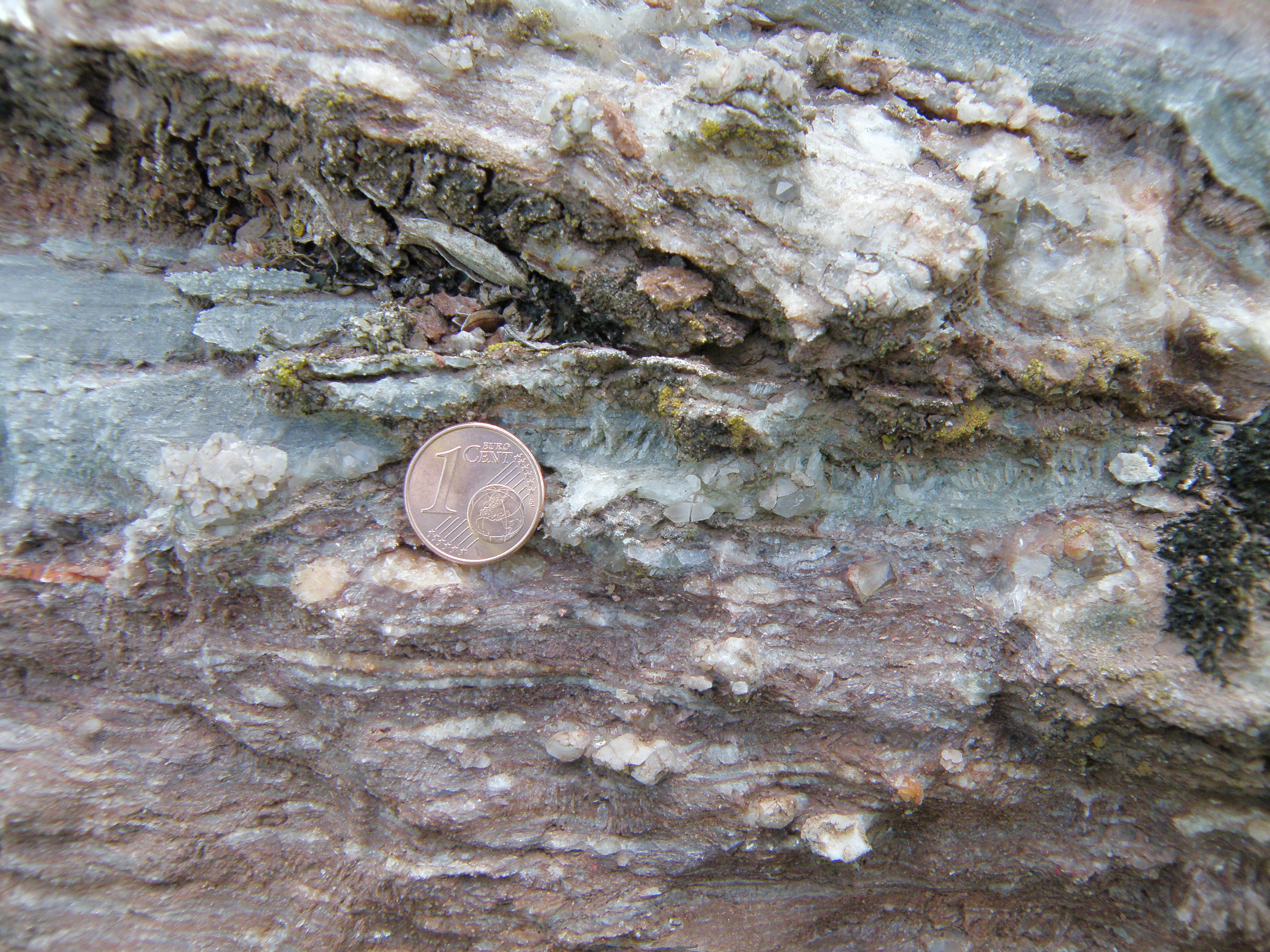
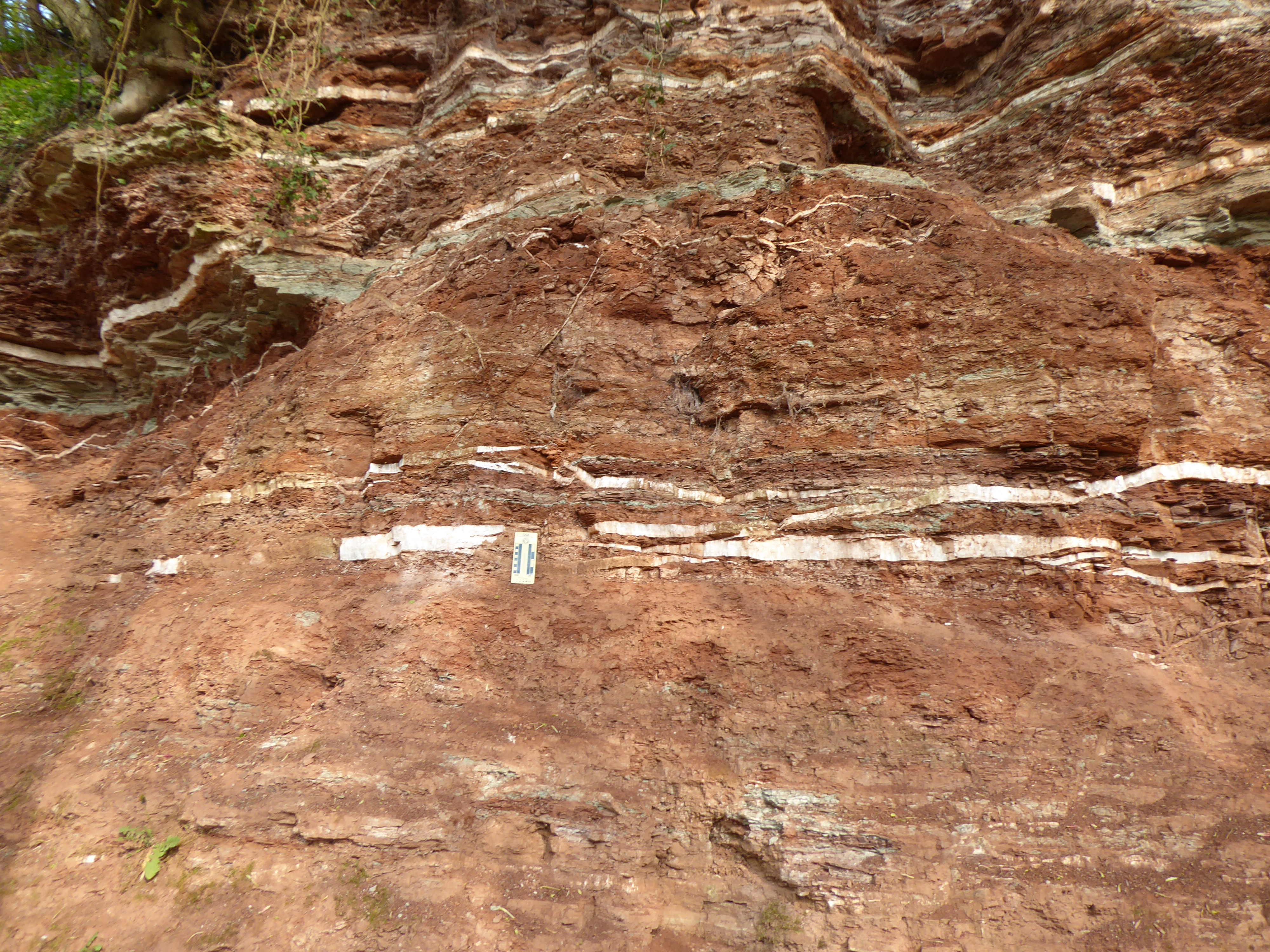
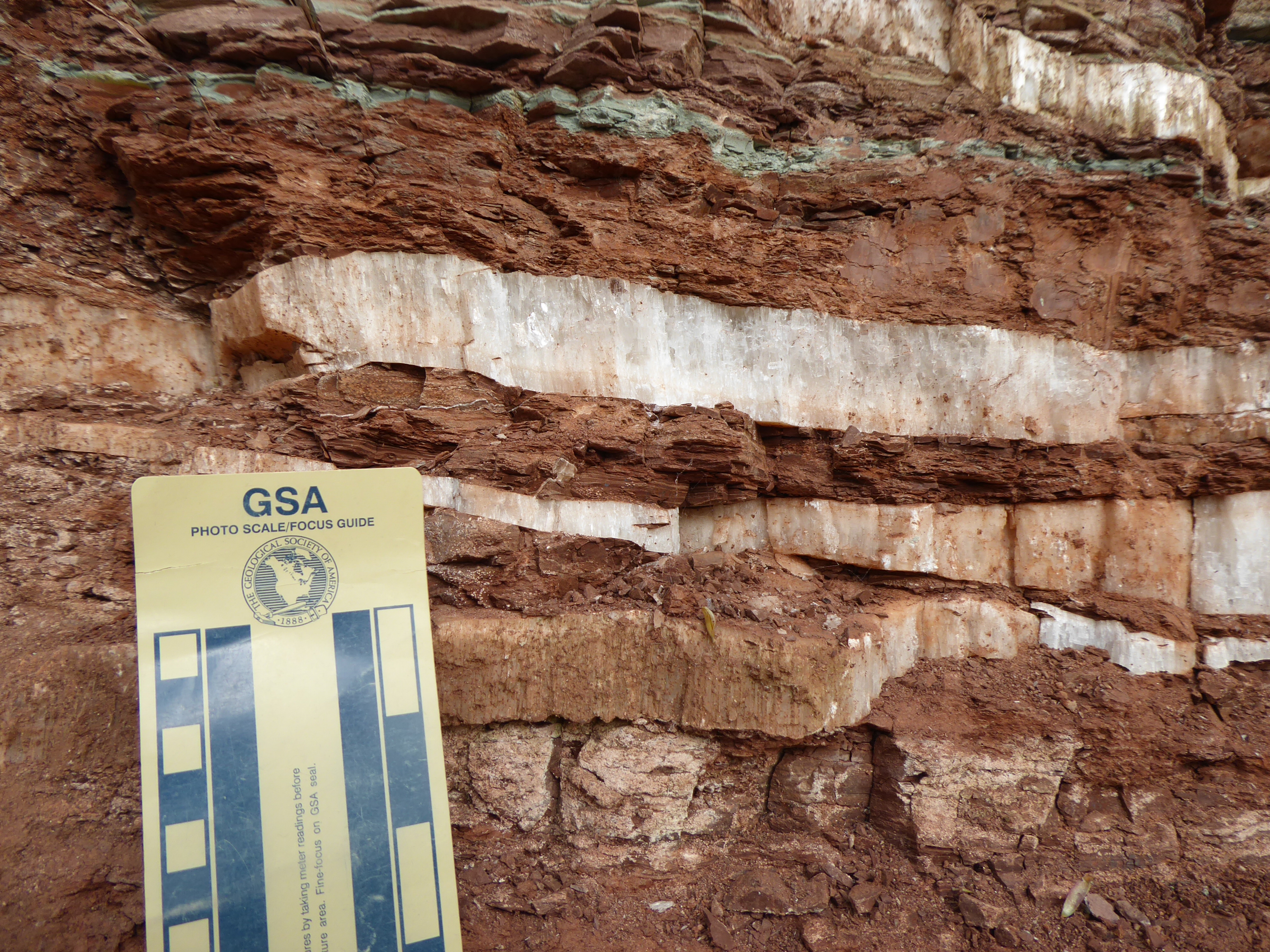
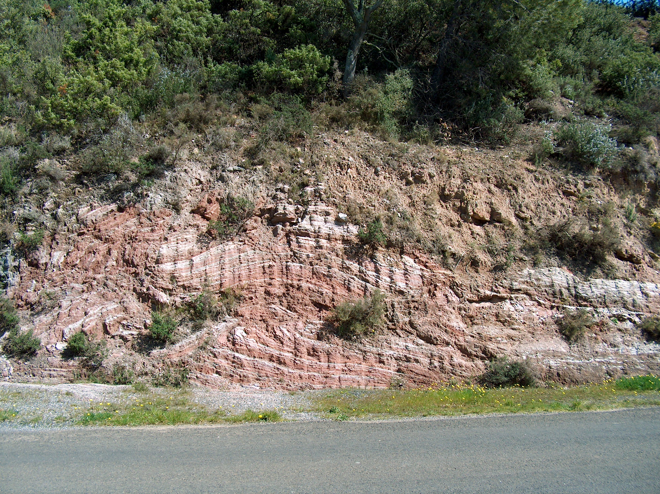 Figure 6. In this set of images, once again gypsum is white or colourless; the red beds are siltstone. |
|
|
|
|
|
|
The outcrops - south end
|
|
|
|
The outcrops - zooming in
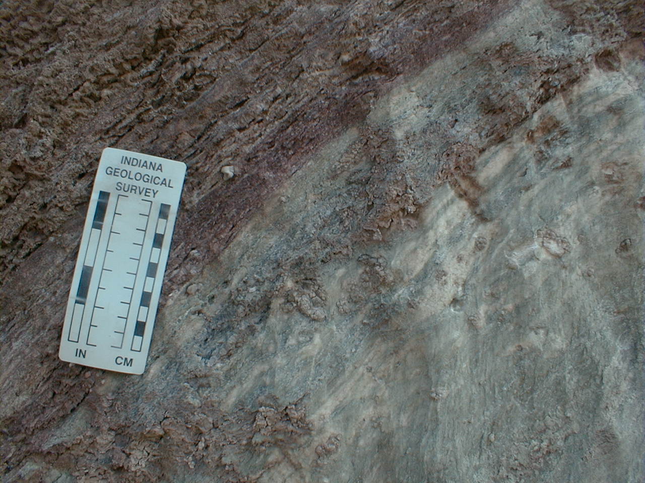
Most of these photos are from the central and southern parts of the outcrop.
|
|
|
|
|
|
|
|
|
|
![]()
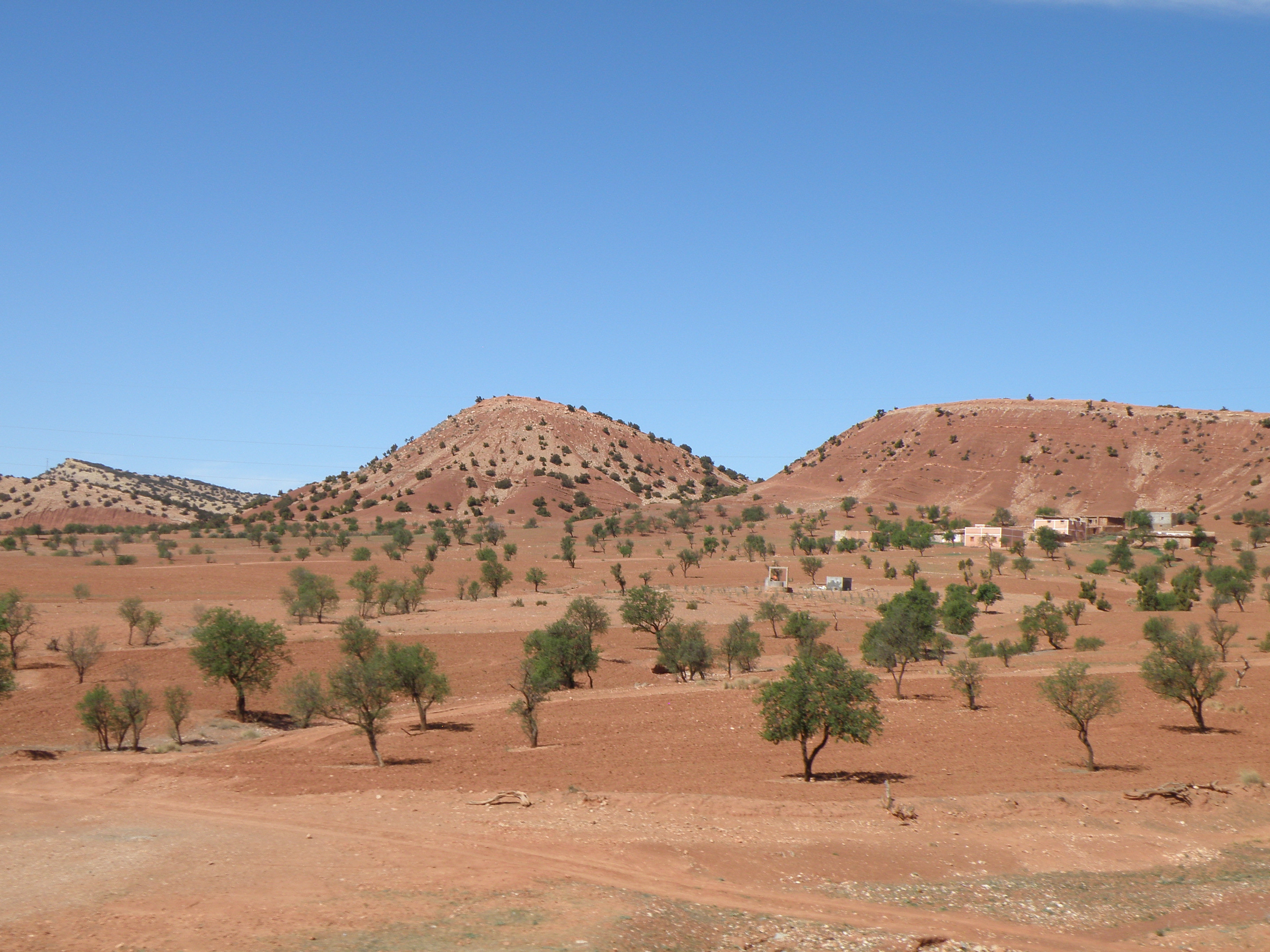
Further afield
This sedimentary facies association in the Upper Triassic is very widespread across Europe and North Africa, where it is often referred to by the old German term Keuper. Palaeogeography. Here are some other locations where it is found:
|
|
|
|
|
|
|
|
|
|
|
|
|
![]()
Bricks: as we have seen above, the Mercia Mudstone Group is an important source of raw materials for the brick-making industry. Here is some further information on the geology and the industry.
Gypsum was mined on a small scale all over the Corbières region, wherever these Upper Triassic rocks outcrop. The presence of former workings is often seen on topographic and geological maps as platrière. Example: see centre of this view of the online geological map.
Gypsum has been mined in the East Midlands of England for centuries. In mediaeval times, it was an important source of alabaster for religious carvings. Gypsum is still mined by British Gypsum at East Leake, Nottinghamshire, and its main use is in plasterboard and plaster for the building industry.

15th C alabaster carving
in the Victoria and Albert Museum, London.
Image by "Opal_Art_Seekers_4" via Wikimedia Commons
Plaster
Alabaster
![]()
Make sure you've completed all the work for this locality. Now we can get back on the virtual coach and head off to our next stop. Or return to the field trip home page.
![]()
This page is maintained by Roger Suthren. Last updated 4 May, 2021 12:21 PM . All images © Roger Suthren unless otherwise stated. Images may be re-used for non-commercial purposes.