It is important that you access this field trip on a laptop or desktop PC. Click on any image to enlarge it.
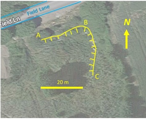
Where are we? This disused quarry is located along a minor road, 1 km to the northeast of the village of South Elmsall, 10 km to the southeast of Wakefield. Grid Reference: SE 484 116. At this location, we will study and interpret part of the Wetherby Member of the Cadeby Formation Formation, of Late Permian age. Study the area in Google Maps and Street View
Geological background: this location provides exposure through part of the Permian (290-248 million years ago) Magnesian Limestone. These limestones were deposited in a relatively shallow landlocked sea extending from north east England to Poland, known as the Zechstein Sea - palaeogeography (see slides 3, 4 and 8). The estimated average sea temperature during the period was approximately 23°C. Within the Magnesian Limestone the remains of fossil reefs, known as patch-reefs, which grew on the edge of the Zechstein Sea can be found. This locality provides exposure through one of the most complete and best-exposed patch-reefs in the British Permian succession and comprises a massive core of limestone formed by bryozoans mantled by domes of laminated limestones. The shallow-water limestones surrounding the reef contain abundant fossil bivalves and gastropods and provide evidence of the marine life that inhabited the area around the reefs.
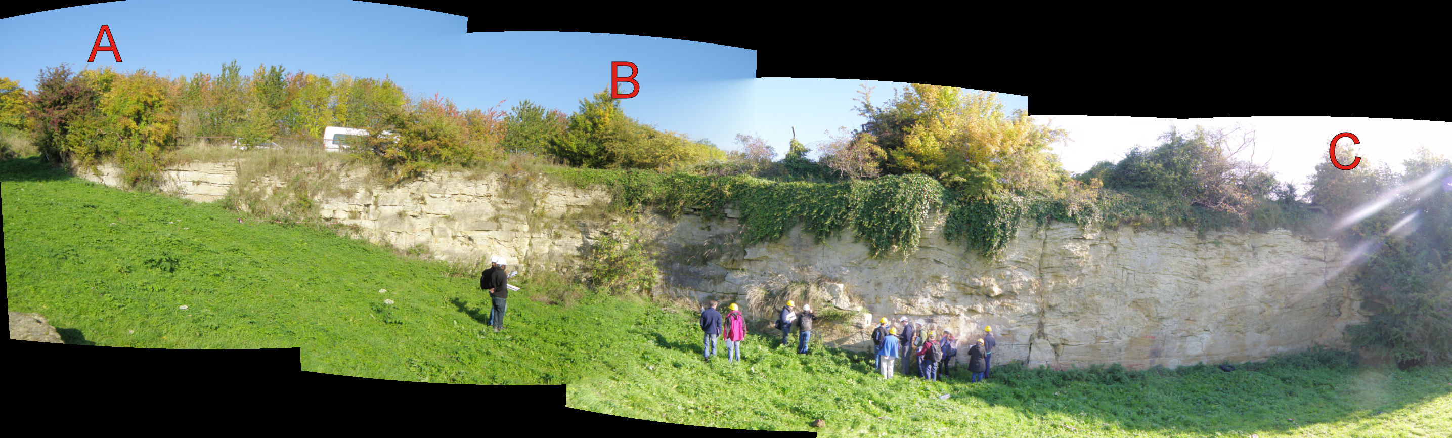
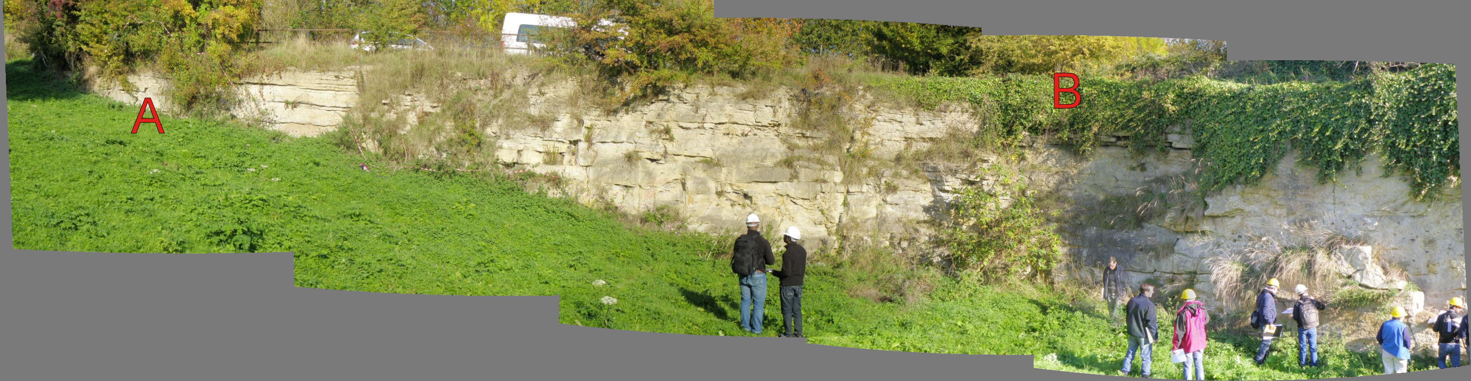
Task: your main task is to construct an interpreted panel for the sections seen at this location, by annotating the panorama of the quarry face.
|
|
|
|
Field evidence
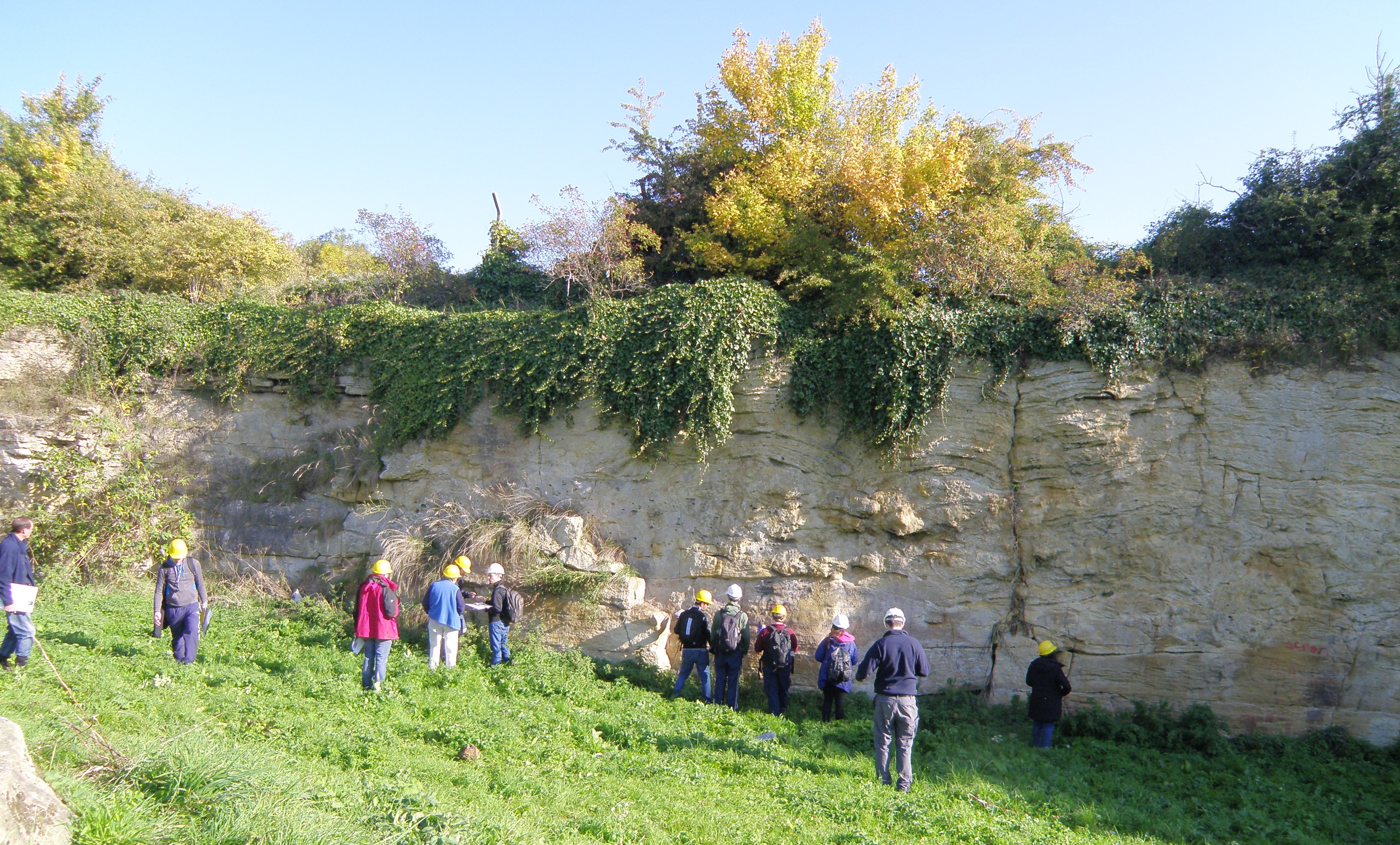
Describe the outcrop photographs below, and use them to provide evidence on which to base your interpretations. Pay particular attention to field relationships - contacts between units, how units change as you trace them laterally, etc.
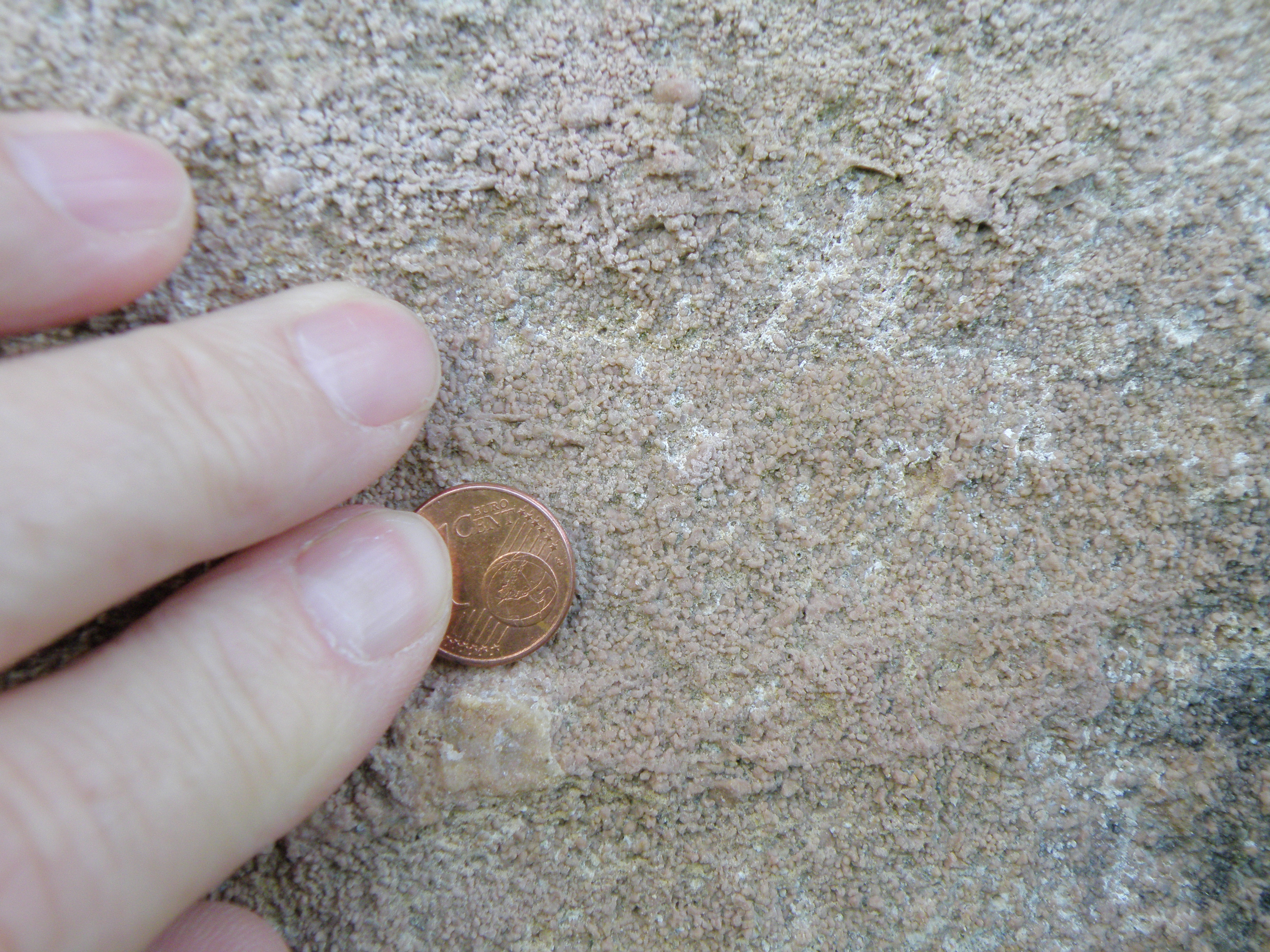
Important note: although this is a carbonate locality, most parts of the section react only weakly with dilute HCl. A stronger reaction may occur if the rock is powdered first.
|
|
|
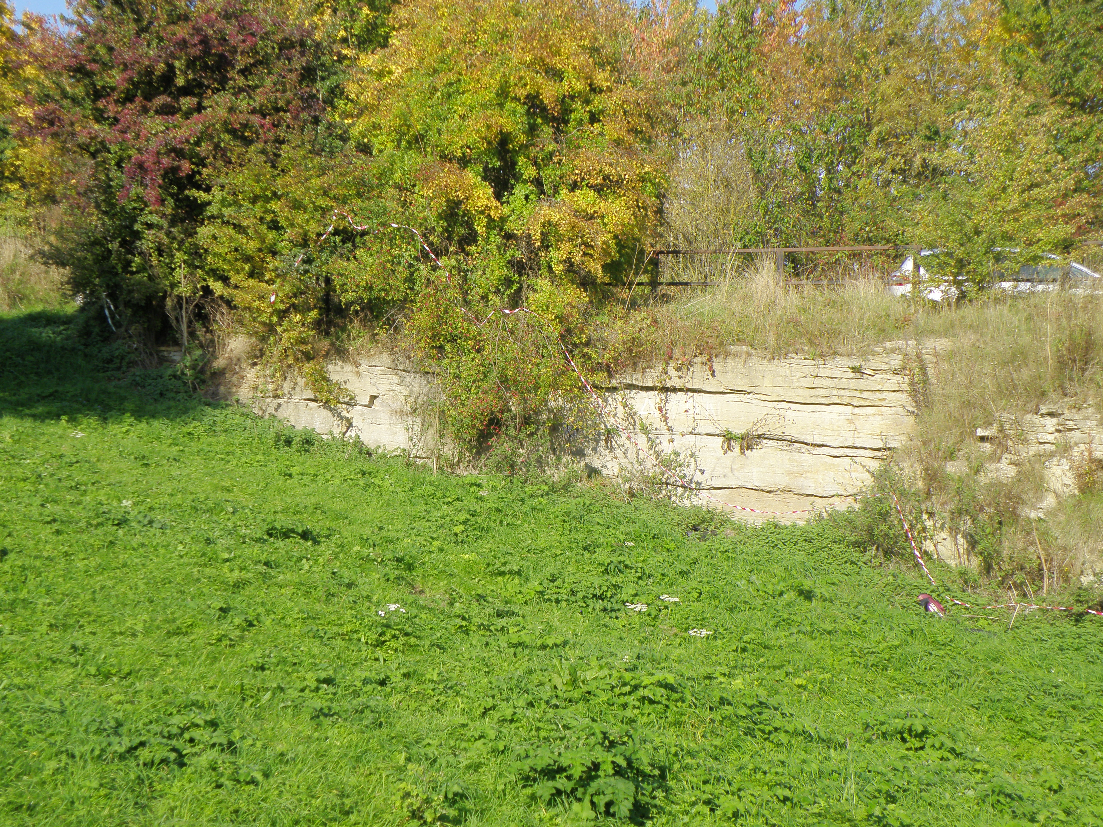
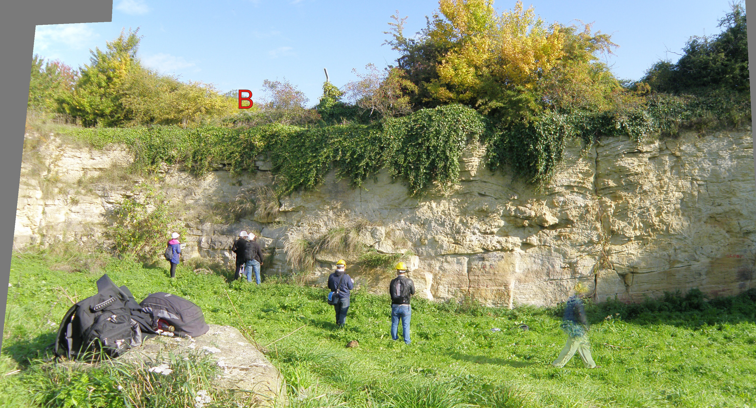 5. The face either side of point B. |
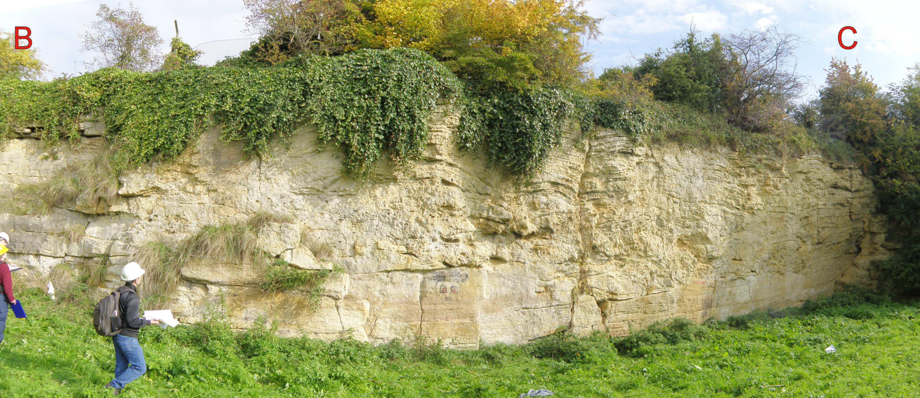 6. The east face of the quarry, BC |
 7. Closer view of the face at point A. |
 8. Close-up of Photo 7. |
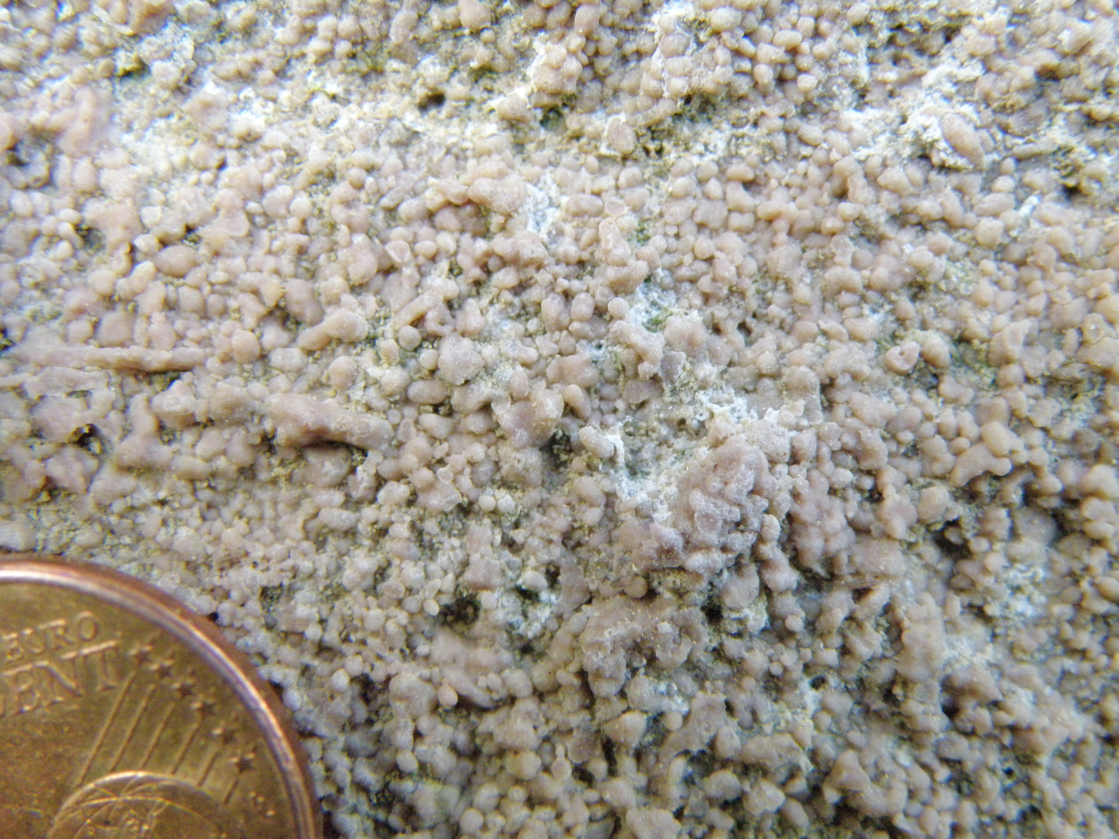
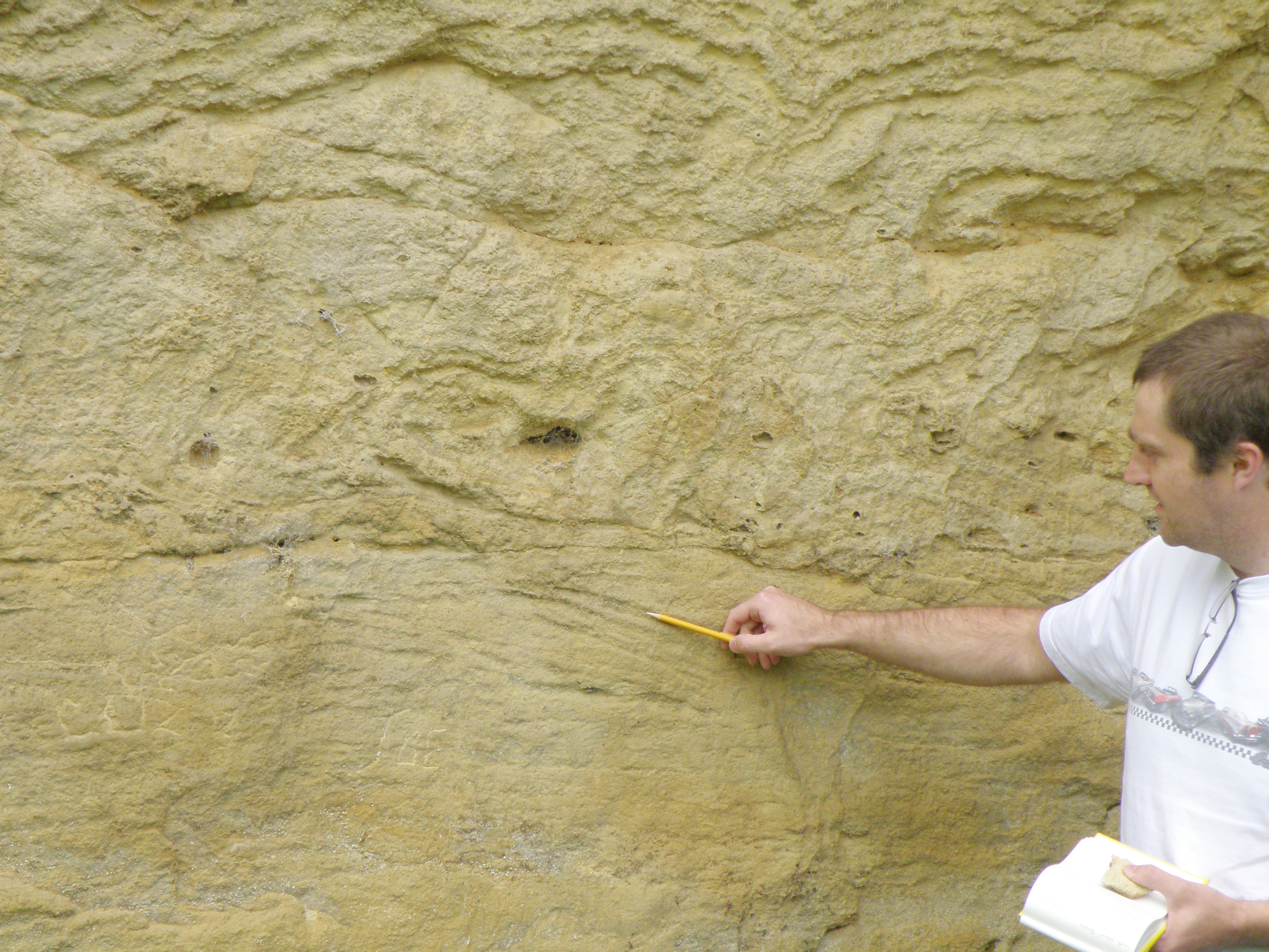
 9. Close-up of Photo 8. Describe the sedimentary structures. |
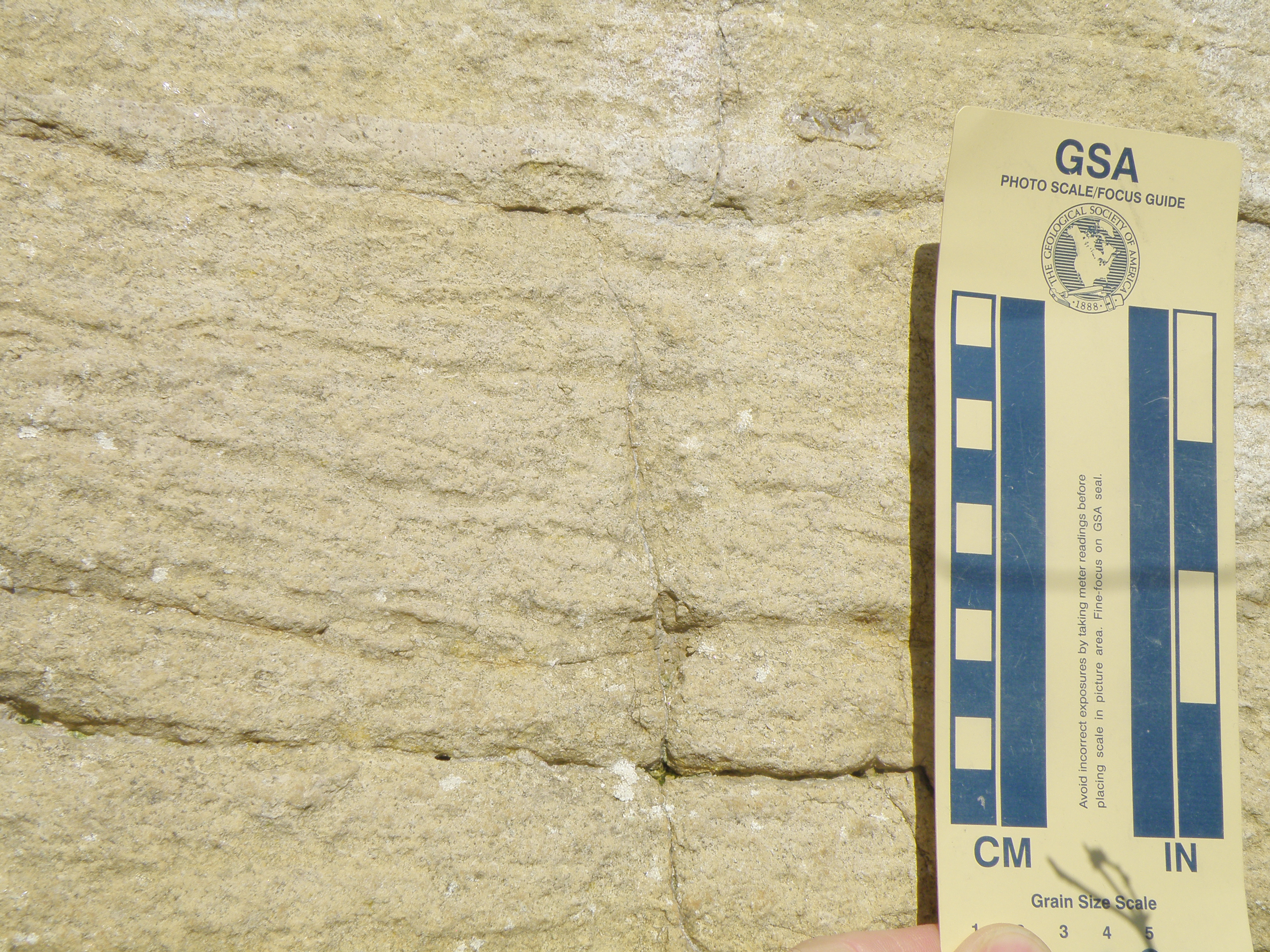 10. Close-up of Photo 9. Describe and identify the sedimentary structures. Can you get any directional information from them? |
 11. Near the centre of face BC Note the presence of bedded limestones in the lower part of the section. |
|
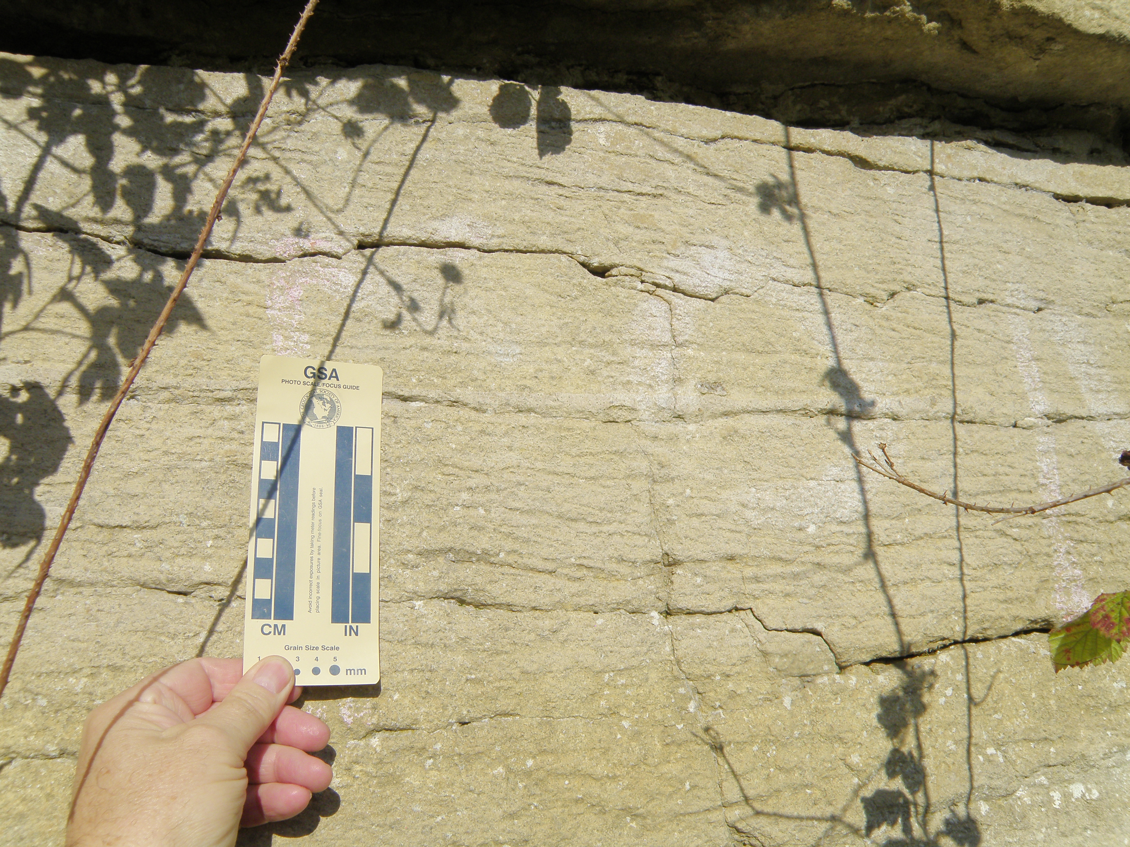
 13. Close-up of Photo 12. Reaction with dilute HCl is weak. |
|
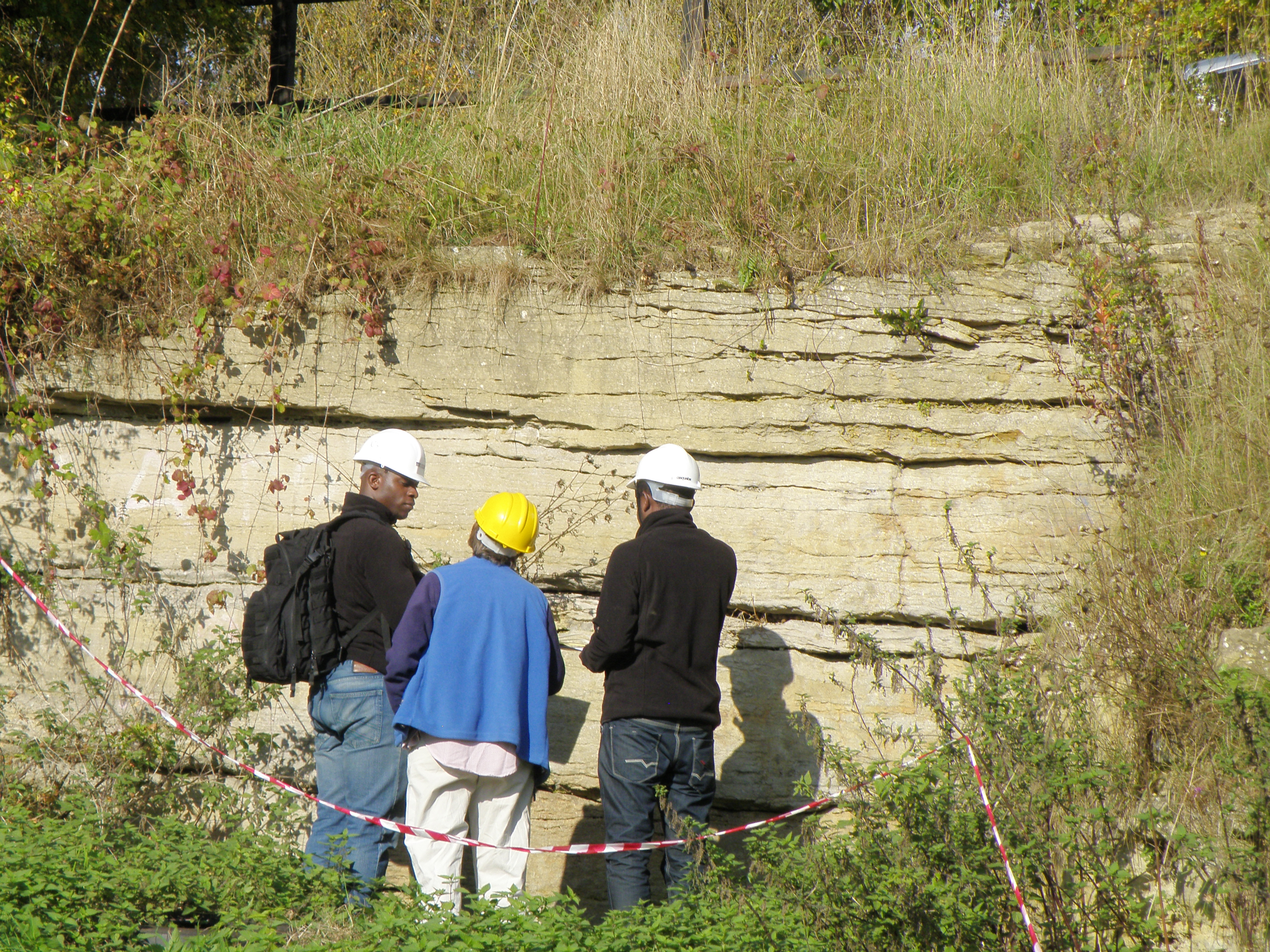
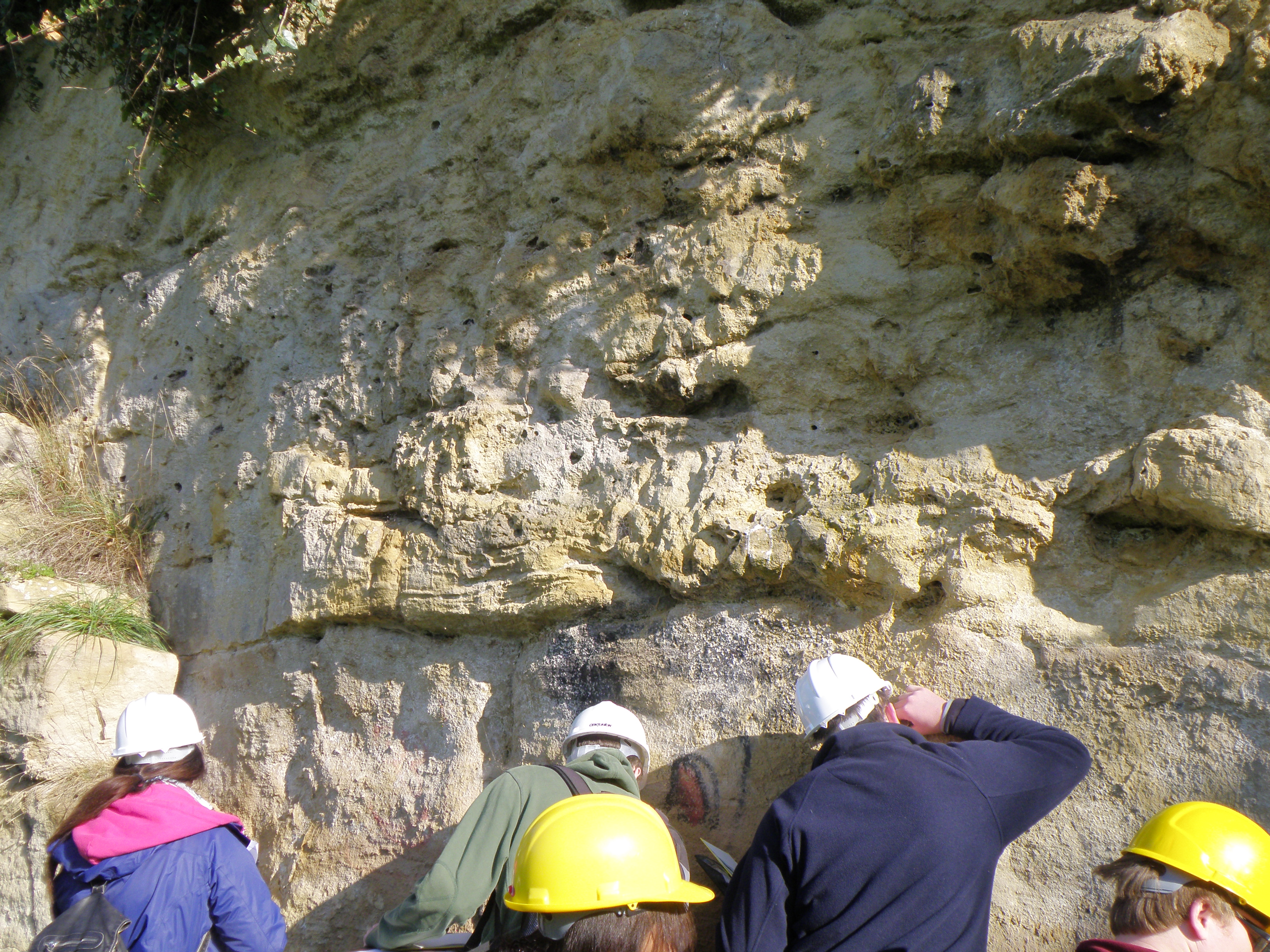
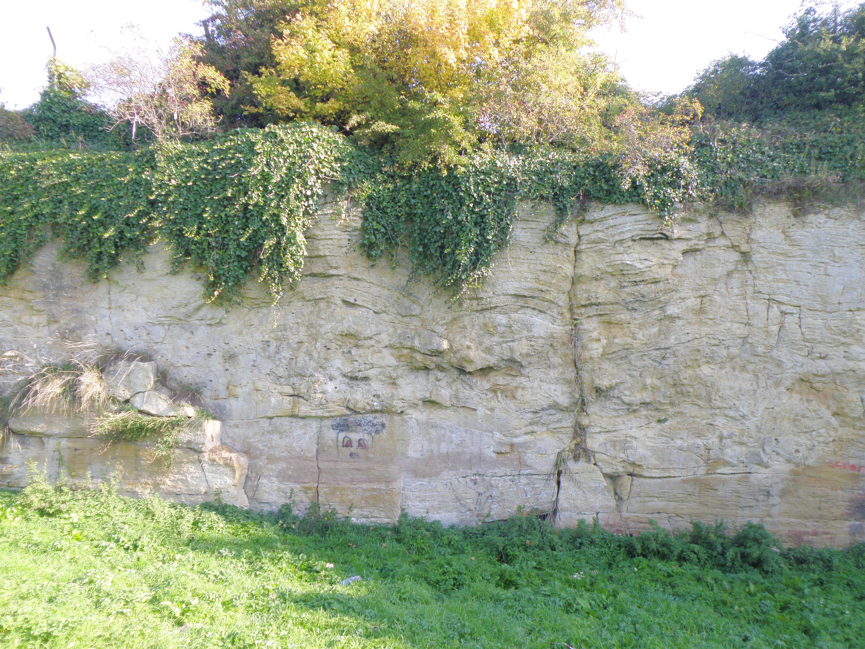
 15. Face to the right of point B. You should be able to identify and describe 3 different units here. |
|
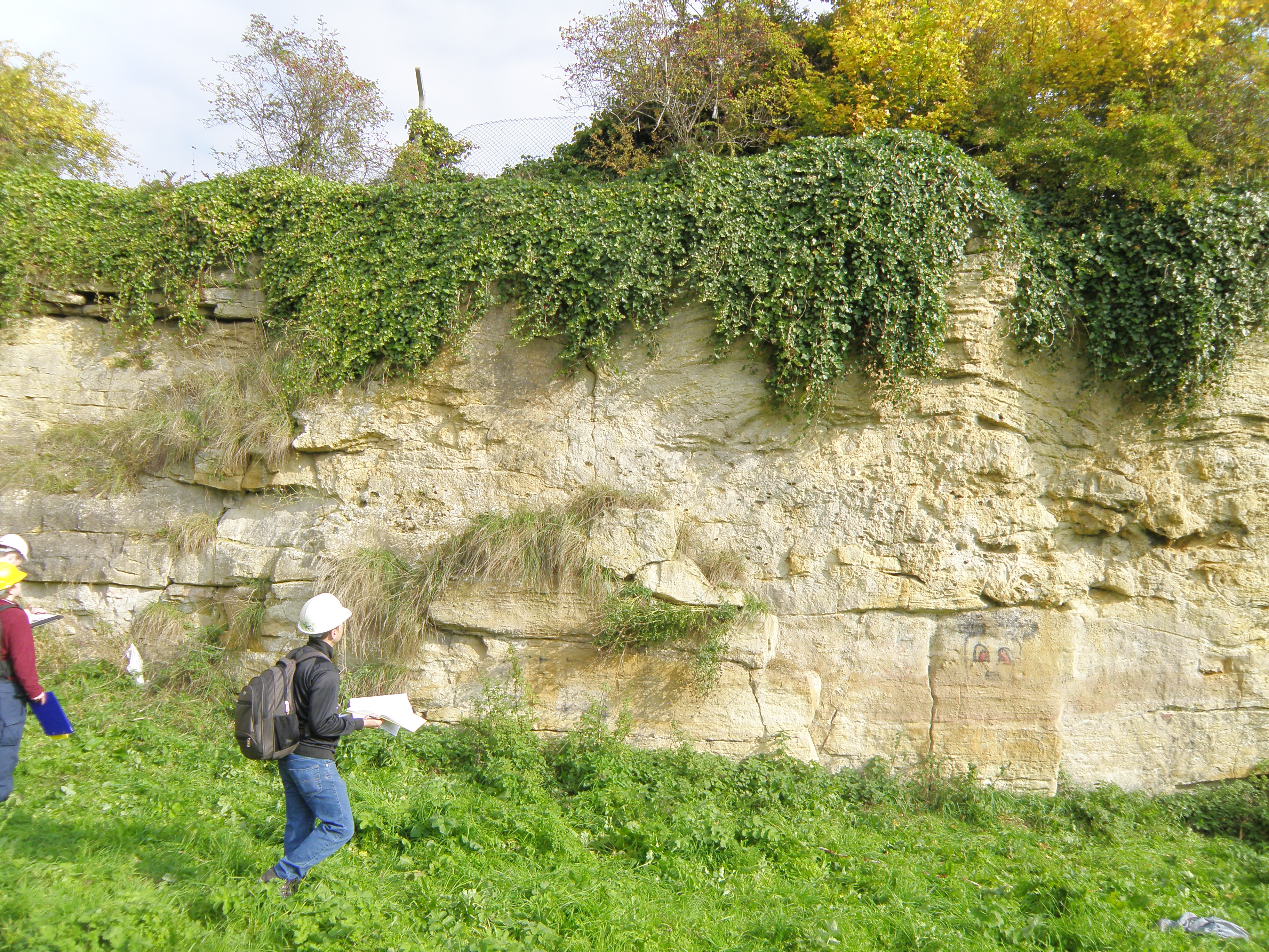
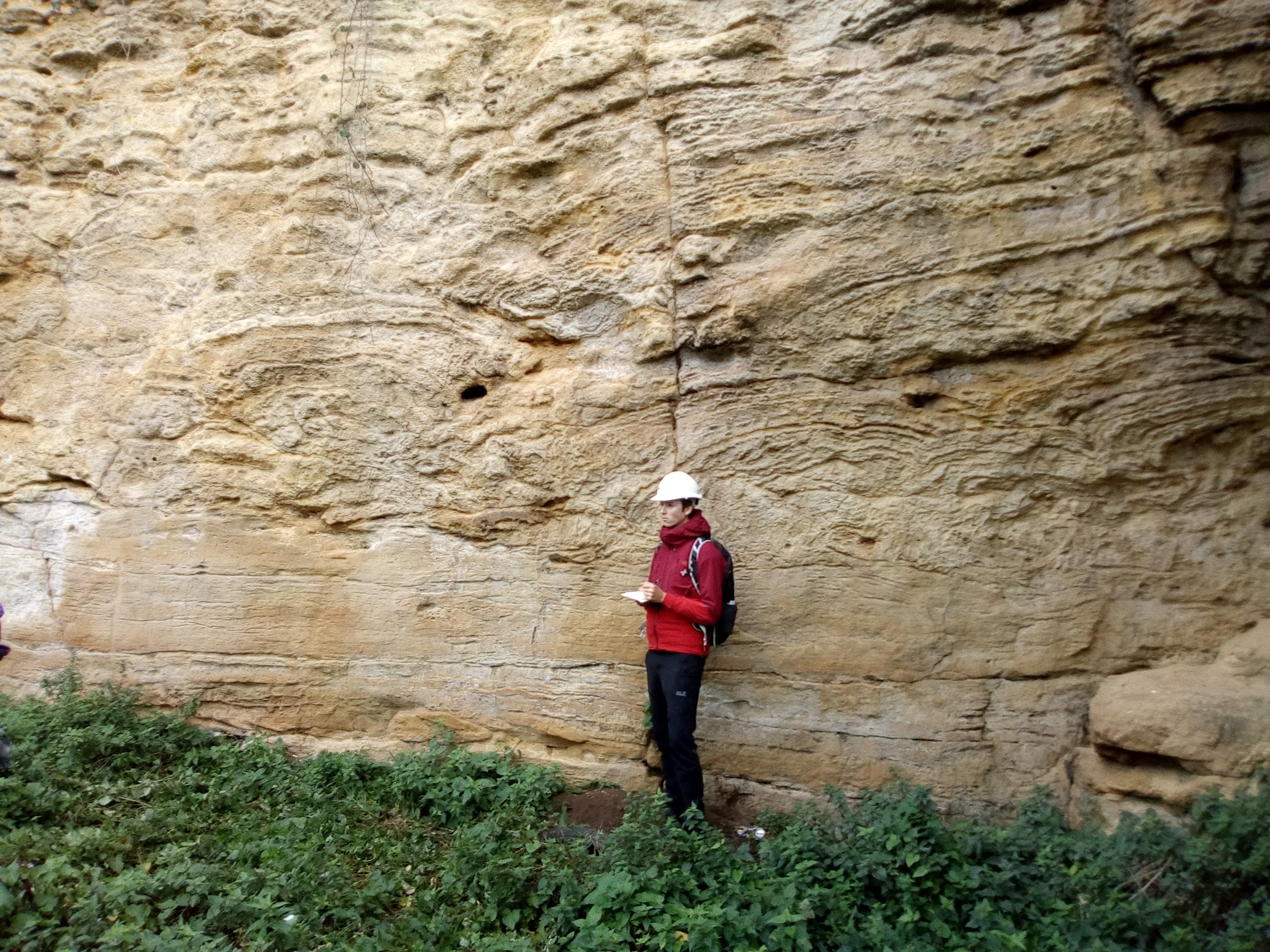
. 17. The section immediately above the graffiti face seen in Photo 16. Note the nature of the contact just above the geologists' heads. Above is the massive bryozoan reef unit, with many large vugs. |
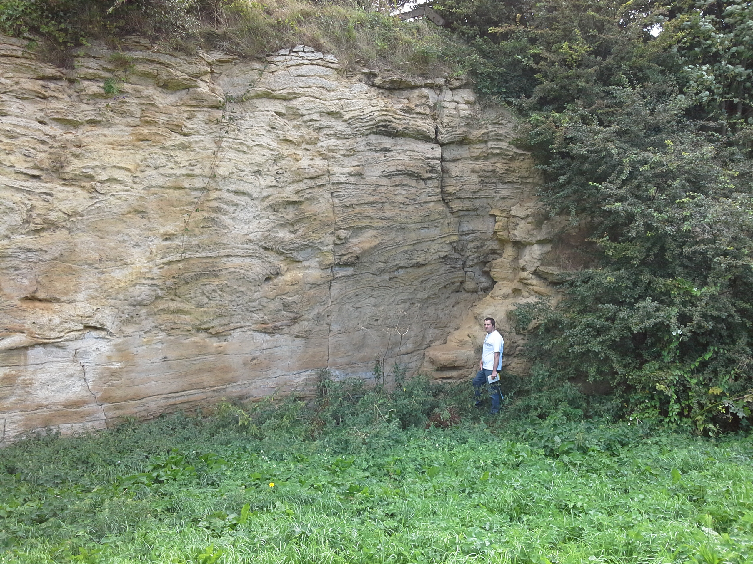
 18. Central part of face BC. Describe the bedding/lamination seen in the top part of the face, above the massive unit. This facies is seen again in the following photos. |
 19. Detail of the face near the right end of Photo 18. Note that the massive, vuggy bryozoan reef unit (just above the geologist's arm) is much thinner here. Describe all three units seen here. |
 20. Right part of face BC. Scale is standing near point C. Describe the sequence here. Is it different to the sequence seen further north (left) on this face? |
|
Interpreting the field evidence
![]()
This page is maintained by Roger Suthren. Last updated 18 November, 2020 8:59 AM . All images © Roger Suthren unless otherwise stated. Images may be re-used for non-commercial purposes.